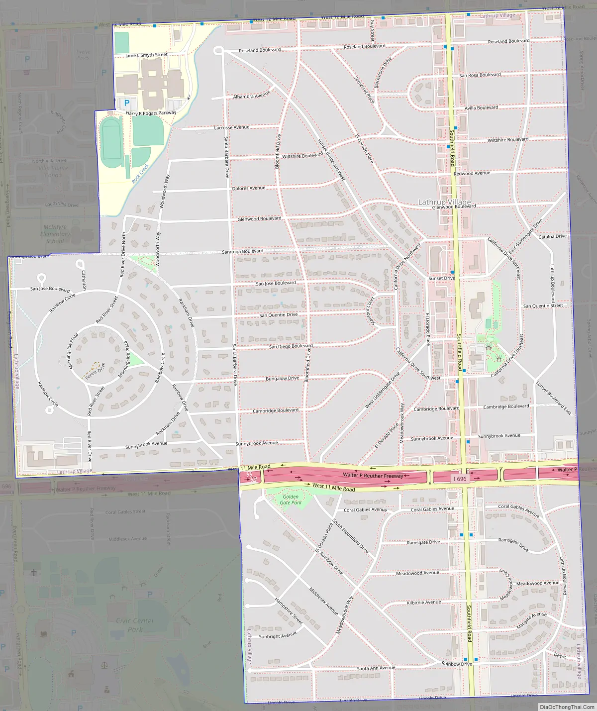
Lathrup Village (/ˈleɪθrəp/ LAY-thrəp) is a city in Oakland County in the U.S. state of Michigan. Per of the 2020 census, the population was 4,088. This city is surrounded by the city of Southfield. The I-696 / Reuther Freeway goes through nearly the east–west center of town, and Southfield Road goes nearly through the north–south center. The Southfield Town Center, formerly known as the Prudential Town Center, is within walking distance of the southwest corner of the city.
| Name: | Lathrup Village city |
|---|---|
| LSAD Code: | 25 |
| LSAD Description: | city (suffix) |
| State: | Michigan |
| County: | Oakland County |
| Incorporated: | 1953 |
| Elevation: | 705 ft (215 m) |
| Land Area: | 1.51 sq mi (3.90 km²) |
| Water Area: | 0.00 sq mi (0.00 km²) |
| Population Density: | 2,714.48/sq mi (1,047.74/km²) |
| Area code: | 248 |
| FIPS code: | 2646320 |
| GNISfeature ID: | 0630184 |
Online Interactive Map
Click on ![]() to view map in "full screen" mode.
to view map in "full screen" mode.
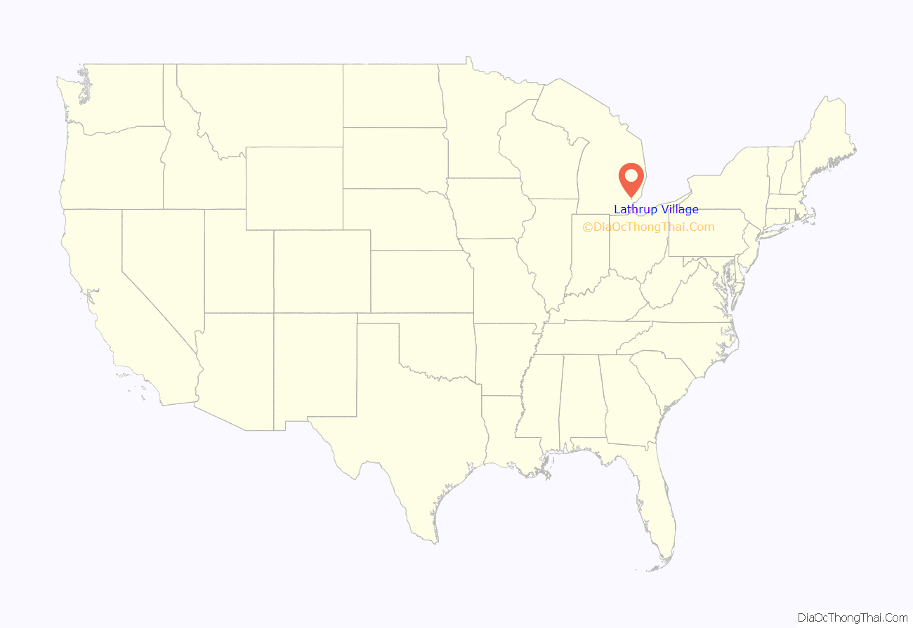
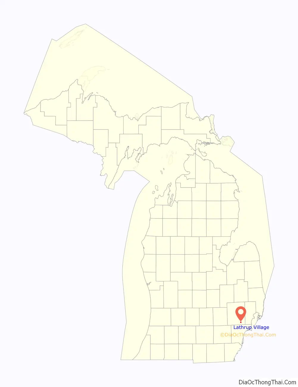
Lathrup Village location map. Where is Lathrup Village city?
History
The city of Lathrup Village is an outgrowth of the development known as Lathrup Townsite, the dream of its developer Louise Lathrup Kelley. In 1923 she purchased a tract of 1,000 acres (4 km) in Southfield Township, in southern Oakland County, and proceeded to plat a residential neighborhood that encompasses the city of 1.5 square miles (3.9 km). Lathrup Townsite was conceived as a controlled community with rigorous standards, including houses built only of masonry construction; early integration of attached garages; as well as established minimums for construction cost to ensure quality. As the community developed, Mrs. Kelley implemented numerous innovative directives, including operating a shuttle service to local shopping areas, and allowing the financing of automobiles as part of the financing of houses, which created a stronger connection between the relatively isolated townsite and more established suburbs, as well as the city of Detroit. Mr. Charles Kelley, who had been a real estate writer for the Detroit News, assisted his wife in bringing talented architects to the community to design many of the custom homes that are features of the community. The City of Lathrup Village was incorporated in 1953 as the first incorporated community in Southfield Township. The residents thwarted an attempt by township residents to include Lathrup Townsite in their planned incorporation of the city of Southfield, resulting in Southfield’s incorporation being delayed until 1958. Louise Lathrup Kelley played an active role in the new city until her death in 1963, after which her remaining real estate holdings in the city were sold and developed.
Lathrup Village Historic District
In 1998 much of Lathrup Village was included on the National Register of Historic Places as the Lathrup Village Historic District. The district includes approximately 1,200 properties, primarily residential, that reflect characteristic housing styles from the first half of the 20th century. These include Colonial Revival, Tudor and ranch houses. According to the Michigan State Historic Preservation Office: “The district possesses a strong geometric street pattern integrated with curvilinear patterns that provide a rural character. This layering of patterns produces octagonal, circular and semi-circular focal points and a series of small triangular parks scattered throughout the district. It also creates unique and changing perspectives, as views of significant buildings suddenly appear at surprising moments. Likewise, at the uniquely configured intersections of many streets, one is met with a new perspective as suddenly several sections of the district become visible.” The developer of the district was Louise Lathrup Kelley. According to the Michigan State Historic Preservation Office “As a woman acting as developer starting in the 1920s, she was essentially alone, however her dogged persistence and insistence on quality resulted in a unique community that was the summation of her career.”
Lathrup Village Road Map
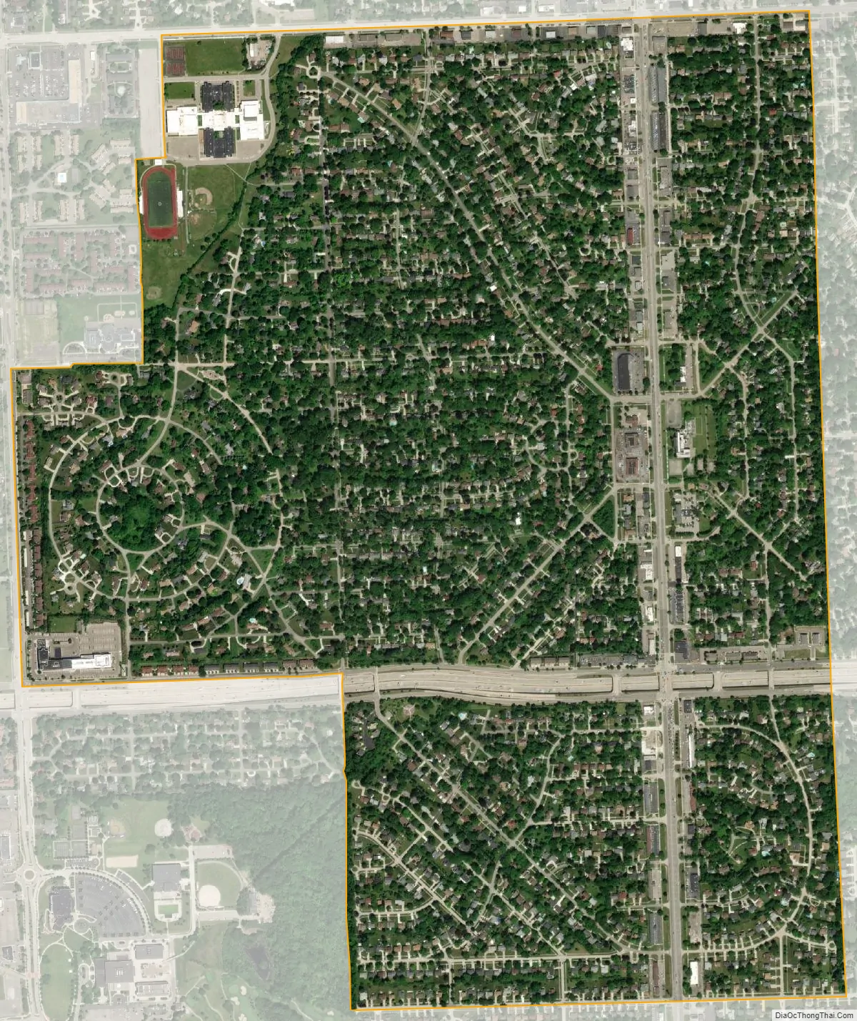
Lathrup Village city Satellite Map
Geography
According to the United States Census Bureau, the city has a total area of 1.50 square miles (3.88 km), all land.
See also
Map of Michigan State and its subdivision:- Alcona
- Alger
- Allegan
- Alpena
- Antrim
- Arenac
- Baraga
- Barry
- Bay
- Benzie
- Berrien
- Branch
- Calhoun
- Cass
- Charlevoix
- Cheboygan
- Chippewa
- Clare
- Clinton
- Crawford
- Delta
- Dickinson
- Eaton
- Emmet
- Genesee
- Gladwin
- Gogebic
- Grand Traverse
- Gratiot
- Hillsdale
- Houghton
- Huron
- Ingham
- Ionia
- Iosco
- Iron
- Isabella
- Jackson
- Kalamazoo
- Kalkaska
- Kent
- Keweenaw
- Lake
- Lake Hurron
- Lake Michigan
- Lake St. Clair
- Lake Superior
- Lapeer
- Leelanau
- Lenawee
- Livingston
- Luce
- Mackinac
- Macomb
- Manistee
- Marquette
- Mason
- Mecosta
- Menominee
- Midland
- Missaukee
- Monroe
- Montcalm
- Montmorency
- Muskegon
- Newaygo
- Oakland
- Oceana
- Ogemaw
- Ontonagon
- Osceola
- Oscoda
- Otsego
- Ottawa
- Presque Isle
- Roscommon
- Saginaw
- Saint Clair
- Saint Joseph
- Sanilac
- Schoolcraft
- Shiawassee
- Tuscola
- Van Buren
- Washtenaw
- Wayne
- Wexford
- Alabama
- Alaska
- Arizona
- Arkansas
- California
- Colorado
- Connecticut
- Delaware
- District of Columbia
- Florida
- Georgia
- Hawaii
- Idaho
- Illinois
- Indiana
- Iowa
- Kansas
- Kentucky
- Louisiana
- Maine
- Maryland
- Massachusetts
- Michigan
- Minnesota
- Mississippi
- Missouri
- Montana
- Nebraska
- Nevada
- New Hampshire
- New Jersey
- New Mexico
- New York
- North Carolina
- North Dakota
- Ohio
- Oklahoma
- Oregon
- Pennsylvania
- Rhode Island
- South Carolina
- South Dakota
- Tennessee
- Texas
- Utah
- Vermont
- Virginia
- Washington
- West Virginia
- Wisconsin
- Wyoming


