Laurium (/ˈlɔːriəm/; LAW-ri-um or /ˈleɪriəm/ LAIR-i-um) is a village in Calumet Township, Houghton County in the U.S. state of Michigan, in the center of the Keweenaw Peninsula. The population was 1,977 at the 2010 census.
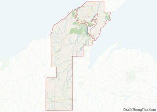
The village is mostly surrounded by Calumet Township, with a small portion bordering Schoolcraft Township on the east. The portion of Calumet Township south of Laurium is considered part of the Florida (or Florida Location) unincorporated community.
| Name: | Laurium village |
|---|---|
| LSAD Code: | 47 |
| LSAD Description: | village (suffix) |
| State: | Michigan |
| County: | Houghton County |
| Incorporated: | 1889 (as Calumet) 1895 (as Laurium) |
| Elevation: | 1,237 ft (377 m) |
| Total Area: | 0.65 sq mi (1.68 km²) |
| Land Area: | 0.65 sq mi (1.68 km²) |
| Water Area: | 0.00 sq mi (0.00 km²) |
| Total Population: | 1,864 |
| Population Density: | 2,872.11/sq mi (1,108.40/km²) |
| Area code: | 906 |
| FIPS code: | 2646360 |
| GNISfeature ID: | 0630196 |
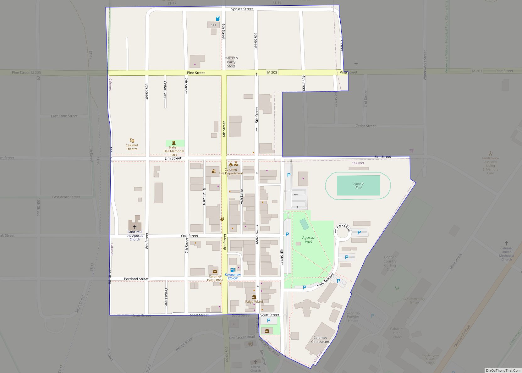
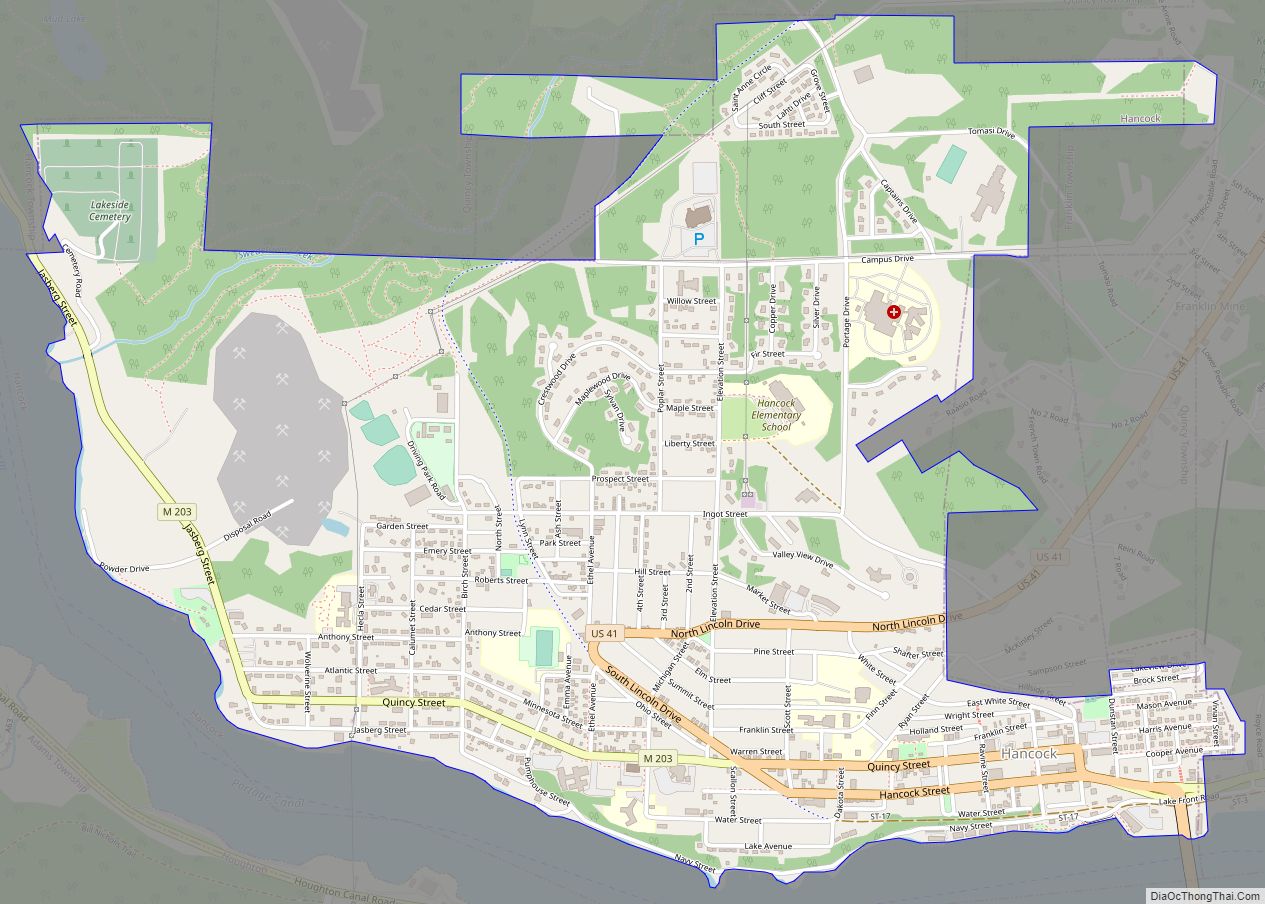
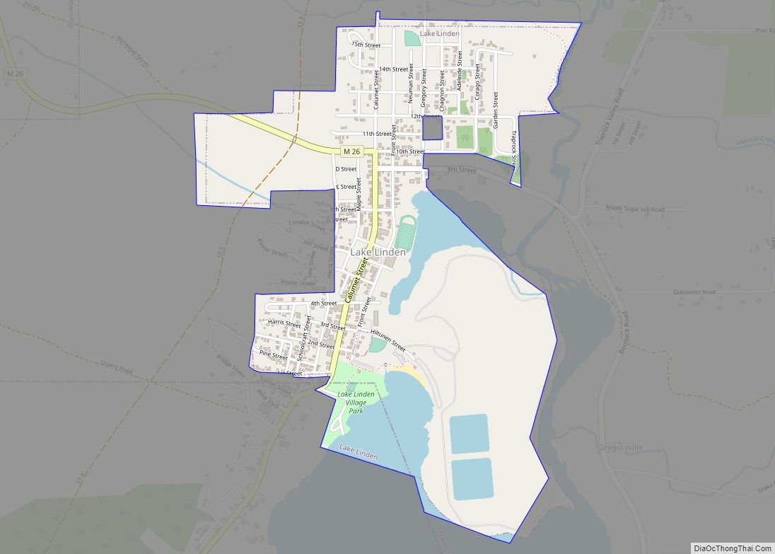
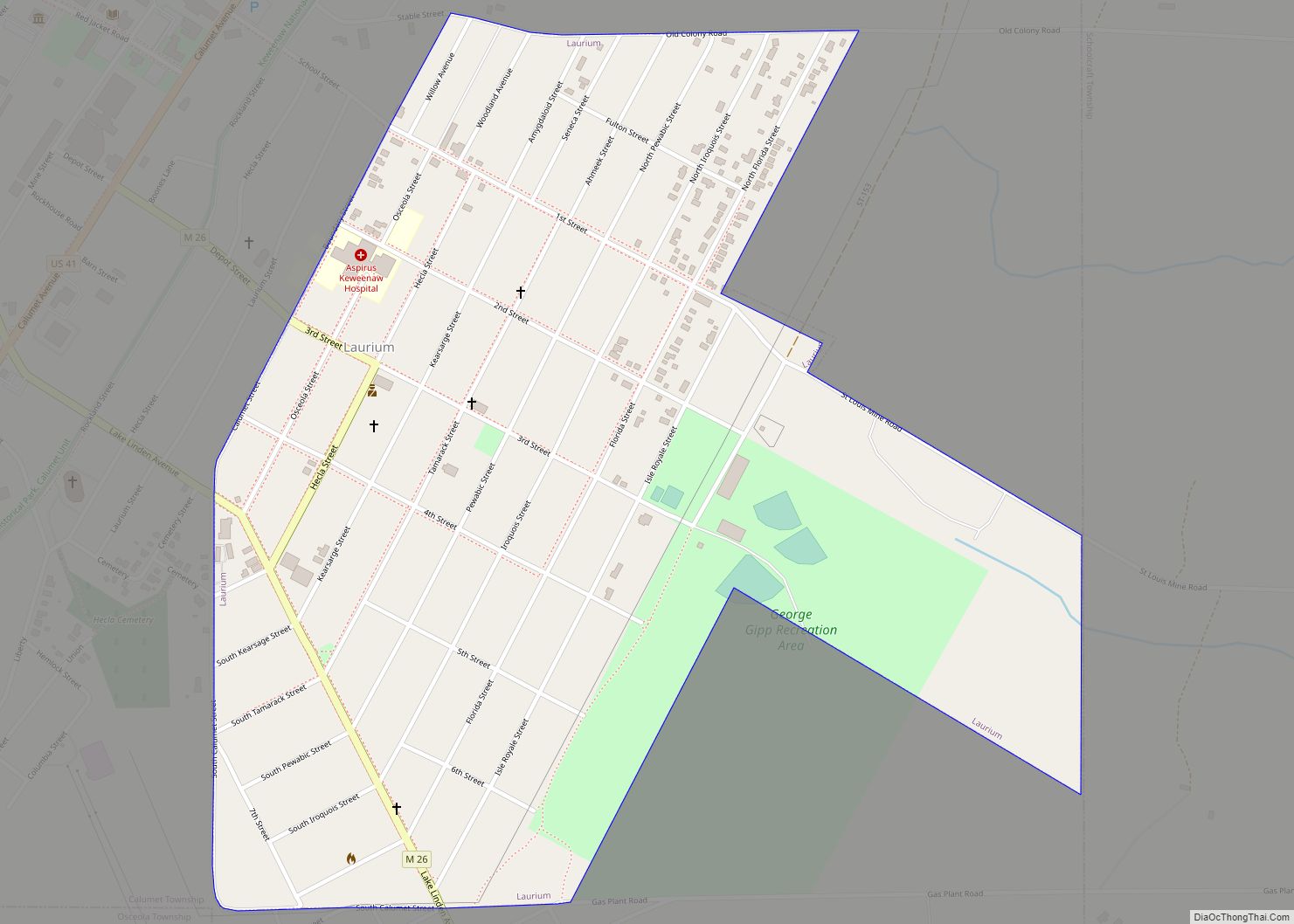
Online Interactive Map
Click on ![]() to view map in "full screen" mode.
to view map in "full screen" mode.
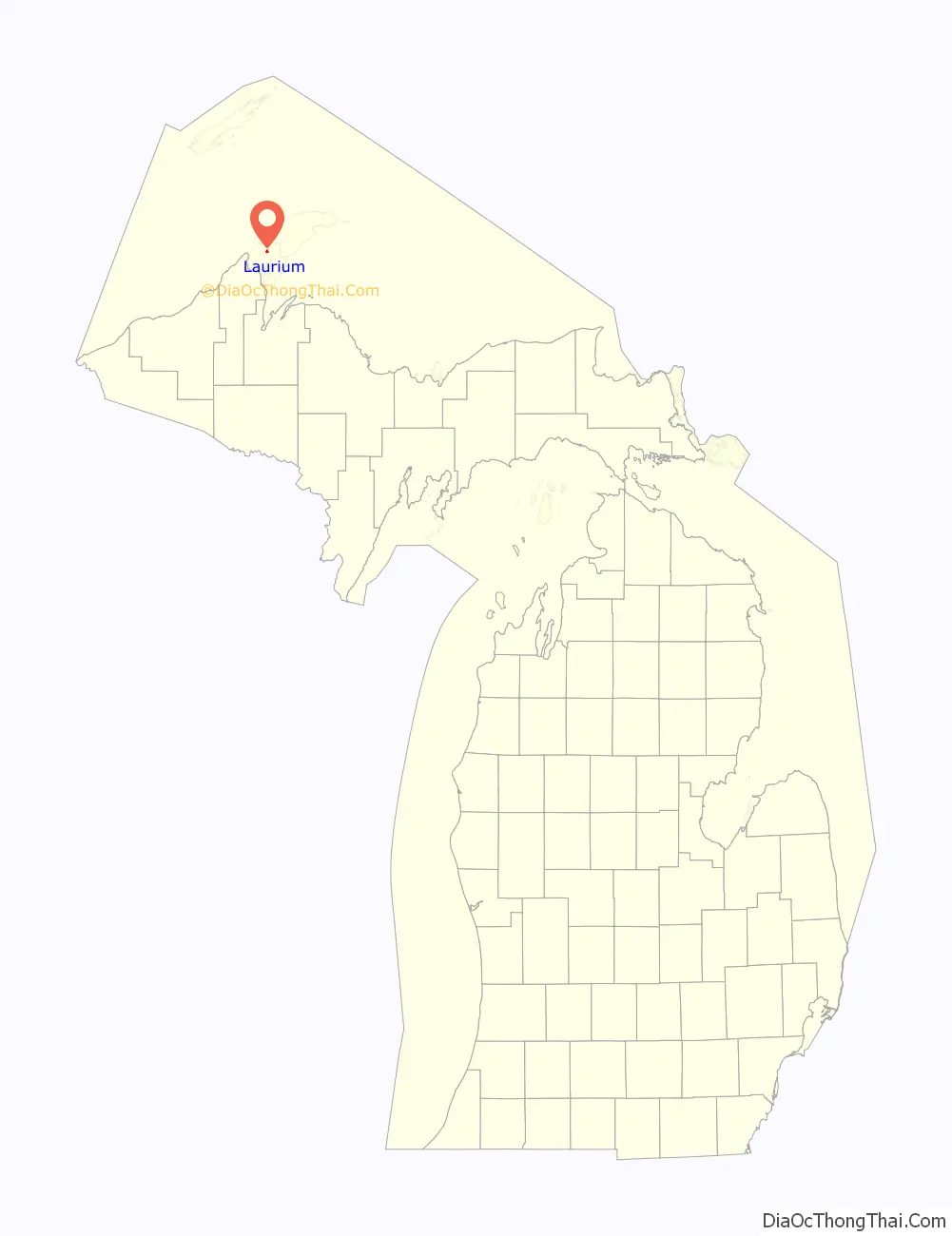
Laurium location map. Where is Laurium village?

History
Until 1895, Laurium was known as “Calumet” (not to be confused with the present nearby town of Calumet, Michigan, which was known as “Red Jacket” until it adopted the name Calumet in 1929). In 1895 the legislature changed Calumet’s name to Laurium, after the famous mining town in ancient Greece. Laurium is located in the center of the Copper Country, the first major copper mining region in the United States. It was founded as a company town serving the Laurium copper mine, which later became part of the Calumet & Hecla mine. The town was generally home to the wealthier members of Keweenaw society, such as mine owners and captains. Although the mines have long since closed, the town still sports many large houses and mansions built by the wealthy mine owners. Today, many of the houses are participating locations in the Keweenaw National Historical Park.
The population in 1900 was 5643, of whom 2286 were foreign-born.
Noted 20th-century football player George Gipp (“the Gipper”) was born in Laurium. A small memorial to the football legend is located on the corner of Lake Linden Avenue and Tamarack Street and his grave is in nearby Lake View Cemetery.
The Palestra was a noted hockey arena, built in Laurium in 1904. It is thought to have been the first purpose-built indoor hockey venue in the United States. In 1921, the entire arena was moved to Marquette, Michigan, and remained there until being razed in 1974.
Laurium Road Map
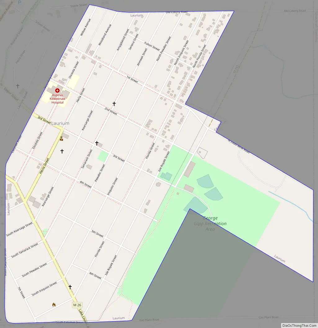
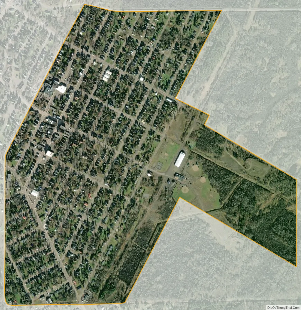
Laurium city Satellite Map
Geography
According to the United States Census Bureau, the village has a total area of 0.65 square miles (1.68 km), all land.
See also
Map of Michigan State and its subdivision:- Alcona
- Alger
- Allegan
- Alpena
- Antrim
- Arenac
- Baraga
- Barry
- Bay
- Benzie
- Berrien
- Branch
- Calhoun
- Cass
- Charlevoix
- Cheboygan
- Chippewa
- Clare
- Clinton
- Crawford
- Delta
- Dickinson
- Eaton
- Emmet
- Genesee
- Gladwin
- Gogebic
- Grand Traverse
- Gratiot
- Hillsdale
- Houghton
- Huron
- Ingham
- Ionia
- Iosco
- Iron
- Isabella
- Jackson
- Kalamazoo
- Kalkaska
- Kent
- Keweenaw
- Lake
- Lake Hurron
- Lake Michigan
- Lake St. Clair
- Lake Superior
- Lapeer
- Leelanau
- Lenawee
- Livingston
- Luce
- Mackinac
- Macomb
- Manistee
- Marquette
- Mason
- Mecosta
- Menominee
- Midland
- Missaukee
- Monroe
- Montcalm
- Montmorency
- Muskegon
- Newaygo
- Oakland
- Oceana
- Ogemaw
- Ontonagon
- Osceola
- Oscoda
- Otsego
- Ottawa
- Presque Isle
- Roscommon
- Saginaw
- Saint Clair
- Saint Joseph
- Sanilac
- Schoolcraft
- Shiawassee
- Tuscola
- Van Buren
- Washtenaw
- Wayne
- Wexford
- Alabama
- Alaska
- Arizona
- Arkansas
- California
- Colorado
- Connecticut
- Delaware
- District of Columbia
- Florida
- Georgia
- Hawaii
- Idaho
- Illinois
- Indiana
- Iowa
- Kansas
- Kentucky
- Louisiana
- Maine
- Maryland
- Massachusetts
- Michigan
- Minnesota
- Mississippi
- Missouri
- Montana
- Nebraska
- Nevada
- New Hampshire
- New Jersey
- New Mexico
- New York
- North Carolina
- North Dakota
- Ohio
- Oklahoma
- Oregon
- Pennsylvania
- Rhode Island
- South Carolina
- South Dakota
- Tennessee
- Texas
- Utah
- Vermont
- Virginia
- Washington
- West Virginia
- Wisconsin
- Wyoming