Northville is a city in Oakland and Wayne counties in the U.S. state of Michigan. The population was 6,119 at the 2020 census.
Northville is a suburb of Metro Detroit and is located about 11 miles (17.7 km) west of the city of Detroit and 17 miles (27.4 km) northeast of Ann Arbor. Part of the city is in Oakland County and is surrounded by the city of Novi, while the other part is in Wayne County and is surrounded by Northville Township. Northville is served by Northville Public Schools.
| Name: | Northville city |
|---|---|
| LSAD Code: | 25 |
| LSAD Description: | city (suffix) |
| State: | Michigan |
| County: | Oakland County, Wayne County |
| Incorporated: | 1867 (village) 1955 (city) |
| Elevation: | 830 ft (253 m) |
| Land Area: | 2.04 sq mi (5.28 km²) |
| Water Area: | 0.02 sq mi (0.04 km²) |
| Population Density: | 3,000.98/sq mi (1,158.62/km²) |
| Area code: | 248 |
| FIPS code: | 2658980 |
| GNISfeature ID: | 0633707 |
Online Interactive Map
Click on ![]() to view map in "full screen" mode.
to view map in "full screen" mode.
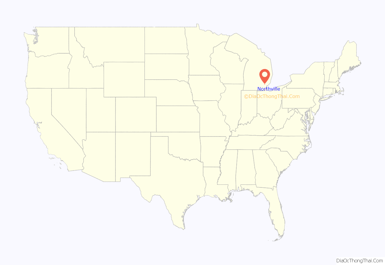
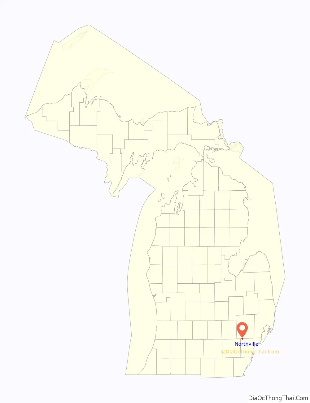
Northville location map. Where is Northville city?
History
Settlement
Northville was first settled by European Americans in 1825, and was incorporated as a Village in 1867. It was not incorporated as a City until 1955. Originally one of two communities within Plymouth Township, Northville Township split off in 1898 to form its own township.
The first land patent in the Northville area was granted to Gideon Benton in 1823; the current Cass Benton Park is located here. The first settlers did not arrive, however, until 1825. Many of these first settlers were originally from central and western New York State, with ancestors in New England. Others came from the nearby, already settled Plymouth community to Northville.
Among these early settlers were Alanson Aldrich, followed by Alvale Smith, who sold his property to John Miller. Miller built the first mill in Plymouth Township, sometime between 1825 and 1828. Mill Race Historical Village is now preserved at this site. Many employees of the mill began to build their houses near it. Northville was named for its relation north of Plymouth.
In 1827, Northville was home to a post office, and Gideon Benton was the US postmaster. Also in 1827, J.F. Davis, became the first resident doctor in Northville. A tailor, tavern, shoe shop, and two blacksmiths also started business in the village. Many of Northville’s first settlers’ surnames became namesakes for contemporary street names today. These include Rufus Thayer Jr. (Thayer Blvd.), Joseph Yerkes (Yerkes St.), Daniel and Samuel Cady (Cady St.), William Dunlap (Dunlap St.), and other settlers. The first church was constructed in 1836 by a Methodist congregation.
Victorian era
Northville continued to grow throughout the Victorian era. This is evident in the architecture around downtown where many homes are in the Queen Anne style. Northville’s Victorian heritage is celebrated every September in the Victorian Festival, which was recently rechristened the “Heritage Festival”.
The first schoolhouse in Northville opened in 1853 and was taught by Jacob Ramsdell. Northville was incorporated as a village in 1867 from a portion of Plymouth Township. By the end of the nineteenth century, it had established a public school system headed by a superintendent.
Village era
Henry Ford purchased a factory in Northville and moved machinery from plants in the area to the factory in 1919. Known as the Northville Valve Plant, the plant was rebuilt in 1936, and enlarged in 1956. The plant provided valves for every Ford, Mercury, and Lincoln vehicle, except for the Lincoln Continental, until closing and being sold in 1981. The building now houses offices and a health club. In 1925, the Penniman-Allen Theater opened downtown and remained open through the mid-70’s. The theater eventually closed, but opened again in 1978 as the Marquis Theater and is now home to live children’s theater. When Northville was more rural, skiing was popular and tournaments were held often. In 1944, Northville Downs opened as the first nighttime harness racing track in Michigan. The Downs were built on the site of the former Wayne County Fair, where Joe Louis trained in 1939 for his World Championship later that year. Northville Downs has been in continuous operation since 1944, and is located at the corner of Center Street and 7 Mile Road.
City era
The city was incorporated in 1955 along the boundaries of the Village of Northville, and grew rapidly during the prolonged period of white flight from the City of Detroit in the middle and late 20th century. The Village of Northville included portions of Novi Township in Oakland County and Northville Township in Wayne County. Over the next several years, the city boundaries expanded through annexation of portions of Novi Township and the Village of Novi both east and west of the city and north of Baseline Road. The city’s northern boundary was fixed by the incorporation of the Village of Novi into the City of Novi in 1969. The city has also annexed small portions of Northville Township, the most recent of which was an expansion of the Rural Hill Cemetery. Northville Township’s status as a Charter Township generally precludes the City from annexing any significant portion of the Township. The most recent annexation was permitted by the Township in order for the city to expand the city-owned and operated cemetery.
Libraries
In 1889, the Ladies Library Association was organized by Mary Lapham, and had 1,200 books and 150 members by 1892. The library was located in the former Young Men’s Hall until 1964, when it moved temporarily to the new City Hall . In 1975, the library moved again temporarily to the Northville Square Mall; in 1980 it returned to City Hall. In 1996, it moved into the newly built Northville District Library.
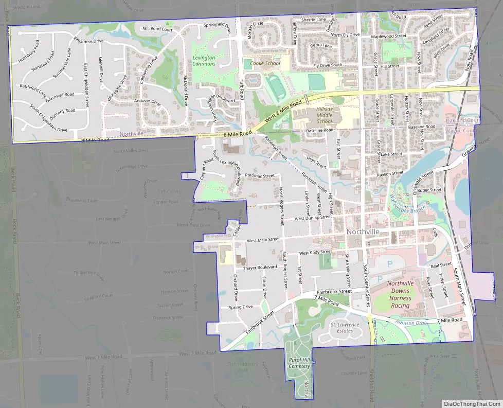
Northville Road Map
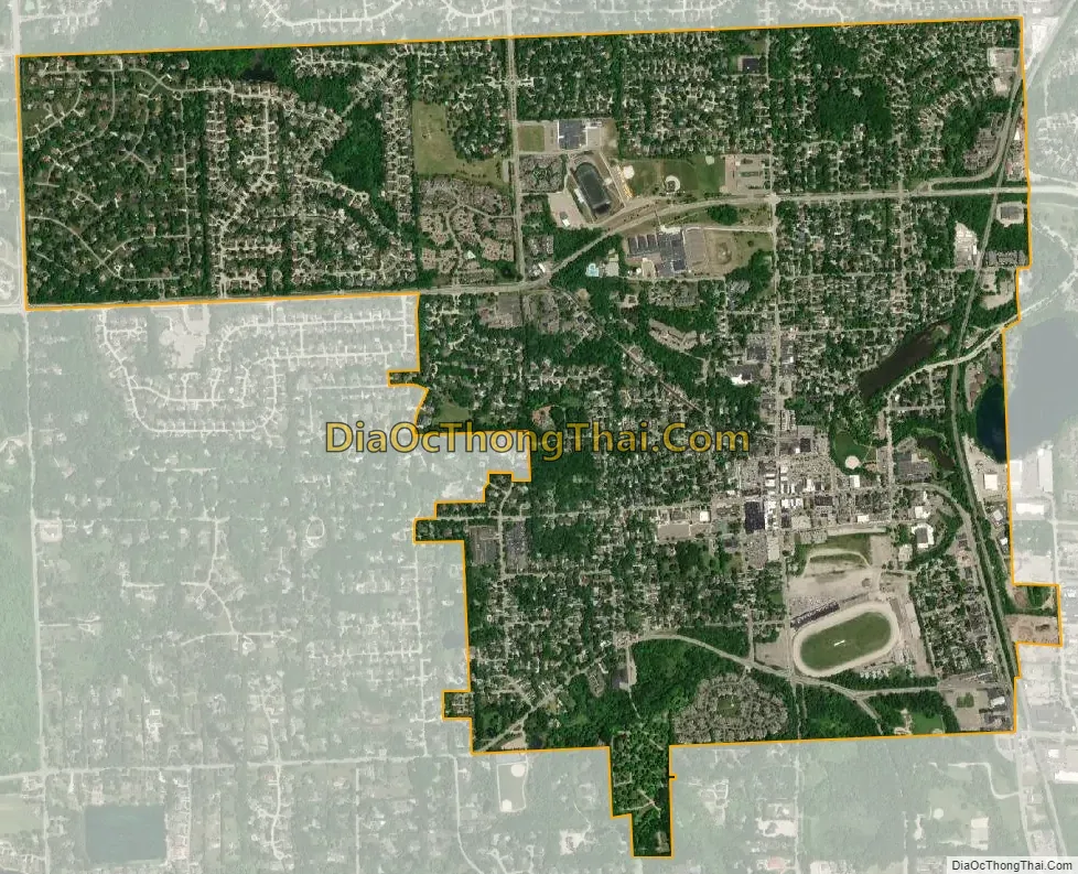
Northville city Satellite Map
Geography
According to the United States Census Bureau, the city has a total area of 2.06 square miles (5.34 km), of which 2.04 square miles (5.28 km) is land and 0.02 square miles (0.05 km) (0.97%) is water.
The city is divided almost equally between Oakland County to the north and Wayne County to the south. Eight Mile Road (or Baseline Road) serves as the county line. Of the city’s 2.06 square miles (5.34 km) in area and population of 5,970, 1.06 square miles (2.75 km) (51.4%) and 2,739 residences (45.9%) are within Wayne County. Oakland County contains 1.00 square mile (2.59 km) of land (48.6%) and 3,231 residents (54.1%).
See also
Map of Michigan State and its subdivision:- Alcona
- Alger
- Allegan
- Alpena
- Antrim
- Arenac
- Baraga
- Barry
- Bay
- Benzie
- Berrien
- Branch
- Calhoun
- Cass
- Charlevoix
- Cheboygan
- Chippewa
- Clare
- Clinton
- Crawford
- Delta
- Dickinson
- Eaton
- Emmet
- Genesee
- Gladwin
- Gogebic
- Grand Traverse
- Gratiot
- Hillsdale
- Houghton
- Huron
- Ingham
- Ionia
- Iosco
- Iron
- Isabella
- Jackson
- Kalamazoo
- Kalkaska
- Kent
- Keweenaw
- Lake
- Lake Hurron
- Lake Michigan
- Lake St. Clair
- Lake Superior
- Lapeer
- Leelanau
- Lenawee
- Livingston
- Luce
- Mackinac
- Macomb
- Manistee
- Marquette
- Mason
- Mecosta
- Menominee
- Midland
- Missaukee
- Monroe
- Montcalm
- Montmorency
- Muskegon
- Newaygo
- Oakland
- Oceana
- Ogemaw
- Ontonagon
- Osceola
- Oscoda
- Otsego
- Ottawa
- Presque Isle
- Roscommon
- Saginaw
- Saint Clair
- Saint Joseph
- Sanilac
- Schoolcraft
- Shiawassee
- Tuscola
- Van Buren
- Washtenaw
- Wayne
- Wexford
- Alabama
- Alaska
- Arizona
- Arkansas
- California
- Colorado
- Connecticut
- Delaware
- District of Columbia
- Florida
- Georgia
- Hawaii
- Idaho
- Illinois
- Indiana
- Iowa
- Kansas
- Kentucky
- Louisiana
- Maine
- Maryland
- Massachusetts
- Michigan
- Minnesota
- Mississippi
- Missouri
- Montana
- Nebraska
- Nevada
- New Hampshire
- New Jersey
- New Mexico
- New York
- North Carolina
- North Dakota
- Ohio
- Oklahoma
- Oregon
- Pennsylvania
- Rhode Island
- South Carolina
- South Dakota
- Tennessee
- Texas
- Utah
- Vermont
- Virginia
- Washington
- West Virginia
- Wisconsin
- Wyoming


