Orchard Lake Village is a city in Oakland County in the U.S. state of Michigan. The population was 2,375 at the 2010 census.
A northern suburb of Metro Detroit, Orchard Lake Village is located about 3 miles (4.8 km) southwest of the city of Pontiac and 16 miles (25.7 km) northwest of the city of Detroit. The city is mostly surrounded by West Bloomfield Township, with a small northeast border with Keego Harbor. About 40% of the city’s total area is water, with the main geographic feature being Orchard Lake, which occupies about 30% of the city’s total area.
Orchard Lake Village is home to St. Mary’s Preparatory and SS. Cyril and Methodius Seminary, in addition to the Orchard Lake Country Club and Pine Lake Country Club. It is also the home of Orchard Lake St. Mary’s Preparatory and Orchard Lake Schools, formerly Michigan Military Academy.
| Name: | Orchard Lake Village city |
|---|---|
| LSAD Code: | 25 |
| LSAD Description: | city (suffix) |
| State: | Michigan |
| County: | Oakland County |
| Incorporated: | 1928 (village) 1964 (city) |
| Land Area: | 2.40 sq mi (6.21 km²) |
| Water Area: | 1.66 sq mi (4.29 km²) |
| Population Density: | 933.28/sq mi (360.41/km²) |
| Area code: | 248 |
| FIPS code: | 2661020 |
| GNISfeature ID: | 634090 |
Online Interactive Map
Click on ![]() to view map in "full screen" mode.
to view map in "full screen" mode.
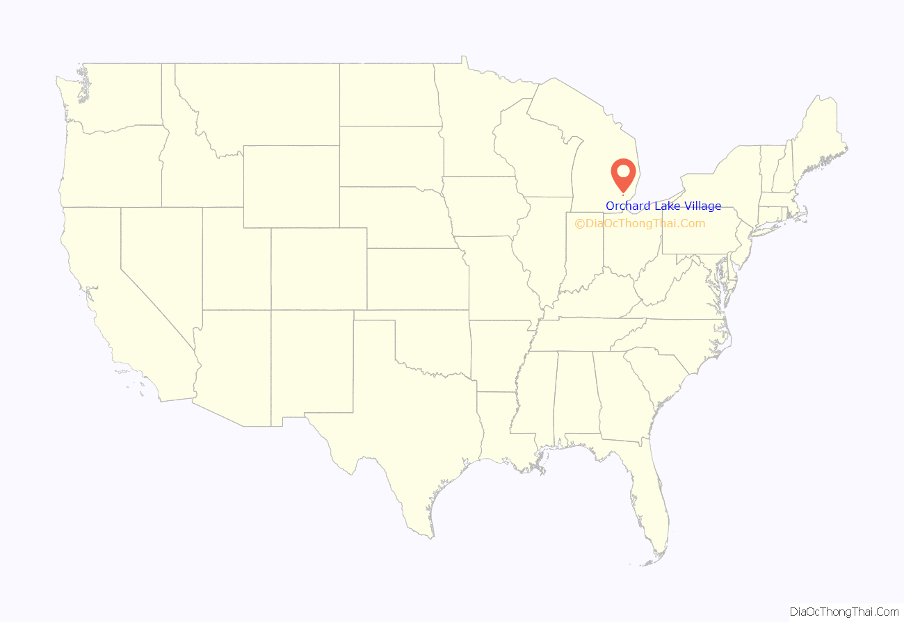
Orchard Lake Village location map. Where is Orchard Lake Village city?
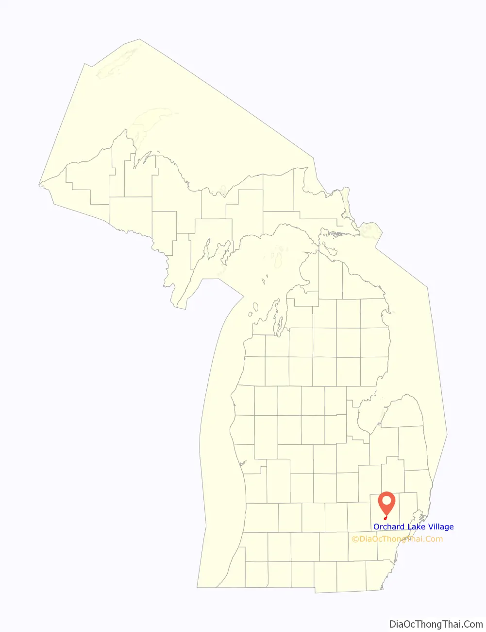
Orchard Lake Village Road Map
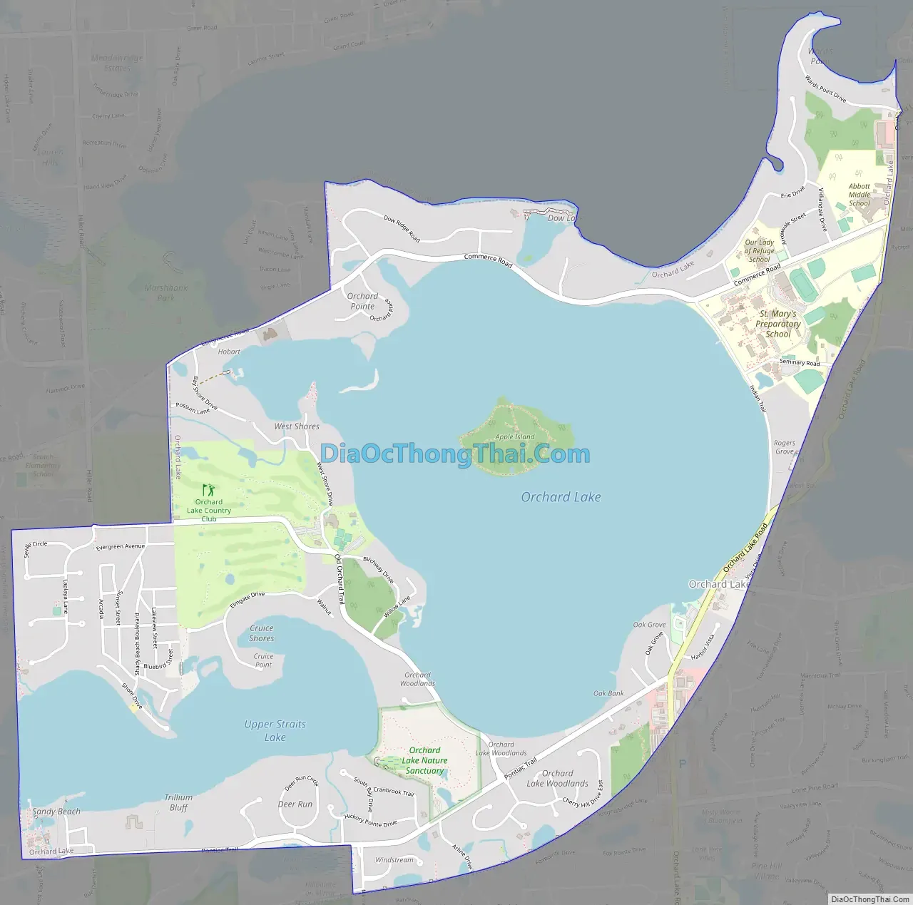
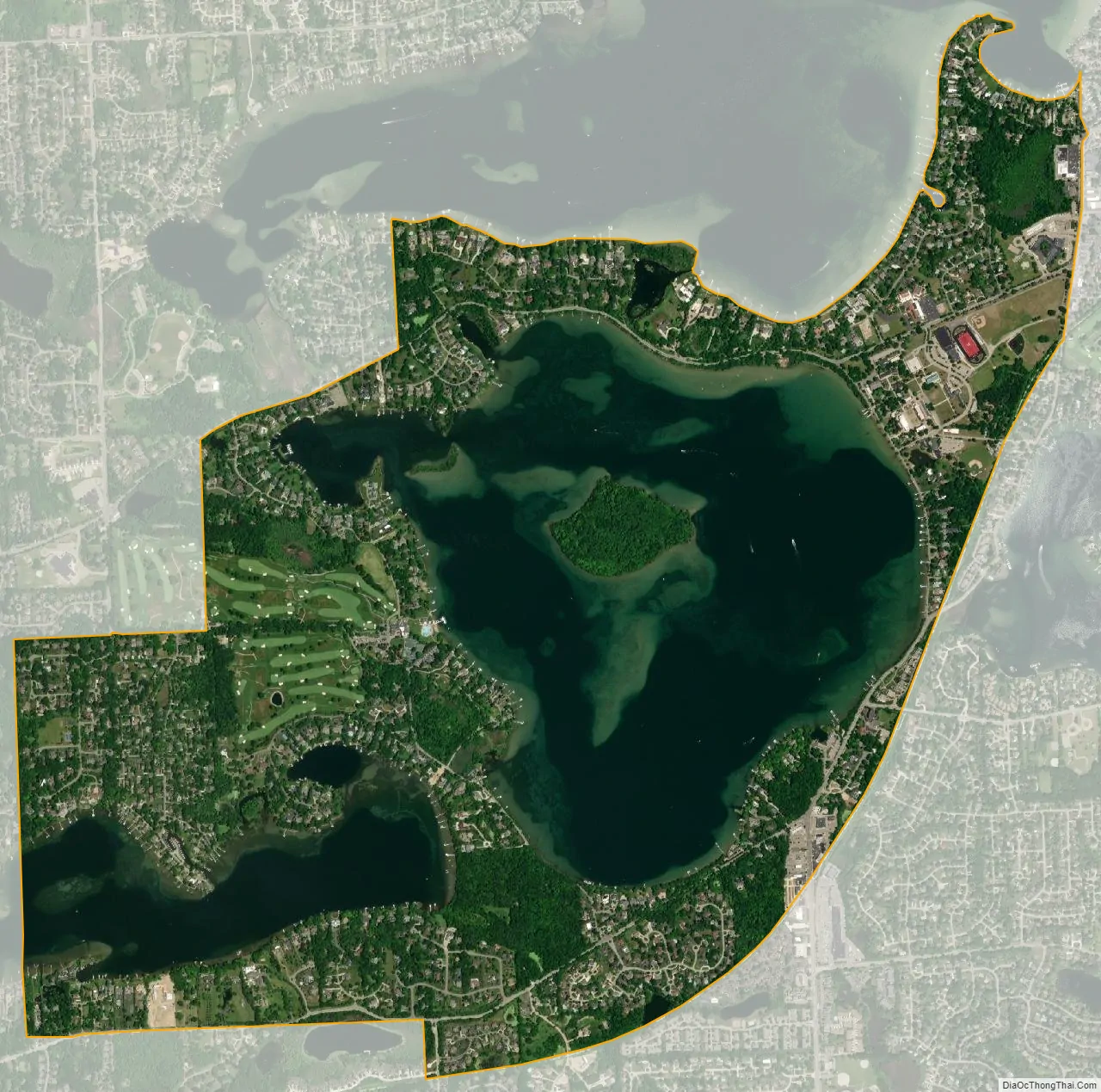
Orchard Lake Village city Satellite Map
Geography
According to the United States Census Bureau, the city has a total area of 4.12 square miles (10.67 km), of which 2.44 square miles (6.32 km) is land and 1.68 square miles (4.35 km) (40.78%) is water.
Orchard Lake, Cass Lake, and Upper Straits Lake are all within or partially within the city limits. Terrain is rolling and high. Orchard Lake Village surrounds Orchard Lake, the third-largest lake in Oakland County (after Cass Lake, which is also partially in Orchard Lake Village, and Kent Lake). The city is surrounded by West Bloomfield Township, except for the northeast boundary along Keego Harbor.
See also
Map of Michigan State and its subdivision:- Alcona
- Alger
- Allegan
- Alpena
- Antrim
- Arenac
- Baraga
- Barry
- Bay
- Benzie
- Berrien
- Branch
- Calhoun
- Cass
- Charlevoix
- Cheboygan
- Chippewa
- Clare
- Clinton
- Crawford
- Delta
- Dickinson
- Eaton
- Emmet
- Genesee
- Gladwin
- Gogebic
- Grand Traverse
- Gratiot
- Hillsdale
- Houghton
- Huron
- Ingham
- Ionia
- Iosco
- Iron
- Isabella
- Jackson
- Kalamazoo
- Kalkaska
- Kent
- Keweenaw
- Lake
- Lake Hurron
- Lake Michigan
- Lake St. Clair
- Lake Superior
- Lapeer
- Leelanau
- Lenawee
- Livingston
- Luce
- Mackinac
- Macomb
- Manistee
- Marquette
- Mason
- Mecosta
- Menominee
- Midland
- Missaukee
- Monroe
- Montcalm
- Montmorency
- Muskegon
- Newaygo
- Oakland
- Oceana
- Ogemaw
- Ontonagon
- Osceola
- Oscoda
- Otsego
- Ottawa
- Presque Isle
- Roscommon
- Saginaw
- Saint Clair
- Saint Joseph
- Sanilac
- Schoolcraft
- Shiawassee
- Tuscola
- Van Buren
- Washtenaw
- Wayne
- Wexford
- Alabama
- Alaska
- Arizona
- Arkansas
- California
- Colorado
- Connecticut
- Delaware
- District of Columbia
- Florida
- Georgia
- Hawaii
- Idaho
- Illinois
- Indiana
- Iowa
- Kansas
- Kentucky
- Louisiana
- Maine
- Maryland
- Massachusetts
- Michigan
- Minnesota
- Mississippi
- Missouri
- Montana
- Nebraska
- Nevada
- New Hampshire
- New Jersey
- New Mexico
- New York
- North Carolina
- North Dakota
- Ohio
- Oklahoma
- Oregon
- Pennsylvania
- Rhode Island
- South Carolina
- South Dakota
- Tennessee
- Texas
- Utah
- Vermont
- Virginia
- Washington
- West Virginia
- Wisconsin
- Wyoming


