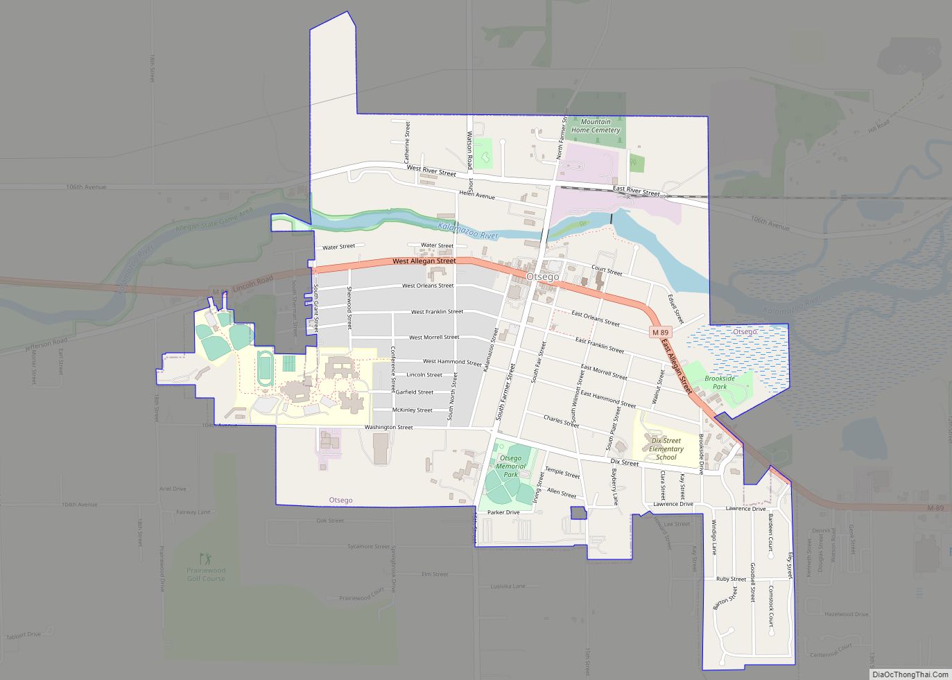
Otsego is a city in Allegan County in the U.S. state of Michigan. The population was 3,956 at the 2010 census. The city is within Otsego Township, but is administratively autonomous.
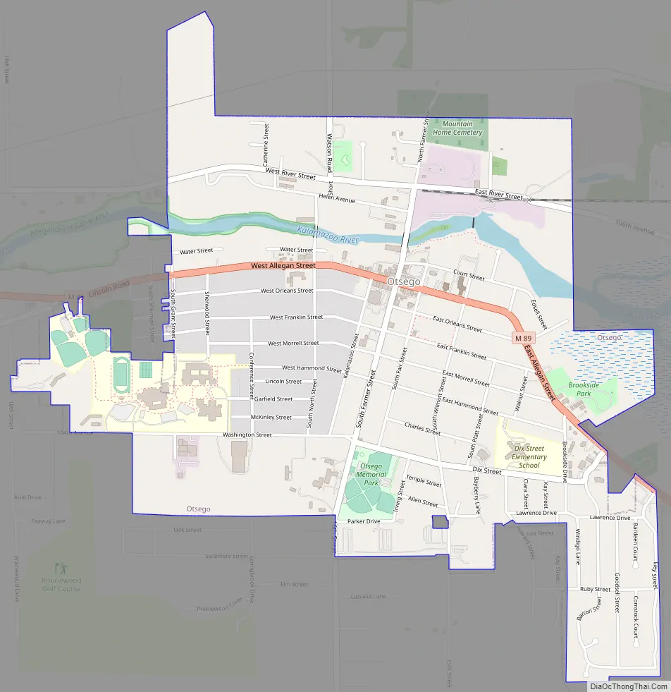
Otsego is situated on M-89 about three miles (5 km) west of Plainwell and US 131. It is about nine miles (14 km) southeast of Allegan and the Kalamazoo River flows east to west through the city.
| Name: | Otsego city |
|---|---|
| LSAD Code: | 25 |
| LSAD Description: | city (suffix) |
| State: | Michigan |
| County: | Allegan County |
| Elevation: | 709 ft (216 m) |
| Total Area: | 2.09 sq mi (5.42 km²) |
| Land Area: | 2.03 sq mi (5.26 km²) |
| Water Area: | 0.06 sq mi (0.16 km²) |
| Total Population: | 4,120 |
| Population Density: | 2,028.56/sq mi (783.07/km²) |
| ZIP code: | 49078 |
| Area code: | 269 |
| FIPS code: | 2661620 |
| GNISfeature ID: | 0634156 |
| Website: | www.cityofotsego.org |
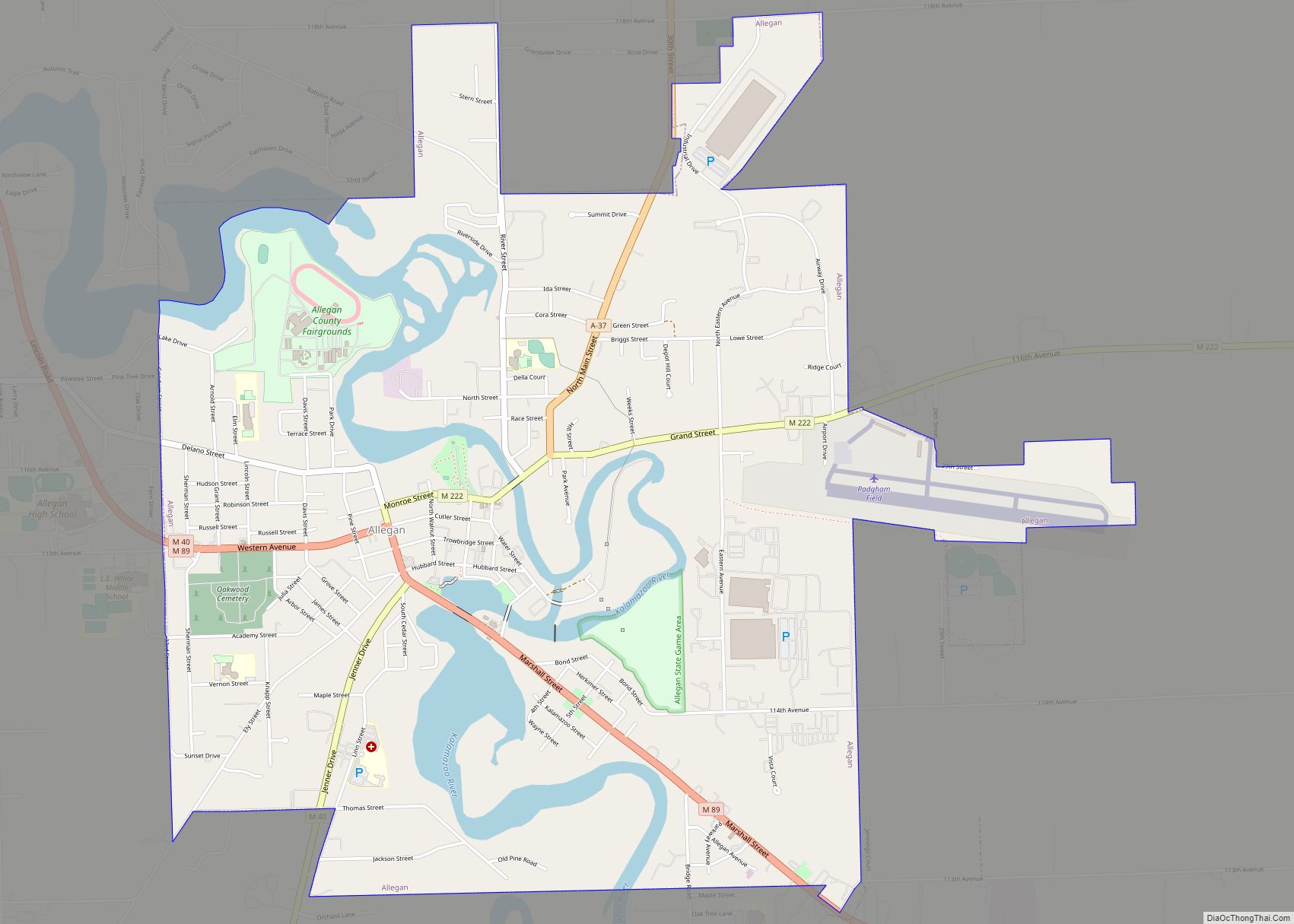
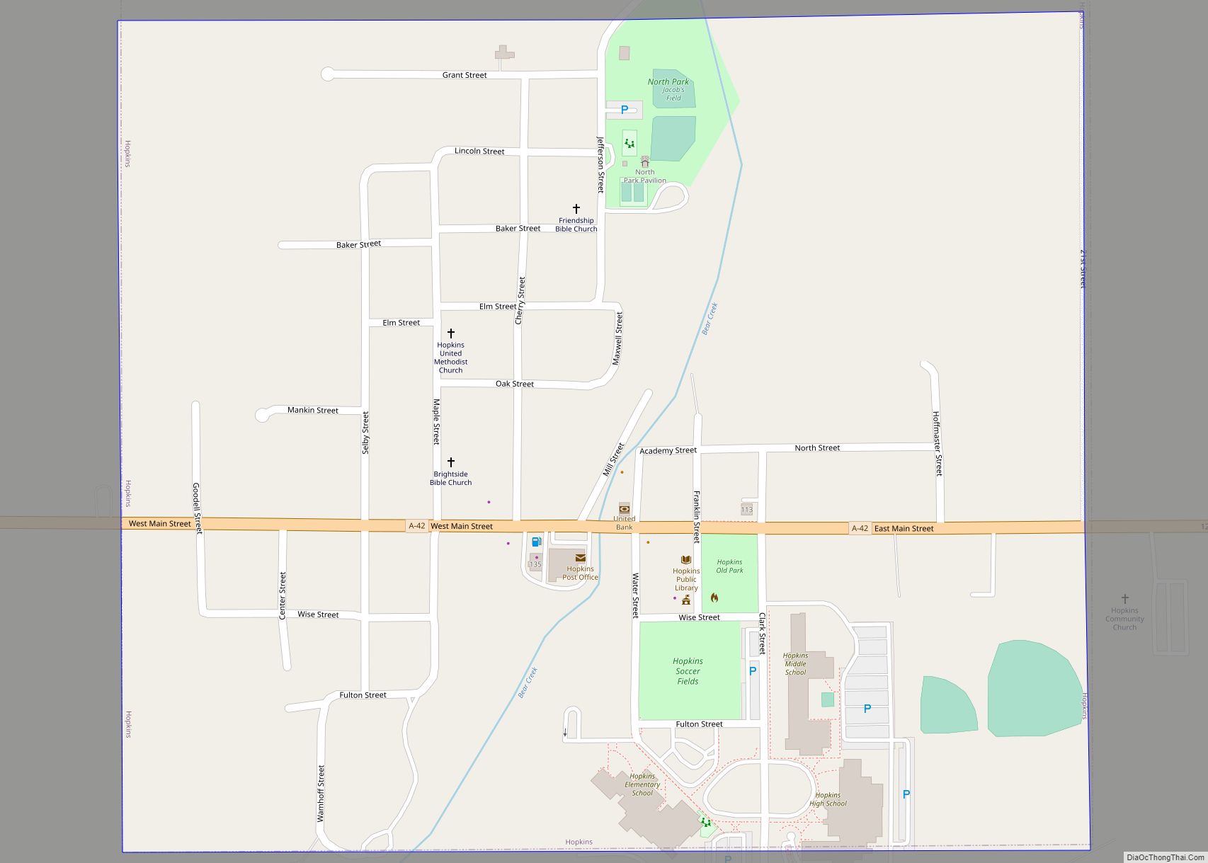
Online Interactive Map
Click on ![]() to view map in "full screen" mode.
to view map in "full screen" mode.
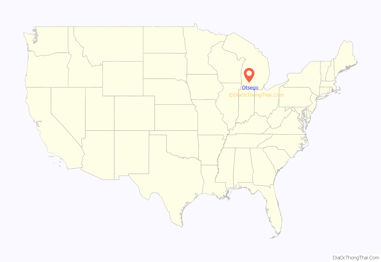
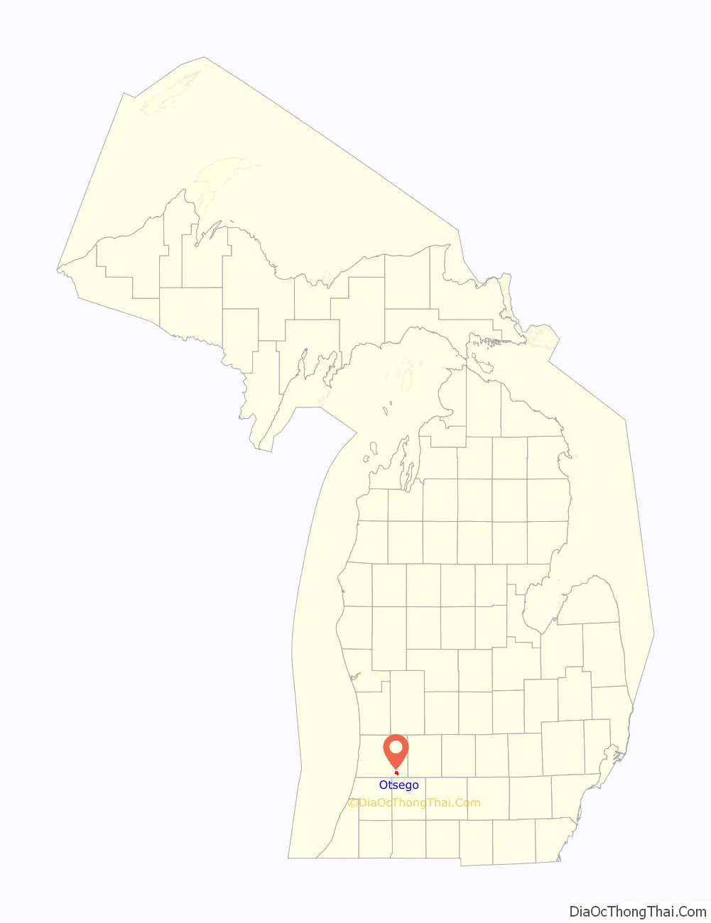
Otsego location map. Where is Otsego city?
History
Otsego was established in 1831, called Pine Creek by its initial settlers: Giles Scott and Hull Sherwood. A post office was established in 1832 under the name of Allegan, the name being changed to Otsego in 1835 with the organization of Allegan County, spearheaded by Otsego resident Dr. Samuel Foster. 1833 brought a school to the new town, and a hotel – the Tompkins House – followed in the 1860s.
On June 6, 1863, at Aaron Hilliard’s house Ellen G. White, a founder of the Seventh-day Adventist church, experienced a vision about health and disease, and it showed vegetarian food, as was described in Genesis 1:29, was the proper food for humankind. Her vision led to the creation of many vegetarian foods and vegetarian food companies, including the Battle Creek Sanitarium and Loma Linda Foods.
The 1880s saw some big advances for Otsego. In 1883, Otsego High School held its first commencement ceremony, graduating three students; A home-delivery milk route was started up in 1885; and 1886 brought the establishment of the volunteer fire department still in operation today, but no longer using horse-drawn water-wagons. The decade closes out with the formation of the city’s Republican Club in 1888.
The city’s popular baseball park was sold to the area Catholics as a site for a church in 1890. The Russell Buggy Company came to town as well, making popular ironclad carriages. The Bardeen Mansion was completed in 1894, and would remain a subject of public adoration until it was razed in 1962–63. A smallpox epidemic swept the town in 1894, as well.
A flu epidemic struck 800 residents, killing some, in 1918.
Otsego was struck by a tornado in 1962, uprooting trees and wiping out electricity/telephone services for several days.
Otsego Road Map
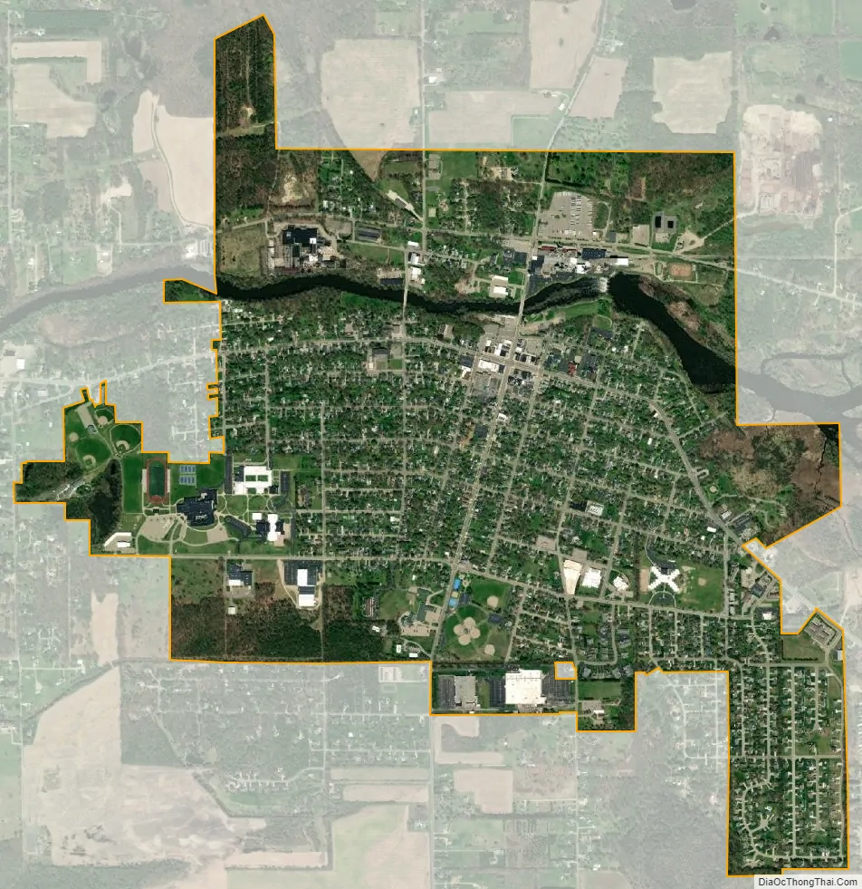
Otsego city Satellite Map
Geography
According to the United States Census Bureau, the city has a total area of 2.13 square miles (5.52 km), of which 2.07 square miles (5.36 km) is land and 0.06 square miles (0.16 km) is water.
See also
Map of Michigan State and its subdivision:- Alcona
- Alger
- Allegan
- Alpena
- Antrim
- Arenac
- Baraga
- Barry
- Bay
- Benzie
- Berrien
- Branch
- Calhoun
- Cass
- Charlevoix
- Cheboygan
- Chippewa
- Clare
- Clinton
- Crawford
- Delta
- Dickinson
- Eaton
- Emmet
- Genesee
- Gladwin
- Gogebic
- Grand Traverse
- Gratiot
- Hillsdale
- Houghton
- Huron
- Ingham
- Ionia
- Iosco
- Iron
- Isabella
- Jackson
- Kalamazoo
- Kalkaska
- Kent
- Keweenaw
- Lake
- Lake Hurron
- Lake Michigan
- Lake St. Clair
- Lake Superior
- Lapeer
- Leelanau
- Lenawee
- Livingston
- Luce
- Mackinac
- Macomb
- Manistee
- Marquette
- Mason
- Mecosta
- Menominee
- Midland
- Missaukee
- Monroe
- Montcalm
- Montmorency
- Muskegon
- Newaygo
- Oakland
- Oceana
- Ogemaw
- Ontonagon
- Osceola
- Oscoda
- Otsego
- Ottawa
- Presque Isle
- Roscommon
- Saginaw
- Saint Clair
- Saint Joseph
- Sanilac
- Schoolcraft
- Shiawassee
- Tuscola
- Van Buren
- Washtenaw
- Wayne
- Wexford
- Alabama
- Alaska
- Arizona
- Arkansas
- California
- Colorado
- Connecticut
- Delaware
- District of Columbia
- Florida
- Georgia
- Hawaii
- Idaho
- Illinois
- Indiana
- Iowa
- Kansas
- Kentucky
- Louisiana
- Maine
- Maryland
- Massachusetts
- Michigan
- Minnesota
- Mississippi
- Missouri
- Montana
- Nebraska
- Nevada
- New Hampshire
- New Jersey
- New Mexico
- New York
- North Carolina
- North Dakota
- Ohio
- Oklahoma
- Oregon
- Pennsylvania
- Rhode Island
- South Carolina
- South Dakota
- Tennessee
- Texas
- Utah
- Vermont
- Virginia
- Washington
- West Virginia
- Wisconsin
- Wyoming