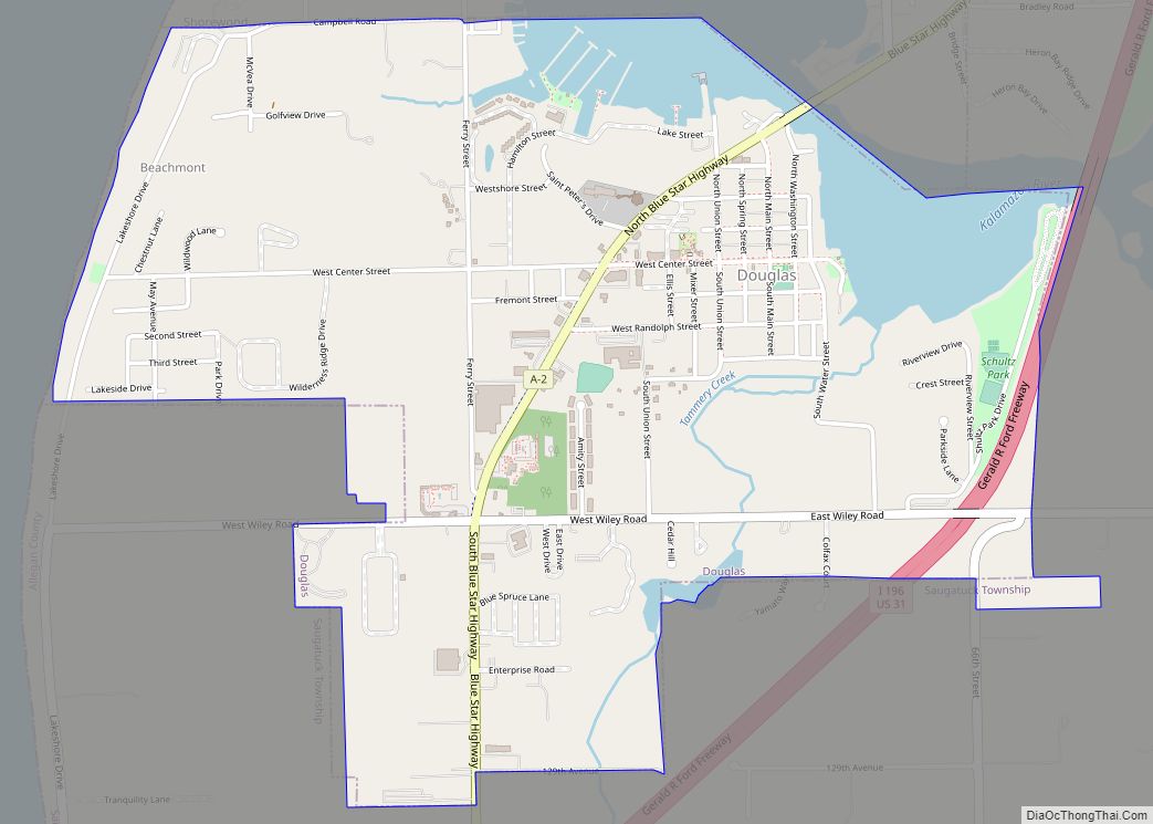
Douglas (officially known as the City of the Village of Douglas) is a city in Allegan County in the U.S. state of Michigan. The population was 1,378 at the 2020 census. The city is surrounded by Saugatuck Township and the city of Saugatuck is adjacent on the north.
On December 13, 2004, residents voted to adopt a charter changing the status of the village into a city form of government. Under Michigan law, cities are independent entities whereas villages are part of the township. The official name is City of the Village of Douglas.
| Name: | Douglas city |
|---|---|
| LSAD Code: | 25 |
| LSAD Description: | city (suffix) |
| State: | Michigan |
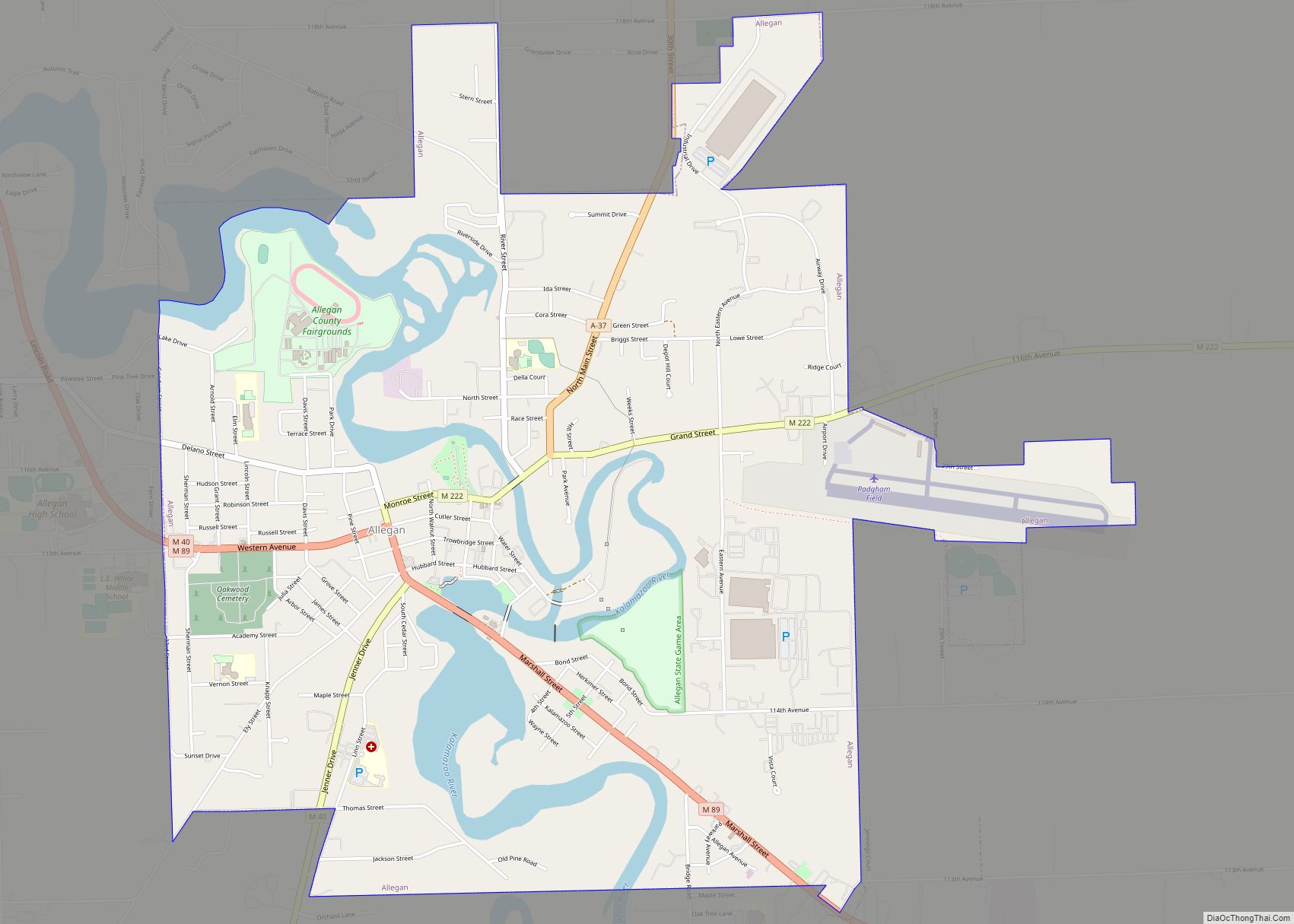
| County: | Allegan County |
| Elevation: | 610 ft (186 m) |
| Total Area: | 2.01 sq mi (5.20 km²) |
| Land Area: | 1.78 sq mi (4.61 km²) |
| Water Area: | 0.23 sq mi (0.59 km²) |
| Total Population: | 1,378 |
| Population Density: | 774.59/sq mi (299.08/km²) |
| ZIP code: | 49406 |
| Area code: | 269 |
| FIPS code: | 2622740 |
| GNISfeature ID: | 0624823 |
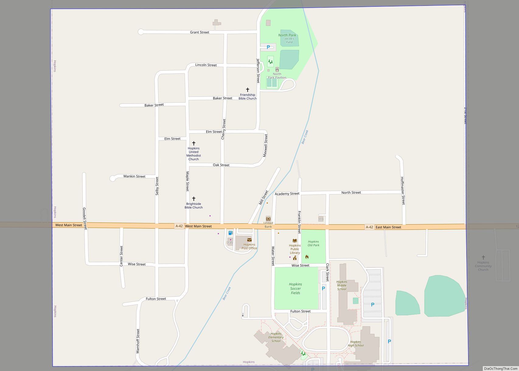
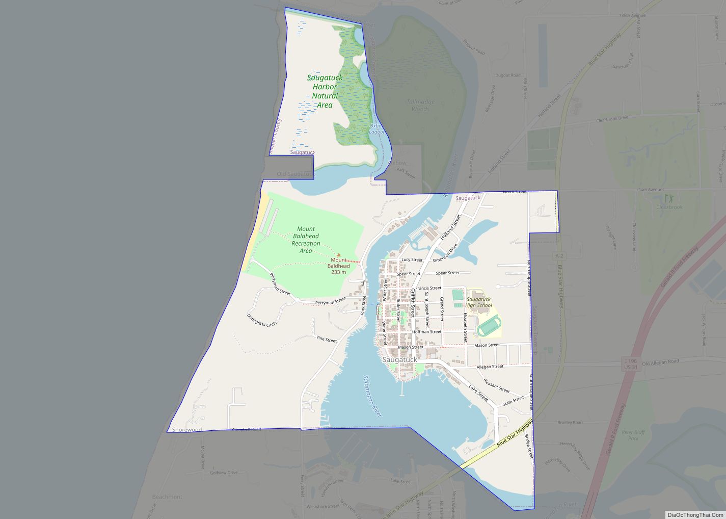
Online Interactive Map
Click on ![]() to view map in "full screen" mode.
to view map in "full screen" mode.
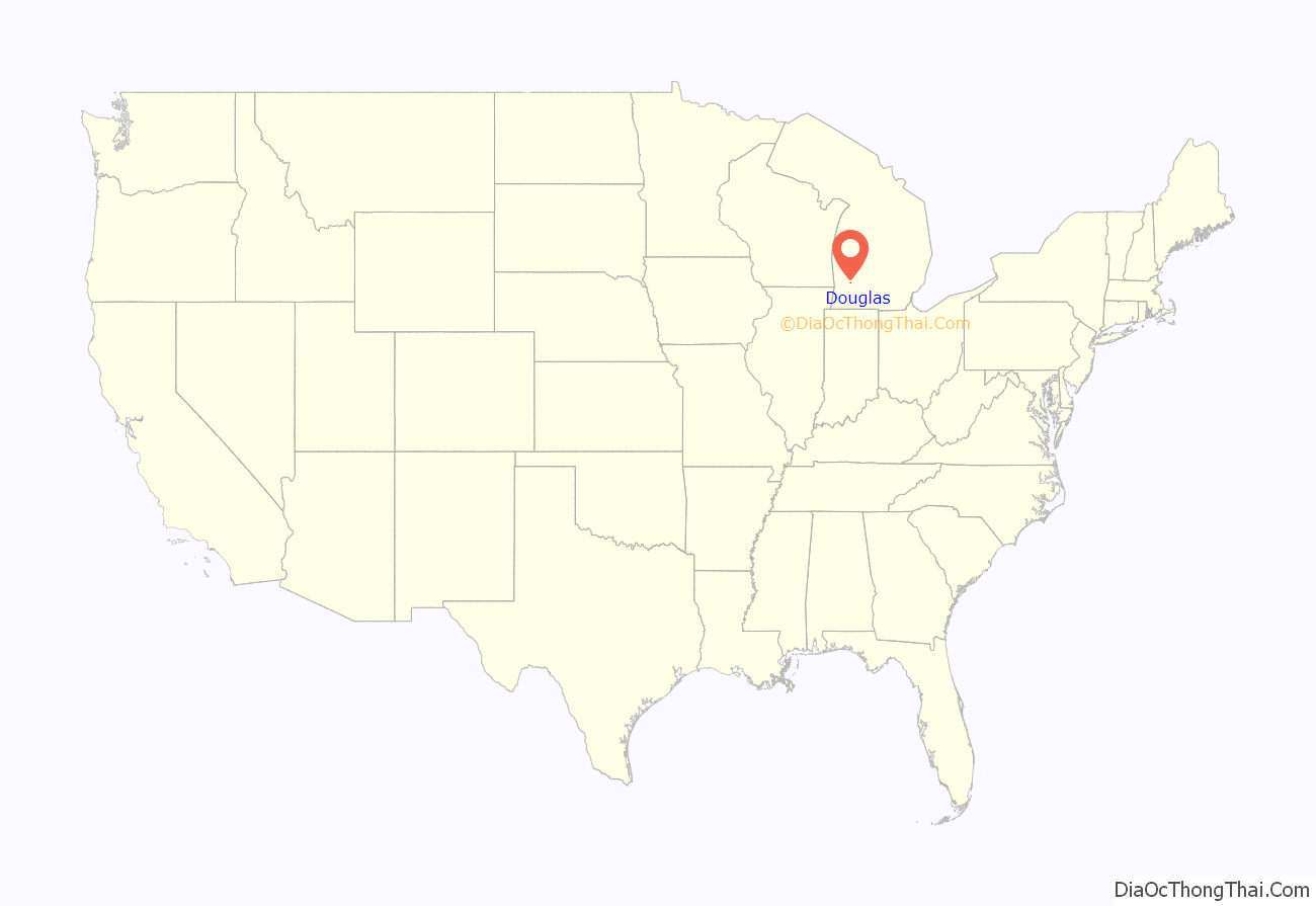
Douglas location map. Where is Douglas city?
History
Douglas, originally known as Dudleyville, was first settled by European-Americans in 1851 as a lumber mill town. In 1861, residents changed the name to Douglas. Reportedly the name was chosen to honor the American statesman Stephen A. Douglas, but other reports indicate that a relative of the original owner of the land also suggested the name because he came from Douglas, the capital of the Isle of Man. Douglas was incorporated as a village in 1870.
Area sawmills provided much of the lumber used to rebuild Chicago after the Great Chicago Fire of 1871. After most of the harvestable trees in the area were cleared by the lumber industry, the area became a center for growing and shipping fruit, especially peaches. Tourism and resorts also became an important part of the area economy.
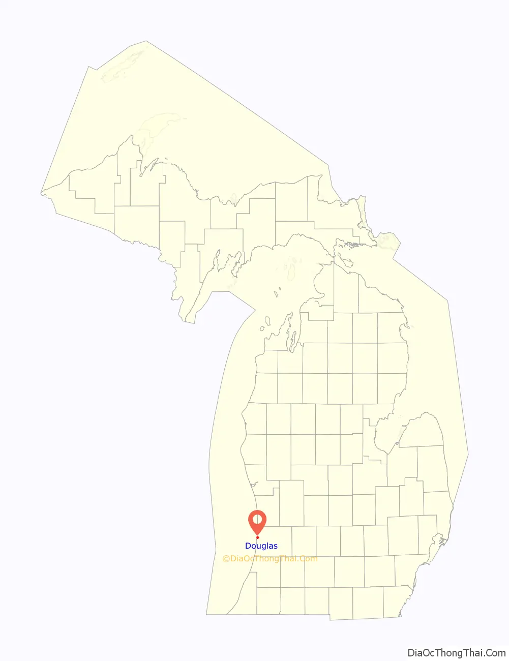
Douglas Road Map

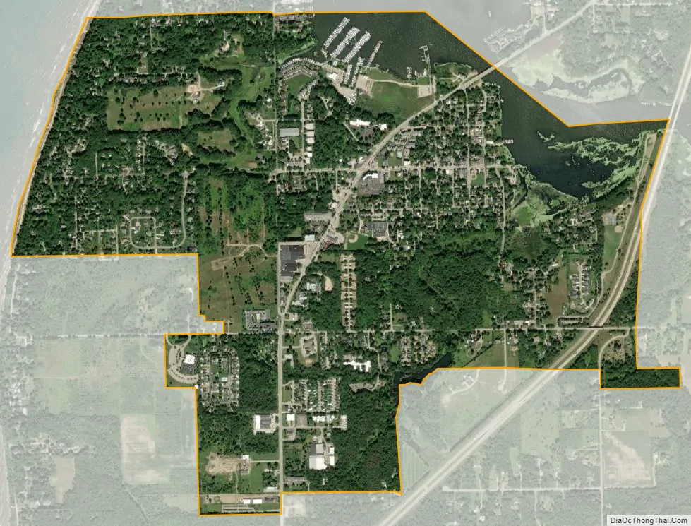
Douglas city Satellite Map
Geography
According to the United States Census Bureau, the city has a total area of 1.98 square miles (5.13 km), of which 1.75 square miles (4.53 km) is land and 0.23 square miles (0.60 km) is water. The city has over 1.5 miles of coastline along the shores of Lake Michigan, and over two miles of frontage along the meandering Kalamazoo River and Lake Kalamazoo Harbor.
See also
Map of Michigan State and its subdivision:- Alcona
- Alger
- Allegan
- Alpena
- Antrim
- Arenac
- Baraga
- Barry
- Bay
- Benzie
- Berrien
- Branch
- Calhoun
- Cass
- Charlevoix
- Cheboygan
- Chippewa
- Clare
- Clinton
- Crawford
- Delta
- Dickinson
- Eaton
- Emmet
- Genesee
- Gladwin
- Gogebic
- Grand Traverse
- Gratiot
- Hillsdale
- Houghton
- Huron
- Ingham
- Ionia
- Iosco
- Iron
- Isabella
- Jackson
- Kalamazoo
- Kalkaska
- Kent
- Keweenaw
- Lake
- Lake Hurron
- Lake Michigan
- Lake St. Clair
- Lake Superior
- Lapeer
- Leelanau
- Lenawee
- Livingston
- Luce
- Mackinac
- Macomb
- Manistee
- Marquette
- Mason
- Mecosta
- Menominee
- Midland
- Missaukee
- Monroe
- Montcalm
- Montmorency
- Muskegon
- Newaygo
- Oakland
- Oceana
- Ogemaw
- Ontonagon
- Osceola
- Oscoda
- Otsego
- Ottawa
- Presque Isle
- Roscommon
- Saginaw
- Saint Clair
- Saint Joseph
- Sanilac
- Schoolcraft
- Shiawassee
- Tuscola
- Van Buren
- Washtenaw
- Wayne
- Wexford
- Alabama
- Alaska
- Arizona
- Arkansas
- California
- Colorado
- Connecticut
- Delaware
- District of Columbia
- Florida
- Georgia
- Hawaii
- Idaho
- Illinois
- Indiana
- Iowa
- Kansas
- Kentucky
- Louisiana
- Maine
- Maryland
- Massachusetts
- Michigan
- Minnesota
- Mississippi
- Missouri
- Montana
- Nebraska
- Nevada
- New Hampshire
- New Jersey
- New Mexico
- New York
- North Carolina
- North Dakota
- Ohio
- Oklahoma
- Oregon
- Pennsylvania
- Rhode Island
- South Carolina
- South Dakota
- Tennessee
- Texas
- Utah
- Vermont
- Virginia
- Washington
- West Virginia
- Wisconsin
- Wyoming