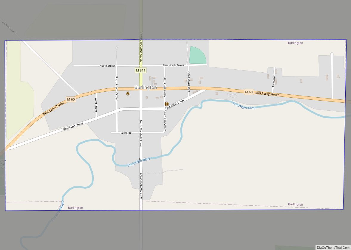
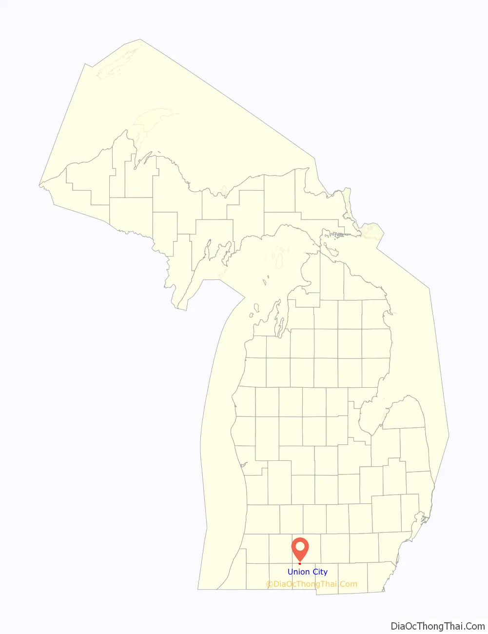
Union City is a village in Branch and Calhoun counties in the U.S. state of Michigan. Located mostly within Union Township in Branch County, it sits at the junction of the Coldwater and St. Joseph rivers; the Calhoun County portion lies within that county’s Burlington Township. It is part of the Battle Creek, Michigan Metropolitan Statistical Area. The population was 1,599 at the 2010 census.
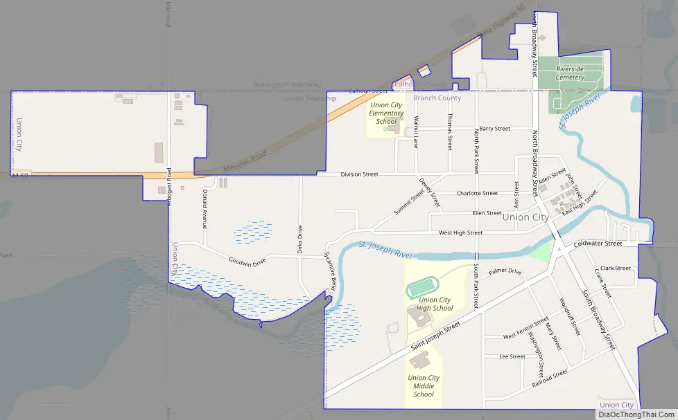
M-60 passes just north of the village.
| Name: | Union City village |
|---|---|
| LSAD Code: | 47 |
| LSAD Description: | village (suffix) |
| State: | Michigan |
| County: | Branch County, Calhoun County |
| Elevation: | 906 ft (276 m) |
| Total Area: | 1.49 sq mi (3.85 km²) |
| Land Area: | 1.45 sq mi (3.74 km²) |
| Water Area: | 0.04 sq mi (0.10 km²) |
| Total Population: | 1,714 |
| Population Density: | 1,186.16/sq mi (457.99/km²) |
| ZIP code: | 49094 |
| Area code: | 517 |
| FIPS code: | 2681360 |
| GNISfeature ID: | 1615340 |
| Website: | www.liveinuc.com |
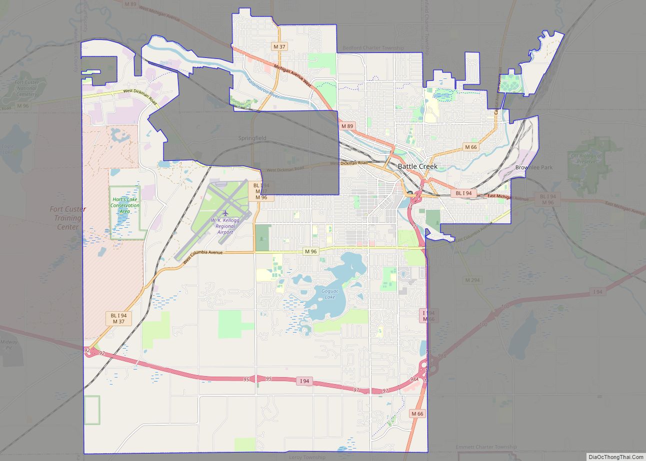
Online Interactive Map
Click on ![]() to view map in "full screen" mode.
to view map in "full screen" mode.
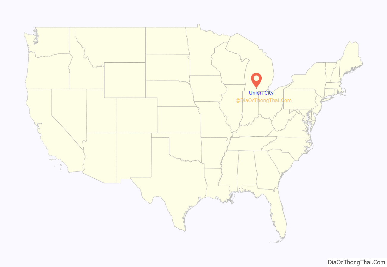
Union City location map. Where is Union City village?
History
Union City is located on the northern border of Branch County, about ten miles (16 km) northwest of Coldwater. This is a small picturesque and historic town that functions primarily as an adjunct community to the greater Coldwater and Battle Creek areas. It has a striking turn-of-the-century look architecturally, with well–preserved downtown buildings and several Victorian style homes. A Civil War monument can be seen on the north end of the main street area in the churchyard, while a veteran’s memorial along the riverbank to the south end commemorates those who fought in more recent wars.
Union City was first settled by Justin Goodwin in 1833, when he built a mill here and became the first postmaster, calling it “Goodwinville”. A year later, he sold several hundred acres to E. W. Morgan, who officially platted the site, renaming it from the “union” of the Coldwater and St. Joseph Rivers, which join there. A consortium of four proprietors bought the site in 1837. It was eventually incorporated as a village in 1866.
Union City was designated as Station No. 2 of the famous Underground Railroad, where John D. Zimmerman (1811-1879), formerly of Connecticut, was stationmaster. The slaves seeking refuge were taken into a home built around 1840 by Mr. Zimmerman, who arrived in Union City from Fairfield, Connecticut, in the spring of 1838. He brought with him a set of blacksmith tools to operate the blacksmith shop promised for him by Israel Ward Clark, one of the four proprietors of the village of Union City in 1837. In September 1839, Zimmerman returned to Union City with his family; he soon built a wagon factory, blacksmith shop, and a Greek Revival house. Outraged by the institution of slavery, Zimmerman became a stationmaster for the Underground Railroad, hiding escaped slaves in his house and assisting them in their flight to Canada and freedom. The home is on the list of Michigan State Historic Sites and is located at 119 East High Street.
In the early 1920s Union City built a hydroelectrical plant to deliver cheaper electricity to the town. By 1923 Riley Dam was constructed on nearby St. Joseph River, and the backwater forms Union Lake. Union Lake is known for its many stumps that occasionally create problems for power boaters.
Children’s author and illustrator Patricia Polacco lives in Union City. Her home, the Meteor Ridge Farm, formerly called The Plantation, was built in 1859 or 1860 and also served as a stop on the Underground Railroad, even receiving a personal visit from President Lincoln. One of Polacco’s first books, Meteor!, is based on a true story of a meteor that fell on a farm in the town. Union City now has an annual Meteor Festival in early July, with many activities for children. The original meteor of the story resides in Riverside Cemetery as a family marker.
Union City also sponsors an annual Memorial Day parade, and holds a community Memorial Day service at Riverside Cemetery.
Parts of the horror film trilogy Evil Dead were filmed west of Union City.
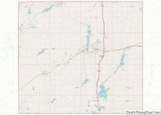
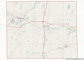
Union City Road Map
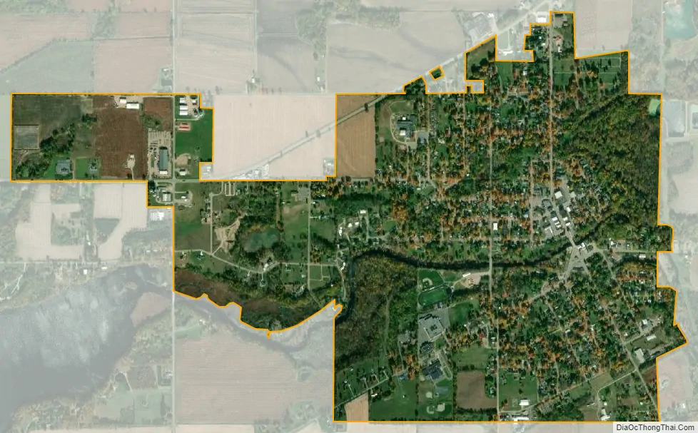
Union City city Satellite Map
Geography
Union City is at 42°04′00″N 85°08′10″W / 42.06667°N 85.13611°W / 42.06667; -85.13611. The ZIP code is 49094 and the FIPS place code is 81360.
According to the United States Census Bureau, the village has a total area of 1.49 square miles (3.86 km), of which 1.44 square miles (3.73 km) is land and 0.05 square miles (0.13 km) is water.
See also
Map of Michigan State and its subdivision:- Alcona
- Alger
- Allegan
- Alpena
- Antrim
- Arenac
- Baraga
- Barry
- Bay
- Benzie
- Berrien
- Branch
- Calhoun
- Cass
- Charlevoix
- Cheboygan
- Chippewa
- Clare
- Clinton
- Crawford
- Delta
- Dickinson
- Eaton
- Emmet
- Genesee
- Gladwin
- Gogebic
- Grand Traverse
- Gratiot
- Hillsdale
- Houghton
- Huron
- Ingham
- Ionia
- Iosco
- Iron
- Isabella
- Jackson
- Kalamazoo
- Kalkaska
- Kent
- Keweenaw
- Lake
- Lake Hurron
- Lake Michigan
- Lake St. Clair
- Lake Superior
- Lapeer
- Leelanau
- Lenawee
- Livingston
- Luce
- Mackinac
- Macomb
- Manistee
- Marquette
- Mason
- Mecosta
- Menominee
- Midland
- Missaukee
- Monroe
- Montcalm
- Montmorency
- Muskegon
- Newaygo
- Oakland
- Oceana
- Ogemaw
- Ontonagon
- Osceola
- Oscoda
- Otsego
- Ottawa
- Presque Isle
- Roscommon
- Saginaw
- Saint Clair
- Saint Joseph
- Sanilac
- Schoolcraft
- Shiawassee
- Tuscola
- Van Buren
- Washtenaw
- Wayne
- Wexford
- Alabama
- Alaska
- Arizona
- Arkansas
- California
- Colorado
- Connecticut
- Delaware
- District of Columbia
- Florida
- Georgia
- Hawaii
- Idaho
- Illinois
- Indiana
- Iowa
- Kansas
- Kentucky
- Louisiana
- Maine
- Maryland
- Massachusetts
- Michigan
- Minnesota
- Mississippi
- Missouri
- Montana
- Nebraska
- Nevada
- New Hampshire
- New Jersey
- New Mexico
- New York
- North Carolina
- North Dakota
- Ohio
- Oklahoma
- Oregon
- Pennsylvania
- Rhode Island
- South Carolina
- South Dakota
- Tennessee
- Texas
- Utah
- Vermont
- Virginia
- Washington
- West Virginia
- Wisconsin
- Wyoming