Bethel is a village in Shelby County, Missouri, United States. The population was 135 at the 2020 census.
| Name: | Bethel village |
|---|---|
| LSAD Code: | 47 |
| LSAD Description: | village (suffix) |
| State: | Missouri |
| County: | Shelby County |
| Elevation: | 715 ft (218 m) |
| Total Area: | 0.14 sq mi (0.36 km²) |
| Land Area: | 0.14 sq mi (0.36 km²) |
| Water Area: | 0.00 sq mi (0.00 km²) |
| Total Population: | 135 |
| Population Density: | 978.26/sq mi (377.82/km²) |
| ZIP code: | 63434 |
| Area code: | 660 |
| FIPS code: | 2905104 |
| GNISfeature ID: | 0714027 |
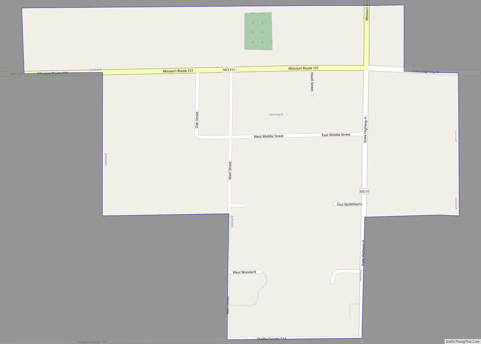
Online Interactive Map
Click on ![]() to view map in "full screen" mode.
to view map in "full screen" mode.
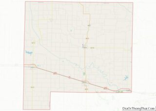
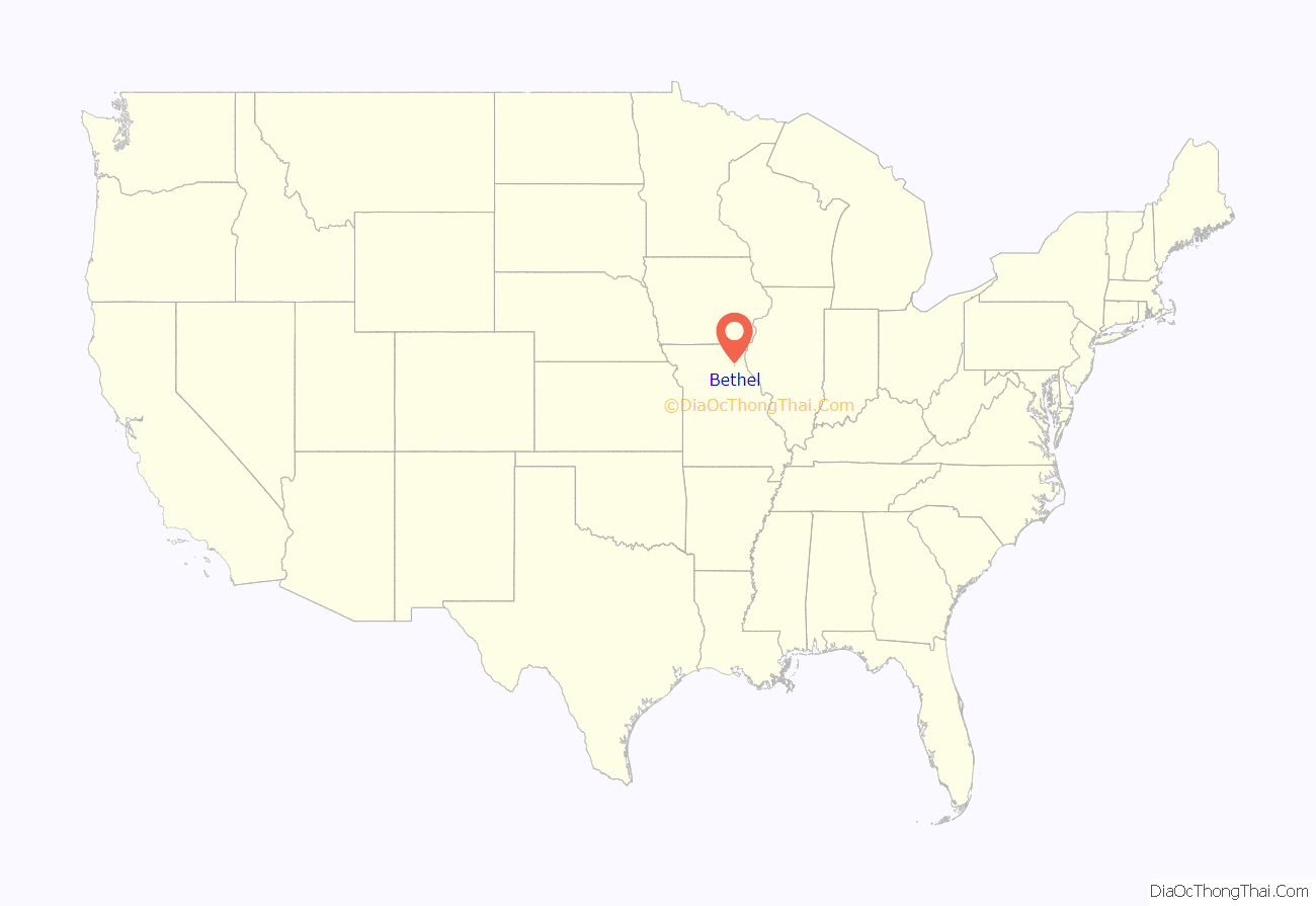
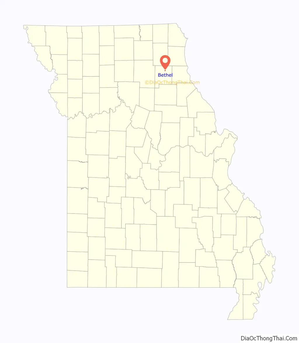
Bethel location map. Where is Bethel village?
History
Bethel was founded as a Bible utopian colony in 1844 by Dr William Keil (1811–1877), a Prussian-born preacher. He and his followers, who were almost exclusively German immigrants to America, believed that the Book of Acts required that Christians hold all property and means of production in common and they organized their Colony accordingly. Traditionally male work was communally performed; however, traditionally female work was still individualized and performed in single family households.
By 1850, the Bethel Colony had a population of 500; by 1860, 600. It owned thousands of sheep, cattle and horses, and had over 3,500 acres under cultivation. It was the commercial center of the region. However, the construction of the Hannibal & St. Joseph Railroad threatened Dr. Keil’s theocracy. In 1855, he led his some of his followers westward over the Oregon Trail, to eventually settle Aurora, Oregon and form the Aurora Colony. Other wagon trains followed in subsequent years. The remainder of the Bethel Colony retained their communal ownership of property and shared means of production until three years after his death in 1877. In 1880, the property was divided among the remaining members, thus ending Missouri’s most successful communal experiment.
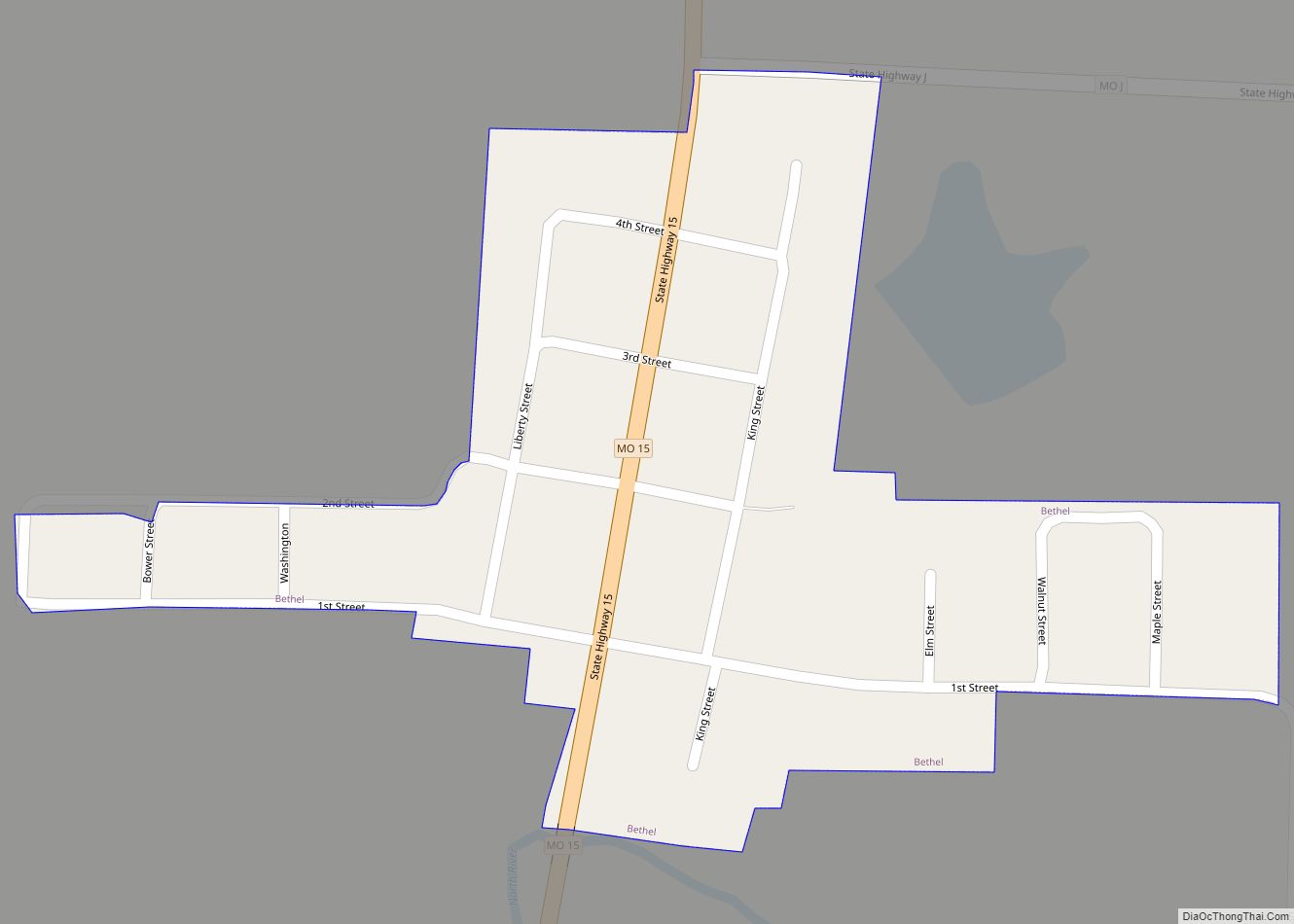
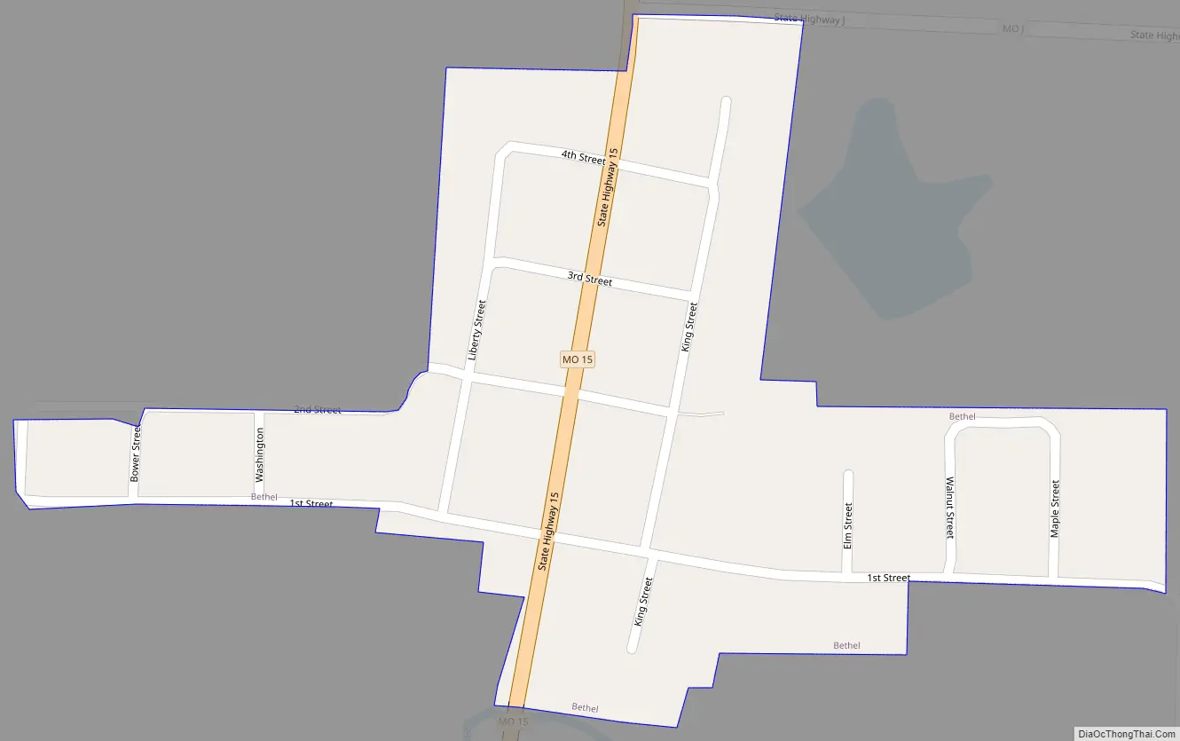
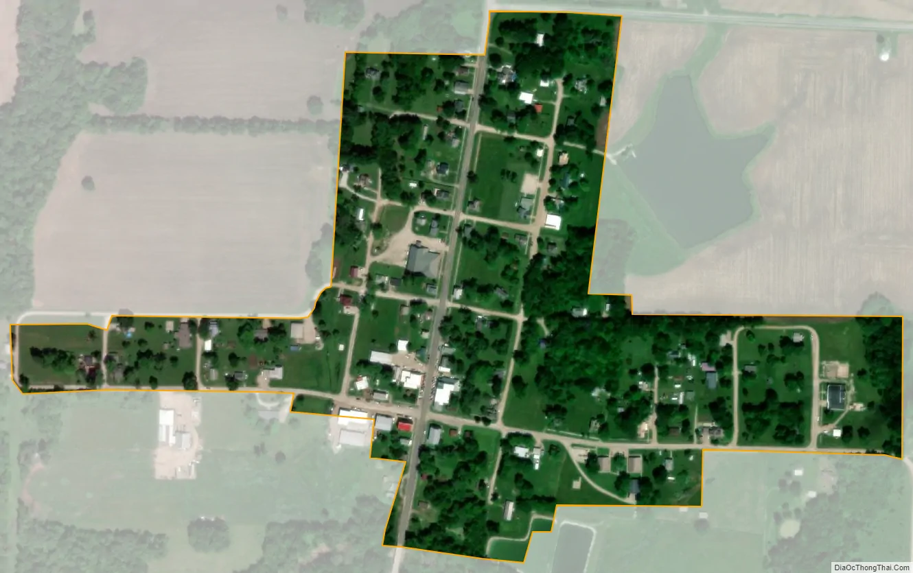
The Bethel Historic District, bounded by Liberty, King, 1st, and 4th Streets, was listed on the National Register of Historic Places in 1970. At least twenty of the buildings constructed by the Bethel Colony are still extant. These houses are on exhibit to visitors and to the public.
Also listed on the National Register of Historic Places are nearby Elim and Hebron.
Bethel Road Map
Bethel city Satellite Map
Geography
Bethel is located at 39°52′38″N 92°1′28″W / 39.87722°N 92.02444°W / 39.87722; -92.02444 (39.877205, -92.024433).
According to the United States Census Bureau, the village has a total area of 0.14 square miles (0.36 km), all land.
See also
Map of Missouri State and its subdivision:- Adair
- Andrew
- Atchison
- Audrain
- Barry
- Barton
- Bates
- Benton
- Bollinger
- Boone
- Buchanan
- Butler
- Caldwell
- Callaway
- Camden
- Cape Girardeau
- Carroll
- Carter
- Cass
- Cedar
- Chariton
- Christian
- Clark
- Clay
- Clinton
- Cole
- Cooper
- Crawford
- Dade
- Dallas
- Daviess
- De Kalb
- Dent
- Douglas
- Dunklin
- Franklin
- Gasconade
- Gentry
- Greene
- Grundy
- Harrison
- Henry
- Hickory
- Holt
- Howard
- Howell
- Iron
- Jackson
- Jasper
- Jefferson
- Johnson
- Knox
- Laclede
- Lafayette
- Lawrence
- Lewis
- Lincoln
- Linn
- Livingston
- Macon
- Madison
- Maries
- Marion
- McDonald
- Mercer
- Miller
- Mississippi
- Moniteau
- Monroe
- Montgomery
- Morgan
- New Madrid
- Newton
- Nodaway
- Oregon
- Osage
- Ozark
- Pemiscot
- Perry
- Pettis
- Phelps
- Pike
- Platte
- Polk
- Pulaski
- Putnam
- Ralls
- Randolph
- Ray
- Reynolds
- Ripley
- Saint Charles
- Saint Clair
- Saint Francois
- Saint Louis
- Sainte Genevieve
- Saline
- Schuyler
- Scotland
- Scott
- Shannon
- Shelby
- Stoddard
- Stone
- Sullivan
- Taney
- Texas
- Vernon
- Warren
- Washington
- Wayne
- Webster
- Worth
- Wright
- Alabama
- Alaska
- Arizona
- Arkansas
- California
- Colorado
- Connecticut
- Delaware
- District of Columbia
- Florida
- Georgia
- Hawaii
- Idaho
- Illinois
- Indiana
- Iowa
- Kansas
- Kentucky
- Louisiana
- Maine
- Maryland
- Massachusetts
- Michigan
- Minnesota
- Mississippi
- Missouri
- Montana
- Nebraska
- Nevada
- New Hampshire
- New Jersey
- New Mexico
- New York
- North Carolina
- North Dakota
- Ohio
- Oklahoma
- Oregon
- Pennsylvania
- Rhode Island
- South Carolina
- South Dakota
- Tennessee
- Texas
- Utah
- Vermont
- Virginia
- Washington
- West Virginia
- Wisconsin
- Wyoming