Bonne Terre (/bɒnˈtɛər/ bon-TAIR) is a city in St. Francois County, Missouri, United States with a population of 6,864 at the 2010 census. Situated in the Southeast Missouri Lead District, lead mining shaped the history and character of the area from the earliest French settlers in the 1720´s until today, even though Bonne Terre Mine established by St. Joseph lead mining company in 1864 closed in 1962. Mine tailing piles eroded, and contaminated the area as dust, posing residential hazards or were washed into the Big River. Only in 1992, the Bonne Terre Mine Tailings Site was listed as a Superfund Site; as of 2022 remediation is still ongoing.
The Bonne Terre Depot from 1909, the St. Joe Lead Company Administration Building and the Bonne Terre Mine, are listed on the National Register of Historic Places. The latter is spring water filled and became a scuba diving attraction.
Bonne Terre is also home to the Eastern Reception, Diagnostic and Correctional Center, a 3000 bed prison of adult males who may have substance abuse issues or are mentally disabled, where Missouri has conducted all of its executions since April 2005.
| Name: | Bonne Terre city |
|---|---|
| LSAD Code: | 25 |
| LSAD Description: | city (suffix) |
| State: | Missouri |
| County: | St. Francois County |
| Elevation: | 824 ft (251 m) |
| Total Area: | 4.10 sq mi (10.63 km²) |
| Land Area: | 4.07 sq mi (10.54 km²) |
| Water Area: | 0.04 sq mi (0.09 km²) |
| Total Population: | 6,903 |
| Population Density: | 1,696.90/sq mi (655.14/km²) |
| Area code: | 573 |
| FIPS code: | 2907102 |
| GNISfeature ID: | 2394219 |
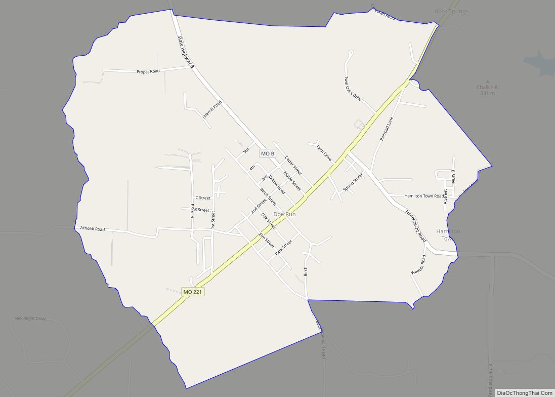
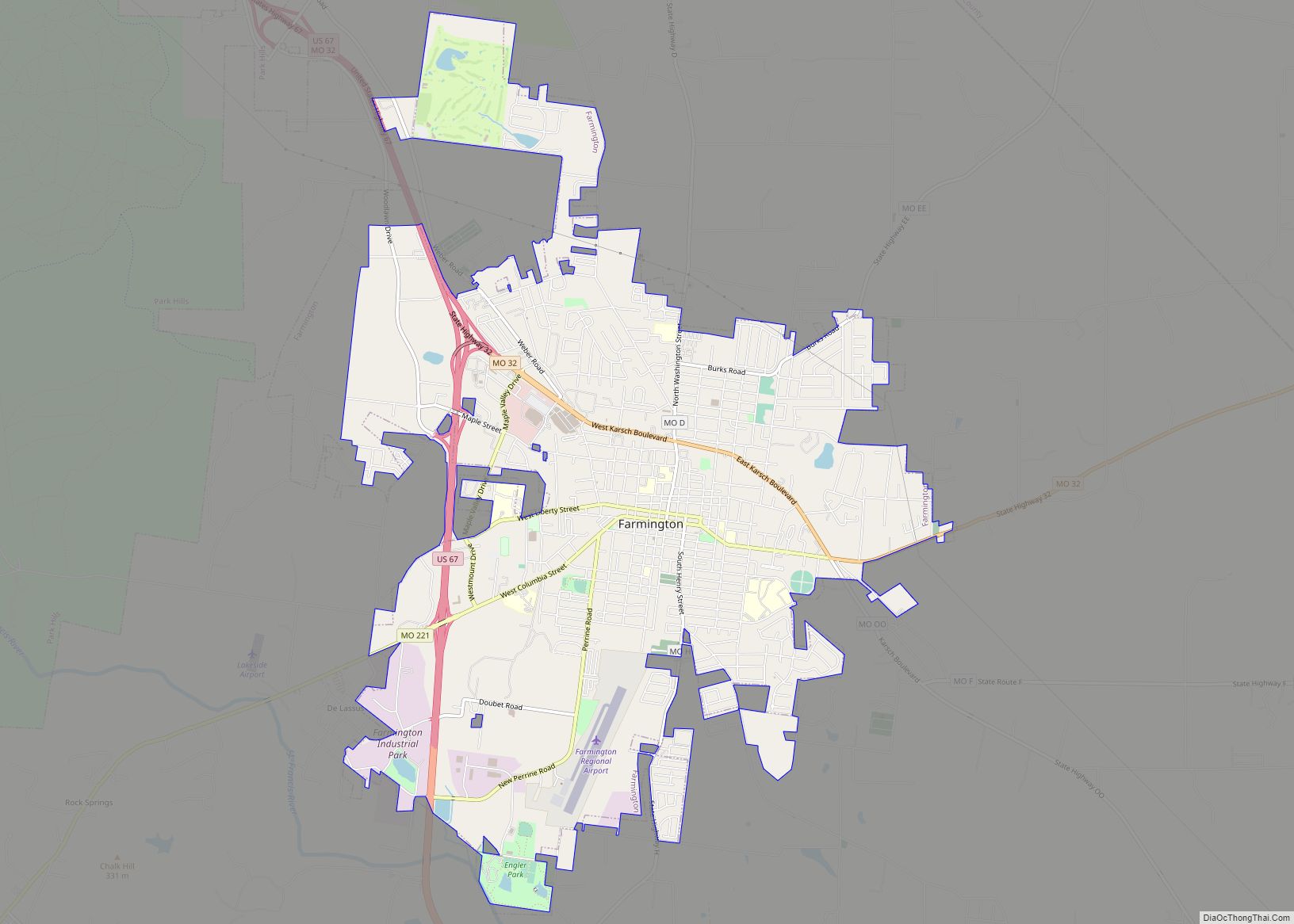
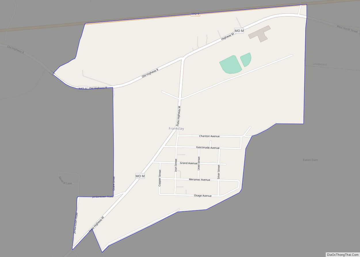
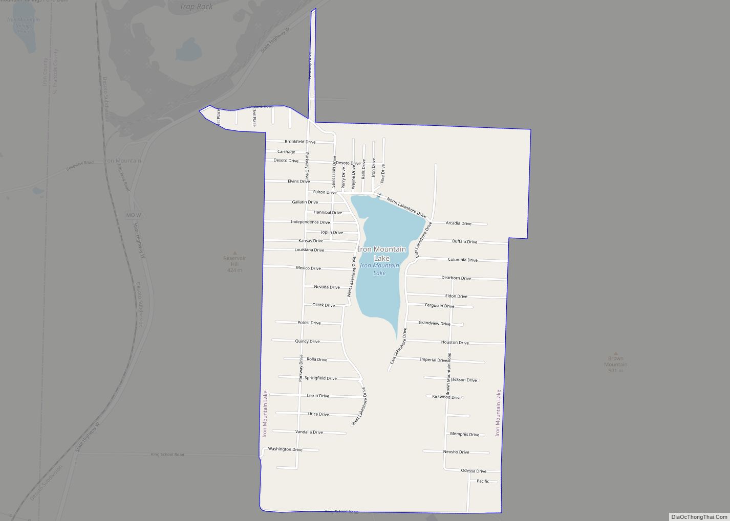
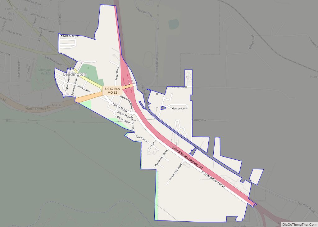
Online Interactive Map
Click on ![]() to view map in "full screen" mode.
to view map in "full screen" mode.
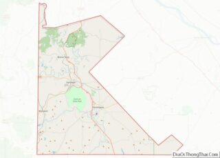
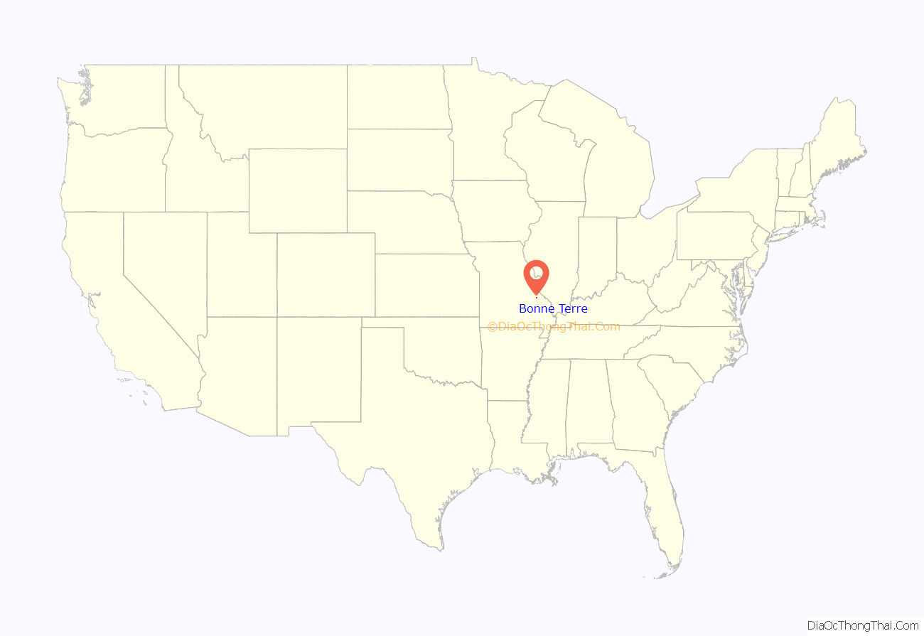
Bonne Terre location map. Where is Bonne Terre city?

History
Lead mining era, 1860´s-1963
The community was originally part of the Louisiana Territory and settled by Frenchmen in 1720 after they discovered lead ore. Two Frenchmen, La Motte and Philip Francois Renault had left France in 1719 with 200 miners in search of minerals as part of the Company of the West. Surface miners referred to it as La Bonne Terre around 1825, meaning “the good soil” because of the lead. In 1828, St. Anne, the first Catholic chapel in St Francois county was built here.
In 1864, Bonne Terre Mine was established by St. Joseph lead mining company which was incorporated in NYC the same year. In 1865, a new superintendent, J. C. Winslow, brought a number of Cornish miners. Underground mining began in 1869. After a post office was established in 1868, the corporate name of the town, “St. Joe´s mines” changed to Bonne Terre.
Major lead mining operations from the 1870s also included the Desloge Lead Company, and Doe Run. The Desloge mines were started by Firmin V. Desloge, and above-ground works were bounded approximately by present-day Division Street on the west, Benham Street on the south, Route 67 on the east, and the township line to the north.
In 1880, Bone Terre was platted as a town. The miners were local small farmers, timber cutters and rock quarrymen supplementing their income, and later Hungarian and other Slavic and southern European immigrants. In 1890, the Mississippi River & Bonne Terre Railroad hauled ore to Herculaneum smelters. The Bonne Terre Depot from 1909 still exists. At the beginning of the 20th century, St. Joe Lead was the only one of initially dozens of mining companies left, as it had bought up the remaining companies. In 1962, the mine closed. Lead mine tailings were used as paving gravel for decades.
In 1977, heavy rains caused about 50,000 cubic yards of tailings to slough into the Big River.
21st century
Chat dumps or mine tailing piles remain until today; lead dust contaminated the surrounding area and was a hazard to residents. Only in 1992, the Bonne Terre Mine Tailings Site was listed as a Superfund Site. As of 2021, over 1,400 residential yards have been remediated. The Bonne Terre East Tailings Flat is still used as a repository for lead-contaminated soils. Because lead levels in fish downstream of the mining area are elevated above World Health Organization Standards, the state of Missouri advises people not to eat fish they catch from the Big River.
Bonne Terre is home to the Eastern Reception, Diagnostic and Correctional Center, a roughly 3000-bed prison of adult males who may have substance abuse issues or are mentally disabled. Since April 2005, Missouri has conducted all of its executions there.
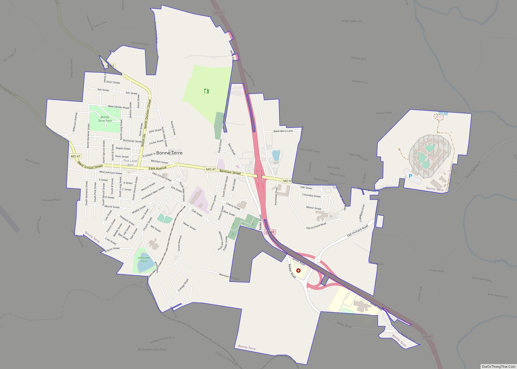
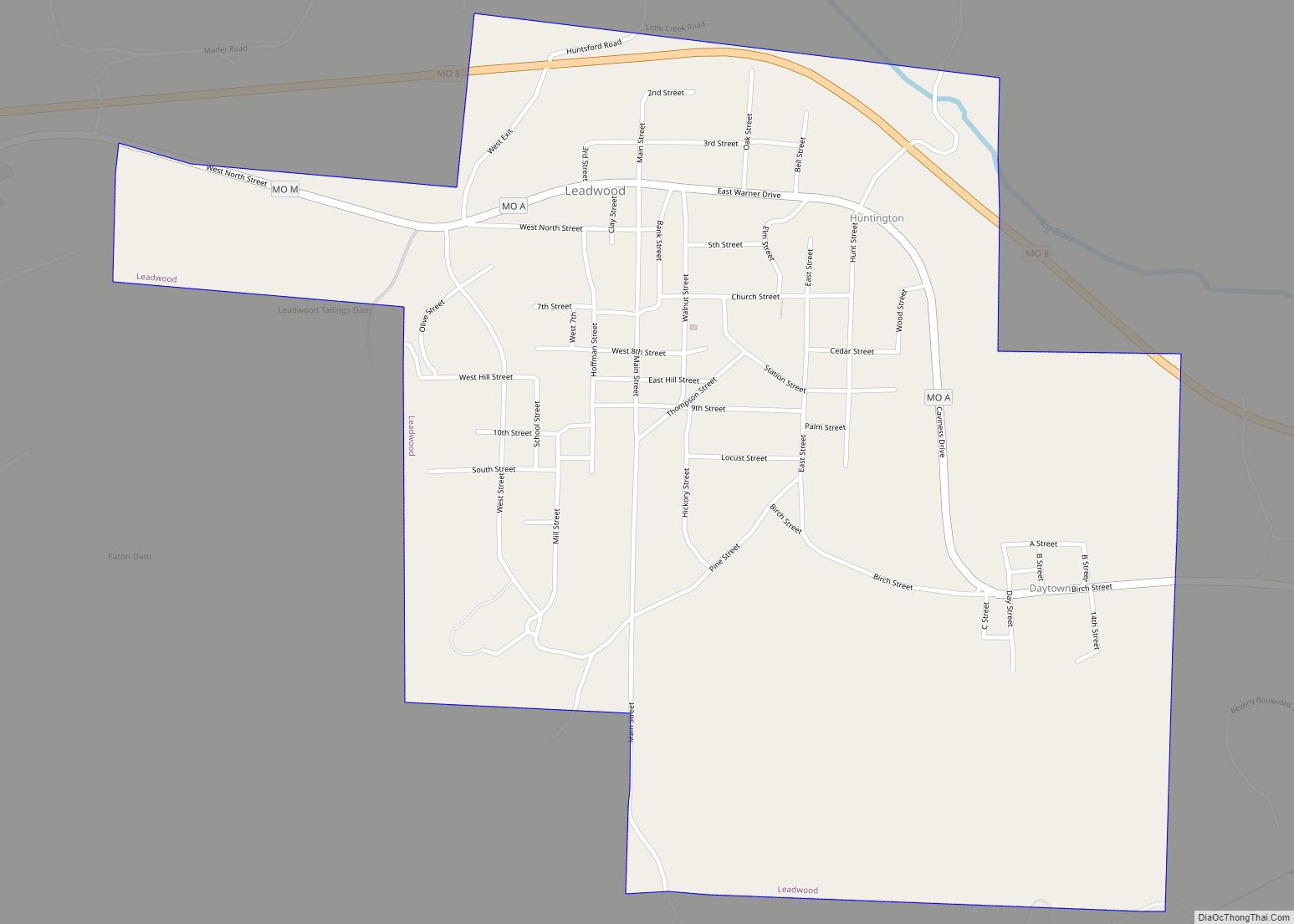
Bonne Terre Road Map

Bonne Terre city Satellite Map

Geography
Bonne Terre is part of the Southeast Missouri Lead District, an area of rolling hills of the Ozark Plateau with elevations up to 300 feet. The ground is mostly red clay over a base of limestone. The area contains the highest concentration of galena (lead(II) sulfide) in the world.
According to the United States Census Bureau, the city has a total area of 4.10 square miles (10.62 km), of which 4.04 square miles (10.46 km) is land and 0.06 square miles (0.16 km) is water.
See also
Map of Missouri State and its subdivision:- Adair
- Andrew
- Atchison
- Audrain
- Barry
- Barton
- Bates
- Benton
- Bollinger
- Boone
- Buchanan
- Butler
- Caldwell
- Callaway
- Camden
- Cape Girardeau
- Carroll
- Carter
- Cass
- Cedar
- Chariton
- Christian
- Clark
- Clay
- Clinton
- Cole
- Cooper
- Crawford
- Dade
- Dallas
- Daviess
- De Kalb
- Dent
- Douglas
- Dunklin
- Franklin
- Gasconade
- Gentry
- Greene
- Grundy
- Harrison
- Henry
- Hickory
- Holt
- Howard
- Howell
- Iron
- Jackson
- Jasper
- Jefferson
- Johnson
- Knox
- Laclede
- Lafayette
- Lawrence
- Lewis
- Lincoln
- Linn
- Livingston
- Macon
- Madison
- Maries
- Marion
- McDonald
- Mercer
- Miller
- Mississippi
- Moniteau
- Monroe
- Montgomery
- Morgan
- New Madrid
- Newton
- Nodaway
- Oregon
- Osage
- Ozark
- Pemiscot
- Perry
- Pettis
- Phelps
- Pike
- Platte
- Polk
- Pulaski
- Putnam
- Ralls
- Randolph
- Ray
- Reynolds
- Ripley
- Saint Charles
- Saint Clair
- Saint Francois
- Saint Louis
- Sainte Genevieve
- Saline
- Schuyler
- Scotland
- Scott
- Shannon
- Shelby
- Stoddard
- Stone
- Sullivan
- Taney
- Texas
- Vernon
- Warren
- Washington
- Wayne
- Webster
- Worth
- Wright
- Alabama
- Alaska
- Arizona
- Arkansas
- California
- Colorado
- Connecticut
- Delaware
- District of Columbia
- Florida
- Georgia
- Hawaii
- Idaho
- Illinois
- Indiana
- Iowa
- Kansas
- Kentucky
- Louisiana
- Maine
- Maryland
- Massachusetts
- Michigan
- Minnesota
- Mississippi
- Missouri
- Montana
- Nebraska
- Nevada
- New Hampshire
- New Jersey
- New Mexico
- New York
- North Carolina
- North Dakota
- Ohio
- Oklahoma
- Oregon
- Pennsylvania
- Rhode Island
- South Carolina
- South Dakota
- Tennessee
- Texas
- Utah
- Vermont
- Virginia
- Washington
- West Virginia
- Wisconsin
- Wyoming