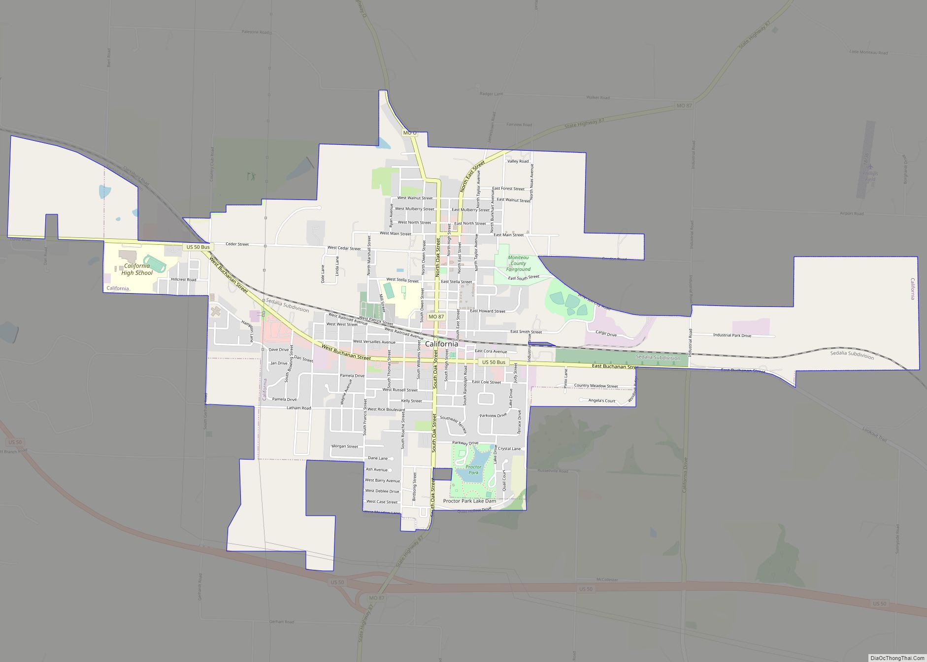
California is a city in and the county seat of Moniteau County, Missouri, United States. The 2010 census has the population at 4,278. California is the third largest city in the Jefferson City, Missouri Metropolitan Statistical Area, as well as the largest city in Moniteau County.
| Name: | California city |
|---|---|
| LSAD Code: | 25 |
| LSAD Description: | city (suffix) |
| State: | Missouri |
| County: | Moniteau County |
| Founded: | 1834 (as Boonesborough) 1847 (as California) |
| Incorporated: | 1848 |
| Elevation: | 896 ft (273 m) |
| Total Area: | 3.88 sq mi (10.05 km²) |
| Land Area: | 3.87 sq mi (10.01 km²) |
| Water Area: | 0.01 sq mi (0.04 km²) |
| Total Population: | 4,498 |
| Population Density: | 1,163.78/sq mi (449.29/km²) |
| ZIP code: | 65018, 65042 |
| Area code: | 573 |
| FIPS code: | 2910468 |
| GNISfeature ID: | 2393495 |
Online Interactive Map
Click on ![]() to view map in "full screen" mode.
to view map in "full screen" mode.
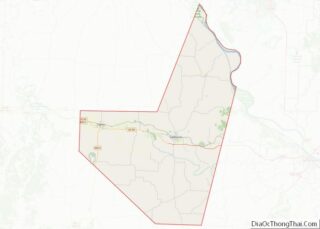
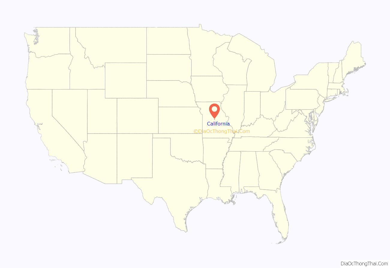
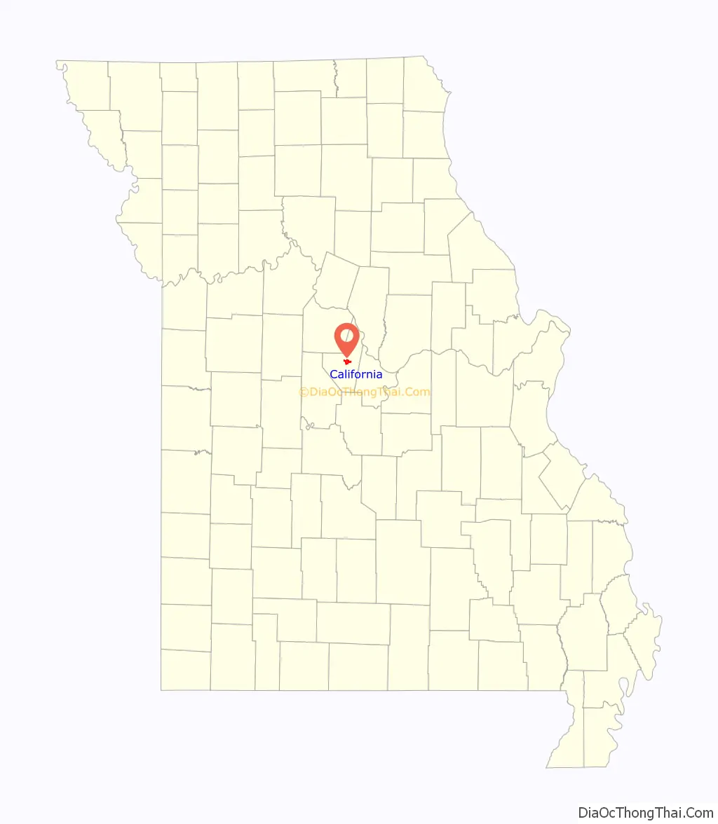
California location map. Where is California city?
History
The City of California was established in 1834. The seat of justice of Moniteau County was originally known as Boonesborough. When Moniteau County was organized in 1845, it was decided that Boonsborough would become the county seat. Because the county court was unwilling to pay for land in Boonsborough, a site was selected one-mile (1.6 km) west and this would become the new county seat. In 1846, the Post Office required a new name to be selected for Boonsborough since there was already a Boonsborough in Missouri. The city was renamed California on January 25, 1847 for the territory on the West Coast that was just then drawing attention due to progress of the overland railroad. That same year, a courthouse was erected on the square.
California was incorporated in 1848 and elected its first city officials in 1858, ten years later.
The Weekly California News printed its first edition on September 18, 1858 and has since been Moniteau County’s oldest established business still in operation. Today it is known as the California Democrat.
By the end of the Civil War, California’s population was around 1,000. The city had 10 dry goods stores, 2 drug stores, a tobacco factory, a large steam flouring mill and carding machine, a high school, a printing office, and a bank.
In 1867, money was appropriated for a new courthouse, which was completed in 1868 and is still in use today.
Historical places of interest
In addition to the Finke Opera House, Gray-Wood Buildings, and Moniteau County Courthouse listed below, the Old Barnhill Building and Old California City Hall and Fire Station are also listed on the National Register of Historic Places.
Located at 201 North High Street in downtown California, the Cultural Heritage Center was the old Post Office. Today, it houses the Moniteau County Historical Society, museum, information center, gift shop, and genealogical library.
Built in 1898 by Charles A. Eitzen, the Eitzen Mansion has 19 rooms and 9 fireplaces and includes the original slate roof. The carriage house and stable, with a room for the coachman, are still standing on the property, which takes up an entire city block. The home remained in the Eitzen family until 1952. Since then, it has been used as a nursing home, restaurant, and bed and breakfast successively. Through all of those changes, the original fireplaces, woodwork, and main staircase with its ornate woodwork remained intact. Today, the mansion serves as a private residence.
Located at 312 North High Street in downtown California, the Finke Opera House/theatre was built in 1885. The building was designed by Jerome Bibb “J.B.” Legg, a well-known St. Louis architect. Legg was also responsible for designing many Missouri courthouses, opera houses, theaters, churches, schools and public buildings and remodeled the Missouri State Capitol in 1887. The theater was named to the National Register of Historic Places for its significance in the area of entertainment and recreation in 2004.
The two-story brick building was California’s only opera house and theater and therefore was the main entertainment center for the community. From 1885 to 1897, it was known as the California Opera House and then the Finke Opera House from 1897 to 1922. While it was the opera house, the building was home to stage shows, plays, musical and school performances. Blind Boone played the piano at the opera house in 1893. Cole Younger, an associate of Jesse James, lectured at the opera house in 1909. From 1922 to 1937, it was known as Finke Theater and featured vaudeville and motion pictures. In 1937, it was renovated from its Victorian style to an art deco style and became known as the Ritz Theatre, from 1937 to 1978. It has been known as the Finke Theater since the theater opened for the 2009–10 season on September 26, 2009.
The opera house/theatre was recently renovated by California Progress, Inc., along with the adjacent Finke Building, to save this historical landmark.
Located at 401-407 North High Street in downtown California, the Gray-Wood Buildings were added to the National Register of Historic Places in 1984 for their architectural significance. Built in the late 1800s, the buildings house several businesses today.
Built in 1867, the Moniteau County Courthouse is one of the oldest courthouses in Missouri. The semicircular front portico and the square mounted abaci on top of the brick columns resemble those of former State Capitol built in 1840. The courthouse square has been on the National Register of Historic Places since 1970. The first floor of the courthouse features several museum displays.
This mansion was built in 1867 by Niles Rice. The Victorian home has 12-foot (3.7 m) ceilings, six-foot hallways, and 36 narrow seven-foot windows. It is currently a private residence.
Located in the historic Ehrhardt Building, this building was constructed in 1864 and was home to the J. G. Ehrhardt Mercantile Company. The building was purchased by California Progress, Inc. in 1995 and restored to preserve a historical landmark in the community. The library moved into the building in August 1998.
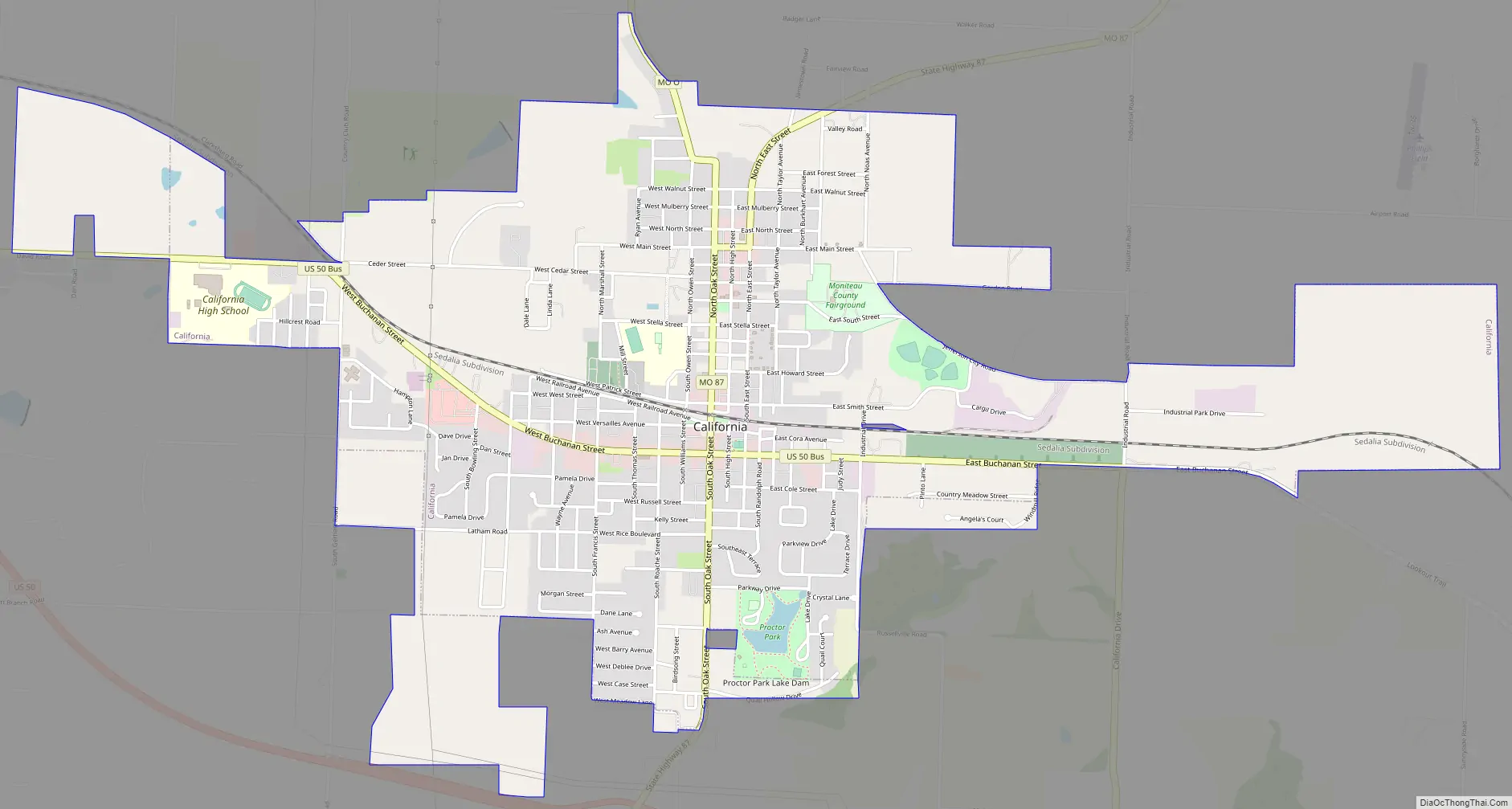
California Road Map
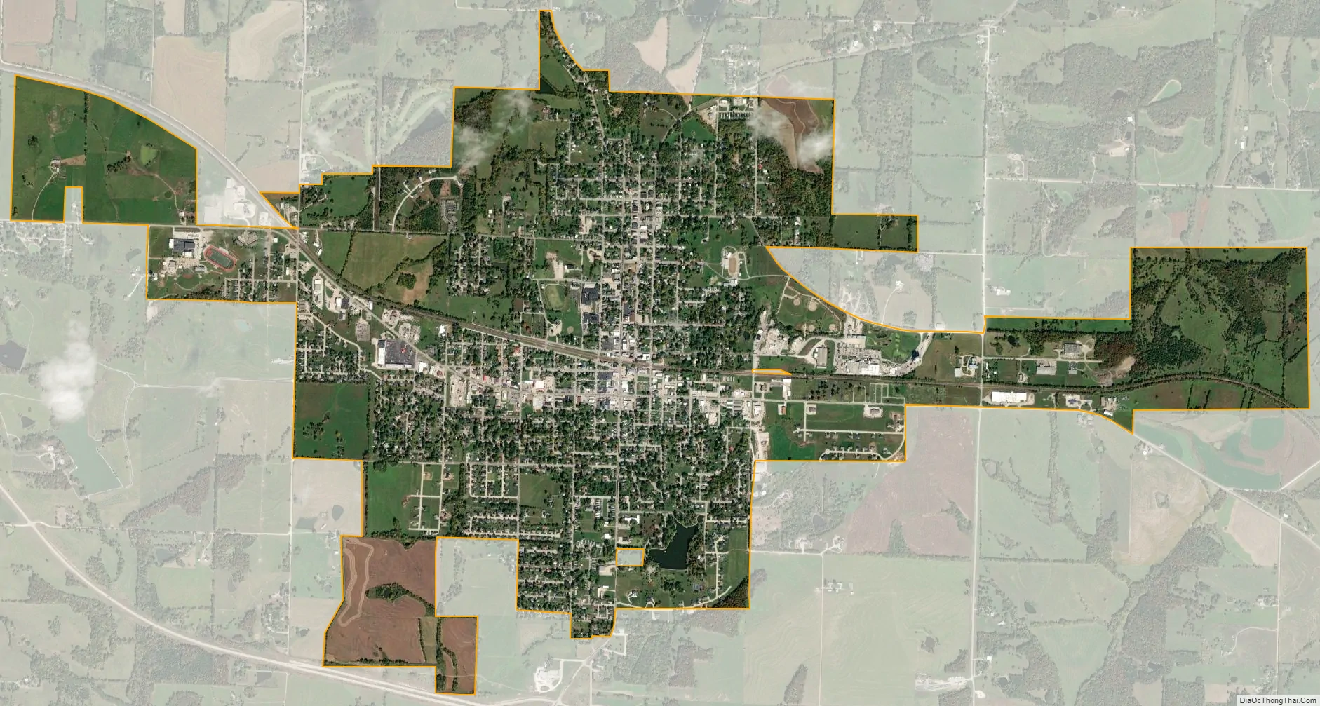
California city Satellite Map
Geography
California is located in central Moniteau County at the intersection of U.S. Route 50 and Missouri Route 87. North Moreau Creek flows past two miles south of the city.
According to the United States Census Bureau, the city has a total area of 3.36 square miles (8.70 km), of which 3.35 square miles (8.68 km) is land and 0.01 square miles (0.03 km) is water.
Climate
See also
Map of Missouri State and its subdivision:- Adair
- Andrew
- Atchison
- Audrain
- Barry
- Barton
- Bates
- Benton
- Bollinger
- Boone
- Buchanan
- Butler
- Caldwell
- Callaway
- Camden
- Cape Girardeau
- Carroll
- Carter
- Cass
- Cedar
- Chariton
- Christian
- Clark
- Clay
- Clinton
- Cole
- Cooper
- Crawford
- Dade
- Dallas
- Daviess
- De Kalb
- Dent
- Douglas
- Dunklin
- Franklin
- Gasconade
- Gentry
- Greene
- Grundy
- Harrison
- Henry
- Hickory
- Holt
- Howard
- Howell
- Iron
- Jackson
- Jasper
- Jefferson
- Johnson
- Knox
- Laclede
- Lafayette
- Lawrence
- Lewis
- Lincoln
- Linn
- Livingston
- Macon
- Madison
- Maries
- Marion
- McDonald
- Mercer
- Miller
- Mississippi
- Moniteau
- Monroe
- Montgomery
- Morgan
- New Madrid
- Newton
- Nodaway
- Oregon
- Osage
- Ozark
- Pemiscot
- Perry
- Pettis
- Phelps
- Pike
- Platte
- Polk
- Pulaski
- Putnam
- Ralls
- Randolph
- Ray
- Reynolds
- Ripley
- Saint Charles
- Saint Clair
- Saint Francois
- Saint Louis
- Sainte Genevieve
- Saline
- Schuyler
- Scotland
- Scott
- Shannon
- Shelby
- Stoddard
- Stone
- Sullivan
- Taney
- Texas
- Vernon
- Warren
- Washington
- Wayne
- Webster
- Worth
- Wright
- Alabama
- Alaska
- Arizona
- Arkansas
- California
- Colorado
- Connecticut
- Delaware
- District of Columbia
- Florida
- Georgia
- Hawaii
- Idaho
- Illinois
- Indiana
- Iowa
- Kansas
- Kentucky
- Louisiana
- Maine
- Maryland
- Massachusetts
- Michigan
- Minnesota
- Mississippi
- Missouri
- Montana
- Nebraska
- Nevada
- New Hampshire
- New Jersey
- New Mexico
- New York
- North Carolina
- North Dakota
- Ohio
- Oklahoma
- Oregon
- Pennsylvania
- Rhode Island
- South Carolina
- South Dakota
- Tennessee
- Texas
- Utah
- Vermont
- Virginia
- Washington
- West Virginia
- Wisconsin
- Wyoming