Camdenton is a city in and the county seat of Camden County, Missouri, United States. Its population was 3,718 at the 2010 census. The city is enveloped by the Lower Niangua arm of the Lake of the Ozarks, and serves as a popular trade point for visitors to the area.
| Name: | Camdenton city |
|---|---|
| LSAD Code: | 25 |
| LSAD Description: | city (suffix) |
| State: | Missouri |
| County: | Camden County |
| Founded: | 1931 |
| Elevation: | 1,017 ft (310 m) |
| Total Area: | 5.50 sq mi (14.23 km²) |
| Land Area: | 5.49 sq mi (14.22 km²) |
| Water Area: | 0.00 sq mi (0.01 km²) |
| Total Population: | 3,960 |
| Population Density: | 721.05/sq mi (278.42/km²) |
| ZIP code: | 65020 |
| Area code: | 573 |
| FIPS code: | 2910810 |
| GNISfeature ID: | 2393511 |
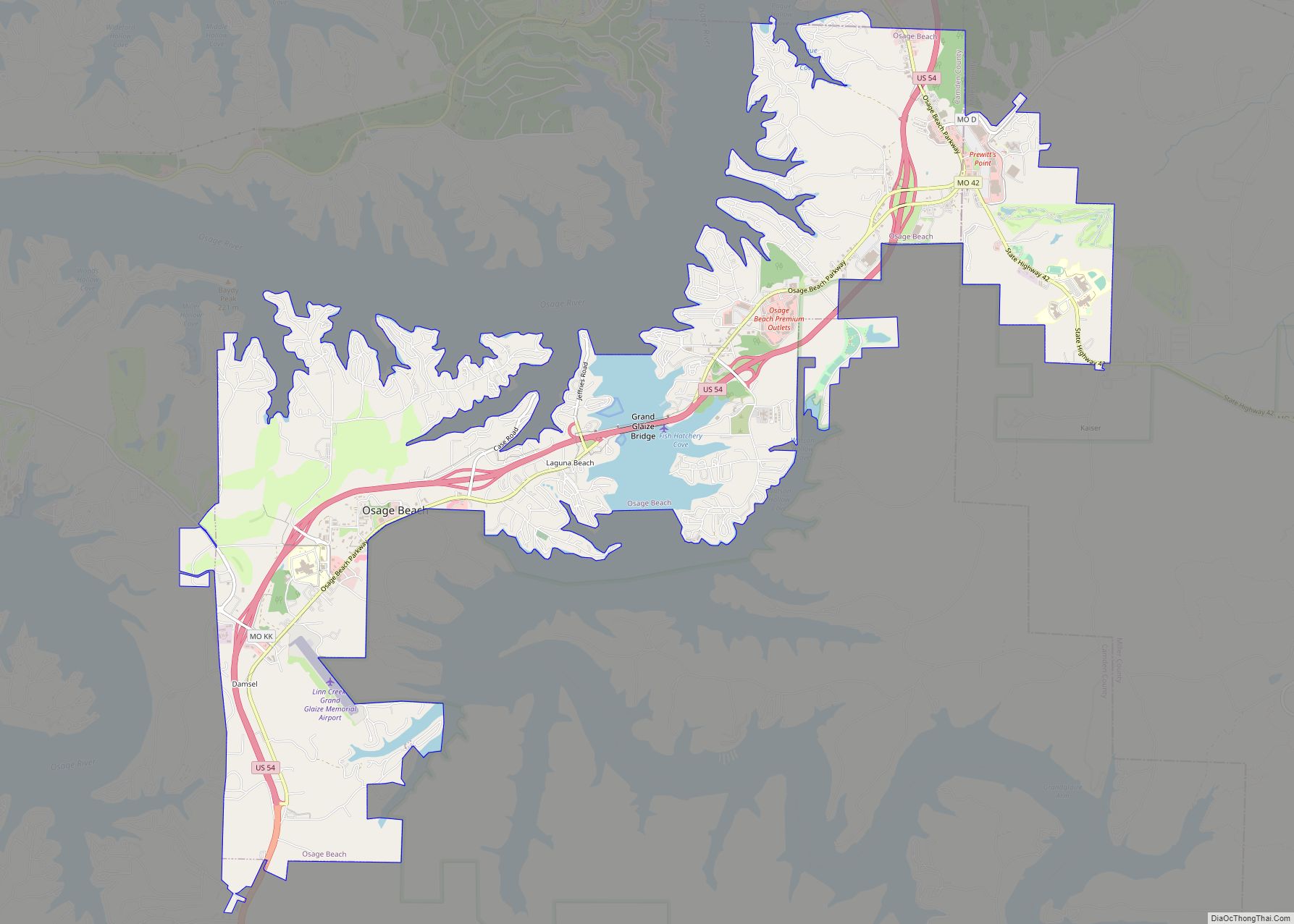
Online Interactive Map
Click on ![]() to view map in "full screen" mode.
to view map in "full screen" mode.
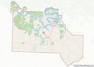
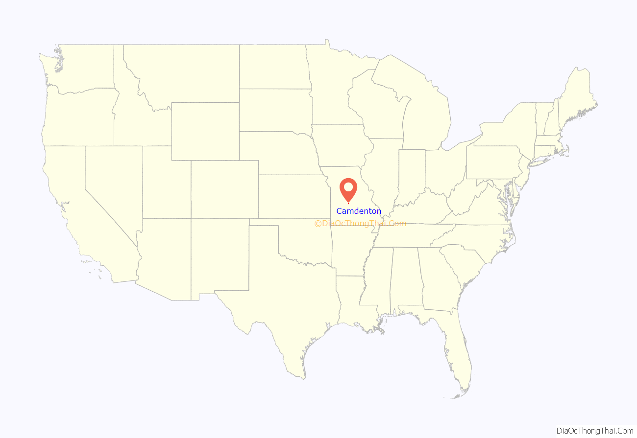
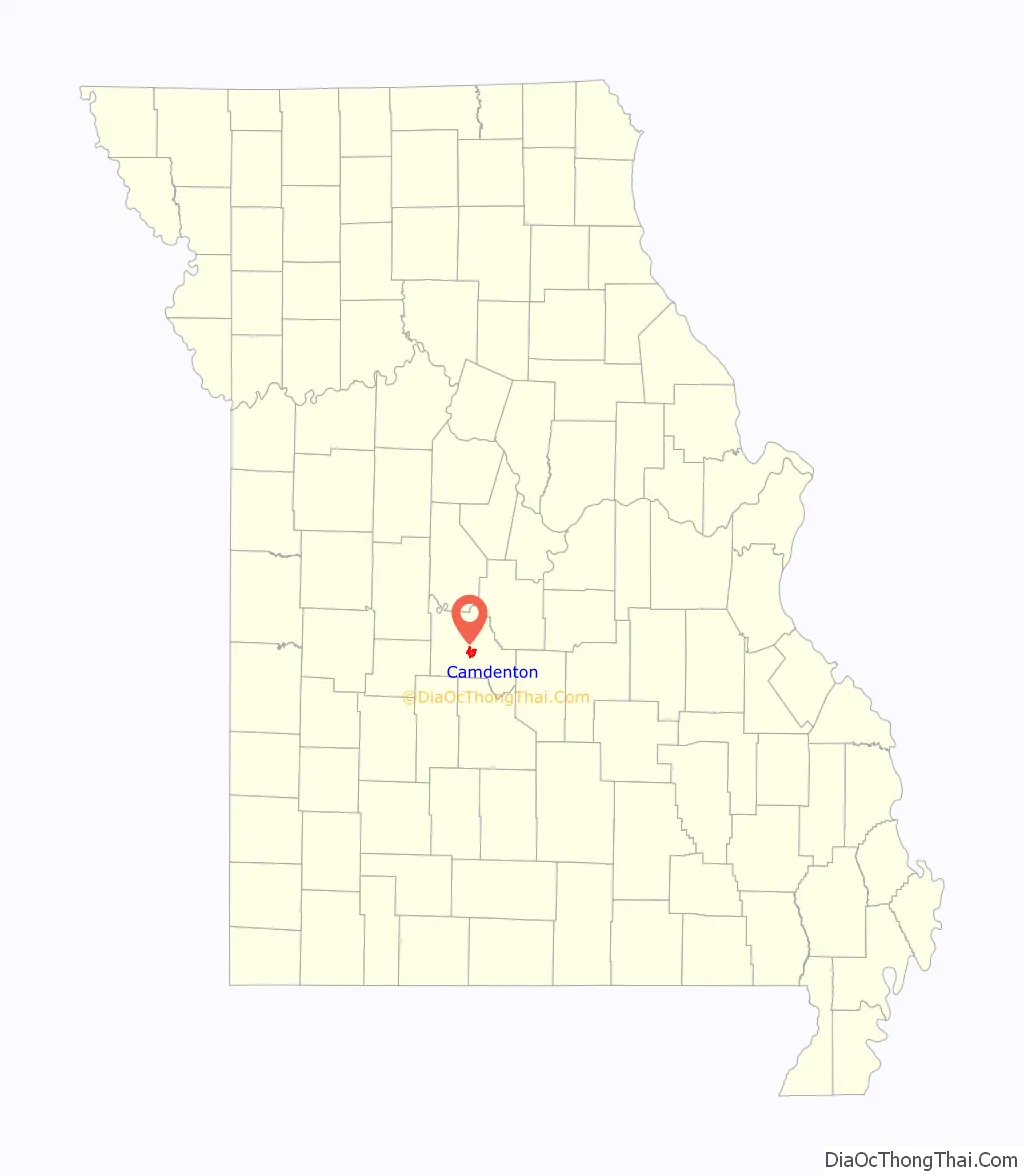
Camdenton location map. Where is Camdenton city?
History
Camdenton, the new county seat, had its start in the 1930s, when construction of the Lake of the Ozarks inundated the old county seat of Linn Creek. The city derives its name from Camden County. The name Camdenton was chosen because there were no other cities with that name. A post office called Camdenton has been in operation since 1931.
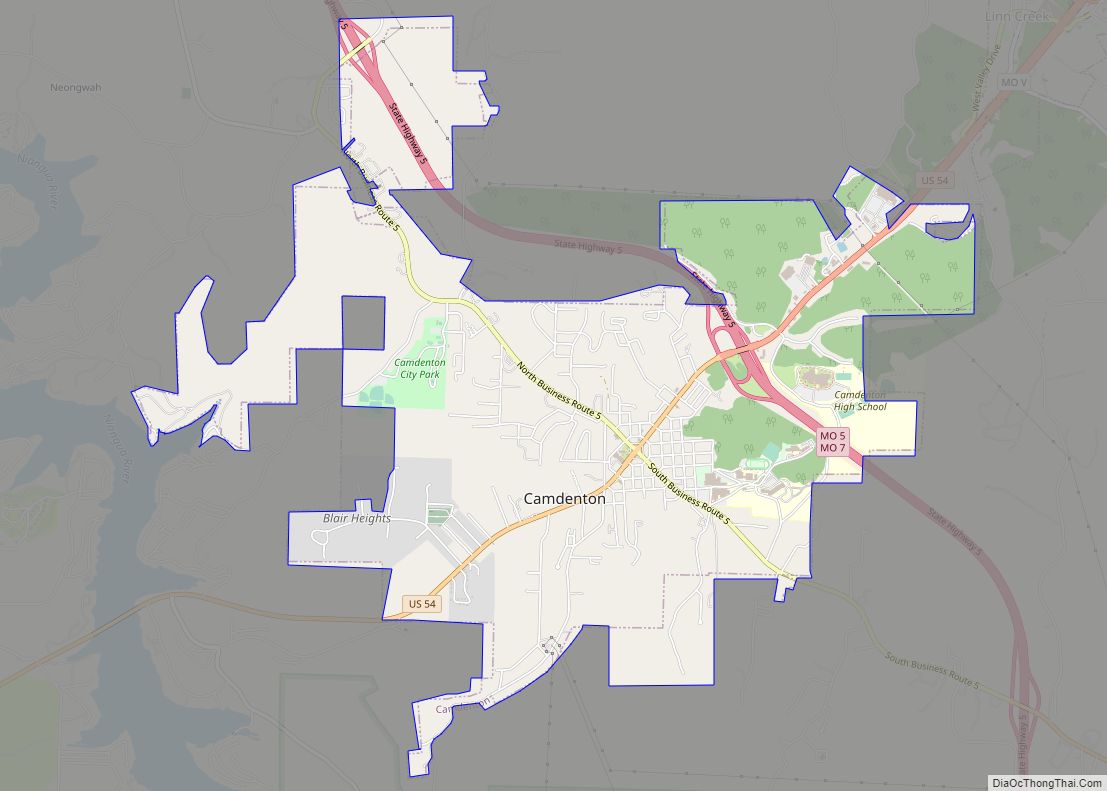
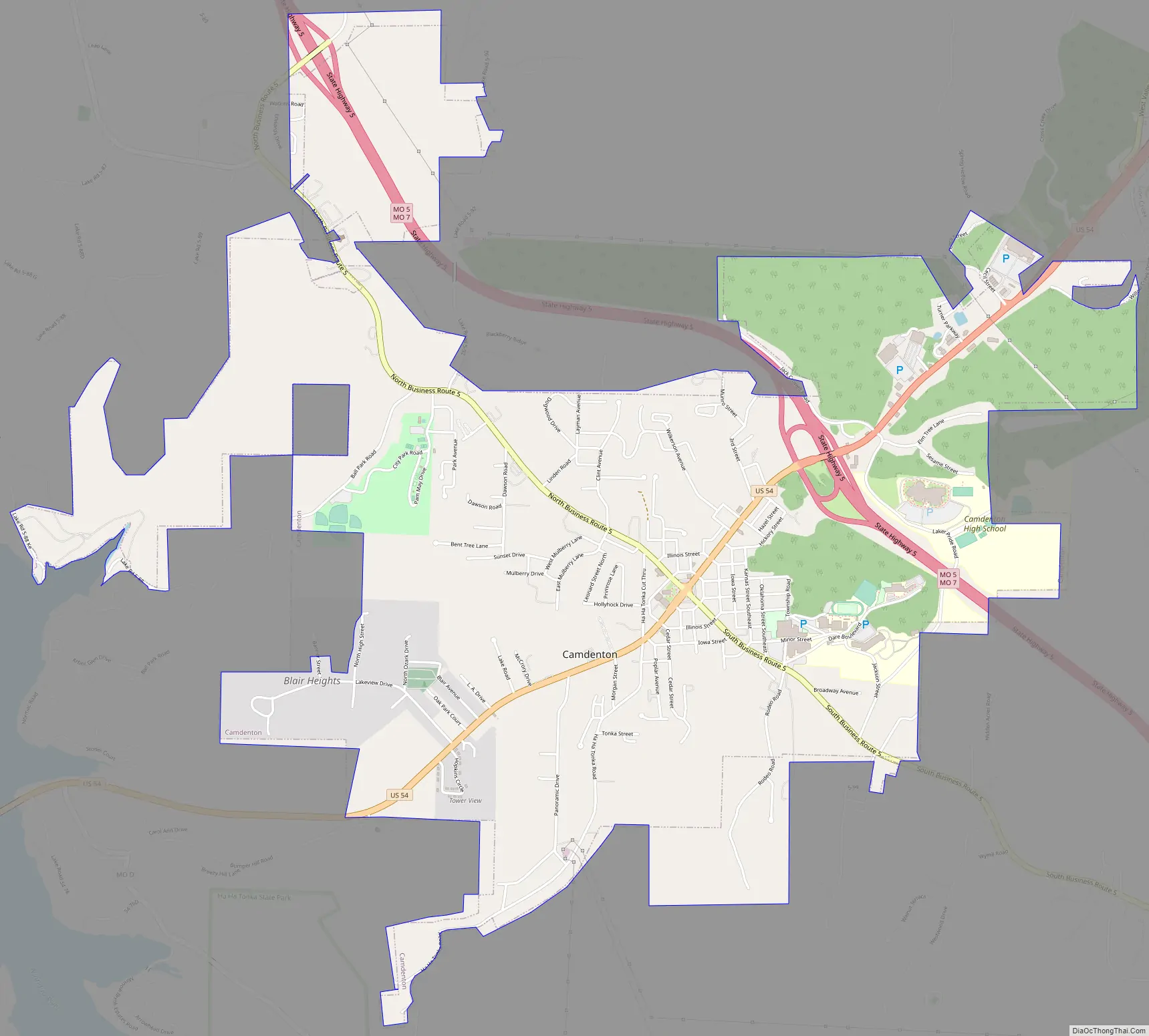
Camdenton Road Map
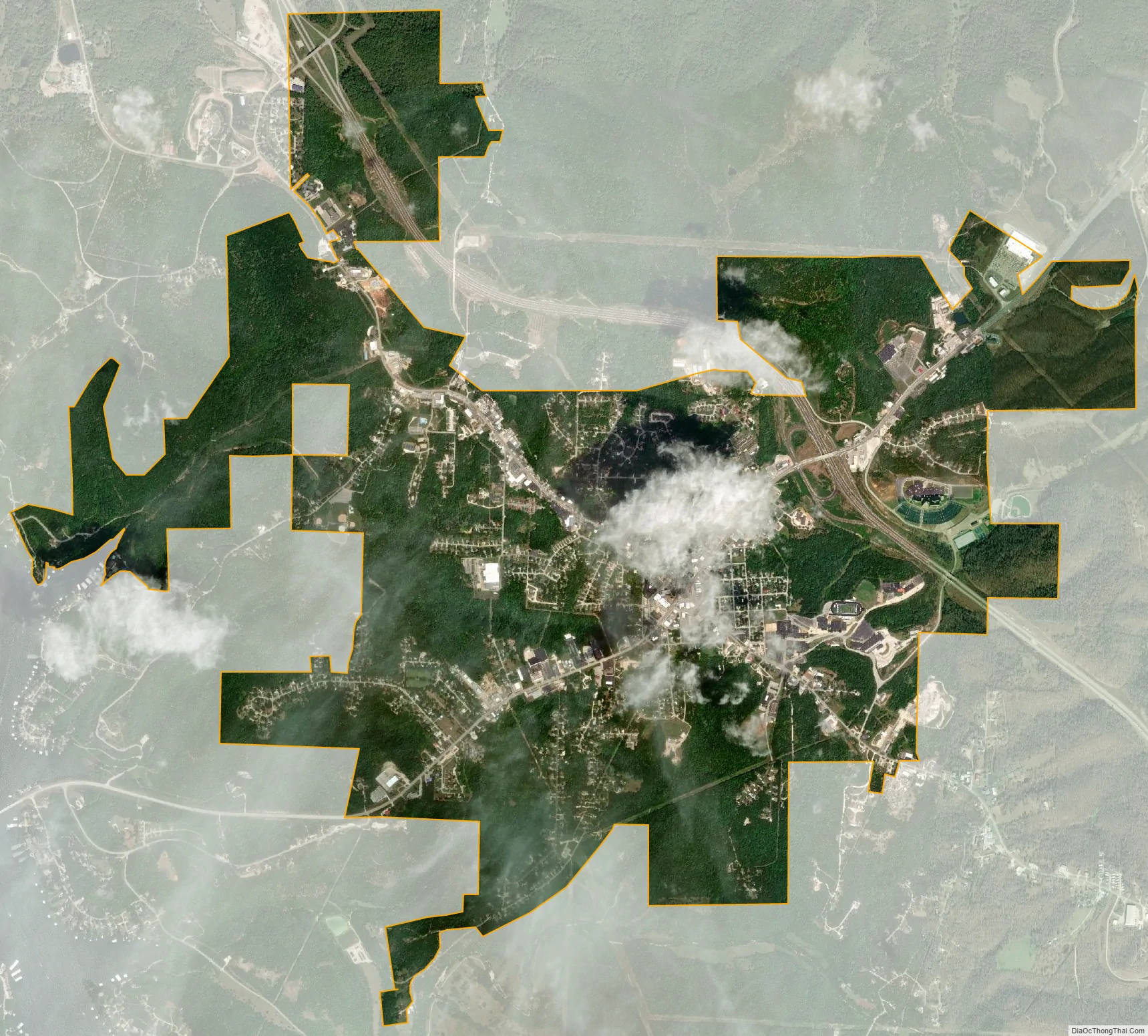
Camdenton city Satellite Map
Geography
Camdenton is located at 38°0′32″N 92°44′47″W / 38.00889°N 92.74639°W / 38.00889; -92.74639 (38.008890, -92.746484). According to the United States Census Bureau, the city has a total area of 5.48 square miles (14.19 km), all land. Camdenton is 1,043 feet (318 m) above sea level.
See also
Map of Missouri State and its subdivision:- Adair
- Andrew
- Atchison
- Audrain
- Barry
- Barton
- Bates
- Benton
- Bollinger
- Boone
- Buchanan
- Butler
- Caldwell
- Callaway
- Camden
- Cape Girardeau
- Carroll
- Carter
- Cass
- Cedar
- Chariton
- Christian
- Clark
- Clay
- Clinton
- Cole
- Cooper
- Crawford
- Dade
- Dallas
- Daviess
- De Kalb
- Dent
- Douglas
- Dunklin
- Franklin
- Gasconade
- Gentry
- Greene
- Grundy
- Harrison
- Henry
- Hickory
- Holt
- Howard
- Howell
- Iron
- Jackson
- Jasper
- Jefferson
- Johnson
- Knox
- Laclede
- Lafayette
- Lawrence
- Lewis
- Lincoln
- Linn
- Livingston
- Macon
- Madison
- Maries
- Marion
- McDonald
- Mercer
- Miller
- Mississippi
- Moniteau
- Monroe
- Montgomery
- Morgan
- New Madrid
- Newton
- Nodaway
- Oregon
- Osage
- Ozark
- Pemiscot
- Perry
- Pettis
- Phelps
- Pike
- Platte
- Polk
- Pulaski
- Putnam
- Ralls
- Randolph
- Ray
- Reynolds
- Ripley
- Saint Charles
- Saint Clair
- Saint Francois
- Saint Louis
- Sainte Genevieve
- Saline
- Schuyler
- Scotland
- Scott
- Shannon
- Shelby
- Stoddard
- Stone
- Sullivan
- Taney
- Texas
- Vernon
- Warren
- Washington
- Wayne
- Webster
- Worth
- Wright
- Alabama
- Alaska
- Arizona
- Arkansas
- California
- Colorado
- Connecticut
- Delaware
- District of Columbia
- Florida
- Georgia
- Hawaii
- Idaho
- Illinois
- Indiana
- Iowa
- Kansas
- Kentucky
- Louisiana
- Maine
- Maryland
- Massachusetts
- Michigan
- Minnesota
- Mississippi
- Missouri
- Montana
- Nebraska
- Nevada
- New Hampshire
- New Jersey
- New Mexico
- New York
- North Carolina
- North Dakota
- Ohio
- Oklahoma
- Oregon
- Pennsylvania
- Rhode Island
- South Carolina
- South Dakota
- Tennessee
- Texas
- Utah
- Vermont
- Virginia
- Washington
- West Virginia
- Wisconsin
- Wyoming