Carterville is a city in Jasper County, Missouri, United States. The population was 1,855 at the 2020 census. It is part of the Joplin, Missouri Metropolitan Statistical Area.
| Name: | Carterville city |
|---|---|
| LSAD Code: | 25 |
| LSAD Description: | city (suffix) |
| State: | Missouri |
| County: | Jasper County |
| Elevation: | 1,001 ft (305 m) |
| Total Area: | 2.61 sq mi (6.75 km²) |
| Land Area: | 2.61 sq mi (6.75 km²) |
| Water Area: | 0.00 sq mi (0.00 km²) |
| Total Population: | 1,855 |
| Population Density: | 711.55/sq mi (274.76/km²) |
| ZIP code: | 64835 |
| Area code: | 417 |
| FIPS code: | 2911638 |
| GNISfeature ID: | 2393758 |
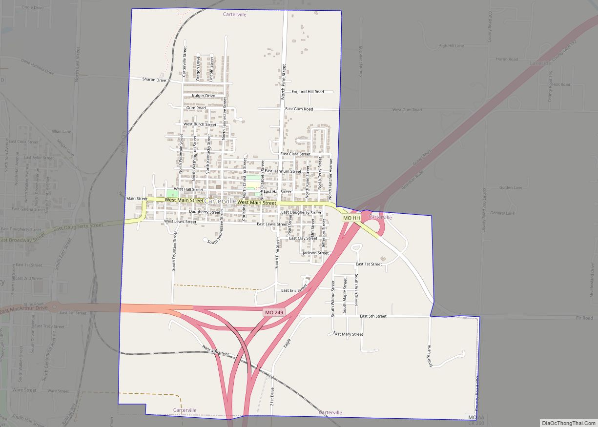
Online Interactive Map
Click on ![]() to view map in "full screen" mode.
to view map in "full screen" mode.
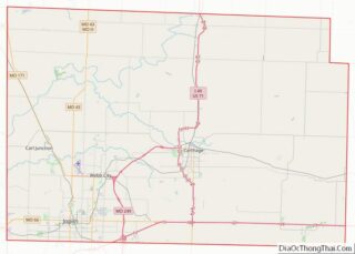
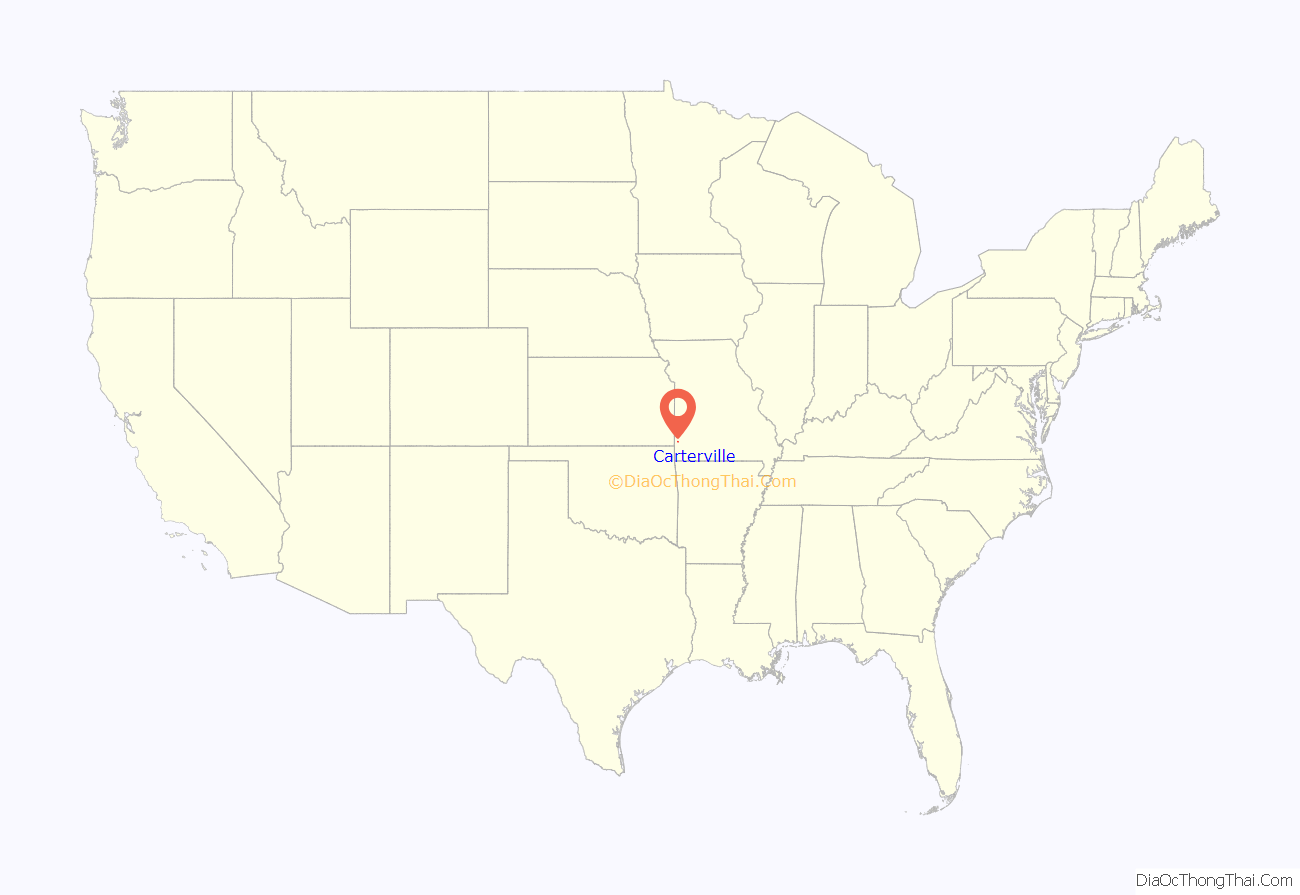
Carterville location map. Where is Carterville city?

History
While one James Carter settled in Jasper County in 1841, the land on which Carterville was built was originally owned by his son, James George Leroy Carter, who created a farm in the 1860’s. The town considers itself founded in 1875, when a post office called Carterville opened that year. However, the settlement was not officially incorporated until 1882. Early Carterville was little more than a lead-mining camp, one of many in the tri-state mining district in southwestern Missouri, southeastern Kansas and northwestern Oklahoma. It nevertheless thrived, and at one time had a population of over 12,000 residents, making it larger than nearby Webb City.
When interurban transportation came to the mining district in 1889, it was in the form of a horsecar line (other sources say a mule road) between Webb City and Carterville. That operation was absorbed in 1892 by the Southwest Missouri Electric Railway Company, later the Southwest Missouri Railroad Company, and by 1894 an electrified streetcar line linked Carterville to Webb City and Joplin in one direction, and Prosperity in the other. Two additional rail lines, that of the Missouri Pacific Railway and the Kansas City, Fort Scott and Memphis Railway, ran down the west border of Carterville.
The town began its decline in size after World War I, when the mining industry began to dry up.
Carterville Road Map

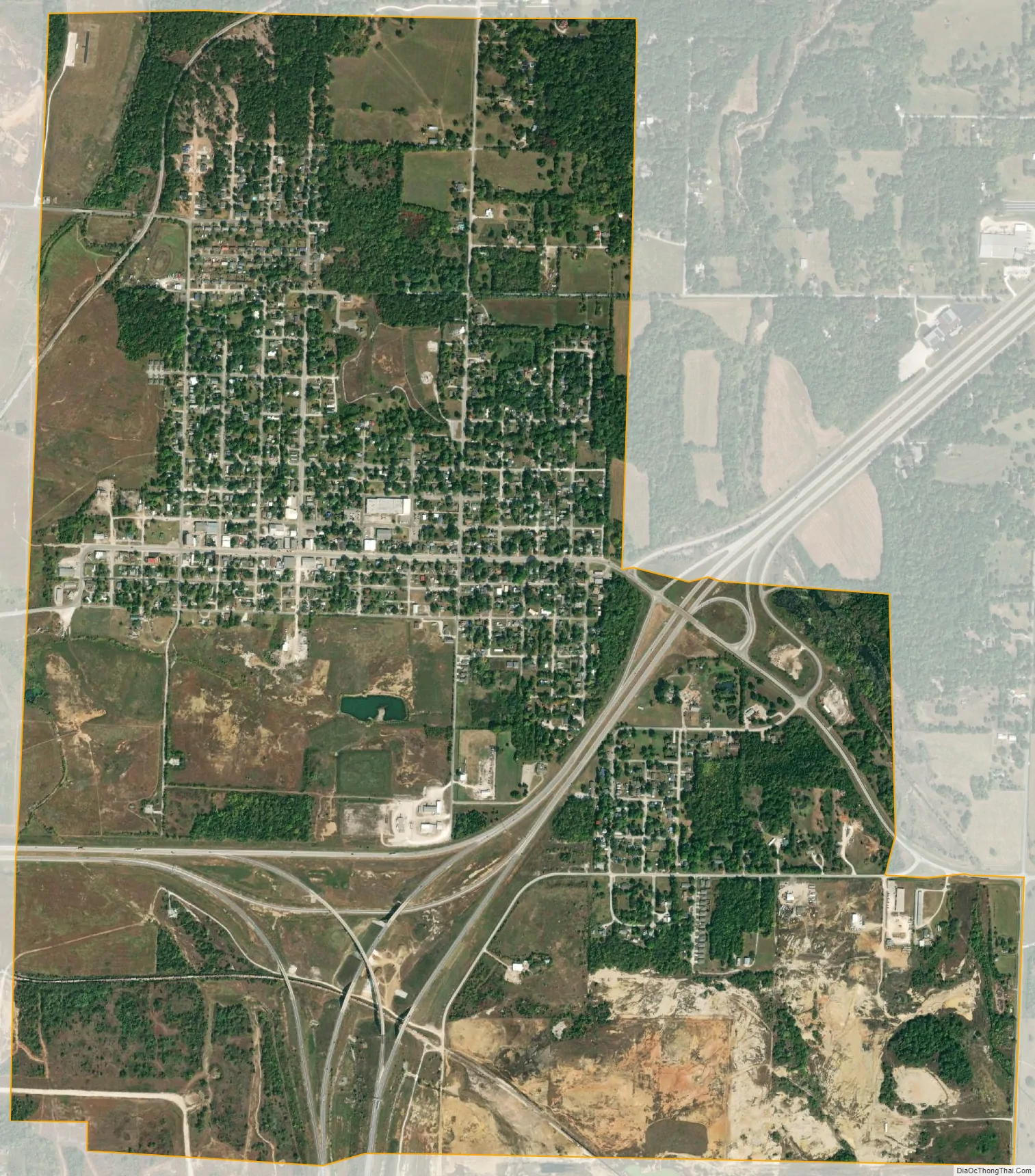
Carterville city Satellite Map
Geography
Carterville’s main street is the former U.S. Route 66.
According to the United States Census Bureau, the city has a total area of 2.60 square miles (6.73 km), all land.
See also
Map of Missouri State and its subdivision:- Adair
- Andrew
- Atchison
- Audrain
- Barry
- Barton
- Bates
- Benton
- Bollinger
- Boone
- Buchanan
- Butler
- Caldwell
- Callaway
- Camden
- Cape Girardeau
- Carroll
- Carter
- Cass
- Cedar
- Chariton
- Christian
- Clark
- Clay
- Clinton
- Cole
- Cooper
- Crawford
- Dade
- Dallas
- Daviess
- De Kalb
- Dent
- Douglas
- Dunklin
- Franklin
- Gasconade
- Gentry
- Greene
- Grundy
- Harrison
- Henry
- Hickory
- Holt
- Howard
- Howell
- Iron
- Jackson
- Jasper
- Jefferson
- Johnson
- Knox
- Laclede
- Lafayette
- Lawrence
- Lewis
- Lincoln
- Linn
- Livingston
- Macon
- Madison
- Maries
- Marion
- McDonald
- Mercer
- Miller
- Mississippi
- Moniteau
- Monroe
- Montgomery
- Morgan
- New Madrid
- Newton
- Nodaway
- Oregon
- Osage
- Ozark
- Pemiscot
- Perry
- Pettis
- Phelps
- Pike
- Platte
- Polk
- Pulaski
- Putnam
- Ralls
- Randolph
- Ray
- Reynolds
- Ripley
- Saint Charles
- Saint Clair
- Saint Francois
- Saint Louis
- Sainte Genevieve
- Saline
- Schuyler
- Scotland
- Scott
- Shannon
- Shelby
- Stoddard
- Stone
- Sullivan
- Taney
- Texas
- Vernon
- Warren
- Washington
- Wayne
- Webster
- Worth
- Wright
- Alabama
- Alaska
- Arizona
- Arkansas
- California
- Colorado
- Connecticut
- Delaware
- District of Columbia
- Florida
- Georgia
- Hawaii
- Idaho
- Illinois
- Indiana
- Iowa
- Kansas
- Kentucky
- Louisiana
- Maine
- Maryland
- Massachusetts
- Michigan
- Minnesota
- Mississippi
- Missouri
- Montana
- Nebraska
- Nevada
- New Hampshire
- New Jersey
- New Mexico
- New York
- North Carolina
- North Dakota
- Ohio
- Oklahoma
- Oregon
- Pennsylvania
- Rhode Island
- South Carolina
- South Dakota
- Tennessee
- Texas
- Utah
- Vermont
- Virginia
- Washington
- West Virginia
- Wisconsin
- Wyoming