De Soto is a city in Jefferson County, Missouri, United States. The population was 6,449 at the 2020 census and the city is part of the St. Louis metropolitan area. The Van Metre family were first to settle in 1803. The town was organized in 1857 and is named for the explorer Hernando De Soto, who claimed the Louisiana Territory for Spain. De Soto was the city closest to the mean center of U.S. population in 1980. The city celebrated its Bicentennial in 2003. The city made national news on and after May 6, 2003, when straight-line winds and a tornado struck.
| Name: | De Soto city |
|---|---|
| LSAD Code: | 25 |
| LSAD Description: | city (suffix) |
| State: | Missouri |
| County: | Jefferson County |
| Incorporated: | 1869 |
| Elevation: | 545 ft (166 m) |
| Total Area: | 4.38 sq mi (11.35 km²) |
| Land Area: | 4.38 sq mi (11.35 km²) |
| Water Area: | 0.00 sq mi (0.00 km²) |
| Total Population: | 6,449 |
| Population Density: | 1,471.37/sq mi (568.10/km²) |
| ZIP code: | 63020 |
| Area code: | 636 |
| FIPS code: | 2919252 |
| GNISfeature ID: | 2394475 |
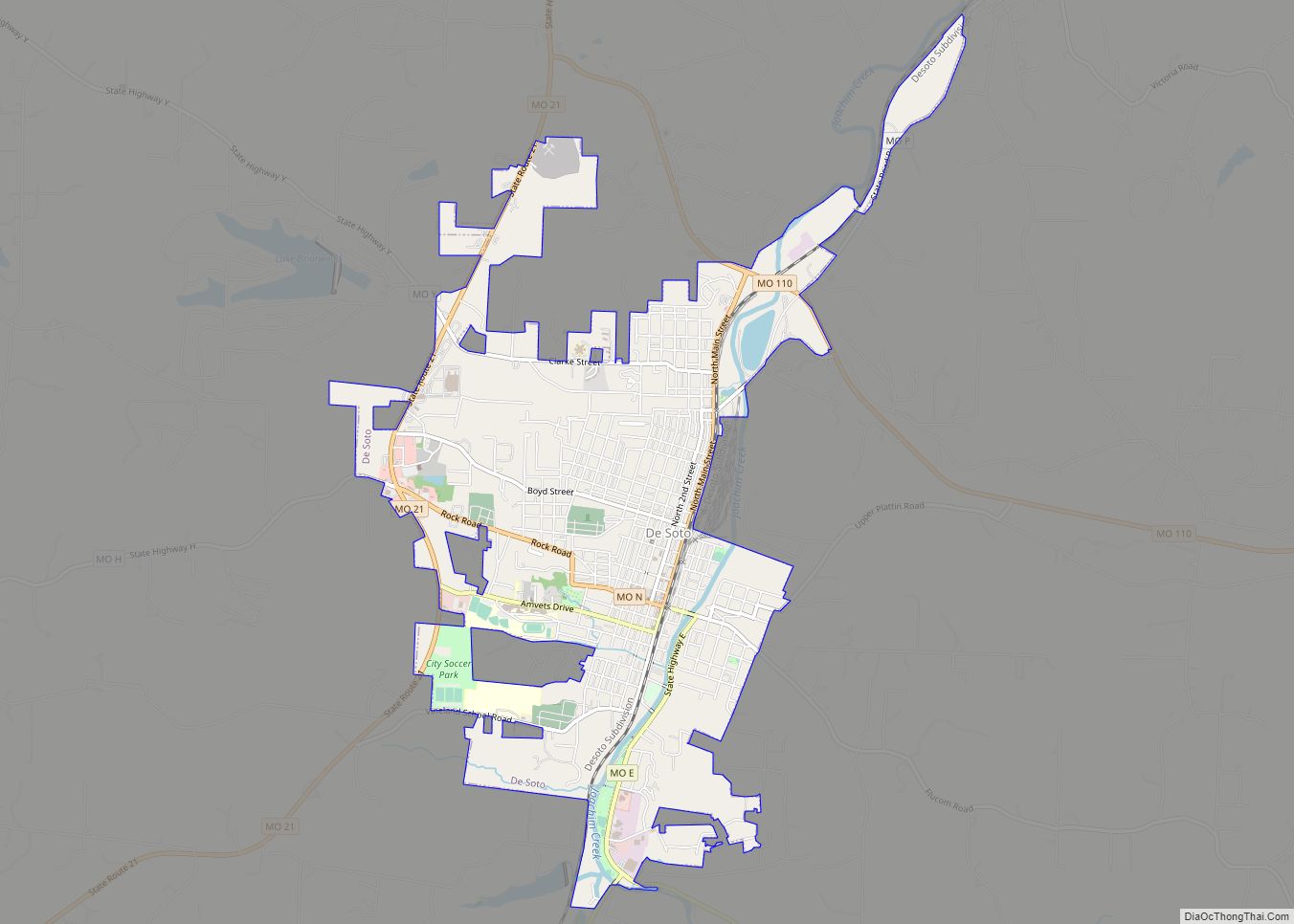
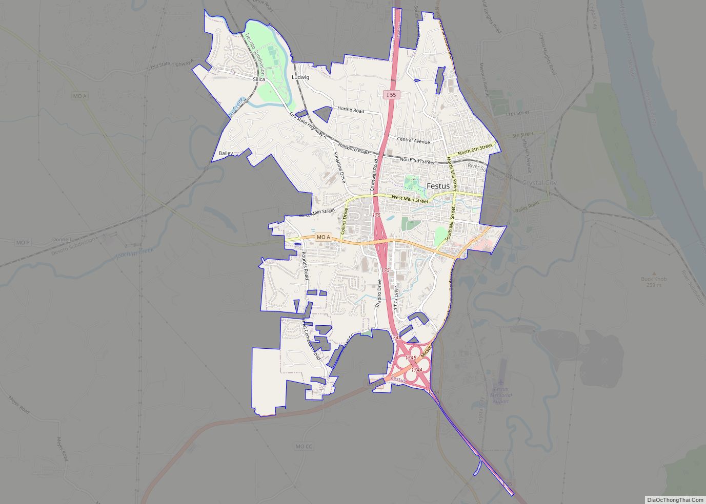
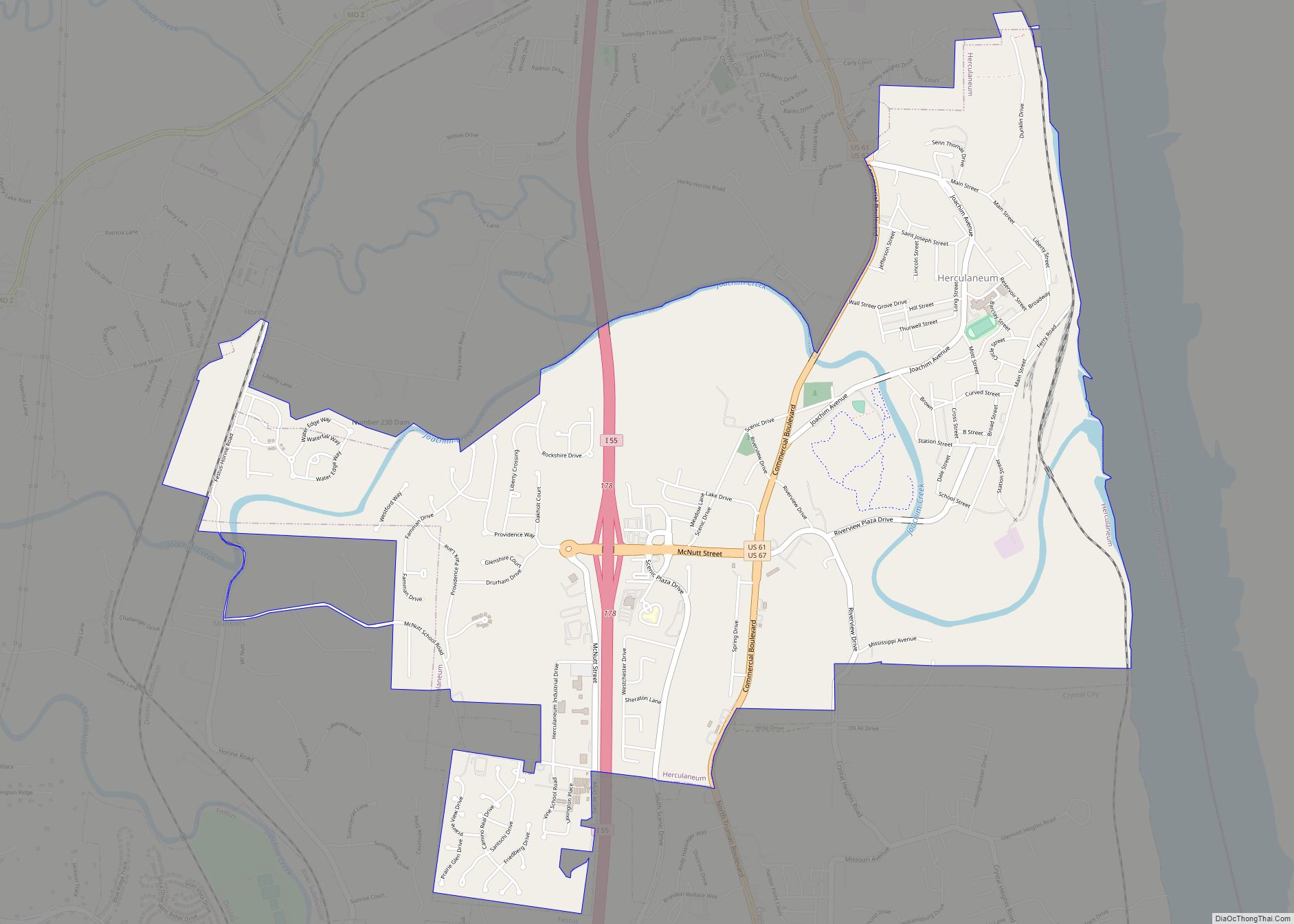
Online Interactive Map
Click on ![]() to view map in "full screen" mode.
to view map in "full screen" mode.
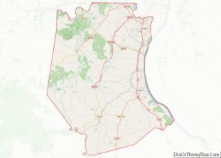
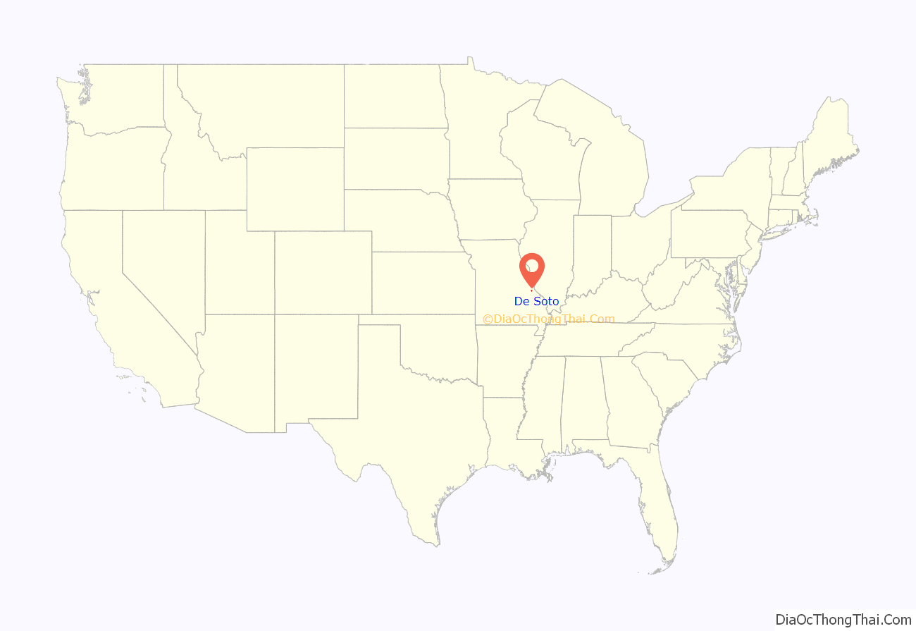
De Soto location map. Where is De Soto city?
History
De Soto was platted in 1857 and named after Hernando de Soto (c. 1496/1497–1542), Spanish conquistador. A post office has been in operation at De Soto since 1858.
The city is known as “Fountain City” because of its numerous artesian wells. Water from these wells and springs were bottled and shipped by tank car to the 1904 World Fair in St. Louis.
The Central School Campus and Louis J. and Harriet Rozier House are listed on the National Register of Historic Places.
Tornado activity
On December 21, 1967, an F4 tornado 16.8 miles away from the city center killed three people, injured 52 people, and caused between $500,000 and $5,000,000 in damages.
On June 22, 1969, an F4 (max. wind speeds 207-260 mph) tornado 13.5 miles away from the De Soto city center killed two people and injured 22 people and caused between $500,000 and $5,000,000 in damages.
On April 22, 1981, a tornado destroyed the Joachim Savings & Loan, the offices of the Republic and Press newspaper, and a tire store. One person was killed in the Savings & Loan.
On May 6, 2003, at approximately 3:45 pm, a tornado outbreak began in Kansas, Missouri, and Tennessee. At 5:14pm, a tornado touched down two miles northwest of De Soto. Fourteen minutes later, the tornado sirens went off in Jefferson County. The tornado hit De Soto at F3 intensity, causing $12,800,000 in damage. The tornado destroyed the junior high gymnasium, caused significant damage to the high school and Vineland Elementary, destroyed 58 houses and a local grocery store. It injured 23 and killed nine inside De Soto.
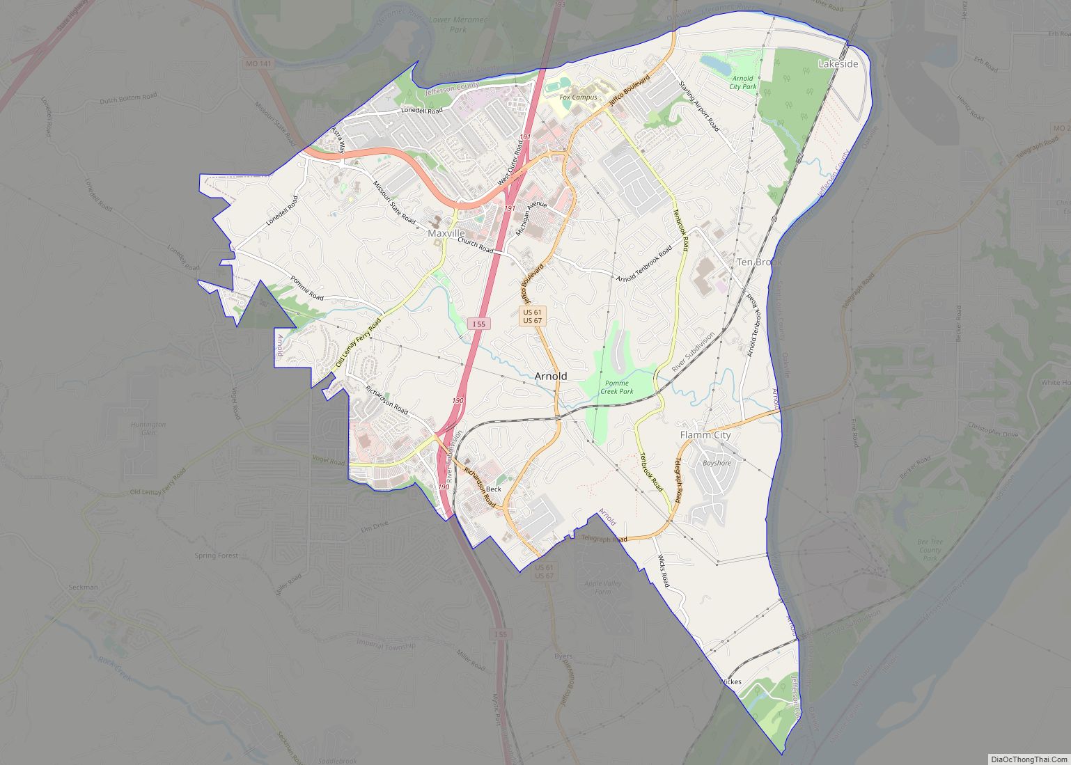
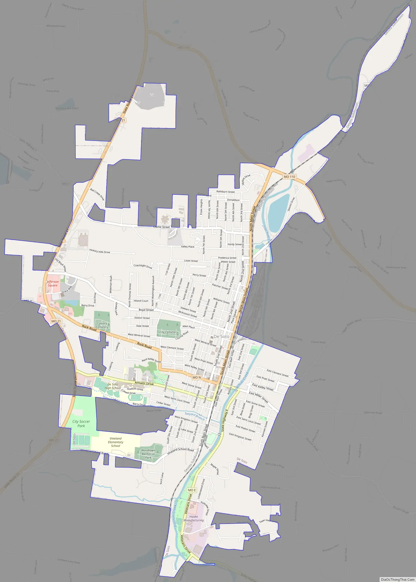
De Soto Road Map
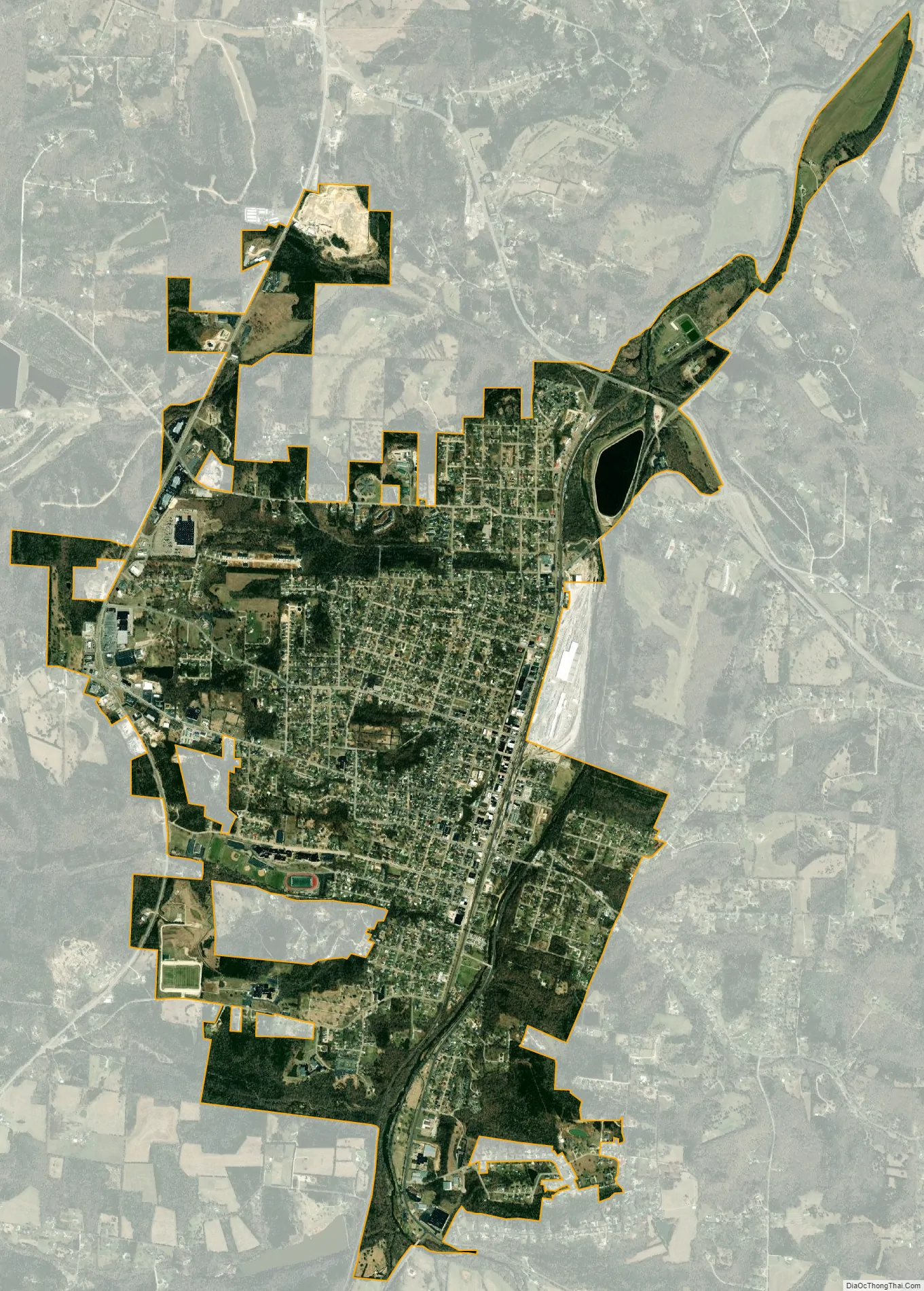
De Soto city Satellite Map
Geography
The community is located along Joachim Creek in southwest Jefferson County. Missouri Route 21 passes just west to the west and Missouri Route 110 connects to US Route 67 approximately three miles east of the town.
According to the United States Census Bureau, the city has a total area of 4.30 square miles (11.14 km), all land.
See also
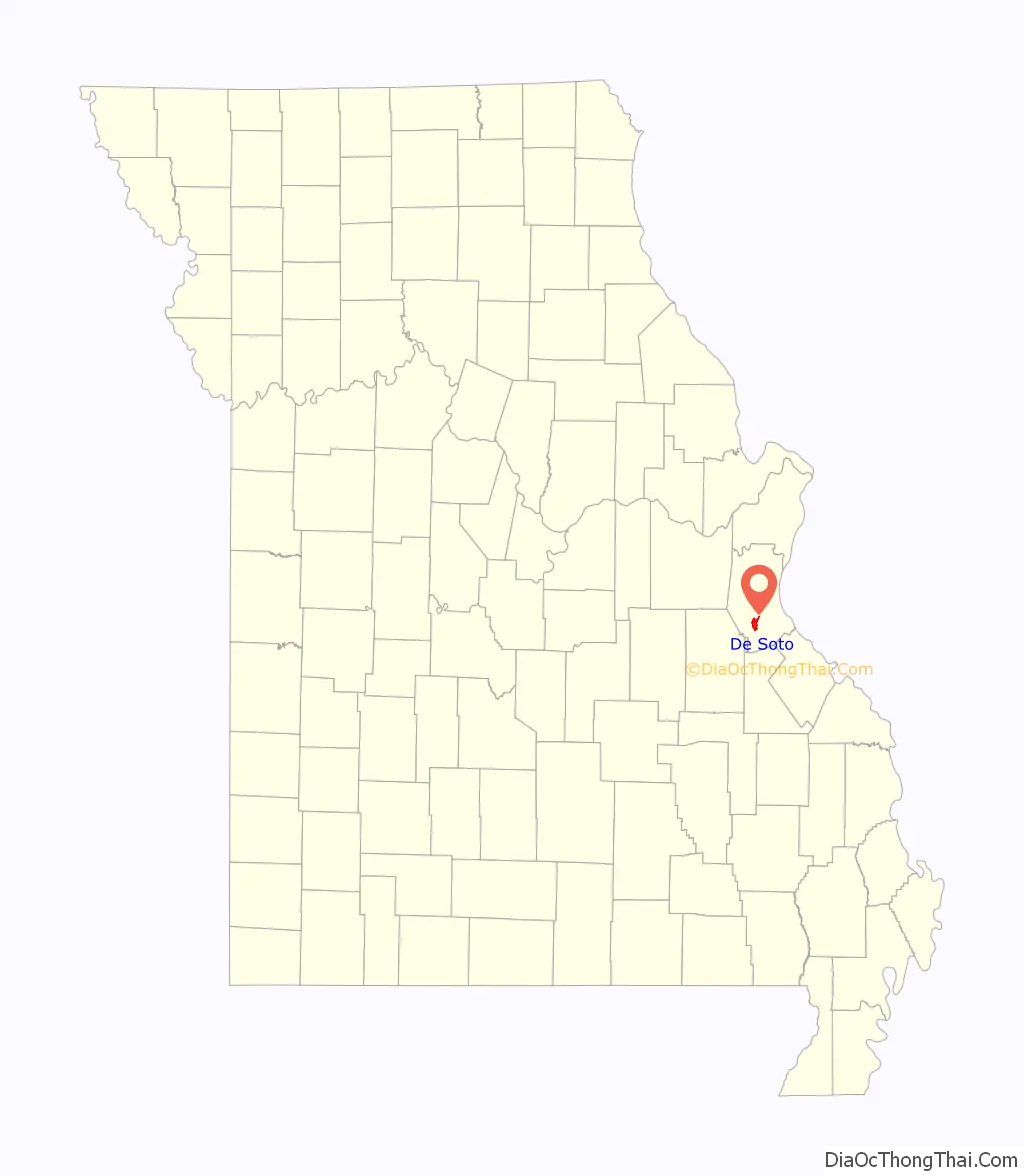
Map of Missouri State and its subdivision:- Adair
- Andrew
- Atchison
- Audrain
- Barry
- Barton
- Bates
- Benton
- Bollinger
- Boone
- Buchanan
- Butler
- Caldwell
- Callaway
- Camden
- Cape Girardeau
- Carroll
- Carter
- Cass
- Cedar
- Chariton
- Christian
- Clark
- Clay
- Clinton
- Cole
- Cooper
- Crawford
- Dade
- Dallas
- Daviess
- De Kalb
- Dent
- Douglas
- Dunklin
- Franklin
- Gasconade
- Gentry
- Greene
- Grundy
- Harrison
- Henry
- Hickory
- Holt
- Howard
- Howell
- Iron
- Jackson
- Jasper
- Jefferson
- Johnson
- Knox
- Laclede
- Lafayette
- Lawrence
- Lewis
- Lincoln
- Linn
- Livingston
- Macon
- Madison
- Maries
- Marion
- McDonald
- Mercer
- Miller
- Mississippi
- Moniteau
- Monroe
- Montgomery
- Morgan
- New Madrid
- Newton
- Nodaway
- Oregon
- Osage
- Ozark
- Pemiscot
- Perry
- Pettis
- Phelps
- Pike
- Platte
- Polk
- Pulaski
- Putnam
- Ralls
- Randolph
- Ray
- Reynolds
- Ripley
- Saint Charles
- Saint Clair
- Saint Francois
- Saint Louis
- Sainte Genevieve
- Saline
- Schuyler
- Scotland
- Scott
- Shannon
- Shelby
- Stoddard
- Stone
- Sullivan
- Taney
- Texas
- Vernon
- Warren
- Washington
- Wayne
- Webster
- Worth
- Wright
- Alabama
- Alaska
- Arizona
- Arkansas
- California
- Colorado
- Connecticut
- Delaware
- District of Columbia
- Florida
- Georgia
- Hawaii
- Idaho
- Illinois
- Indiana
- Iowa
- Kansas
- Kentucky
- Louisiana
- Maine
- Maryland
- Massachusetts
- Michigan
- Minnesota
- Mississippi
- Missouri
- Montana
- Nebraska
- Nevada
- New Hampshire
- New Jersey
- New Mexico
- New York
- North Carolina
- North Dakota
- Ohio
- Oklahoma
- Oregon
- Pennsylvania
- Rhode Island
- South Carolina
- South Dakota
- Tennessee
- Texas
- Utah
- Vermont
- Virginia
- Washington
- West Virginia
- Wisconsin
- Wyoming