Doolittle is a city in Phelps County, Missouri, United States. The population was 630 at the 2010 census.
| Name: | Doolittle city |
|---|---|
| LSAD Code: | 25 |
| LSAD Description: | city (suffix) |
| State: | Missouri |
| County: | Phelps County |
| Elevation: | 948 ft (289 m) |
| Total Area: | 2.78 sq mi (7.21 km²) |
| Land Area: | 2.78 sq mi (7.21 km²) |
| Water Area: | 0.00 sq mi (0.00 km²) |
| Total Population: | 564 |
| Population Density: | 202.59/sq mi (78.21/km²) |
| ZIP code: | 65550 |
| Area code: | 573 |
| FIPS code: | 2919828 |
| GNISfeature ID: | 2394547 |
Online Interactive Map
Click on ![]() to view map in "full screen" mode.
to view map in "full screen" mode.
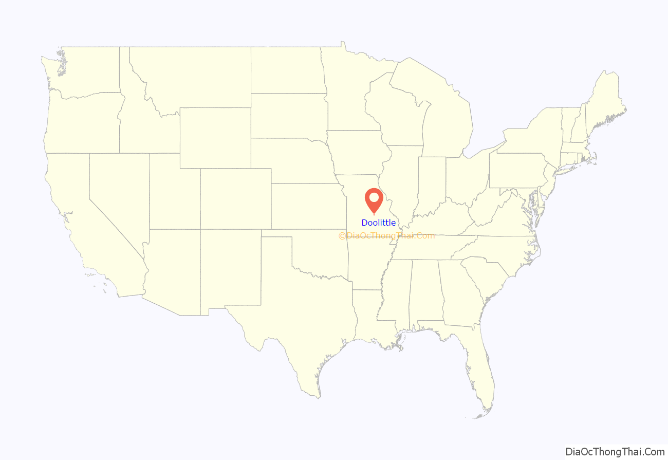
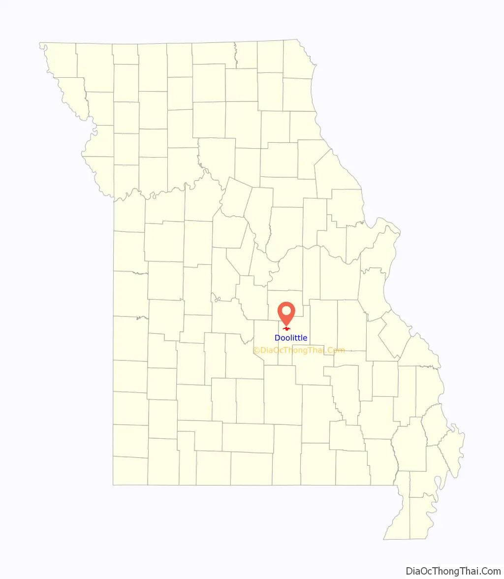
Doolittle location map. Where is Doolittle city?
History
The town is named for Lt. General Jimmy Doolittle of World War II fame who bombed Tokyo in a daring raid, which helped to turn the tide of the war in the Pacific. The settlement was originally called Centertown because it was halfway between Rolla and Newburg. This name, coined by a local man named Monroe Ramsey, caught on over the years.
The town boomed in the spring of 1941 when construction of Fort Leonard Wood, 20 miles away, began in earnest due to the war effort. Thousands of workers poured in and slept anywhere they could. In some places, it was said beds never got cold because different shifts shared occupancy. So the two mile stretch which was unofficially called Centertown grew and boomed and a local businessman, Lou Hargis, felt it was time for an incorporated city. The idea of naming the new city after General Doolittle was well-received, along with the idea of having General Doolittle dedicate the town after the war effort.
The original trustees of the town when it was incorporated were Lou Hargis, Mr. Durham (principal of the Newburg High School), Bob Crain (an employee of the Missouri Bureau of Mines, resident of Rolla), and Ike Towell (operator of a local filling station and grocery store). They continued as interim trustees until April 1944 when a general election was held and a mayor and city officials elected. It was those five men who presented themselves at the courthouse “to announce the birth of a town and give it a hero’s name.”
In 1946, Lt. General Doolittle spoke at the dedication ceremony in which the town was christened in his honor. Doolittle flew his own B-25 into the airport in Vichy, fulfilling a promise he had made two years before.
Doolittle Road Map
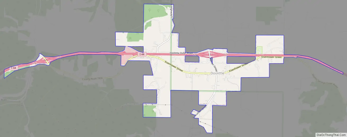
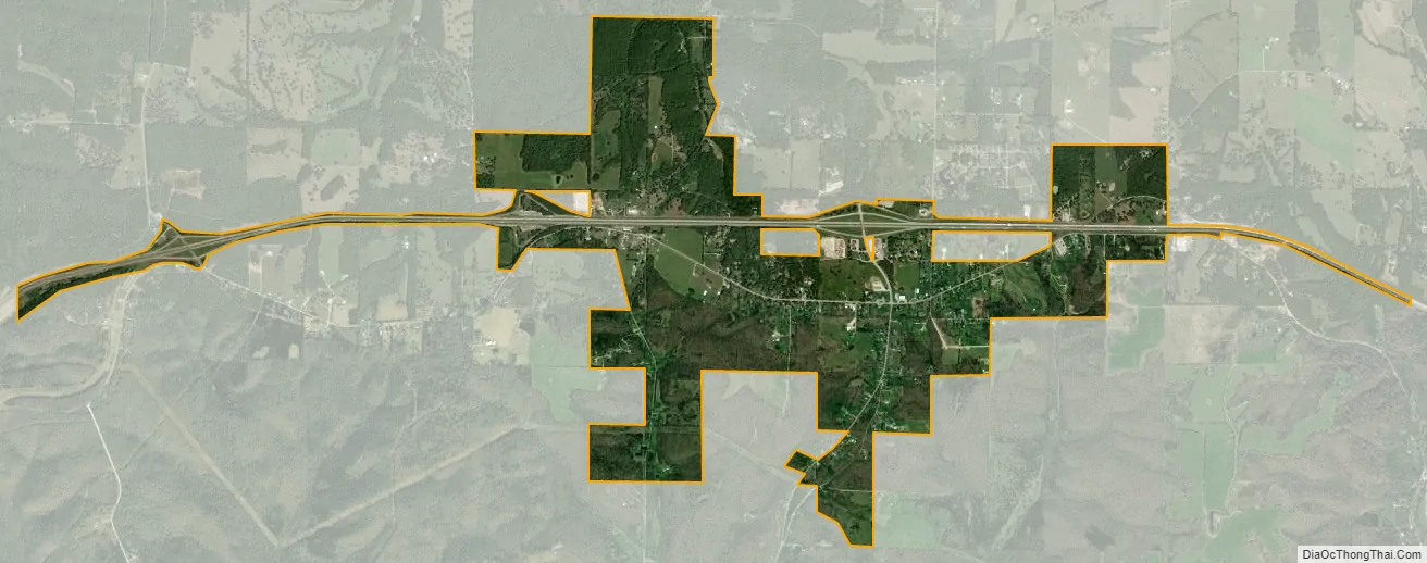
Doolittle city Satellite Map
Geography
Doolittle is located at the intersection of Missouri Route T and I-44 between Rolla and Jerome. Newburg lies approximately 2.5 miles south on Route T.
According to the United States Census Bureau, the city has a total area of 2.68 square miles (6.94 km), all land.
See also
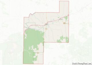
Map of Missouri State and its subdivision:- Adair
- Andrew
- Atchison
- Audrain
- Barry
- Barton
- Bates
- Benton
- Bollinger
- Boone
- Buchanan
- Butler
- Caldwell
- Callaway
- Camden
- Cape Girardeau
- Carroll
- Carter
- Cass
- Cedar
- Chariton
- Christian
- Clark
- Clay
- Clinton
- Cole
- Cooper
- Crawford
- Dade
- Dallas
- Daviess
- De Kalb
- Dent
- Douglas
- Dunklin
- Franklin
- Gasconade
- Gentry
- Greene
- Grundy
- Harrison
- Henry
- Hickory
- Holt
- Howard
- Howell
- Iron
- Jackson
- Jasper
- Jefferson
- Johnson
- Knox
- Laclede
- Lafayette
- Lawrence
- Lewis
- Lincoln
- Linn
- Livingston
- Macon
- Madison
- Maries
- Marion
- McDonald
- Mercer
- Miller
- Mississippi
- Moniteau
- Monroe
- Montgomery
- Morgan
- New Madrid
- Newton
- Nodaway
- Oregon
- Osage
- Ozark
- Pemiscot
- Perry
- Pettis
- Phelps
- Pike
- Platte
- Polk
- Pulaski
- Putnam
- Ralls
- Randolph
- Ray
- Reynolds
- Ripley
- Saint Charles
- Saint Clair
- Saint Francois
- Saint Louis
- Sainte Genevieve
- Saline
- Schuyler
- Scotland
- Scott
- Shannon
- Shelby
- Stoddard
- Stone
- Sullivan
- Taney
- Texas
- Vernon
- Warren
- Washington
- Wayne
- Webster
- Worth
- Wright
- Alabama
- Alaska
- Arizona
- Arkansas
- California
- Colorado
- Connecticut
- Delaware
- District of Columbia
- Florida
- Georgia
- Hawaii
- Idaho
- Illinois
- Indiana
- Iowa
- Kansas
- Kentucky
- Louisiana
- Maine
- Maryland
- Massachusetts
- Michigan
- Minnesota
- Mississippi
- Missouri
- Montana
- Nebraska
- Nevada
- New Hampshire
- New Jersey
- New Mexico
- New York
- North Carolina
- North Dakota
- Ohio
- Oklahoma
- Oregon
- Pennsylvania
- Rhode Island
- South Carolina
- South Dakota
- Tennessee
- Texas
- Utah
- Vermont
- Virginia
- Washington
- West Virginia
- Wisconsin
- Wyoming