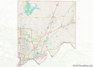
Gladstone is a city in Clay County, Missouri, United States and a suburb of Kansas City. The City of Gladstone is located only 10 minutes from downtown Kansas City, and 10 minutes from Kansas City International Airport. As of the 2020 census, the city population was 27,063. It is part of the Kansas City metropolitan area.
| Name: | Gladstone city |
|---|---|
| LSAD Code: | 25 |
| LSAD Description: | city (suffix) |
| State: | Missouri |
| County: | Clay County |
| Elevation: | 1,017 ft (310 m) |
| Total Area: | 8.09 sq mi (20.94 km²) |
| Land Area: | 8.08 sq mi (20.93 km²) |
| Water Area: | 0.01 sq mi (0.01 km²) |
| Total Population: | 27,063 |
| Population Density: | 3,349.38/sq mi (1,293.25/km²) |
| ZIP code: | 64118-64119 |
| Area code: | 816 |
| FIPS code: | 2927190 |
| GNISfeature ID: | 2394907 |
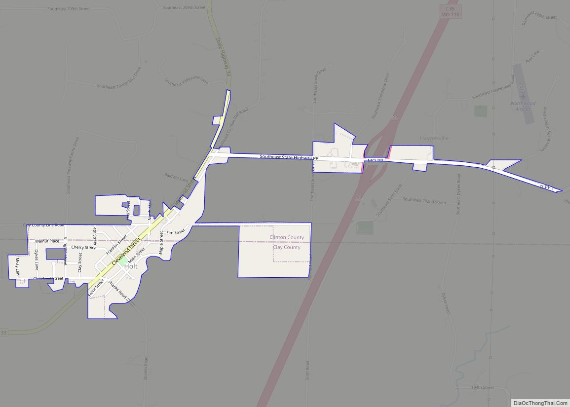
Online Interactive Map
Click on ![]() to view map in "full screen" mode.
to view map in "full screen" mode.
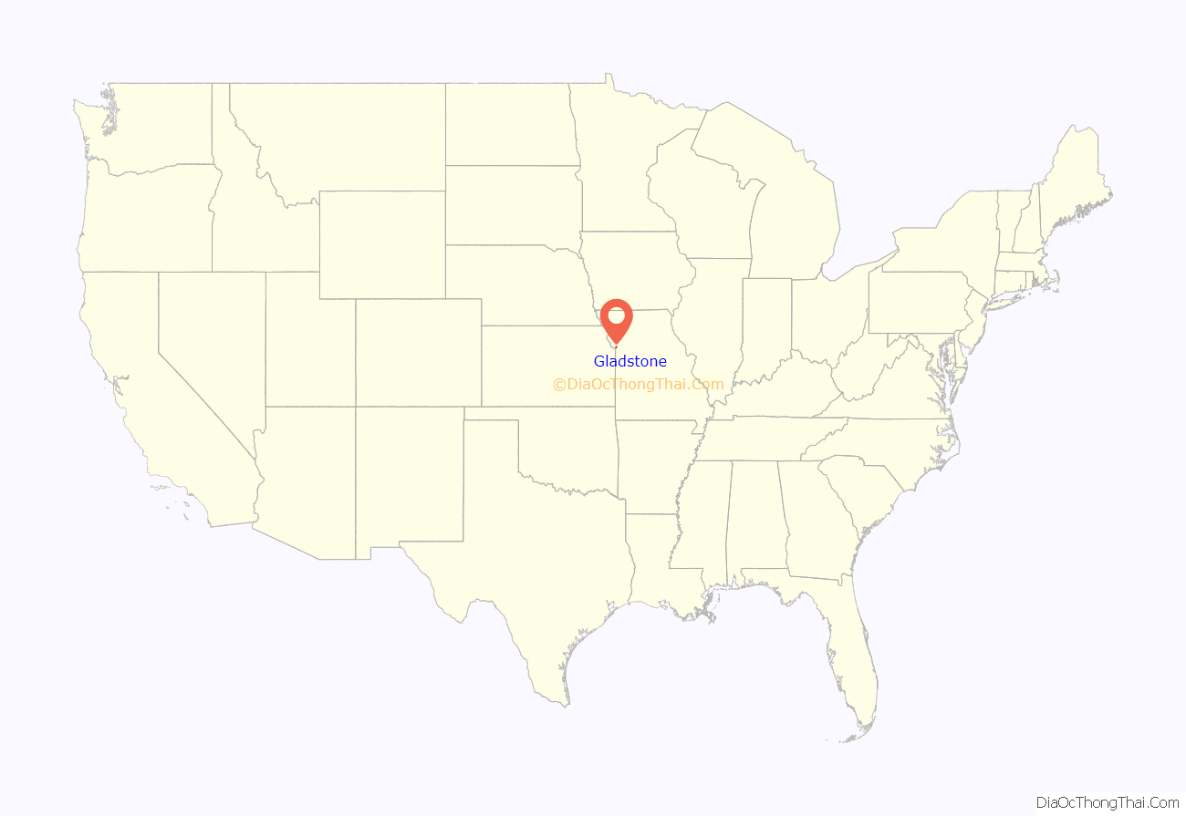
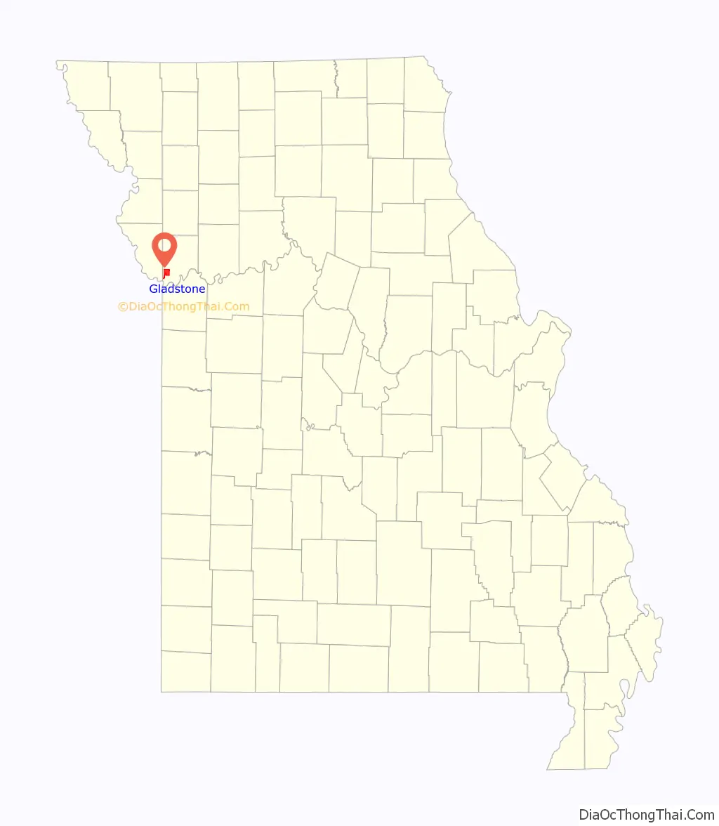
Gladstone location map. Where is Gladstone city?
History
A remnant of the mesic forested land on which Gladstone is built is preserved as the Maple Woods Natural Area, a park within Gladstone that is a National Natural Landmark. The Atkins-Johnson Farmhouse Property was listed on the National Register of Historic Places in 2007.
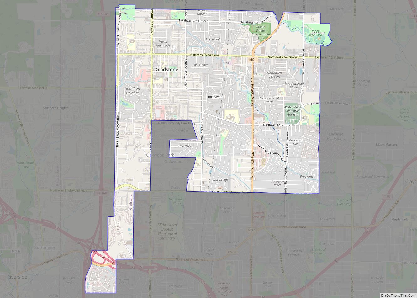
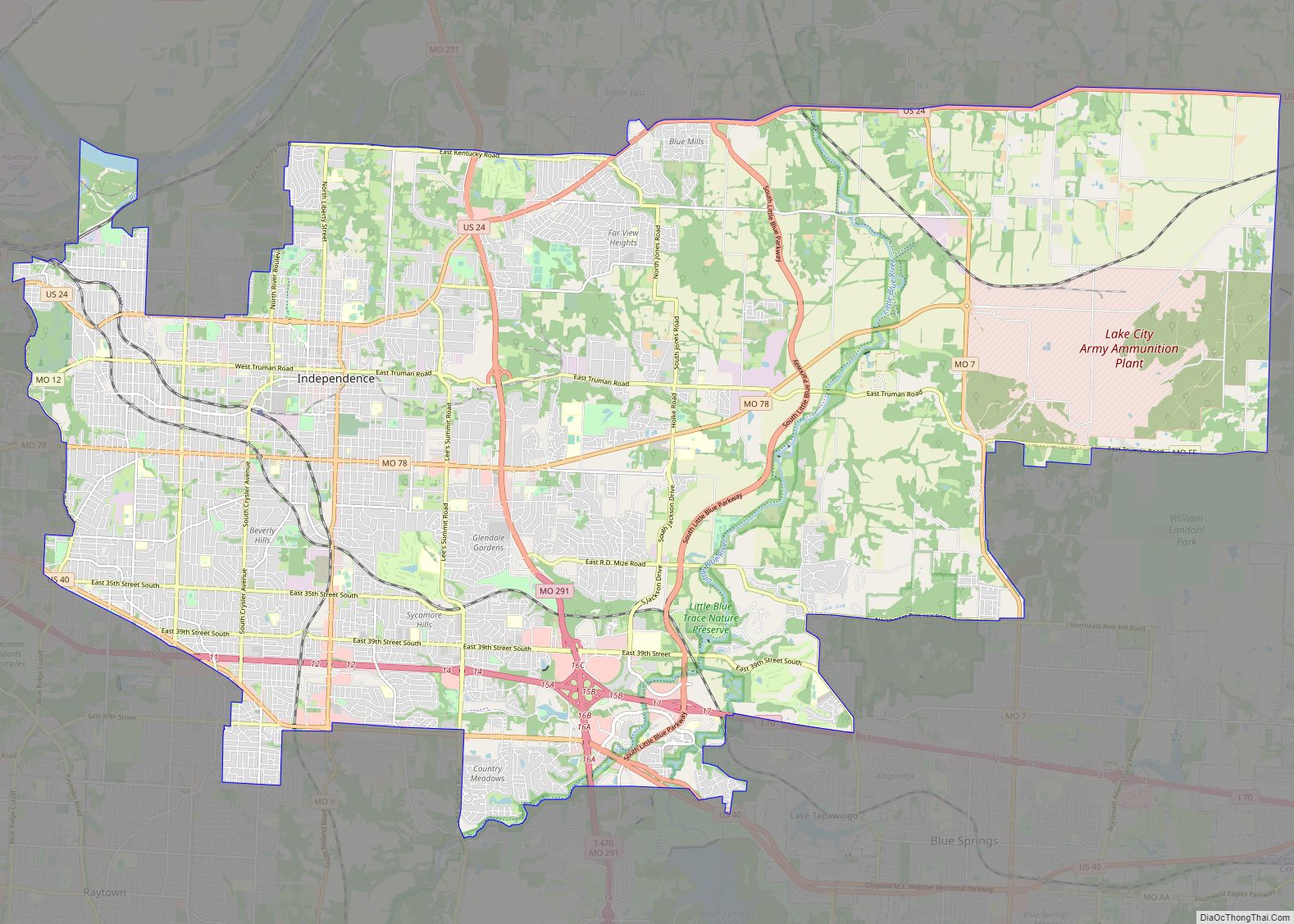
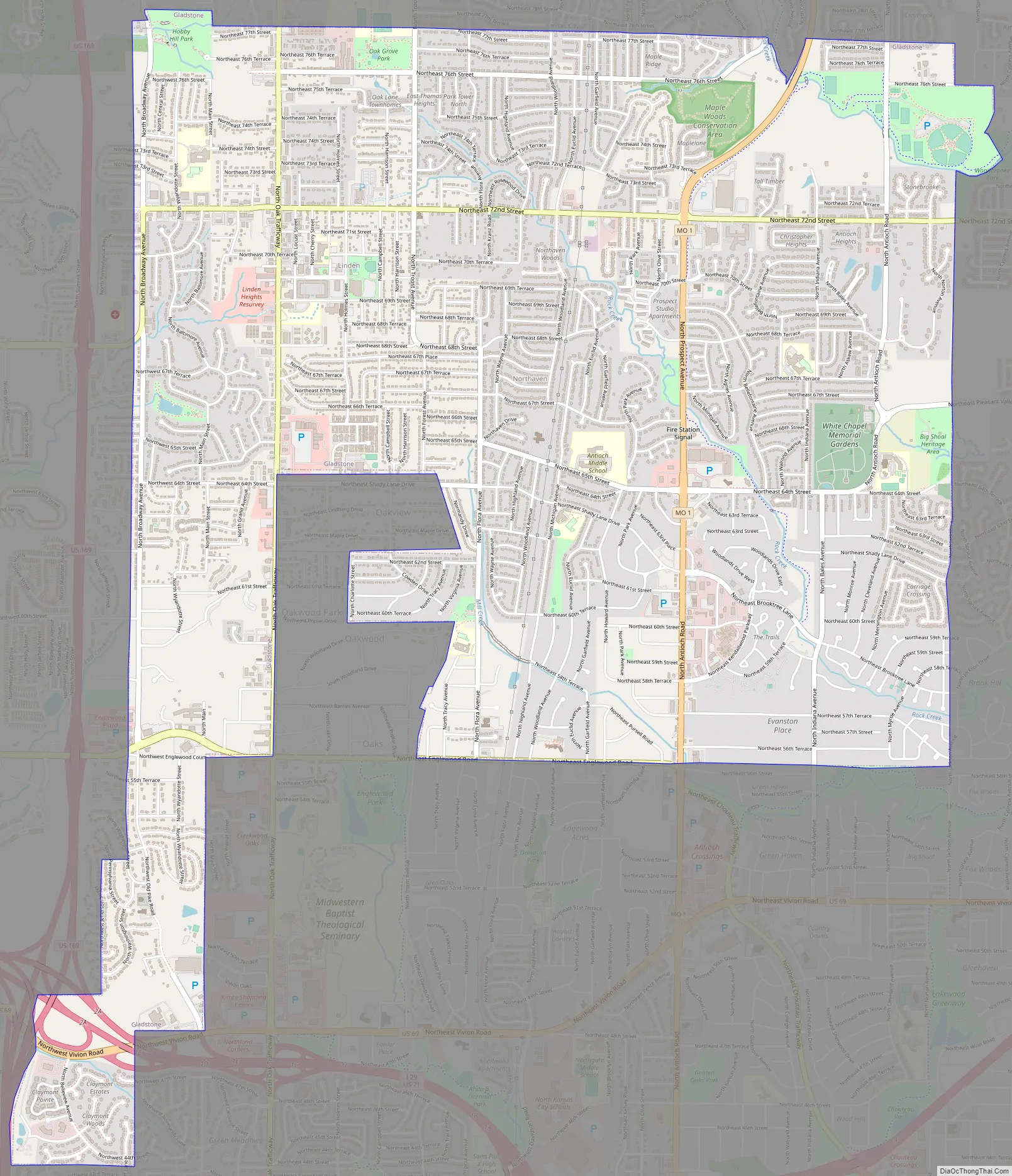
Gladstone Road Map
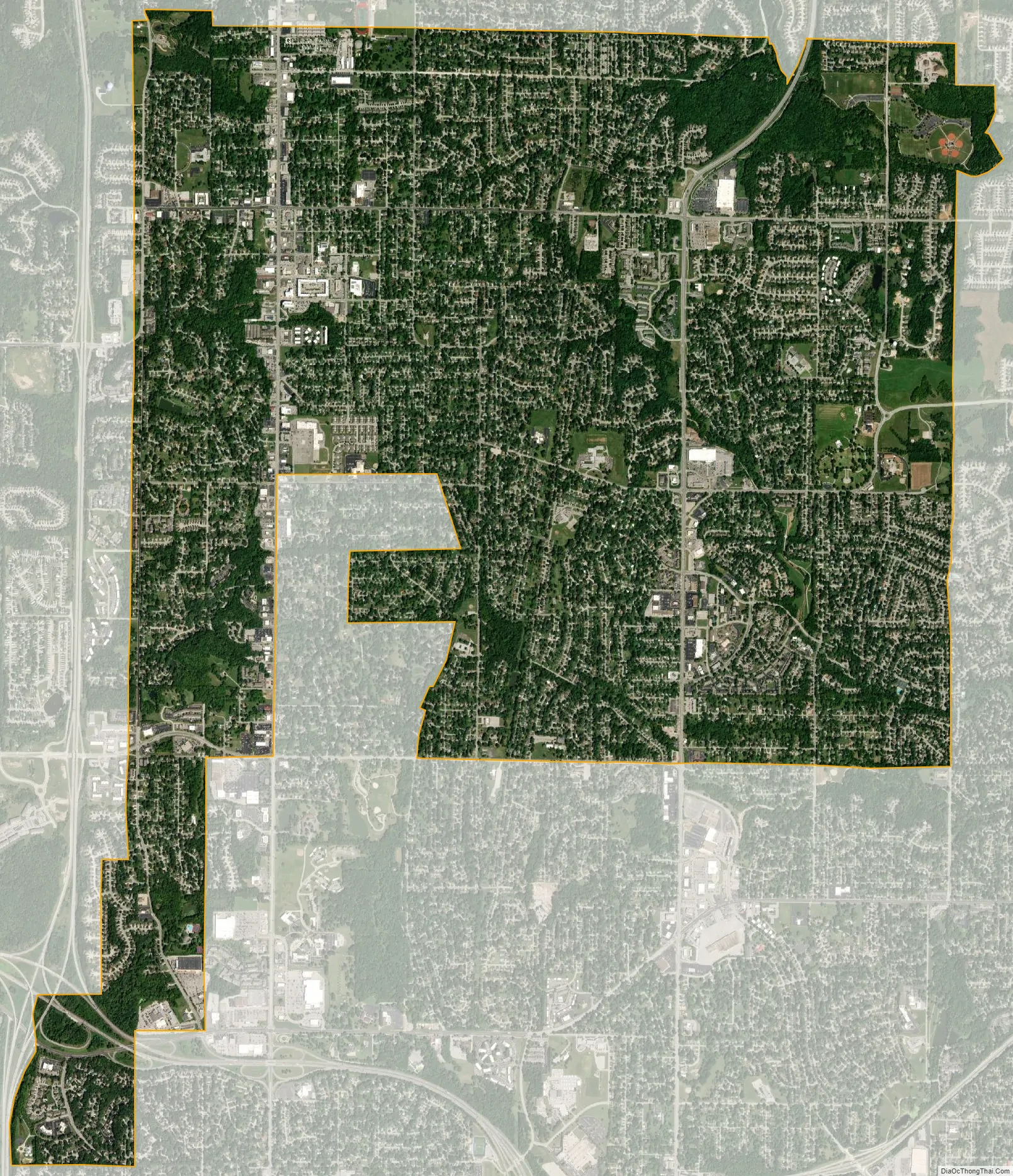
Gladstone city Satellite Map
Geography
According to the United States Census Bureau, the city has a total area of 8.06 square miles (20.88 km), of which 8.05 square miles (20.85 km) is land and 0.01 square miles (0.03 km) is water.
The city is connected to nearby North Kansas City and Kansas City proper by Routes 1 and 283 as well as nearby U.S. Route 169, which sits less than one mile from the city’s western border. I-29 runs near the city’s southernmost tip shortly after its initial break from I-35. A handful of small subdivisions maintain independent municipalities along North Oak Trafficway, a road which is host to much of the area’s shopping. The city is rectangular in shape, with the city limits generally extending from NE Englewood Road or NE 55th to NE 77th south to north, and N. Jackson Ave. to N. Broadway east to west. The city boundaries include a panhandle that goes south to NW 44th St. and from NW Briarcliff Ln. to Gladstone Waterworks Rd. from east to west. A portion of the panhandle was de-annexed by Kansas City and annexed by Gladstone in 2005 to bring the Gladstone Water Plant property within the Gladstone city limits.
See also
Map of Missouri State and its subdivision:- Adair
- Andrew
- Atchison
- Audrain
- Barry
- Barton
- Bates
- Benton
- Bollinger
- Boone
- Buchanan
- Butler
- Caldwell
- Callaway
- Camden
- Cape Girardeau
- Carroll
- Carter
- Cass
- Cedar
- Chariton
- Christian
- Clark
- Clay
- Clinton
- Cole
- Cooper
- Crawford
- Dade
- Dallas
- Daviess
- De Kalb
- Dent
- Douglas
- Dunklin
- Franklin
- Gasconade
- Gentry
- Greene
- Grundy
- Harrison
- Henry
- Hickory
- Holt
- Howard
- Howell
- Iron
- Jackson
- Jasper
- Jefferson
- Johnson
- Knox
- Laclede
- Lafayette
- Lawrence
- Lewis
- Lincoln
- Linn
- Livingston
- Macon
- Madison
- Maries
- Marion
- McDonald
- Mercer
- Miller
- Mississippi
- Moniteau
- Monroe
- Montgomery
- Morgan
- New Madrid
- Newton
- Nodaway
- Oregon
- Osage
- Ozark
- Pemiscot
- Perry
- Pettis
- Phelps
- Pike
- Platte
- Polk
- Pulaski
- Putnam
- Ralls
- Randolph
- Ray
- Reynolds
- Ripley
- Saint Charles
- Saint Clair
- Saint Francois
- Saint Louis
- Sainte Genevieve
- Saline
- Schuyler
- Scotland
- Scott
- Shannon
- Shelby
- Stoddard
- Stone
- Sullivan
- Taney
- Texas
- Vernon
- Warren
- Washington
- Wayne
- Webster
- Worth
- Wright
- Alabama
- Alaska
- Arizona
- Arkansas
- California
- Colorado
- Connecticut
- Delaware
- District of Columbia
- Florida
- Georgia
- Hawaii
- Idaho
- Illinois
- Indiana
- Iowa
- Kansas
- Kentucky
- Louisiana
- Maine
- Maryland
- Massachusetts
- Michigan
- Minnesota
- Mississippi
- Missouri
- Montana
- Nebraska
- Nevada
- New Hampshire
- New Jersey
- New Mexico
- New York
- North Carolina
- North Dakota
- Ohio
- Oklahoma
- Oregon
- Pennsylvania
- Rhode Island
- South Carolina
- South Dakota
- Tennessee
- Texas
- Utah
- Vermont
- Virginia
- Washington
- West Virginia
- Wisconsin
- Wyoming