Glenaire is a city in Clay County, Missouri, United States. The population was 539 at the 2020 census. The city is completely surrounded by the city of Liberty. It was originally referred to as “Interurban Heights” or “Belleview” because of the interurban train that ran through the area and stopped at the Belleview depot near the Belleview Dairy. It is part of the Kansas City metropolitan area.
| Name: | Glenaire city |
|---|---|
| LSAD Code: | 25 |
| LSAD Description: | city (suffix) |
| State: | Missouri |
| County: | Clay County |
| Elevation: | 797 ft (243 m) |
| Total Area: | 0.27 sq mi (0.70 km²) |
| Land Area: | 0.27 sq mi (0.70 km²) |
| Water Area: | 0.00 sq mi (0.00 km²) |
| Total Population: | 539 |
| Population Density: | 1,988.93/sq mi (766.64/km²) |
| Area code: | 816 |
| FIPS code: | 2927262 |
| GNISfeature ID: | 2394911 |
| Website: | www.glenairemo.org |
Online Interactive Map
Click on ![]() to view map in "full screen" mode.
to view map in "full screen" mode.
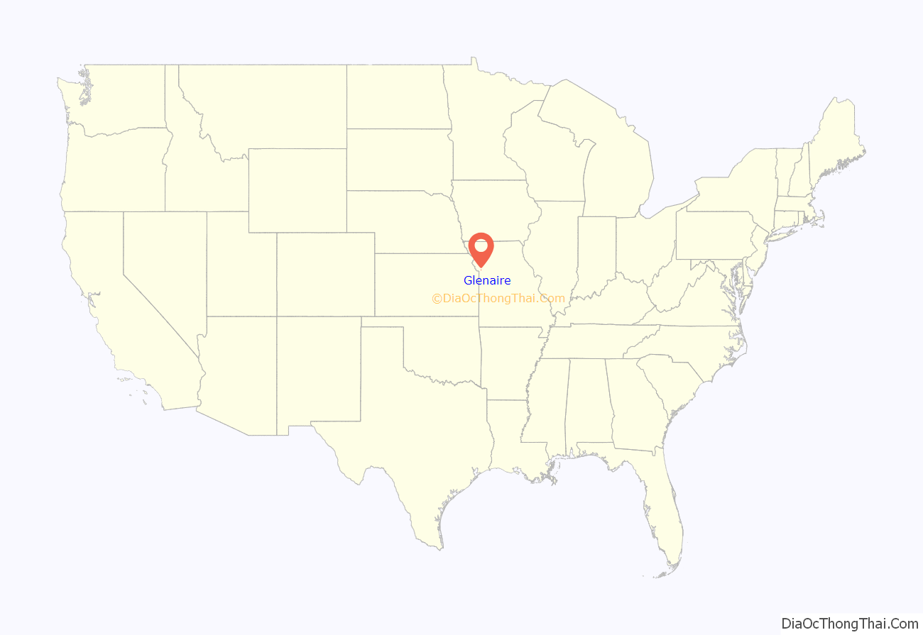
Glenaire location map. Where is Glenaire city?
History
Glenaire was originally the location of a resort in between the cities of Liberty and Claycomo. The resort was called Urban Lake and was home to a 14-acre (57,000 m) lake that was open for recreational activities. The lake disappeared when the dam burst in 1945. Subsequently, in 1950 after petitioning the Clay County courts, the residents of the area celebrated the incorporation of The Village of Glenaire. In 1994 Glenaire became a 4th class city, shedding its status as a village.
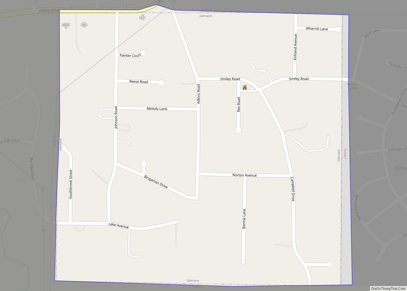
Glenaire Road Map
Glenaire city Satellite Map
Geography
According to the United States Census Bureau, the city has a total area of 0.27 square miles (0.70 km), all land.
See also
Map of Missouri State and its subdivision:- Adair
- Andrew
- Atchison
- Audrain
- Barry
- Barton
- Bates
- Benton
- Bollinger
- Boone
- Buchanan
- Butler
- Caldwell
- Callaway
- Camden
- Cape Girardeau
- Carroll
- Carter
- Cass
- Cedar
- Chariton
- Christian
- Clark
- Clay
- Clinton
- Cole
- Cooper
- Crawford
- Dade
- Dallas
- Daviess
- De Kalb
- Dent
- Douglas
- Dunklin
- Franklin
- Gasconade
- Gentry
- Greene
- Grundy
- Harrison
- Henry
- Hickory
- Holt
- Howard
- Howell
- Iron
- Jackson
- Jasper
- Jefferson
- Johnson
- Knox
- Laclede
- Lafayette
- Lawrence
- Lewis
- Lincoln
- Linn
- Livingston
- Macon
- Madison
- Maries
- Marion
- McDonald
- Mercer
- Miller
- Mississippi
- Moniteau
- Monroe
- Montgomery
- Morgan
- New Madrid
- Newton
- Nodaway
- Oregon
- Osage
- Ozark
- Pemiscot
- Perry
- Pettis
- Phelps
- Pike
- Platte
- Polk
- Pulaski
- Putnam
- Ralls
- Randolph
- Ray
- Reynolds
- Ripley
- Saint Charles
- Saint Clair
- Saint Francois
- Saint Louis
- Sainte Genevieve
- Saline
- Schuyler
- Scotland
- Scott
- Shannon
- Shelby
- Stoddard
- Stone
- Sullivan
- Taney
- Texas
- Vernon
- Warren
- Washington
- Wayne
- Webster
- Worth
- Wright
- Alabama
- Alaska
- Arizona
- Arkansas
- California
- Colorado
- Connecticut
- Delaware
- District of Columbia
- Florida
- Georgia
- Hawaii
- Idaho
- Illinois
- Indiana
- Iowa
- Kansas
- Kentucky
- Louisiana
- Maine
- Maryland
- Massachusetts
- Michigan
- Minnesota
- Mississippi
- Missouri
- Montana
- Nebraska
- Nevada
- New Hampshire
- New Jersey
- New Mexico
- New York
- North Carolina
- North Dakota
- Ohio
- Oklahoma
- Oregon
- Pennsylvania
- Rhode Island
- South Carolina
- South Dakota
- Tennessee
- Texas
- Utah
- Vermont
- Virginia
- Washington
- West Virginia
- Wisconsin
- Wyoming
