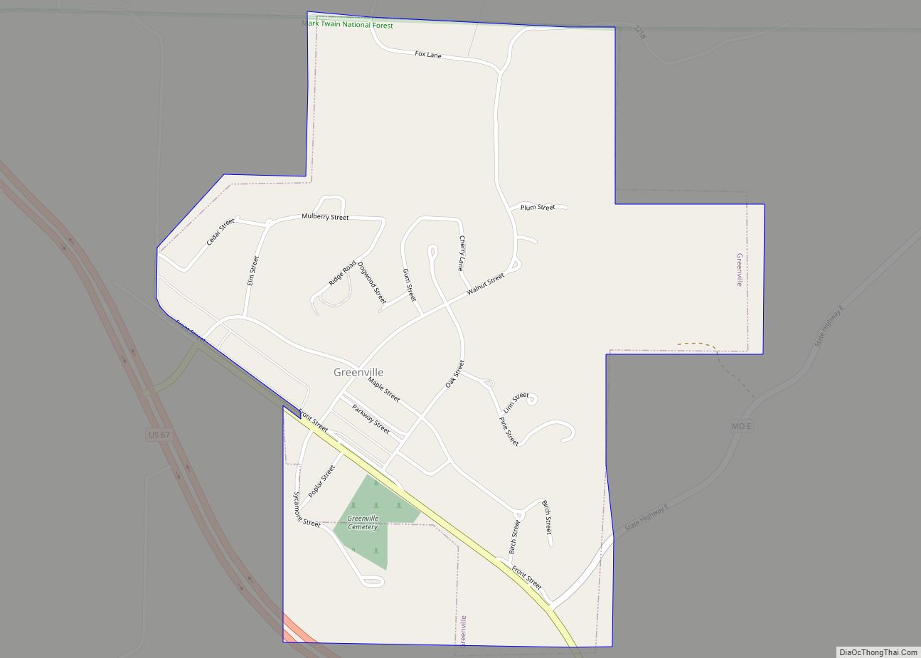
Greenville is a city located on U.S. Route 67 near the intersection with Route D and E in Wayne County, Missouri, United States, along the St. Francis River. The population was 443 at the 2020 census. Greenville was incorporated and founded as the county seat of Wayne County in 1819.
| Name: | Greenville city |
|---|---|
| LSAD Code: | 25 |
| LSAD Description: | city (suffix) |
| State: | Missouri |
| County: | Wayne County |
| Elevation: | 436 ft (133 m) |
| Total Area: | 0.68 sq mi (1.75 km²) |
| Land Area: | 0.68 sq mi (1.75 km²) |
| Water Area: | 0.00 sq mi (0.00 km²) |
| Total Population: | 443 |
| Population Density: | 656.30/sq mi (253.48/km²) |
| ZIP code: | 63944 |
| Area code: | 573 |
| FIPS code: | 2929476 |
| GNISfeature ID: | 2394997 |
Online Interactive Map
Click on ![]() to view map in "full screen" mode.
to view map in "full screen" mode.
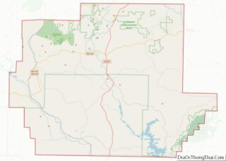
Greenville location map. Where is Greenville city?


History
Greenville was named after Fort Greene Ville (now Greenville), Ohio, the site where General Anthony Wayne signed a treaty with the Native Americans after defeating them in the Battle of Fallen Timbers on August 20, 1794. This was the final battle of the Northwest Indian War. Wayne County was named for this military hero and Greenville was named for the place he was most famous for. Incidentally, Fort Greene Ville, Ohio, was named after Nathanael Greene, a friend of Wayne.
In 1826, Greenville flooded. On August 10, 1832, the first post office opened. Confederate Brigadier General William J. Hardee and officers Patrick Cleburne, Thomas C. Hindman, and Basil W. Duke along with about 800 men were stationed close to Greenville near the outset of the Civil War until they began to retreat to Randolph County, Arkansas on August 28, 1861. On July 20, 1862, a camp of two companies of the 12th Missouri State Militia was attacked at daylight, surprising the camp, taking most of their rifles, 16 Savage revolvers, all of their horses, 50 pairs of holster pistols, and killing four of their men.
Greenville was incorporated as a village on February 23, 1893. In 1941, the village was relocated two miles to the north after the construction of Lake Wappapello.
Old Greenville (23WE637) was listed on the National Register of Historic Places in 1990.
Greenville Road Map
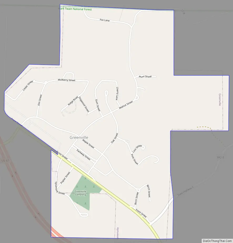
Greenville city Satellite Map

Geography
Greenville is located on the southern edge of the Ozark Mountains, situated in a hilly, forested landscape. U.S. Route 67 passes through Greenville. According to the United States Census Bureau, the city has a total area of 0.68 square miles (1.76 km), all land. Greenville is on the east shore of Lake Wappapello, on the St. Francis River.
See also
Map of Missouri State and its subdivision:- Adair
- Andrew
- Atchison
- Audrain
- Barry
- Barton
- Bates
- Benton
- Bollinger
- Boone
- Buchanan
- Butler
- Caldwell
- Callaway
- Camden
- Cape Girardeau
- Carroll
- Carter
- Cass
- Cedar
- Chariton
- Christian
- Clark
- Clay
- Clinton
- Cole
- Cooper
- Crawford
- Dade
- Dallas
- Daviess
- De Kalb
- Dent
- Douglas
- Dunklin
- Franklin
- Gasconade
- Gentry
- Greene
- Grundy
- Harrison
- Henry
- Hickory
- Holt
- Howard
- Howell
- Iron
- Jackson
- Jasper
- Jefferson
- Johnson
- Knox
- Laclede
- Lafayette
- Lawrence
- Lewis
- Lincoln
- Linn
- Livingston
- Macon
- Madison
- Maries
- Marion
- McDonald
- Mercer
- Miller
- Mississippi
- Moniteau
- Monroe
- Montgomery
- Morgan
- New Madrid
- Newton
- Nodaway
- Oregon
- Osage
- Ozark
- Pemiscot
- Perry
- Pettis
- Phelps
- Pike
- Platte
- Polk
- Pulaski
- Putnam
- Ralls
- Randolph
- Ray
- Reynolds
- Ripley
- Saint Charles
- Saint Clair
- Saint Francois
- Saint Louis
- Sainte Genevieve
- Saline
- Schuyler
- Scotland
- Scott
- Shannon
- Shelby
- Stoddard
- Stone
- Sullivan
- Taney
- Texas
- Vernon
- Warren
- Washington
- Wayne
- Webster
- Worth
- Wright
- Alabama
- Alaska
- Arizona
- Arkansas
- California
- Colorado
- Connecticut
- Delaware
- District of Columbia
- Florida
- Georgia
- Hawaii
- Idaho
- Illinois
- Indiana
- Iowa
- Kansas
- Kentucky
- Louisiana
- Maine
- Maryland
- Massachusetts
- Michigan
- Minnesota
- Mississippi
- Missouri
- Montana
- Nebraska
- Nevada
- New Hampshire
- New Jersey
- New Mexico
- New York
- North Carolina
- North Dakota
- Ohio
- Oklahoma
- Oregon
- Pennsylvania
- Rhode Island
- South Carolina
- South Dakota
- Tennessee
- Texas
- Utah
- Vermont
- Virginia
- Washington
- West Virginia
- Wisconsin
- Wyoming