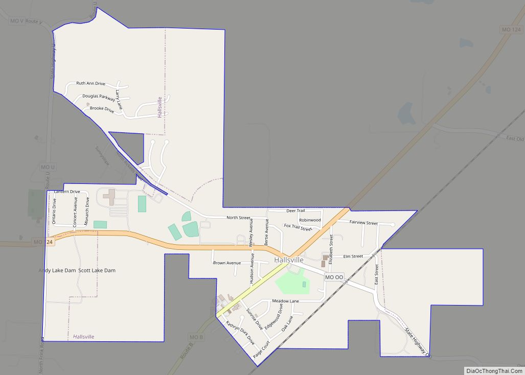
Hallsville is a city in Boone County, Missouri. It is part of the Columbia metropolitan area. The population was 1,614 at the time of the 2020 census. Southeast of the town is Mount Zion Church and Cemetery, the site of the Battle of Mount Zion Church during the Civil War.
| Name: | Hallsville city |
|---|---|
| LSAD Code: | 25 |
| LSAD Description: | city (suffix) |
| State: | Missouri |
| County: | Boone County |
| Founded: | 1866 |
| Elevation: | 899 ft (274 m) |
| Total Area: | 1.60 sq mi (4.13 km²) |
| Land Area: | 1.60 sq mi (4.13 km²) |
| Water Area: | 0.00 sq mi (0.00 km²) |
| Total Population: | 1,614 |
| Population Density: | 1,011.28/sq mi (390.45/km²) |
| ZIP code: | 65255 |
| Area code: | 573 |
| FIPS code: | 2929998 |
| GNISfeature ID: | 2394270 |
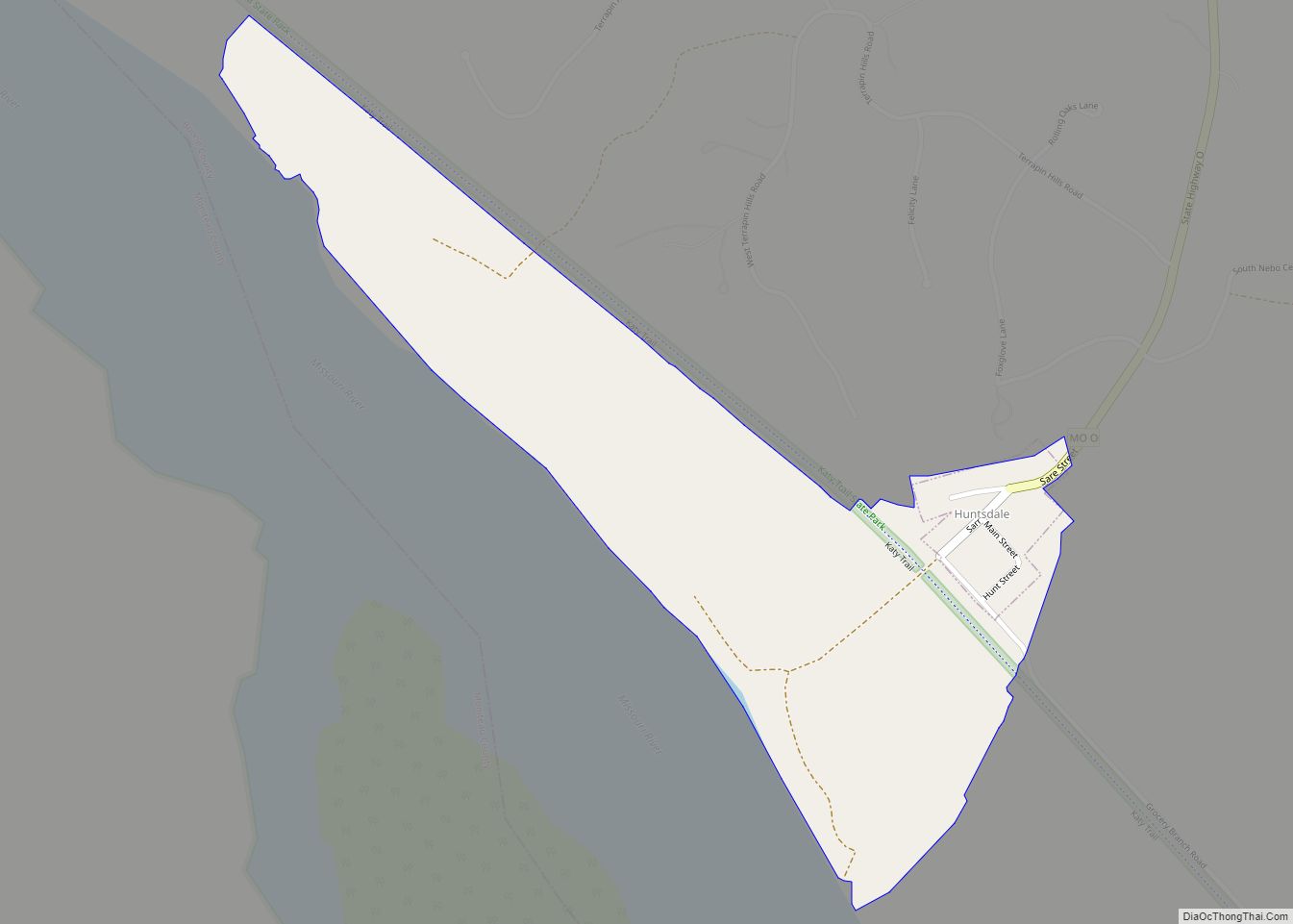
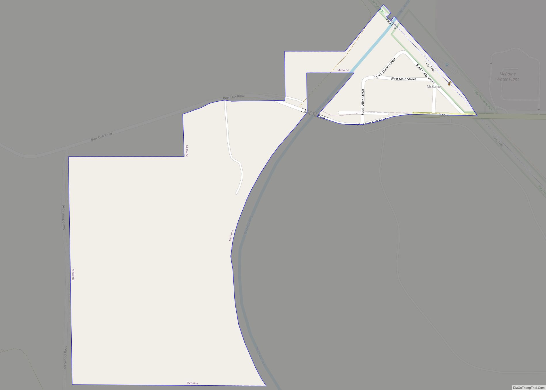
Online Interactive Map
Click on ![]() to view map in "full screen" mode.
to view map in "full screen" mode.
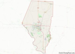
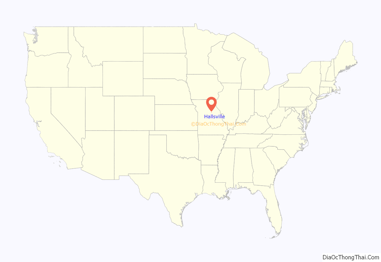
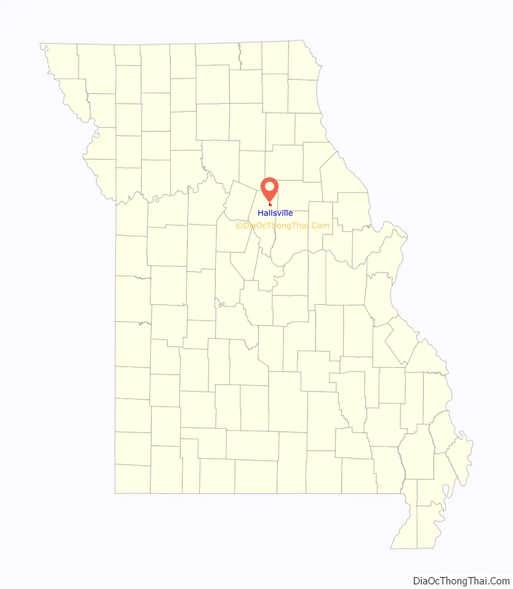
Hallsville location map. Where is Hallsville city?
History
Hallsville was laid out in 1866. It was named for its first postmaster, Judge John W. Hall. The town was not platted originally, having grown naturally at a crossroads around a store and blacksmith. The Columbia Terminal Railroad platted the town of Hickman and installed a depot a half mile south, but Hallsville grew and Hickman did not.
Colonel William F. Switzler reported that in 1882, Hallsville contained five stores, one harness shop and one blacksmith shop, but no church or school house yet. The population was 65. During the Civil War, on 22 September 1863, the Mount Zion Church east of Hallsville was burned by northern troops. According to one claim by William Franklin Switzler, this was because Iowa Lieutenant Hartman found the church to be a “bushwhacker’s nest.” The church was rebuilt in 1861, torn down and rebuilt in 1903, and still stands. Hallsville is also the hometown to the famous painter in the 20th century Charles Morgenthaler. Charles Morgenthaler received his art education at the University of Missouri and the Art Institute of Chicago. He later moved to St. Louis, where he became a successful illustrator and mural painter.
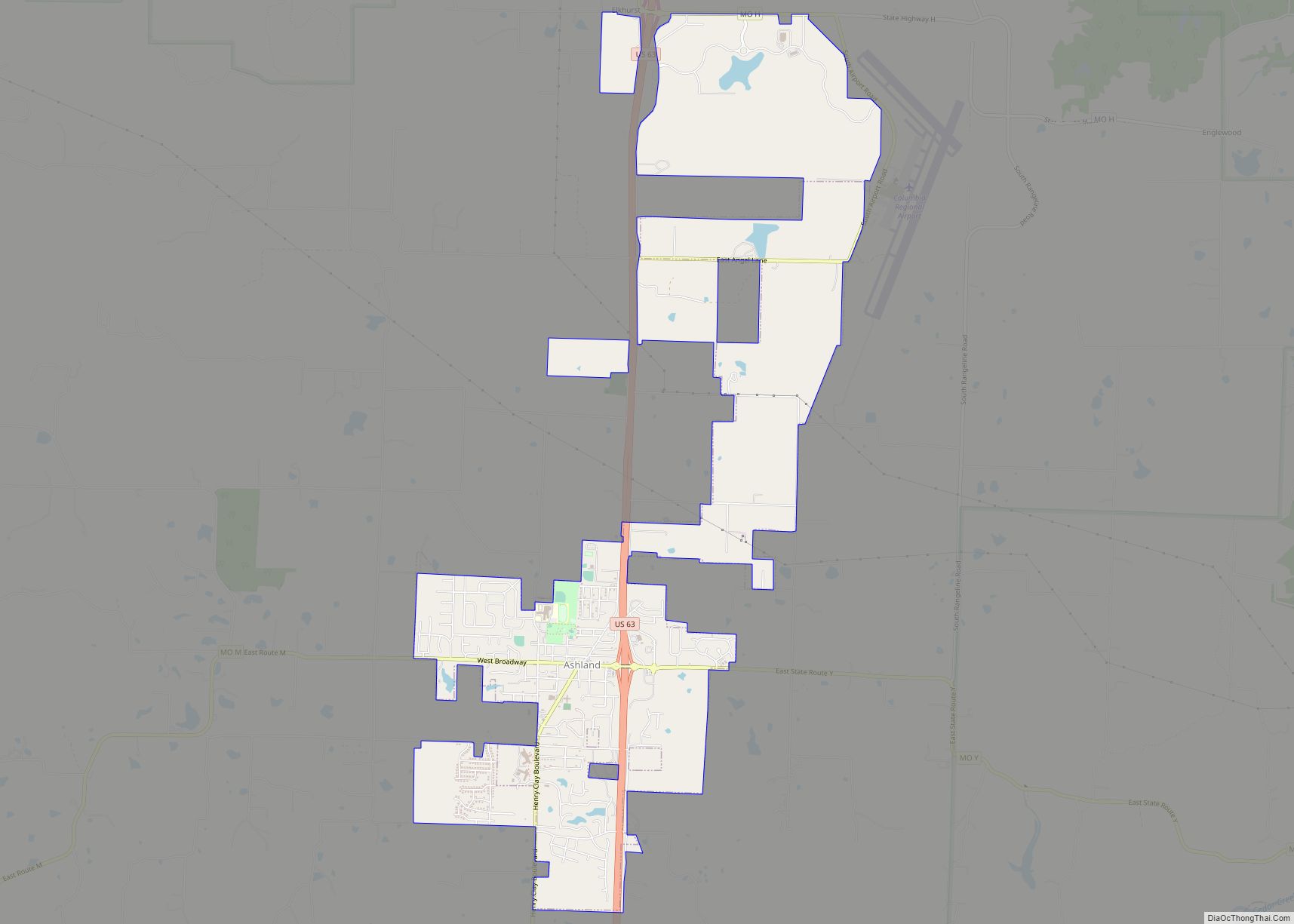
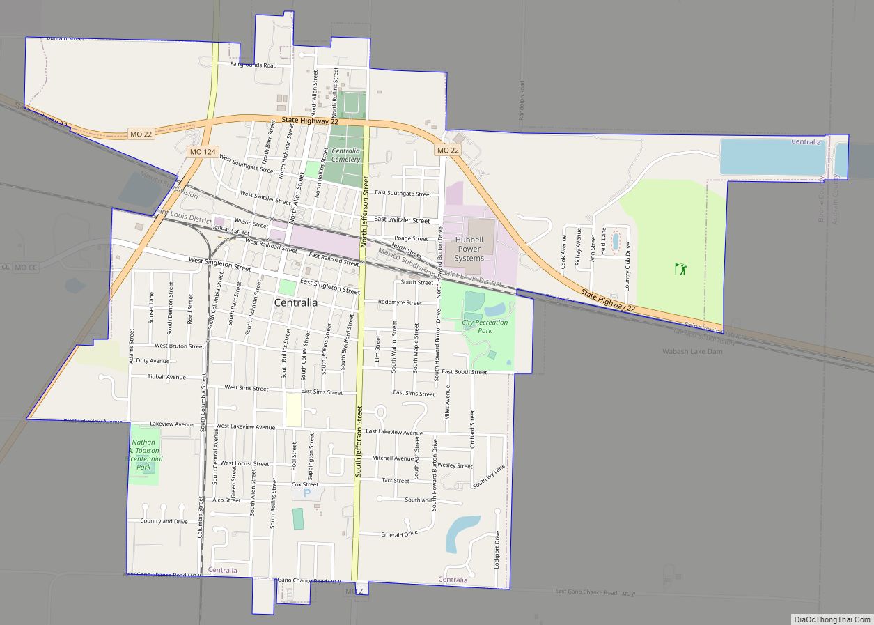
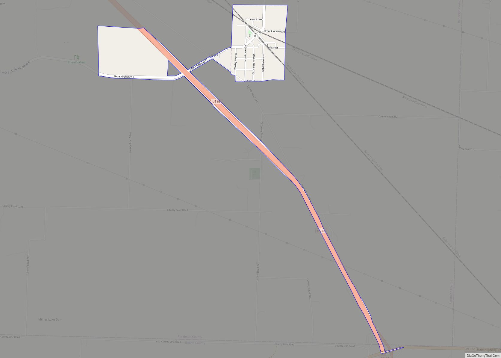
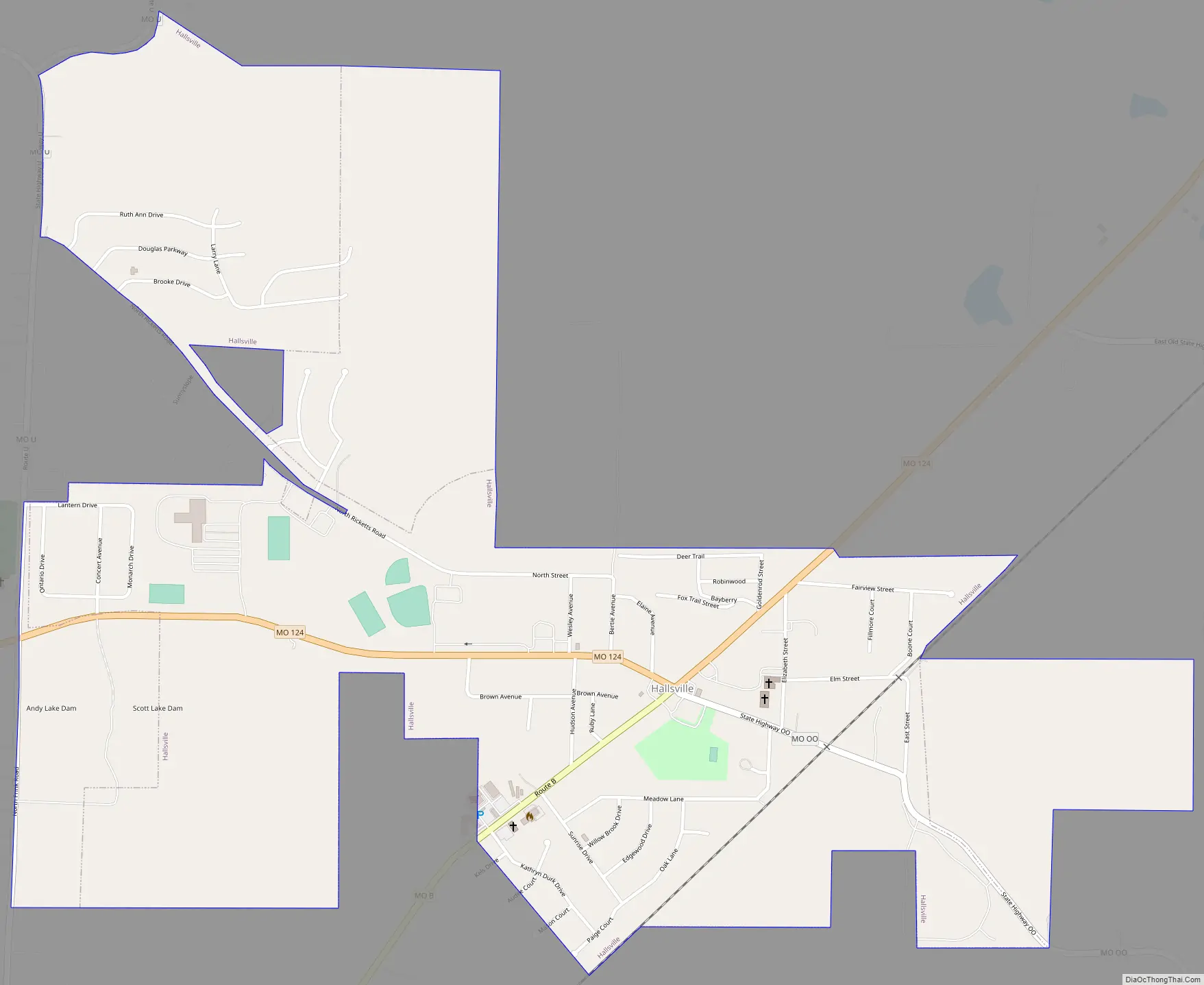
Hallsville Road Map
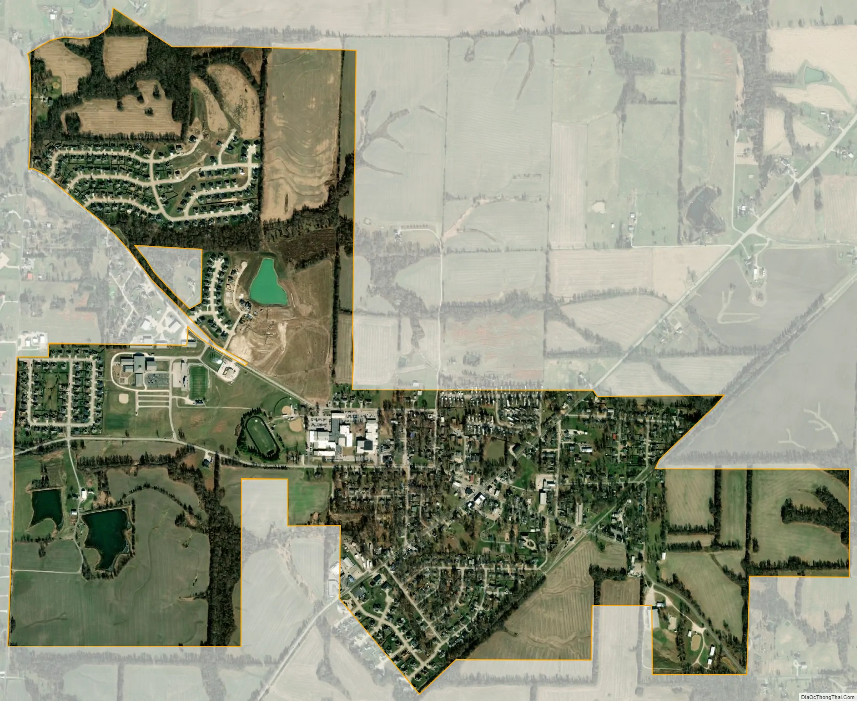
Hallsville city Satellite Map
Geography
According to the United States Census Bureau, the city has a total area of 1.33 square miles (3.44 km), all land.
See also
Map of Missouri State and its subdivision:- Adair
- Andrew
- Atchison
- Audrain
- Barry
- Barton
- Bates
- Benton
- Bollinger
- Boone
- Buchanan
- Butler
- Caldwell
- Callaway
- Camden
- Cape Girardeau
- Carroll
- Carter
- Cass
- Cedar
- Chariton
- Christian
- Clark
- Clay
- Clinton
- Cole
- Cooper
- Crawford
- Dade
- Dallas
- Daviess
- De Kalb
- Dent
- Douglas
- Dunklin
- Franklin
- Gasconade
- Gentry
- Greene
- Grundy
- Harrison
- Henry
- Hickory
- Holt
- Howard
- Howell
- Iron
- Jackson
- Jasper
- Jefferson
- Johnson
- Knox
- Laclede
- Lafayette
- Lawrence
- Lewis
- Lincoln
- Linn
- Livingston
- Macon
- Madison
- Maries
- Marion
- McDonald
- Mercer
- Miller
- Mississippi
- Moniteau
- Monroe
- Montgomery
- Morgan
- New Madrid
- Newton
- Nodaway
- Oregon
- Osage
- Ozark
- Pemiscot
- Perry
- Pettis
- Phelps
- Pike
- Platte
- Polk
- Pulaski
- Putnam
- Ralls
- Randolph
- Ray
- Reynolds
- Ripley
- Saint Charles
- Saint Clair
- Saint Francois
- Saint Louis
- Sainte Genevieve
- Saline
- Schuyler
- Scotland
- Scott
- Shannon
- Shelby
- Stoddard
- Stone
- Sullivan
- Taney
- Texas
- Vernon
- Warren
- Washington
- Wayne
- Webster
- Worth
- Wright
- Alabama
- Alaska
- Arizona
- Arkansas
- California
- Colorado
- Connecticut
- Delaware
- District of Columbia
- Florida
- Georgia
- Hawaii
- Idaho
- Illinois
- Indiana
- Iowa
- Kansas
- Kentucky
- Louisiana
- Maine
- Maryland
- Massachusetts
- Michigan
- Minnesota
- Mississippi
- Missouri
- Montana
- Nebraska
- Nevada
- New Hampshire
- New Jersey
- New Mexico
- New York
- North Carolina
- North Dakota
- Ohio
- Oklahoma
- Oregon
- Pennsylvania
- Rhode Island
- South Carolina
- South Dakota
- Tennessee
- Texas
- Utah
- Vermont
- Virginia
- Washington
- West Virginia
- Wisconsin
- Wyoming