Hartville is a city in Wright County, Missouri, United States. The population was 594 at the 2020 census. It is the county seat of Wright County.
| Name: | Hartville city |
|---|---|
| LSAD Code: | 25 |
| LSAD Description: | city (suffix) |
| State: | Missouri |
| County: | Wright County |
| Elevation: | 1,191 ft (363 m) |
| Total Area: | 0.66 sq mi (1.72 km²) |
| Land Area: | 0.65 sq mi (1.69 km²) |
| Water Area: | 0.01 sq mi (0.03 km²) |
| Total Population: | 594 |
| Population Density: | 911.04/sq mi (351.90/km²) |
| ZIP code: | 65667 |
| Area code: | 417 |
| FIPS code: | 2930754 |
| GNISfeature ID: | 0719185 |
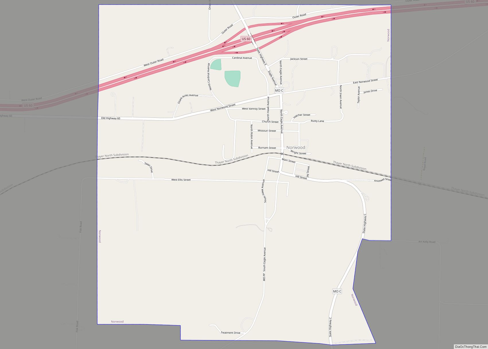
Online Interactive Map
Click on ![]() to view map in "full screen" mode.
to view map in "full screen" mode.
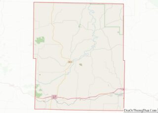
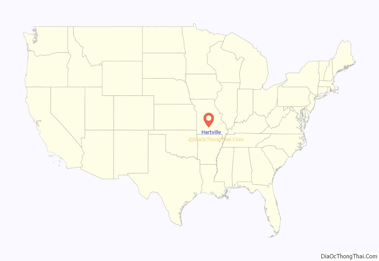
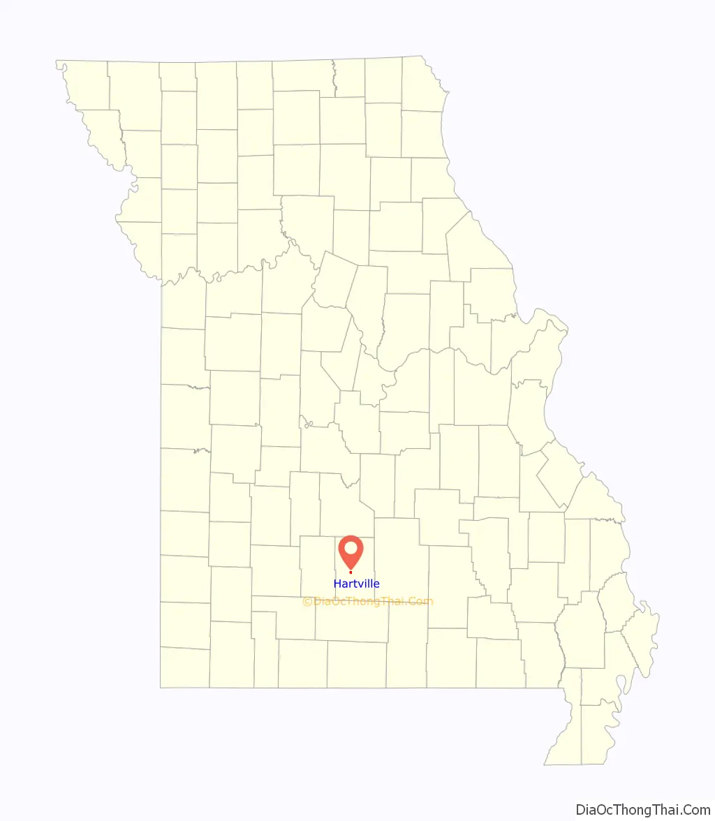
Hartville location map. Where is Hartville city?
History
A post office called Hartville has been in operation since 1842. The community was settled in the early 19th century and bears the name of Isaac Hart, a pioneer citizen.
Much of the town was destroyed during the Battle of Hartville in 1863. Lt. Col. John Wimer of the Confederacy, who had served two nonconsecutive terms as mayor of St. Louis, was killed in the battle and was buried at Hartville.
The Grovespring Tornado in 1959 destroyed most of Hartville’s business district, including the post office. There were no major injuries since a warning alarm had given the citizens time to take cover.
Kelton House was listed on the National Register of Historic Places in 1983.
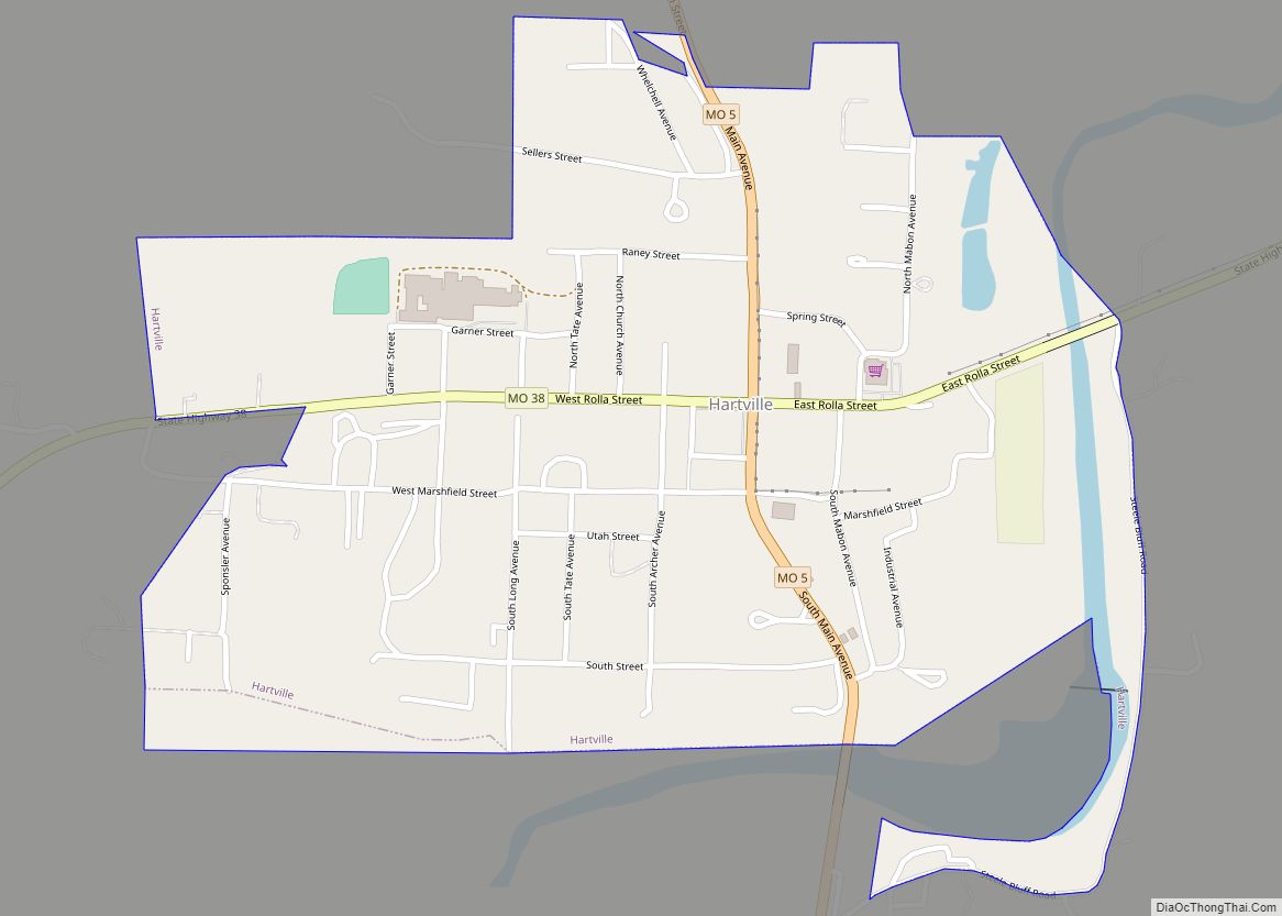
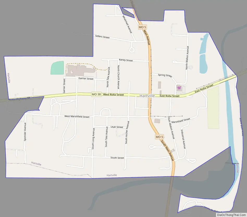
Hartville Road Map
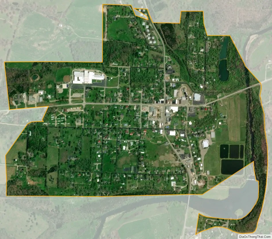
Hartville city Satellite Map
Geography
Hartville is located on Missouri routes 5 and 38, along the Wood’s Fork of the Gasconade River which flows into the Gasconade just east of the community. According to the United States Census Bureau, the city has a total area of 0.66 square miles (1.71 km), of which 0.65 square miles (1.68 km) is land and 0.01 square miles (0.03 km) is water. The Census Bureau determined that the mean center of the United States population as of the 2020 census is located 15 miles (24 km) northeast of Hartville.
See also
Map of Missouri State and its subdivision:- Adair
- Andrew
- Atchison
- Audrain
- Barry
- Barton
- Bates
- Benton
- Bollinger
- Boone
- Buchanan
- Butler
- Caldwell
- Callaway
- Camden
- Cape Girardeau
- Carroll
- Carter
- Cass
- Cedar
- Chariton
- Christian
- Clark
- Clay
- Clinton
- Cole
- Cooper
- Crawford
- Dade
- Dallas
- Daviess
- De Kalb
- Dent
- Douglas
- Dunklin
- Franklin
- Gasconade
- Gentry
- Greene
- Grundy
- Harrison
- Henry
- Hickory
- Holt
- Howard
- Howell
- Iron
- Jackson
- Jasper
- Jefferson
- Johnson
- Knox
- Laclede
- Lafayette
- Lawrence
- Lewis
- Lincoln
- Linn
- Livingston
- Macon
- Madison
- Maries
- Marion
- McDonald
- Mercer
- Miller
- Mississippi
- Moniteau
- Monroe
- Montgomery
- Morgan
- New Madrid
- Newton
- Nodaway
- Oregon
- Osage
- Ozark
- Pemiscot
- Perry
- Pettis
- Phelps
- Pike
- Platte
- Polk
- Pulaski
- Putnam
- Ralls
- Randolph
- Ray
- Reynolds
- Ripley
- Saint Charles
- Saint Clair
- Saint Francois
- Saint Louis
- Sainte Genevieve
- Saline
- Schuyler
- Scotland
- Scott
- Shannon
- Shelby
- Stoddard
- Stone
- Sullivan
- Taney
- Texas
- Vernon
- Warren
- Washington
- Wayne
- Webster
- Worth
- Wright
- Alabama
- Alaska
- Arizona
- Arkansas
- California
- Colorado
- Connecticut
- Delaware
- District of Columbia
- Florida
- Georgia
- Hawaii
- Idaho
- Illinois
- Indiana
- Iowa
- Kansas
- Kentucky
- Louisiana
- Maine
- Maryland
- Massachusetts
- Michigan
- Minnesota
- Mississippi
- Missouri
- Montana
- Nebraska
- Nevada
- New Hampshire
- New Jersey
- New Mexico
- New York
- North Carolina
- North Dakota
- Ohio
- Oklahoma
- Oregon
- Pennsylvania
- Rhode Island
- South Carolina
- South Dakota
- Tennessee
- Texas
- Utah
- Vermont
- Virginia
- Washington
- West Virginia
- Wisconsin
- Wyoming