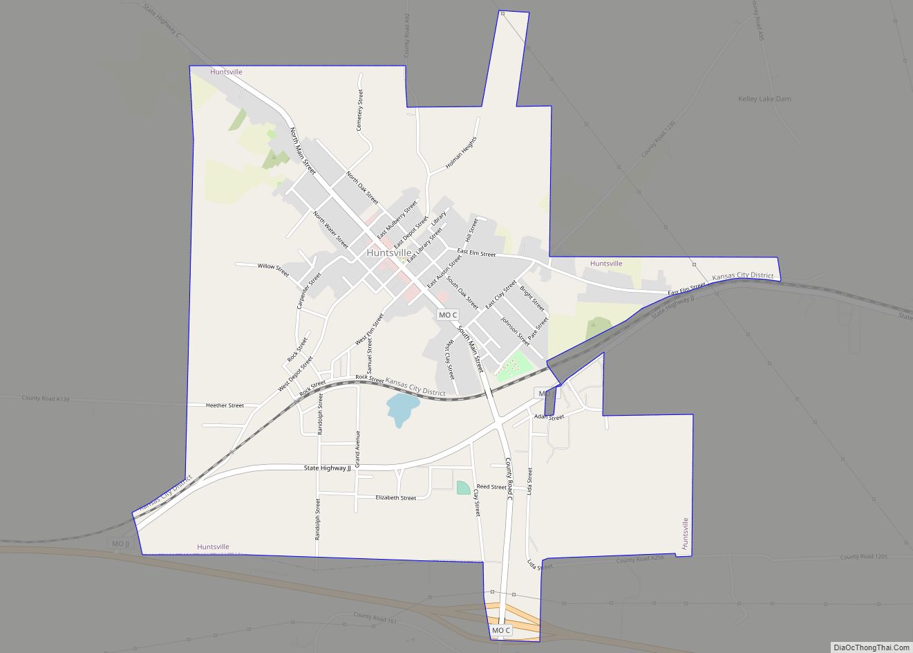
Huntsville is a city in Randolph County, Missouri, United States. The population was 1,376 at the 2020 census. It is the county seat of Randolph County.
| Name: | Huntsville city |
|---|---|
| LSAD Code: | 25 |
| LSAD Description: | city (suffix) |
| State: | Missouri |
| County: | Randolph County |
| Elevation: | 758 ft (231 m) |
| Total Area: | 2.32 sq mi (6.00 km²) |
| Land Area: | 2.32 sq mi (6.00 km²) |
| Water Area: | 0.00 sq mi (0.00 km²) |
| Total Population: | 1,376 |
| Population Density: | 593.87/sq mi (229.30/km²) |
| ZIP code: | 65259 |
| Area code: | 660 |
| FIPS code: | 2933886 |
| GNISfeature ID: | 2394454 |
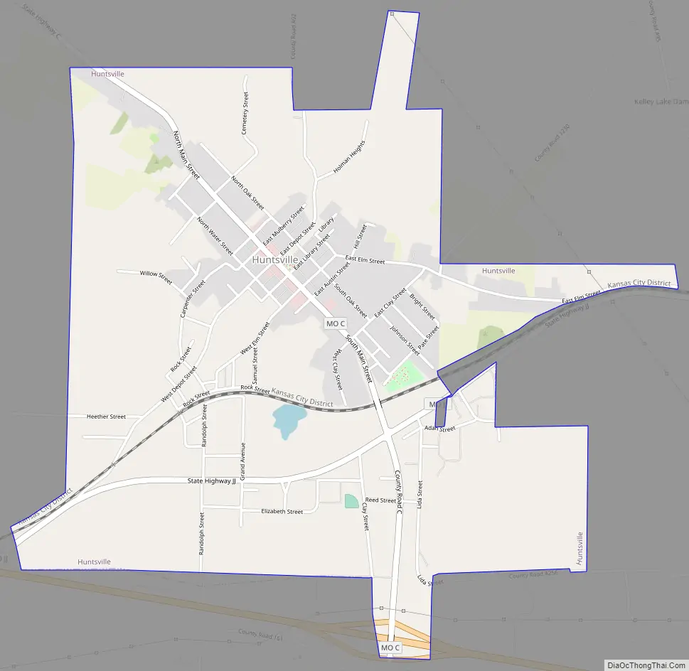
Online Interactive Map
Click on ![]() to view map in "full screen" mode.
to view map in "full screen" mode.
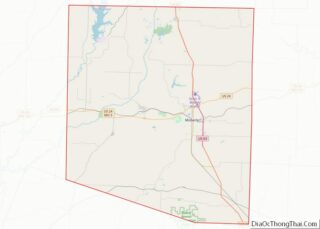
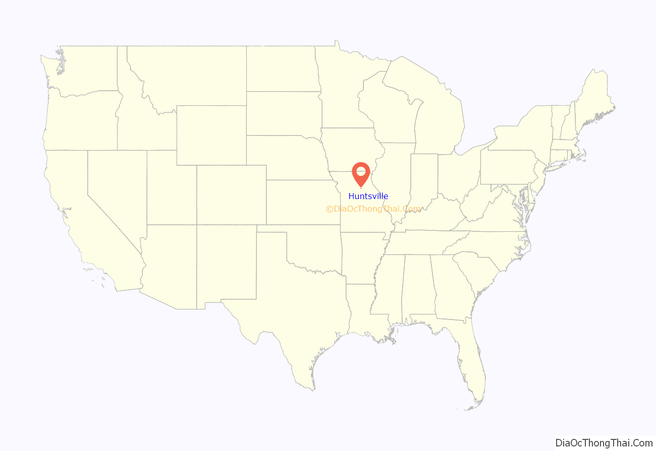
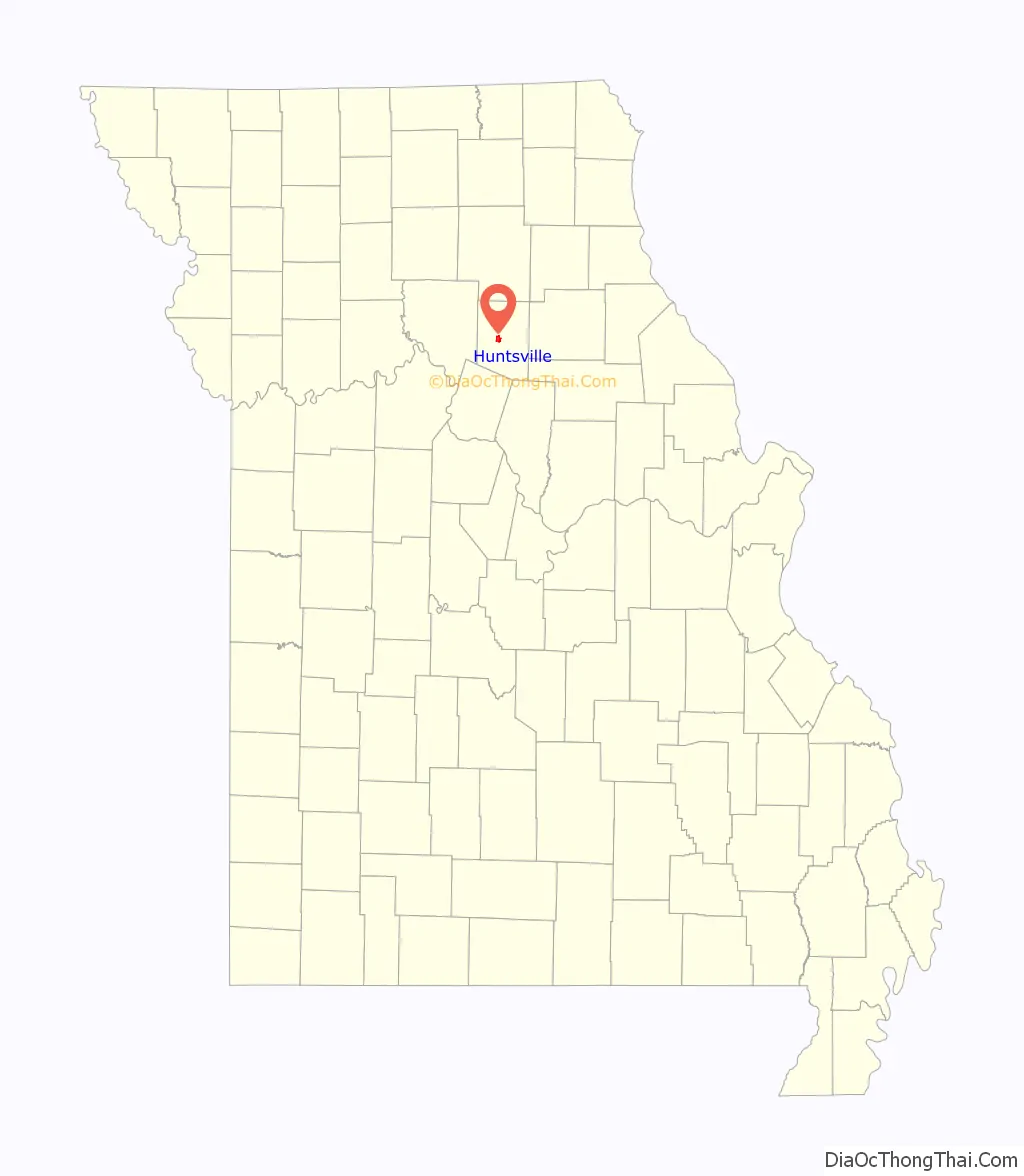
Huntsville location map. Where is Huntsville city?
History
Randolph County was organized February 2, 1829, and Huntsville was established as the county seat in 1831. Daniel Hunt, a Kentuckian, was the first settler of Huntsville, in honor of whom the town was named. He settled here between 1820 and 1821. He was soon followed by William Goggin, Gideon Wright and Henry Winburn, also from Kentucky. William Goggins established a mill here, the first in the county. They entered the land from the government upon which Huntsville is located and donated 50 acres for a town site, giving 12 1/2 acres each forming an exact square, the dome of the court house being the center.
The Randolph County Courthouse houses the following county governmental offices: Assessor, Randolph County Commissioners, Collector, Recorder of Deeds, Treasurer and County Clerk. The first courthouse was built in the center of the public square at the precise meeting point of the four parcels of land; it was completed by June 13, 1831. It was razed in either 1858 or 1859. The next courthouse stood on the same site between 1858 and 1882. On August 12, 1882, a fire, consumed the courthouse. The third courthouse was completed in April 1884. Another fire occurred in July 1955. The current courthouse stands in the same location as the original court building.
In 1838, the Potawatomi Indians passed near Huntsville on the Trail of Death. A marker was dedicated on September 11, 1997, with Potawatomi descendants present. It reads as thus: “On October 17 and 18, 1838, about 850 Potawatomi Indians camped near Huntsville, on their way from northern Indiana to Kansas; a forced march accompanied by soldiers. Having travelled 13 miles in cold, rain, a flooded camp caused them to stay a second day.” The marker is located on the front lawn of the Randolph County Courthouse.
The Huntsville Historical Society was chartered on June 19, 1973. The Society and friends support and maintain a Museum which opened in 1975 in the old Westlake Hardware store in downtown Huntsville on Main Street. The Museum is available to the public with the mission to collect, preserve and disseminate historical information about Huntsville. The Society supports other community projects as well.
Huntsville is home to both the Westran Elementary School and Westran High School. The Westran High School is home to the Westran Hornets and Lady Hornets. Students are offered participation in football, basketball, softball, baseball, track, golf, cheerleading, as well as other sports.
The Huntsville Lincoln School was built on Randolph Street and provided education for African-American children from first to eighth grade. Later the ninth and tenth grades were added. About 1935, pupils were transported to the Moberly Lincoln High School for the eleventh and twelfth grades. This continued until the schools were integrated in the early 1960s.
During the mid-19th century, Huntsville was also the home to Mount Pleasant College. A charter was granted and the cornerstone was laid and work began on Mount Pleasant College in 1855. The building was completed in 1857. The college stood in existence for 26 years until it burned to the ground on July 15, 1882.
Huntsville was well known for its commerce, producing salt, coal, hemp rope, and tobacco.
In June, 2000 the Randolph County jail, located in Huntsville, was the scene of a shooting as part of an attempted escape. The jail supervisor and a guard were both killed in the attack.
Huntsville Road Map
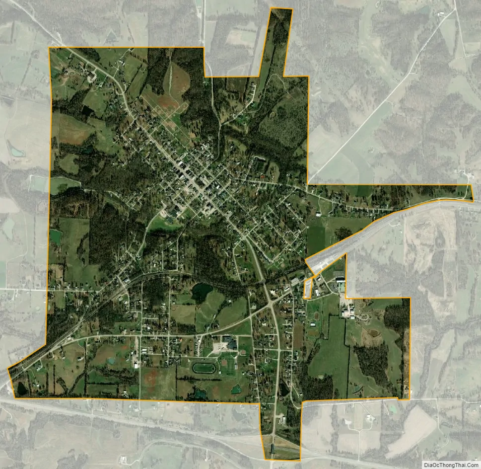
Huntsville city Satellite Map
Geography
According to the United States Census Bureau, the city has a total area of 2.39 square miles (6.19 km), all land.
See also
Map of Missouri State and its subdivision:- Adair
- Andrew
- Atchison
- Audrain
- Barry
- Barton
- Bates
- Benton
- Bollinger
- Boone
- Buchanan
- Butler
- Caldwell
- Callaway
- Camden
- Cape Girardeau
- Carroll
- Carter
- Cass
- Cedar
- Chariton
- Christian
- Clark
- Clay
- Clinton
- Cole
- Cooper
- Crawford
- Dade
- Dallas
- Daviess
- De Kalb
- Dent
- Douglas
- Dunklin
- Franklin
- Gasconade
- Gentry
- Greene
- Grundy
- Harrison
- Henry
- Hickory
- Holt
- Howard
- Howell
- Iron
- Jackson
- Jasper
- Jefferson
- Johnson
- Knox
- Laclede
- Lafayette
- Lawrence
- Lewis
- Lincoln
- Linn
- Livingston
- Macon
- Madison
- Maries
- Marion
- McDonald
- Mercer
- Miller
- Mississippi
- Moniteau
- Monroe
- Montgomery
- Morgan
- New Madrid
- Newton
- Nodaway
- Oregon
- Osage
- Ozark
- Pemiscot
- Perry
- Pettis
- Phelps
- Pike
- Platte
- Polk
- Pulaski
- Putnam
- Ralls
- Randolph
- Ray
- Reynolds
- Ripley
- Saint Charles
- Saint Clair
- Saint Francois
- Saint Louis
- Sainte Genevieve
- Saline
- Schuyler
- Scotland
- Scott
- Shannon
- Shelby
- Stoddard
- Stone
- Sullivan
- Taney
- Texas
- Vernon
- Warren
- Washington
- Wayne
- Webster
- Worth
- Wright
- Alabama
- Alaska
- Arizona
- Arkansas
- California
- Colorado
- Connecticut
- Delaware
- District of Columbia
- Florida
- Georgia
- Hawaii
- Idaho
- Illinois
- Indiana
- Iowa
- Kansas
- Kentucky
- Louisiana
- Maine
- Maryland
- Massachusetts
- Michigan
- Minnesota
- Mississippi
- Missouri
- Montana
- Nebraska
- Nevada
- New Hampshire
- New Jersey
- New Mexico
- New York
- North Carolina
- North Dakota
- Ohio
- Oklahoma
- Oregon
- Pennsylvania
- Rhode Island
- South Carolina
- South Dakota
- Tennessee
- Texas
- Utah
- Vermont
- Virginia
- Washington
- West Virginia
- Wisconsin
- Wyoming