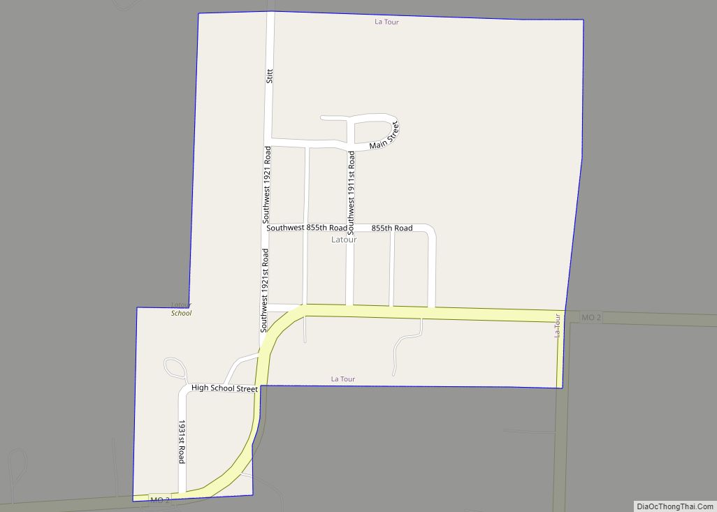
La Tour or Latour is an unincorporated community in southwestern Johnson County, Missouri, United States. The population was 65 at the 2000 census, at which time it was a village. La Tour disincorporated in 2009, and at the 2010 census the community, now listed as a census-designated place (CDP), had a population of 62.
| Name: | La Tour CDP |
|---|---|
| LSAD Code: | 57 |
| LSAD Description: | CDP (suffix) |
| State: | Missouri |
| County: | Johnson County |
| Elevation: | 817 ft (249 m) |
| Total Area: | 0.11 sq mi (0.28 km²) |
| Land Area: | 0.11 sq mi (0.28 km²) |
| Water Area: | 0.00 sq mi (0.00 km²) |
| Total Population: | 65 |
| Population Density: | 590.91/sq mi (229.15/km²) |
| ZIP code: | 64747 |
| FIPS code: | 2940880 |
| GNISfeature ID: | 2587086 |
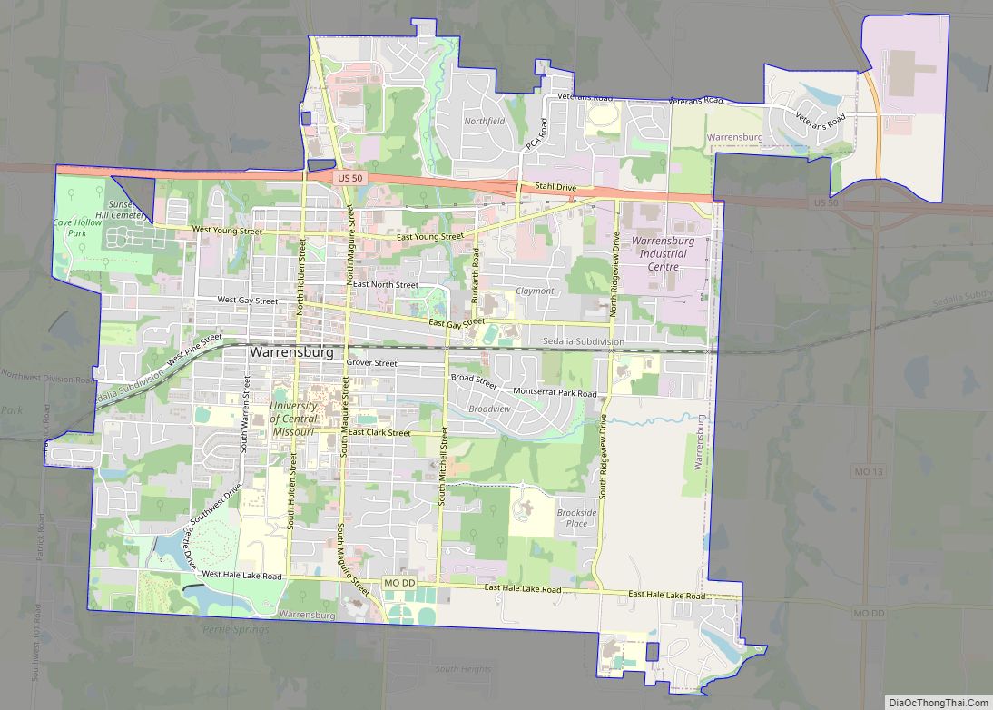
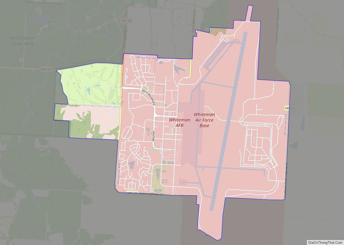
Online Interactive Map
Click on ![]() to view map in "full screen" mode.
to view map in "full screen" mode.
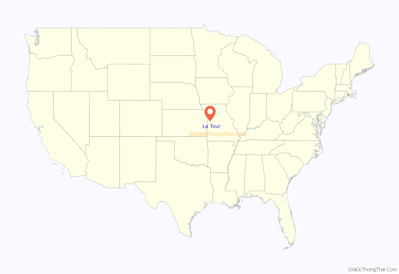
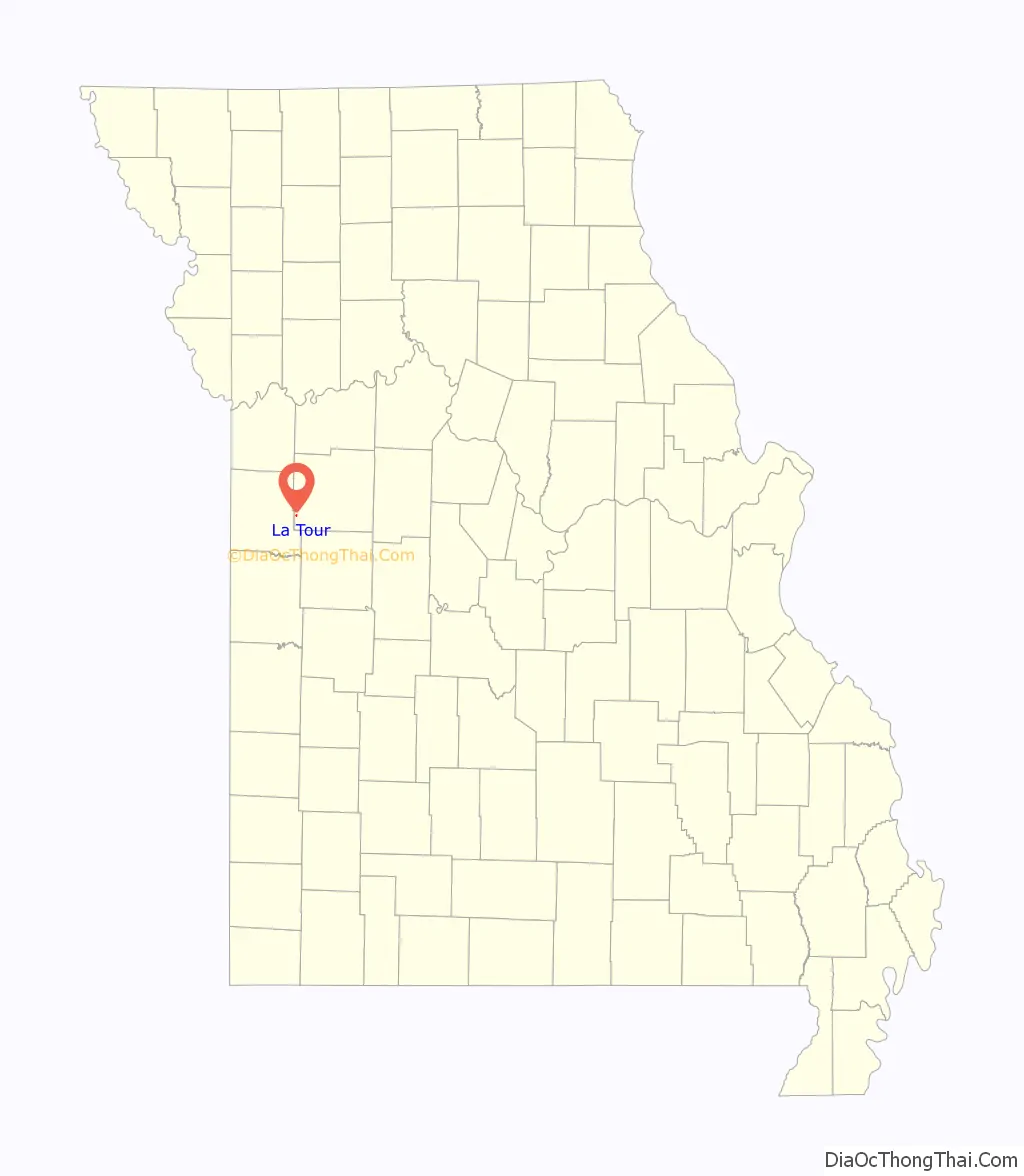
La Tour location map. Where is La Tour CDP?
History
La Tour was platted in 1885, and named after the local Latour family. A post office called Latour was established in 1886, and remained in operation until 1997.
La Tour disincorporated on April 13, 2009, after an April 7 vote on the subject passed by the margin of 20 to 1.
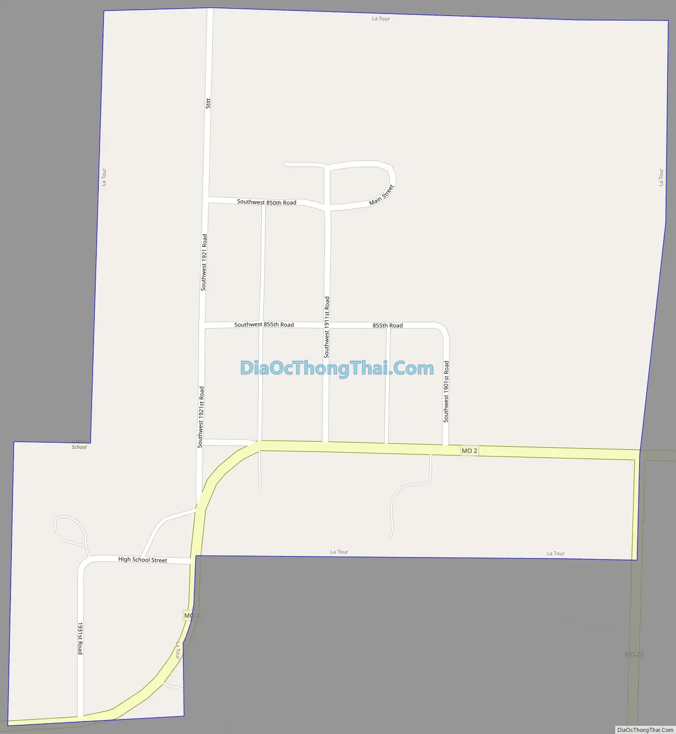
La Tour Road Map
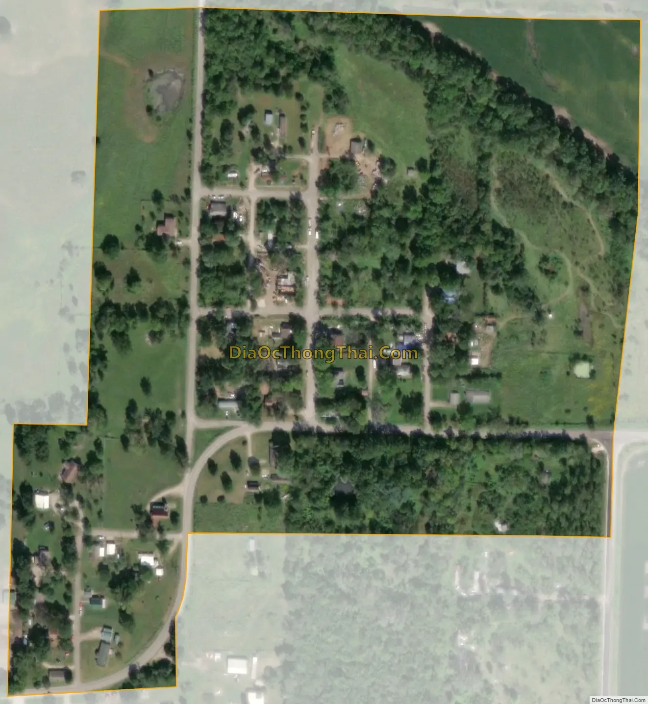
La Tour city Satellite Map
Geography
The community is located in southwestern Johnson County on Missouri Route 2, about 14 miles (23 km) east of Harrisonville and 36 miles (58 km) west of Windsor. The community lies just southwest of the confluence of Camp Branch with Big Creek.
According to the United States Census Bureau, the CDP has a total area of 0.11 square miles (0.28 km), about the same as the former village. 0.2 acres (934 m), or 0.33% of the community’s area, is water.
See also
Map of Missouri State and its subdivision:- Adair
- Andrew
- Atchison
- Audrain
- Barry
- Barton
- Bates
- Benton
- Bollinger
- Boone
- Buchanan
- Butler
- Caldwell
- Callaway
- Camden
- Cape Girardeau
- Carroll
- Carter
- Cass
- Cedar
- Chariton
- Christian
- Clark
- Clay
- Clinton
- Cole
- Cooper
- Crawford
- Dade
- Dallas
- Daviess
- De Kalb
- Dent
- Douglas
- Dunklin
- Franklin
- Gasconade
- Gentry
- Greene
- Grundy
- Harrison
- Henry
- Hickory
- Holt
- Howard
- Howell
- Iron
- Jackson
- Jasper
- Jefferson
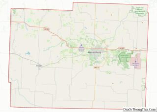
- Johnson
- Knox
- Laclede
- Lafayette
- Lawrence
- Lewis
- Lincoln
- Linn
- Livingston
- Macon
- Madison
- Maries
- Marion
- McDonald
- Mercer
- Miller
- Mississippi
- Moniteau
- Monroe
- Montgomery
- Morgan
- New Madrid
- Newton
- Nodaway
- Oregon
- Osage
- Ozark
- Pemiscot
- Perry
- Pettis
- Phelps
- Pike
- Platte
- Polk
- Pulaski
- Putnam
- Ralls
- Randolph
- Ray
- Reynolds
- Ripley
- Saint Charles
- Saint Clair
- Saint Francois
- Saint Louis
- Sainte Genevieve
- Saline
- Schuyler
- Scotland
- Scott
- Shannon
- Shelby
- Stoddard
- Stone
- Sullivan
- Taney
- Texas
- Vernon
- Warren
- Washington
- Wayne
- Webster
- Worth
- Wright
- Alabama
- Alaska
- Arizona
- Arkansas
- California
- Colorado
- Connecticut
- Delaware
- District of Columbia
- Florida
- Georgia
- Hawaii
- Idaho
- Illinois
- Indiana
- Iowa
- Kansas
- Kentucky
- Louisiana
- Maine
- Maryland
- Massachusetts
- Michigan
- Minnesota
- Mississippi
- Missouri
- Montana
- Nebraska
- Nevada
- New Hampshire
- New Jersey
- New Mexico
- New York
- North Carolina
- North Dakota
- Ohio
- Oklahoma
- Oregon
- Pennsylvania
- Rhode Island
- South Carolina
- South Dakota
- Tennessee
- Texas
- Utah
- Vermont
- Virginia
- Washington
- West Virginia
- Wisconsin
- Wyoming