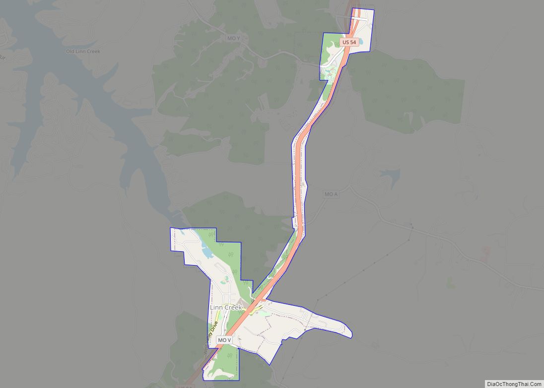
Linn Creek is a city in Camden County, Missouri, United States. The population was 216 at the 2020 census.
The original Linn Creek, which was the original county seat of Camden County, Missouri, is now under water, in the Lake of the Ozarks. Construction of the Bagnell Dam that created the lake was begun August 8, 1929. The county seat was moved to the new town of Camdenton which had its beginnings in 1931.
| Name: | Linn Creek city |
|---|---|
| LSAD Code: | 25 |
| LSAD Description: | city (suffix) |
| State: | Missouri |
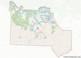
| County: | Camden County |
| Founded: | 1841 |
| Elevation: | 764 ft (233 m) |
| Total Area: | 1.30 sq mi (3.36 km²) |
| Land Area: | 1.30 sq mi (3.36 km²) |
| Water Area: | 0.00 sq mi (0.00 km²) |
| Total Population: | 216 |
| Population Density: | 166.41/sq mi (64.27/km²) |
| ZIP code: | 65052 |
| Area code: | 573 |
| FIPS code: | 2943274 |
| GNISfeature ID: | 2395721 |
| Website: | linncreekmo.com |
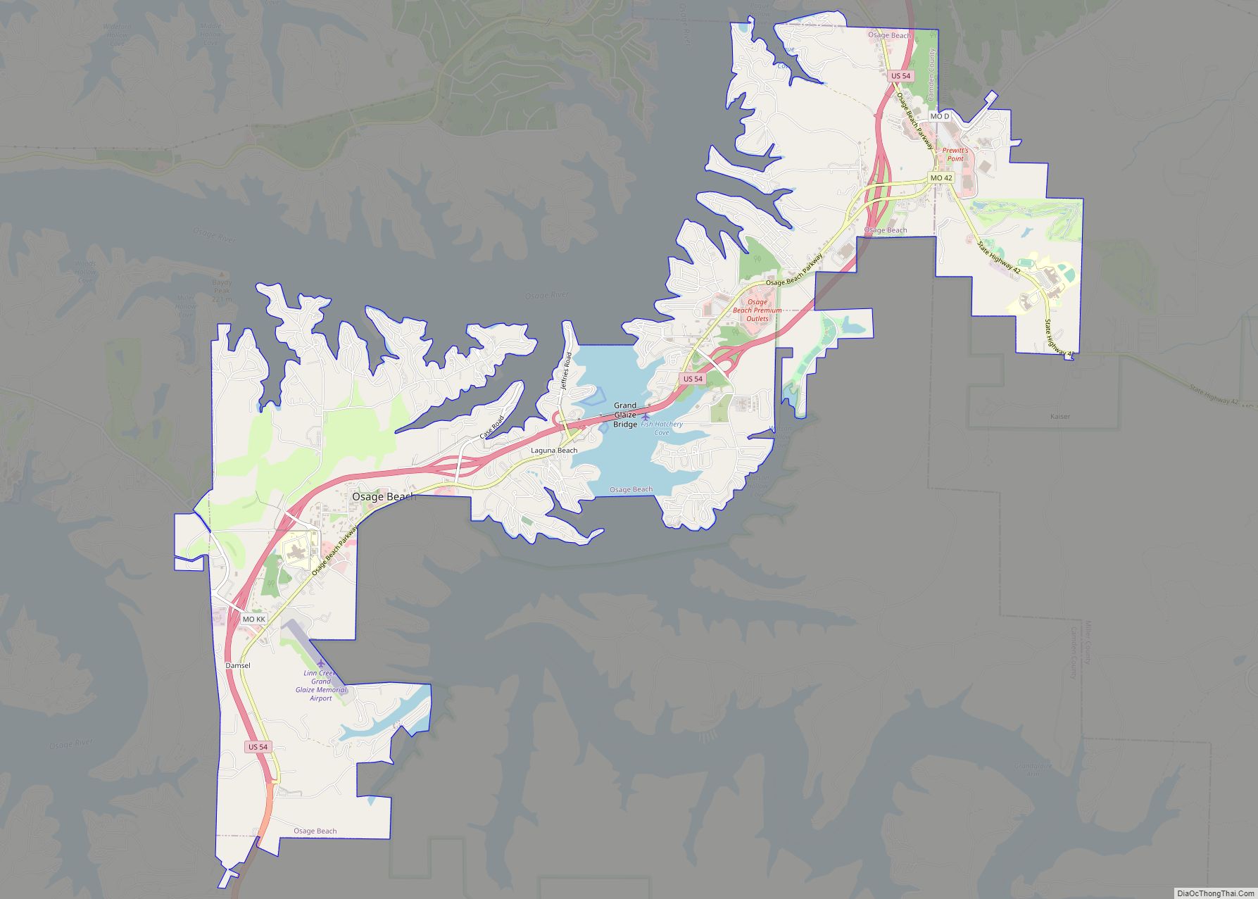
Online Interactive Map
Click on ![]() to view map in "full screen" mode.
to view map in "full screen" mode.
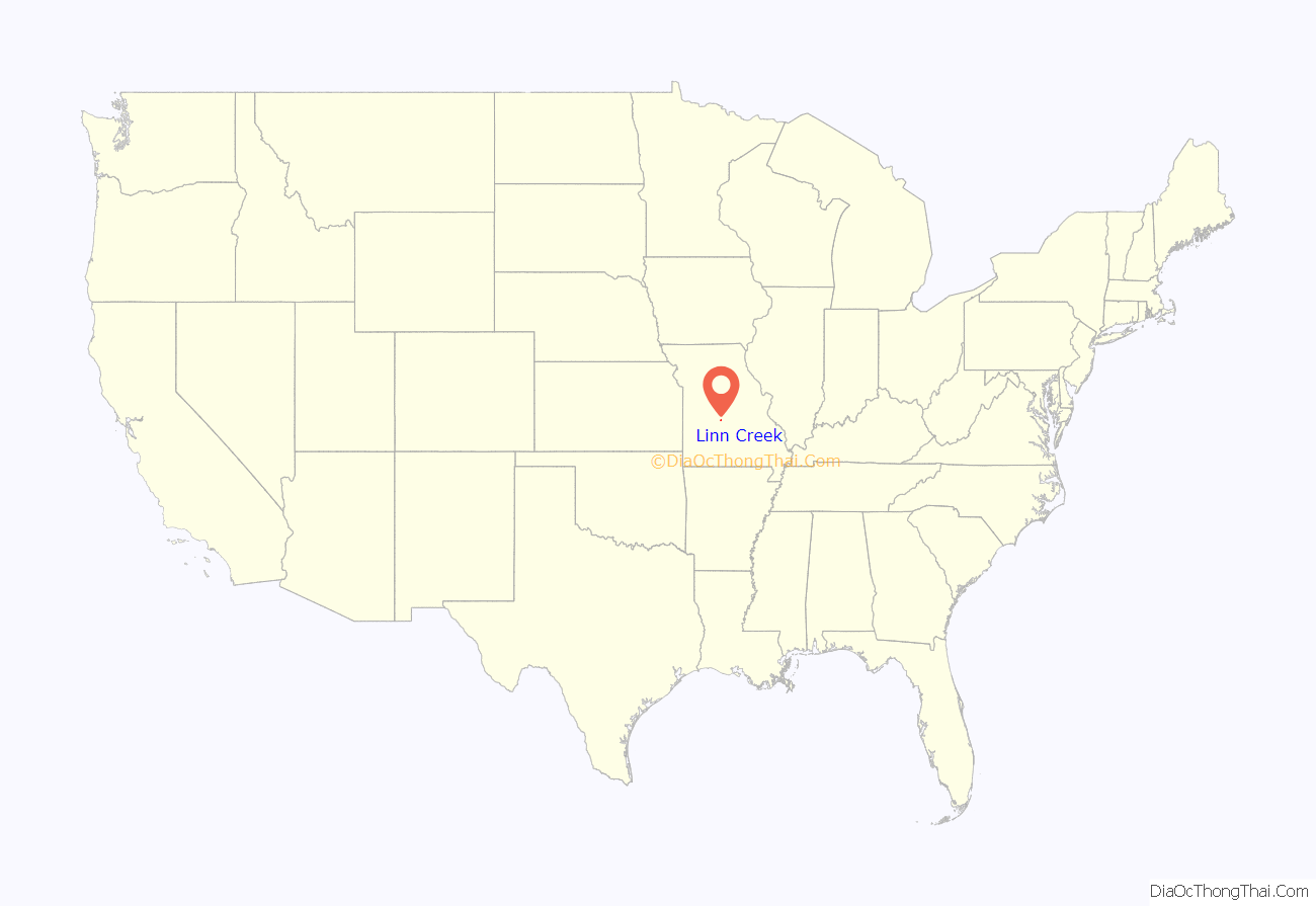
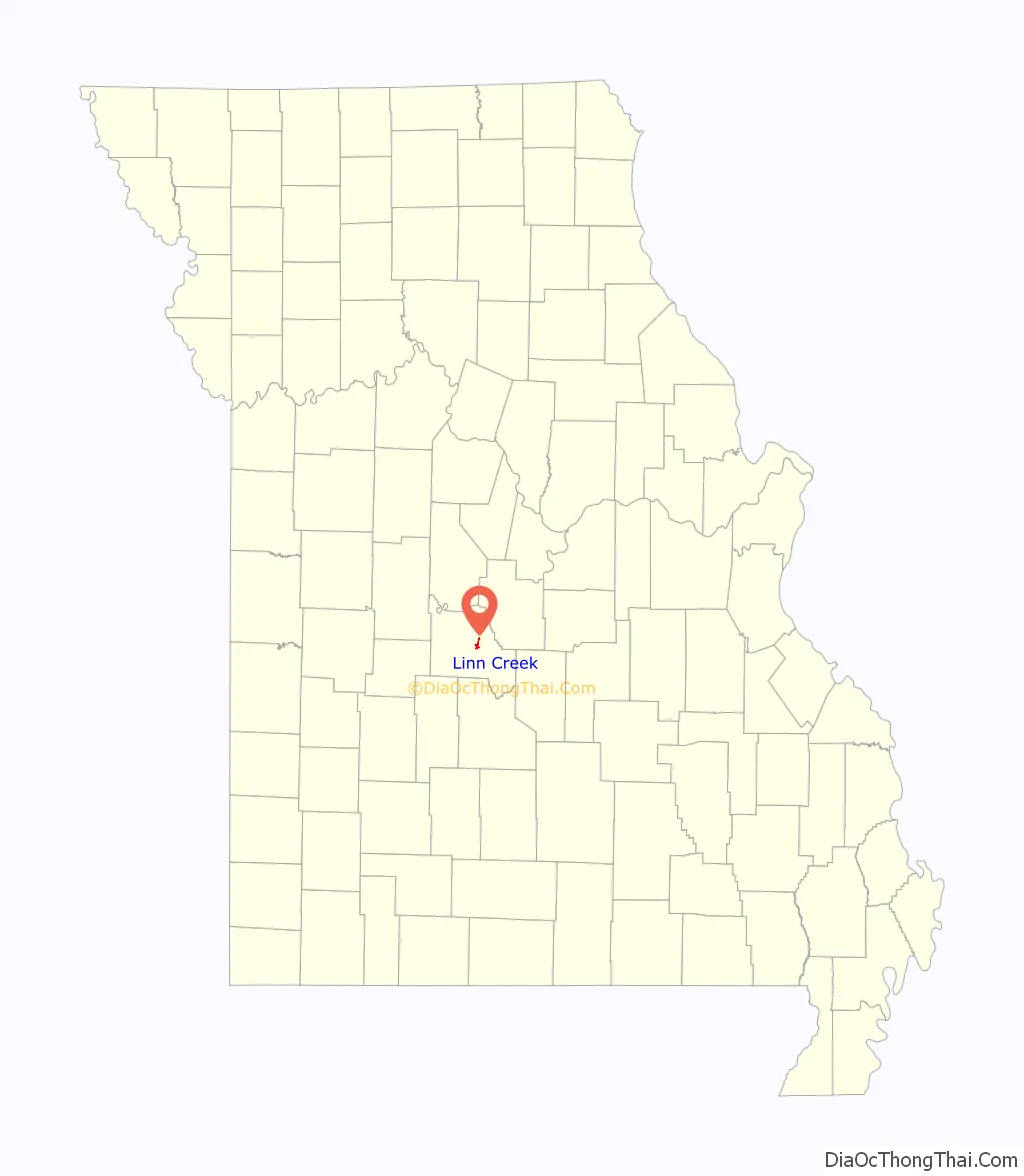
Linn Creek location map. Where is Linn Creek city?
History
Linn Creek was settled in 1841 at the junction of the Niangua and Osage Rivers. It was named from the creek on which it is situated, and which was named for the many linn trees lining its banks. The city was considered a head of navigation on the Osage and became a major hub for transportation in southwest Missouri.
A skirmish took place on October 14, 1861 between Union soldiers of the 13th Illinois, Fremont Battalion (Missouri) Cavalry and Confederates of Captain William Roberts.
In 1929 it was announced that the Bagnell Dam would be constructed and the town would be flooded, causing controversy among the city’s citizens. Almost all of the buildings were demolished, and the city was moved to a higher elevation, losing its designation as the county seat.
The local newspaper, The Linn Creek Reveille, was created and published by J. W. Vincent from 1879 until his death in 1933. According to J. W. Vincent, the Moulder family was the most numerous and prominent family in the county
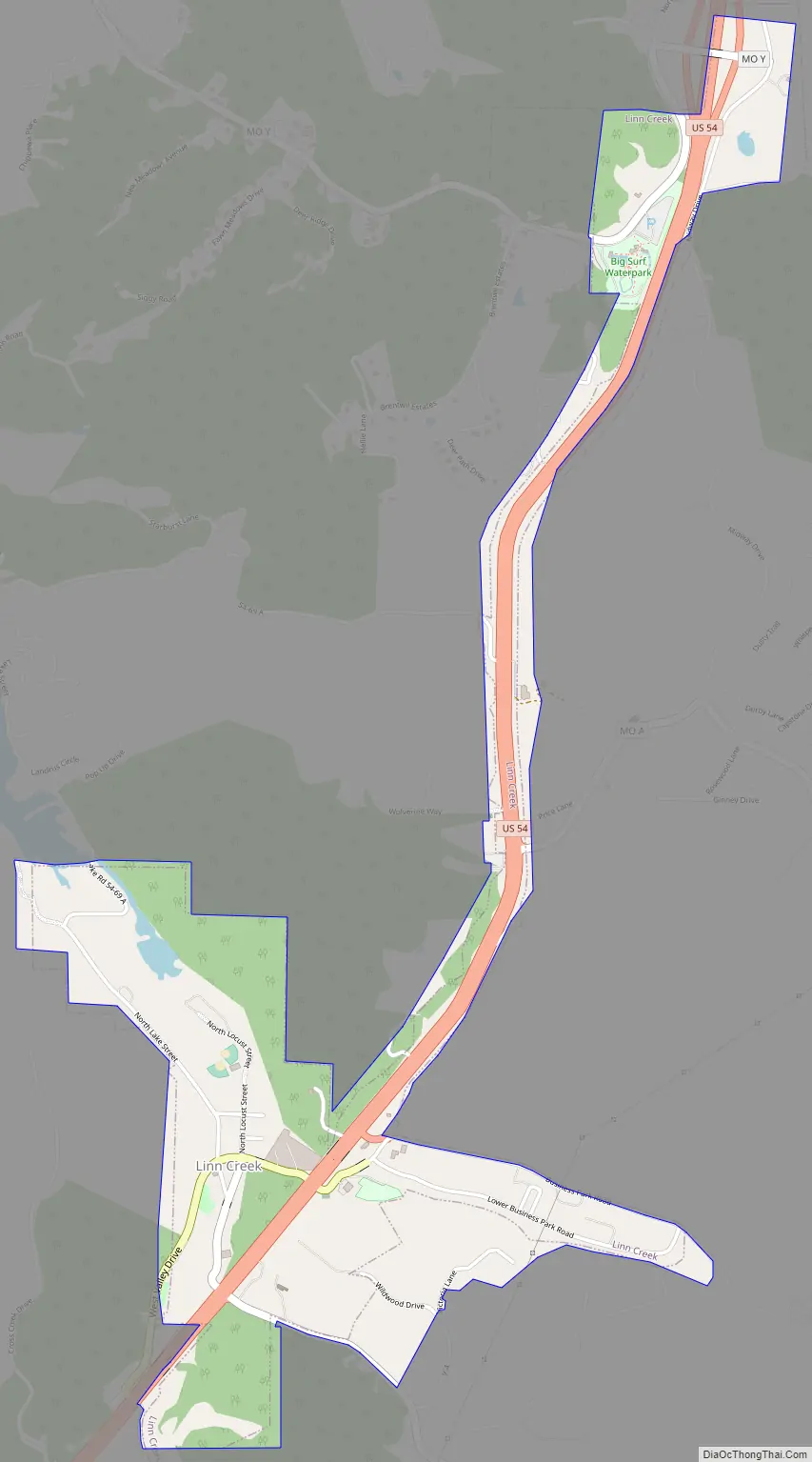
Linn Creek Road Map
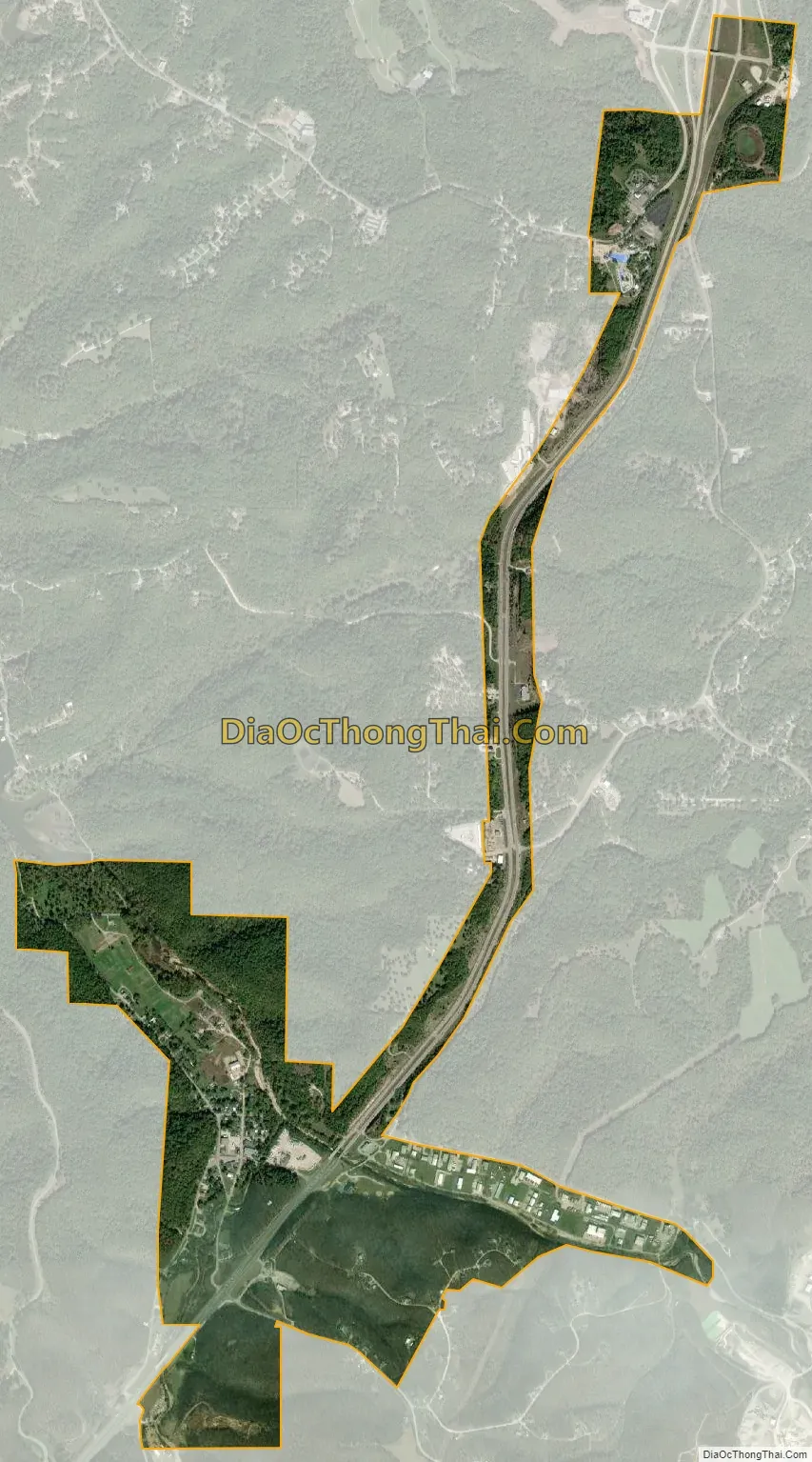
Linn Creek city Satellite Map
Geography
According to the United States Census Bureau, the city has a total area of 1.31 square miles (3.39 km), all land.
See also
Map of Missouri State and its subdivision:- Adair
- Andrew
- Atchison
- Audrain
- Barry
- Barton
- Bates
- Benton
- Bollinger
- Boone
- Buchanan
- Butler
- Caldwell
- Callaway
- Camden
- Cape Girardeau
- Carroll
- Carter
- Cass
- Cedar
- Chariton
- Christian
- Clark
- Clay
- Clinton
- Cole
- Cooper
- Crawford
- Dade
- Dallas
- Daviess
- De Kalb
- Dent
- Douglas
- Dunklin
- Franklin
- Gasconade
- Gentry
- Greene
- Grundy
- Harrison
- Henry
- Hickory
- Holt
- Howard
- Howell
- Iron
- Jackson
- Jasper
- Jefferson
- Johnson
- Knox
- Laclede
- Lafayette
- Lawrence
- Lewis
- Lincoln
- Linn
- Livingston
- Macon
- Madison
- Maries
- Marion
- McDonald
- Mercer
- Miller
- Mississippi
- Moniteau
- Monroe
- Montgomery
- Morgan
- New Madrid
- Newton
- Nodaway
- Oregon
- Osage
- Ozark
- Pemiscot
- Perry
- Pettis
- Phelps
- Pike
- Platte
- Polk
- Pulaski
- Putnam
- Ralls
- Randolph
- Ray
- Reynolds
- Ripley
- Saint Charles
- Saint Clair
- Saint Francois
- Saint Louis
- Sainte Genevieve
- Saline
- Schuyler
- Scotland
- Scott
- Shannon
- Shelby
- Stoddard
- Stone
- Sullivan
- Taney
- Texas
- Vernon
- Warren
- Washington
- Wayne
- Webster
- Worth
- Wright
- Alabama
- Alaska
- Arizona
- Arkansas
- California
- Colorado
- Connecticut
- Delaware
- District of Columbia
- Florida
- Georgia
- Hawaii
- Idaho
- Illinois
- Indiana
- Iowa
- Kansas
- Kentucky
- Louisiana
- Maine
- Maryland
- Massachusetts
- Michigan
- Minnesota
- Mississippi
- Missouri
- Montana
- Nebraska
- Nevada
- New Hampshire
- New Jersey
- New Mexico
- New York
- North Carolina
- North Dakota
- Ohio
- Oklahoma
- Oregon
- Pennsylvania
- Rhode Island
- South Carolina
- South Dakota
- Tennessee
- Texas
- Utah
- Vermont
- Virginia
- Washington
- West Virginia
- Wisconsin
- Wyoming