Nevada (/nəˈveɪdə/ nə-VAY-də) is a city in and the county seat of Vernon County, Missouri, United States. The population was 8,386 at the 2010 census, and 8,254 in the 2018 estimate. The local government has a council-manager model.
| Name: | Nevada city |
|---|---|
| LSAD Code: | 25 |
| LSAD Description: | city (suffix) |
| State: | Missouri |
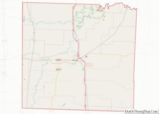
| County: | Vernon County |
| Elevation: | 863 ft (263 m) |
| Total Area: | 9.06 sq mi (23.47 km²) |
| Land Area: | 8.98 sq mi (23.27 km²) |
| Water Area: | 0.08 sq mi (0.20 km²) |
| Total Population: | 8,212 |
| Population Density: | 913.97/sq mi (352.88/km²) |
| ZIP code: | 64772 |
| Area code: | 417 |
| FIPS code: | 2951644 |
| GNISfeature ID: | 2395179 |
| Website: | http://nevadamo.gov/ |
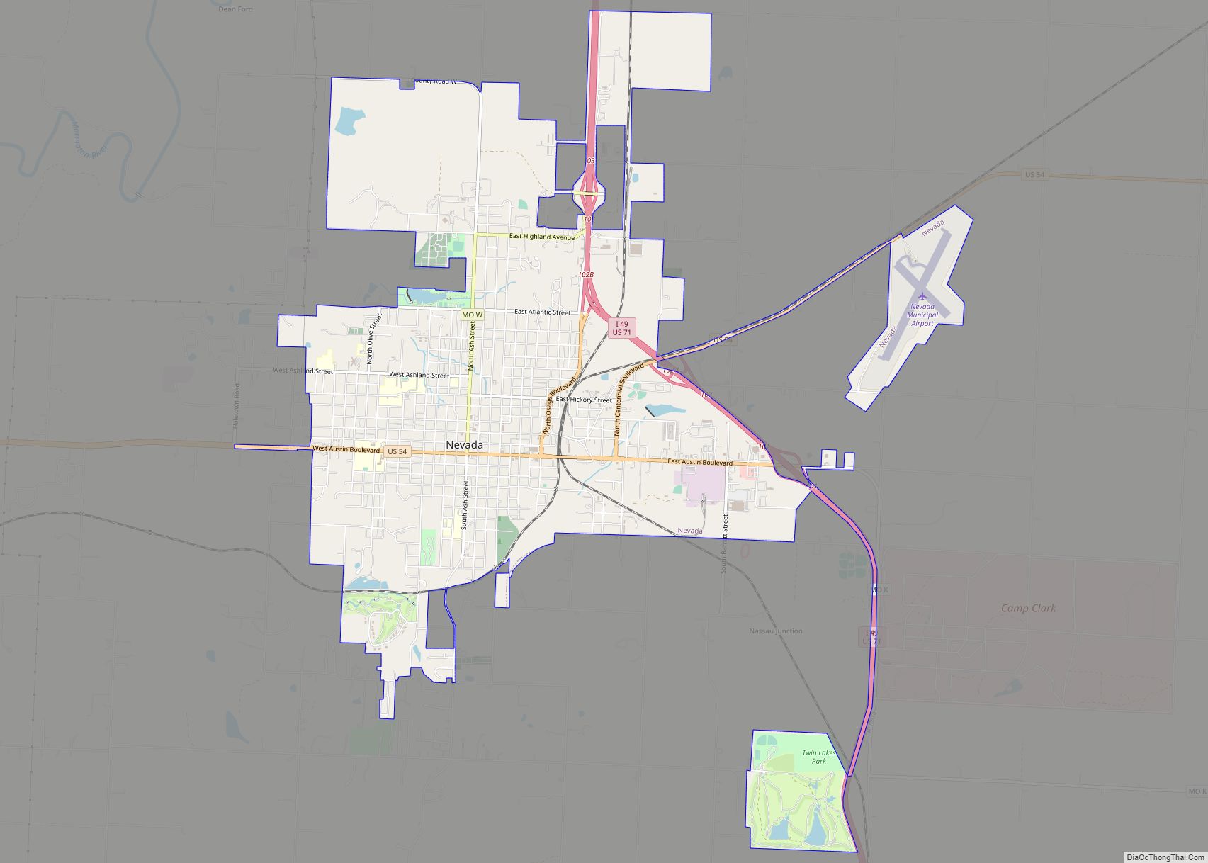
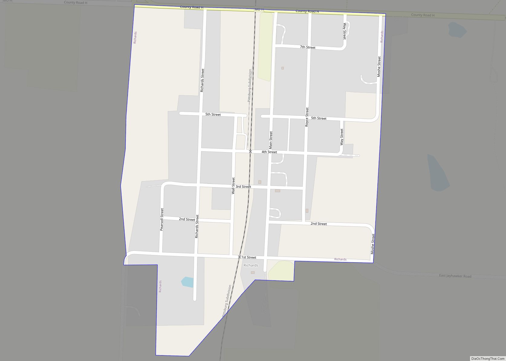
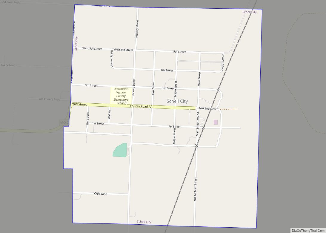
Online Interactive Map
Click on ![]() to view map in "full screen" mode.
to view map in "full screen" mode.
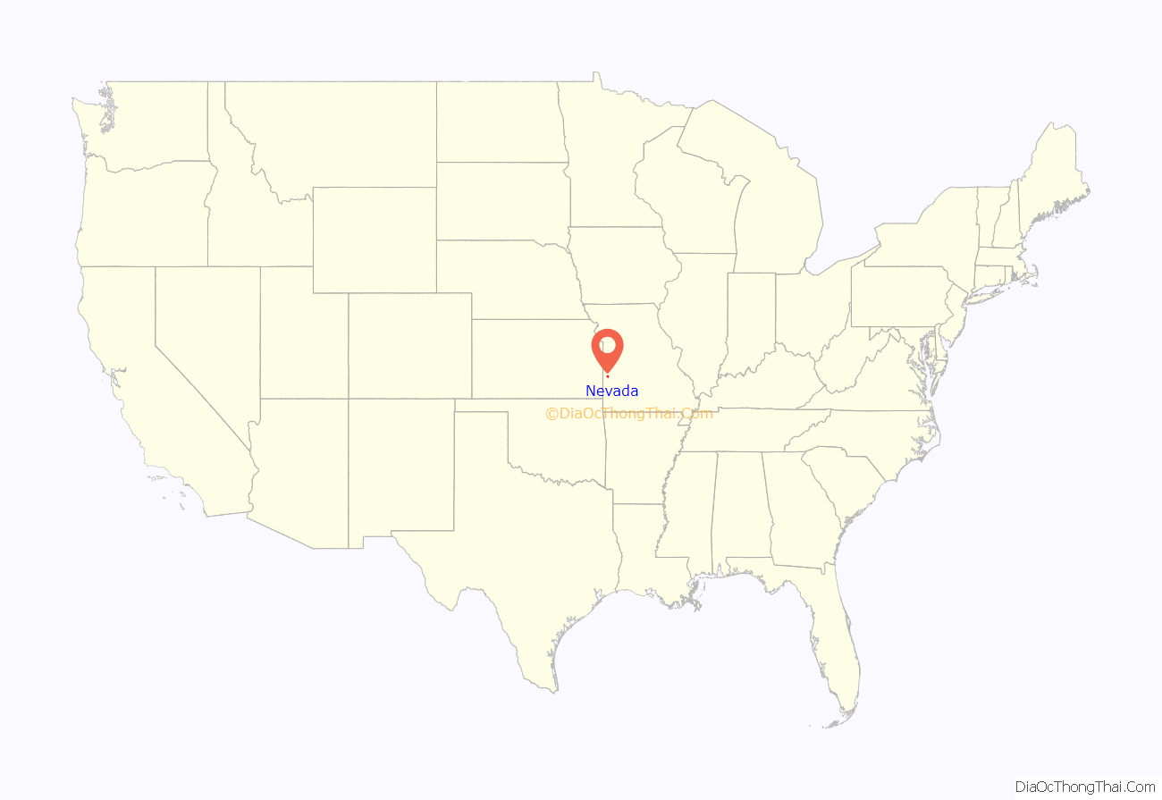
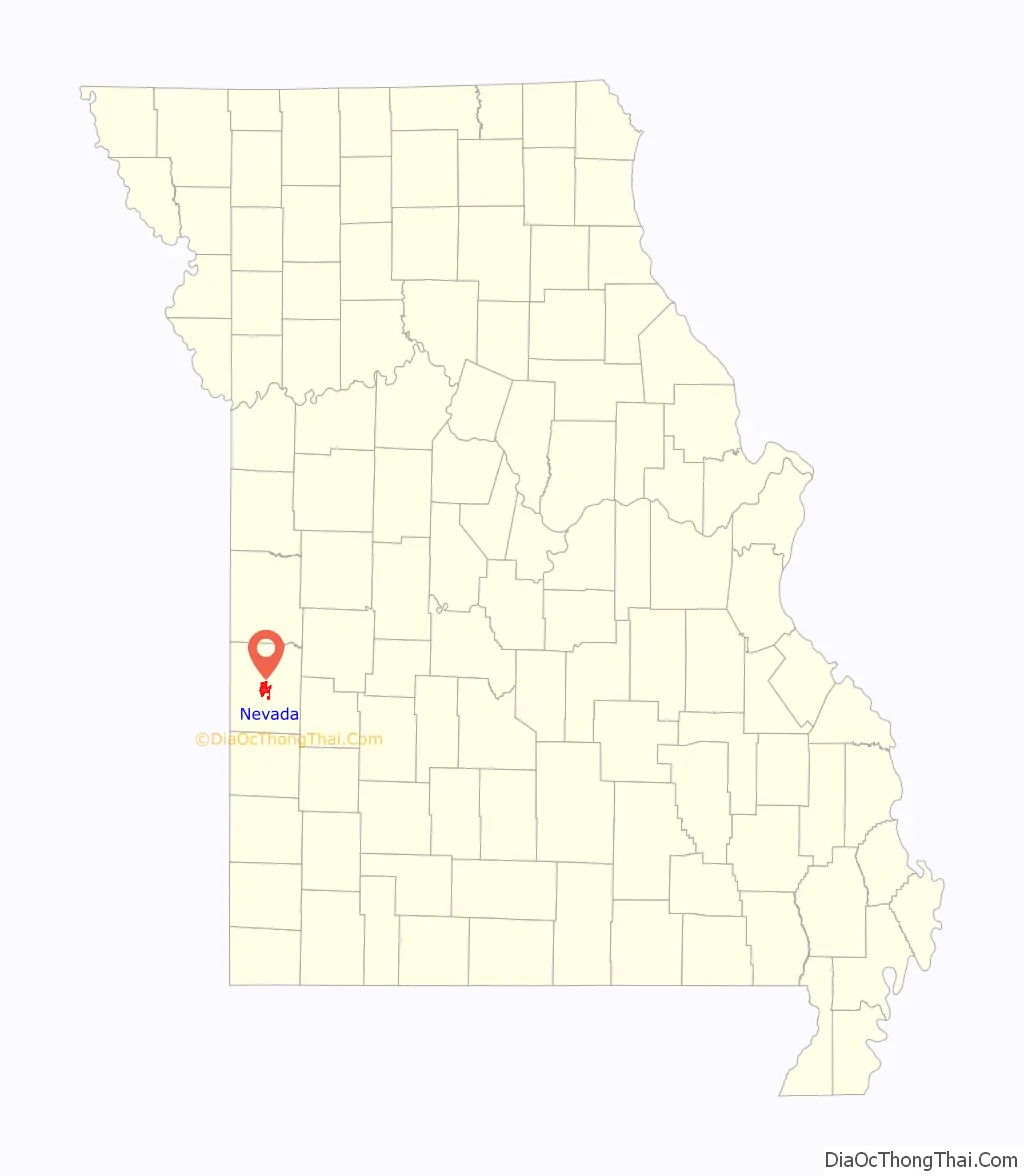
Nevada location map. Where is Nevada city?
History
When French explorers entered the region in the late 17th century, they encountered the indigenous Osage people, who controlled a vast area including parts of what are now several states. The Osage Village State Historic Site, formerly known as the Carrington Osage Village Site, is located on a hilltop above the Osage River valley. Archeological evidence shows an Osage band had nearly 200 lodges and an estimated population of 2000 to 3000 here; they occupied the area from about 1700–1775. They were the most influential people in the region and were integral to the fur trade. After the United States acquired the territory in the Louisiana Purchase, it gradually forced the Osage through the 19th century to cede their lands and remove to Indian Territory. This site has been designated as a National Historic Landmark for its significance to the Osage people and American history.
Nevada was originally called “Hog Eye” by European-American settlers, and under that name was platted in 1855. The town’s name was changed to Nevada by circuit and county clerk DeWitt C. Hunter, after Nevada City, California, where he had been a gold miner.
From 1897 to 1933, Nevada was home to the Weltmer Institute of Suggestive Therapeutics, founded by Sidney Abram Weltmer and Joseph H. Kelly. Weltmer bought a 17-room mansion, built in 1886 by Frank P. Anderson, a successful railroad builder. They wanted a facility large enough so that they could have patients stay for extended periods in a kind of boarding house. During the early 20th century, this healing institute attracted thousands of clients who believed in Weltmer’s cures by mental healing. People paid $100 to stay for a 10-day course of treatment. They also paid for instructional classes. The institute also conducted a large mail-order business for classes and a kind of treatment by mail. It held lectures attracting several hundred people.
The Institute attracted so many clients that the railroad added new trains to its schedule serving the town. In addition, the volume of mail associated with the institute’s business resulted in the post office being classified as first class, and the government building a new, larger post office to handle it. The Weltmer Institute became the center of associated wellness systems and practitioners in town, which increased in prosperity. It attracted psychotherapists, clairvoyants, and people promising various types of miracle cures for such illnesses as tuberculosis, which then had no cure.
In the early 20th century, the town attracted many enthusiasts of what was known as the New Thought Movement. In 1905 the Weltmer Auditorium was the site of the Fifth Annual Convention of the New Thought Federation, held on September 26–29, 1905. Ernest Weltmer, the eldest son of Sidney A. Weltmer, was Secretary of the Federation and helped open the convention. Among the several speakers from across the country was Grace Mann Brown, and entertainment was provided by singers including the Weltmer Quartette. Mrs. Brown served as President of the Federation the following year. In 1916, New Thought followers returned to Nevada for the second International Conference of the movement, and Sidney A. Weltmer was among the speakers.
After Weltmer’s death and the institute’s closure in 1933, the mansion was sold for use as a funeral home. By late 2004, the building was slated for demolition to redevelop the site. Although some residents were interested in its history and the Weltmer Institute, the building was never nominated as a significant historic building or classified for preservation. The City Council approved it being scheduled to be demolished in late 2004 for other development.
Significant historic properties in Nevada include the Infirmary Building, Missouri State Hospital Number 3, Vernon County Courthouse, and Vernon County Jail, Sheriff’s House and Office, which are also listed on the National Register of Historic Places.
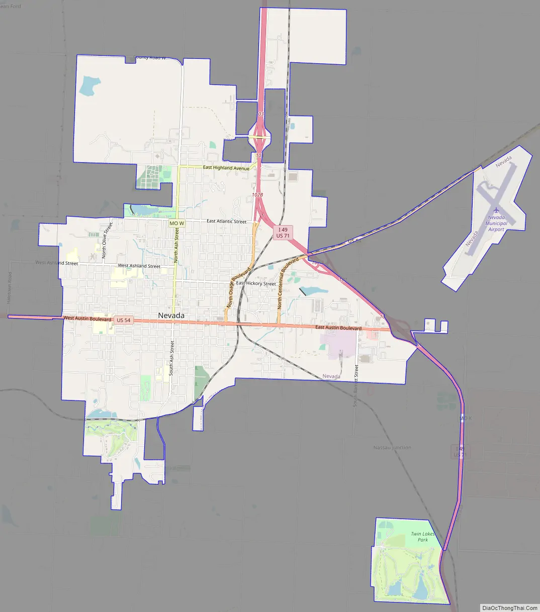
Nevada Road Map
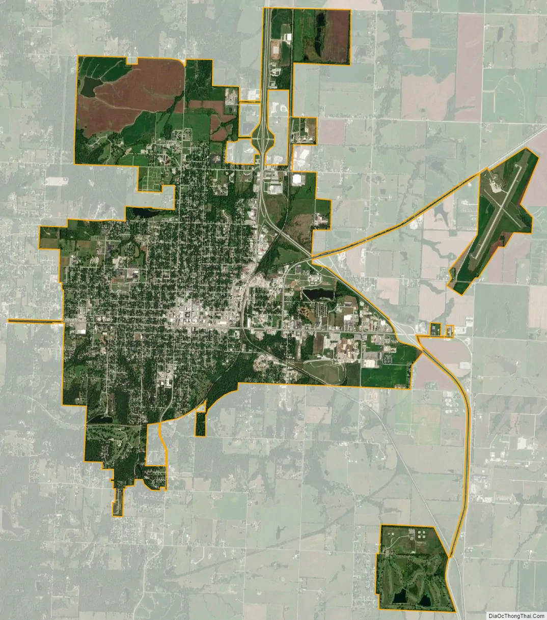
Nevada city Satellite Map
Geography
Nevada is located in central Vernon County at the intersection of US routes 71 and 54.
According to the United States Census Bureau, the city has a total area of 9.06 square miles (23.47 km), of which 8.98 square miles (23.26 km) is land and 0.08 square miles (0.21 km) is water.
Climate
See also
Map of Missouri State and its subdivision:- Adair
- Andrew
- Atchison
- Audrain
- Barry
- Barton
- Bates
- Benton
- Bollinger
- Boone
- Buchanan
- Butler
- Caldwell
- Callaway
- Camden
- Cape Girardeau
- Carroll
- Carter
- Cass
- Cedar
- Chariton
- Christian
- Clark
- Clay
- Clinton
- Cole
- Cooper
- Crawford
- Dade
- Dallas
- Daviess
- De Kalb
- Dent
- Douglas
- Dunklin
- Franklin
- Gasconade
- Gentry
- Greene
- Grundy
- Harrison
- Henry
- Hickory
- Holt
- Howard
- Howell
- Iron
- Jackson
- Jasper
- Jefferson
- Johnson
- Knox
- Laclede
- Lafayette
- Lawrence
- Lewis
- Lincoln
- Linn
- Livingston
- Macon
- Madison
- Maries
- Marion
- McDonald
- Mercer
- Miller
- Mississippi
- Moniteau
- Monroe
- Montgomery
- Morgan
- New Madrid
- Newton
- Nodaway
- Oregon
- Osage
- Ozark
- Pemiscot
- Perry
- Pettis
- Phelps
- Pike
- Platte
- Polk
- Pulaski
- Putnam
- Ralls
- Randolph
- Ray
- Reynolds
- Ripley
- Saint Charles
- Saint Clair
- Saint Francois
- Saint Louis
- Sainte Genevieve
- Saline
- Schuyler
- Scotland
- Scott
- Shannon
- Shelby
- Stoddard
- Stone
- Sullivan
- Taney
- Texas
- Vernon
- Warren
- Washington
- Wayne
- Webster
- Worth
- Wright
- Alabama
- Alaska
- Arizona
- Arkansas
- California
- Colorado
- Connecticut
- Delaware
- District of Columbia
- Florida
- Georgia
- Hawaii
- Idaho
- Illinois
- Indiana
- Iowa
- Kansas
- Kentucky
- Louisiana
- Maine
- Maryland
- Massachusetts
- Michigan
- Minnesota
- Mississippi
- Missouri
- Montana
- Nebraska
- Nevada
- New Hampshire
- New Jersey
- New Mexico
- New York
- North Carolina
- North Dakota
- Ohio
- Oklahoma
- Oregon
- Pennsylvania
- Rhode Island
- South Carolina
- South Dakota
- Tennessee
- Texas
- Utah
- Vermont
- Virginia
- Washington
- West Virginia
- Wisconsin
- Wyoming