Overland is a city in St. Louis County, Missouri, United States. The population was 16,062 at the 2010 census.
| Name: | Overland city |
|---|---|
| LSAD Code: | 25 |
| LSAD Description: | city (suffix) |
| State: | Missouri |
| County: | St. Louis County |
| Elevation: | 650 ft (200 m) |
| Total Area: | 4.41 sq mi (11.41 km²) |
| Land Area: | 4.39 sq mi (11.37 km²) |
| Water Area: | 0.02 sq mi (0.04 km²) |
| Total Population: | 15,955 |
| Population Density: | 3,635.22/sq mi (1,403.53/km²) |
| FIPS code: | 2955550 |
| GNISfeature ID: | 2396112 |
| Website: | www.overlandmo.org |
Online Interactive Map
Click on ![]() to view map in "full screen" mode.
to view map in "full screen" mode.
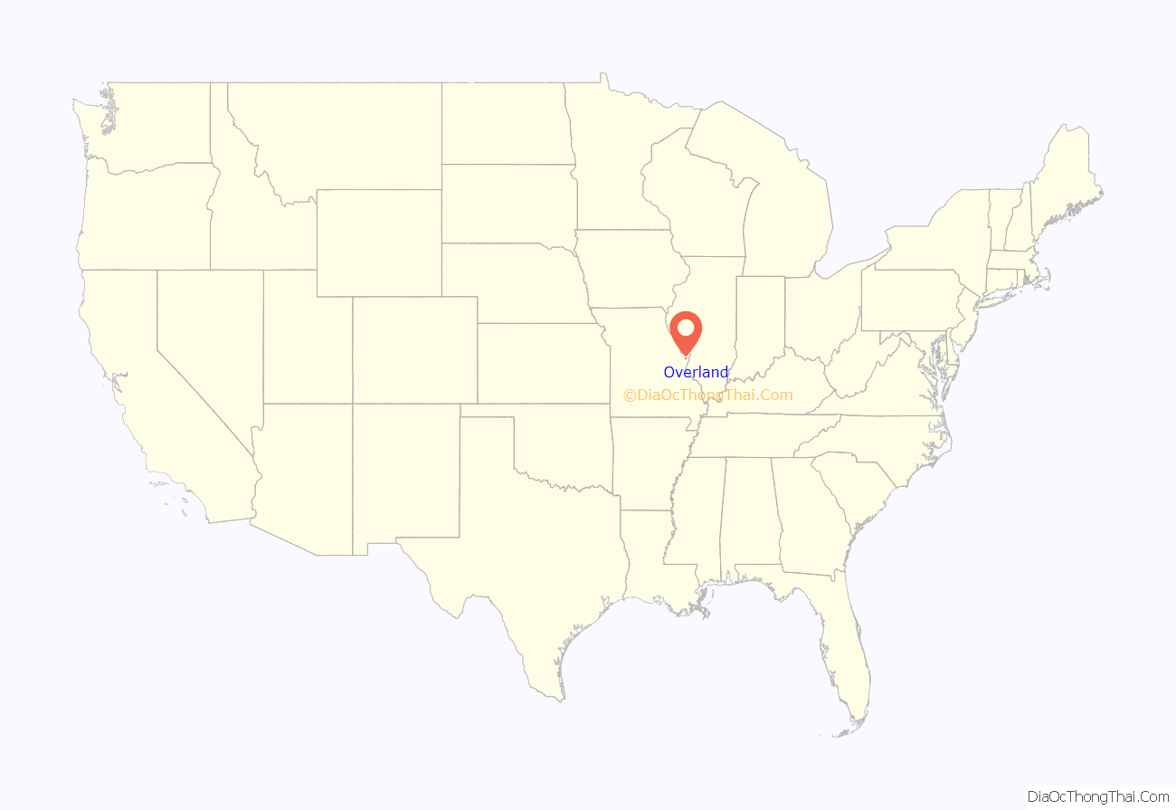
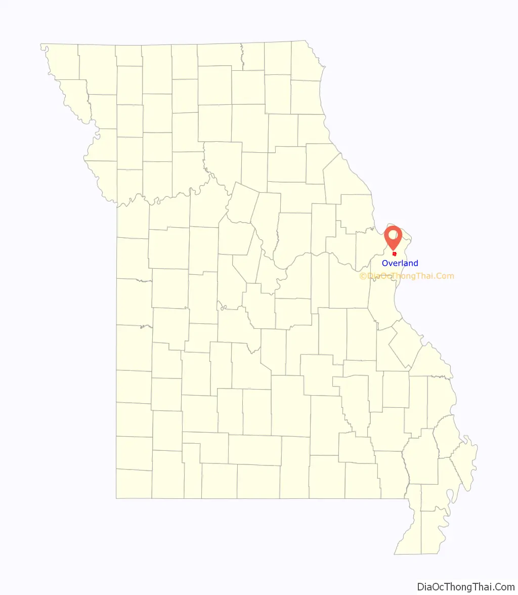
Overland location map. Where is Overland city?
History
The area south of the King’s Road to St. Charles was first settled in the early 1820s, when travelers westward from St. Louis would stop overnight at what became known as “The Overland Park”. Daniel Boone, noted frontiersman, constructed a single room cabin here, near the current location of Lake Sherwood and Wyland Elementary School.
In time, businesses were established and a one-room subscription school, the Buck School, was built in 1846. In 1867, the Ritenour School District was organized. In 1919, the town’s name was shortened to “Overland”, to avoid postal confusion with the city of Overland Park, Kansas.
The town was incorporated as a fourth class city in 1939 with a mayoral-city council government. In the 1990s, the city voters approved a change to a third class city. In 2007, the city voted to move to a mayor-council-administrator form of government. Under this structure, the mayor serves as the chief elected official. The city council serves as the legislative body, and is empowered to pass ordinances and resolutions it deems necessary to the operation of the city. The city administrator is a full-time employee of the city, and executes the day-to-day tasks of operations.
On April 3, 2007, Overland residents voted to recall Mayor Ann Purzner, who had been accused of lying about her career credentials and exceeding her power as mayor. She was temporarily replaced by Alderman Jerry May, and in the August 2007 election, Councilman Mike Schneider was elected mayor.
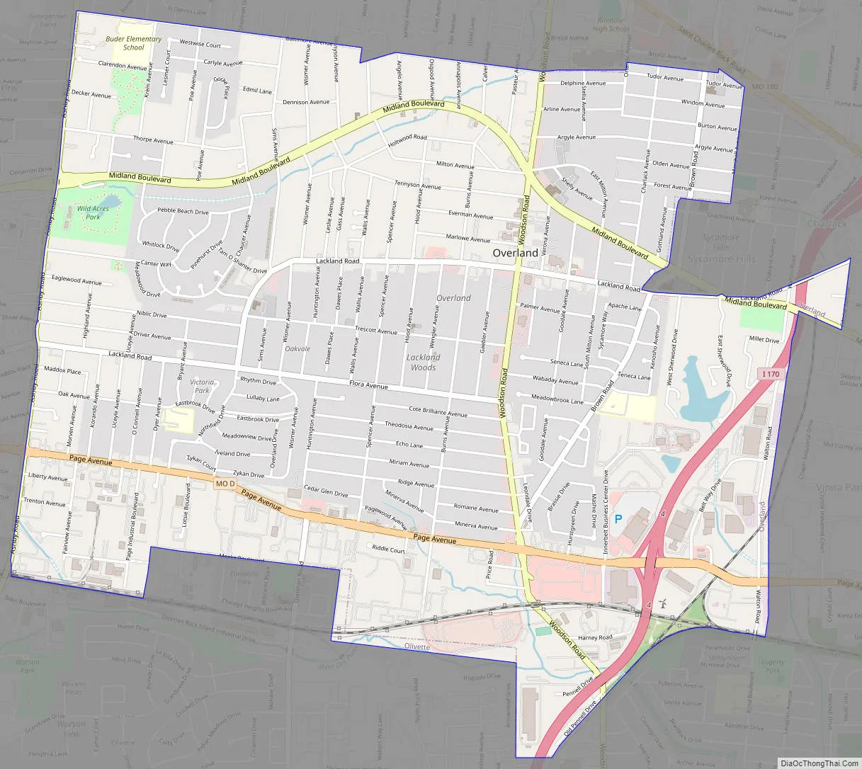
Overland Road Map
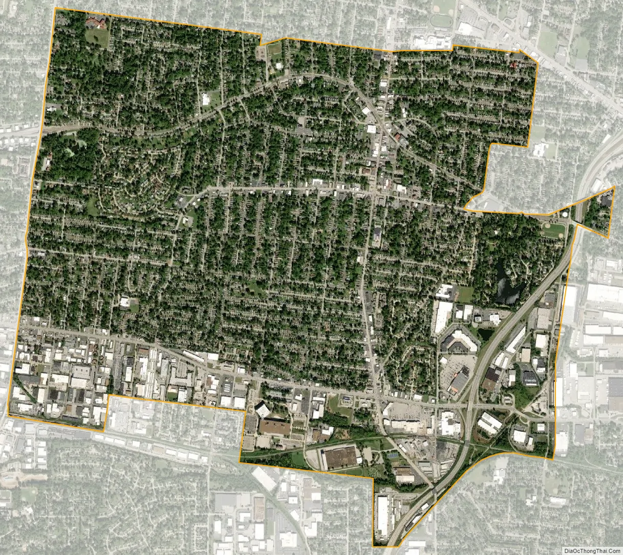
Overland city Satellite Map
Geography
According to the United States Census Bureau, the city has a total area of 4.38 square miles (11.34 km), of which 4.36 square miles (11.29 km) is land and 0.02 square miles (0.05 km) is water.
See also
Map of Missouri State and its subdivision:- Adair
- Andrew
- Atchison
- Audrain
- Barry
- Barton
- Bates
- Benton
- Bollinger
- Boone
- Buchanan
- Butler
- Caldwell
- Callaway
- Camden
- Cape Girardeau
- Carroll
- Carter
- Cass
- Cedar
- Chariton
- Christian
- Clark
- Clay
- Clinton
- Cole
- Cooper
- Crawford
- Dade
- Dallas
- Daviess
- De Kalb
- Dent
- Douglas
- Dunklin
- Franklin
- Gasconade
- Gentry
- Greene
- Grundy
- Harrison
- Henry
- Hickory
- Holt
- Howard
- Howell
- Iron
- Jackson
- Jasper
- Jefferson
- Johnson
- Knox
- Laclede
- Lafayette
- Lawrence
- Lewis
- Lincoln
- Linn
- Livingston
- Macon
- Madison
- Maries
- Marion
- McDonald
- Mercer
- Miller
- Mississippi
- Moniteau
- Monroe
- Montgomery
- Morgan
- New Madrid
- Newton
- Nodaway
- Oregon
- Osage
- Ozark
- Pemiscot
- Perry
- Pettis
- Phelps
- Pike
- Platte
- Polk
- Pulaski
- Putnam
- Ralls
- Randolph
- Ray
- Reynolds
- Ripley
- Saint Charles
- Saint Clair
- Saint Francois
- Saint Louis
- Sainte Genevieve
- Saline
- Schuyler
- Scotland
- Scott
- Shannon
- Shelby
- Stoddard
- Stone
- Sullivan
- Taney
- Texas
- Vernon
- Warren
- Washington
- Wayne
- Webster
- Worth
- Wright
- Alabama
- Alaska
- Arizona
- Arkansas
- California
- Colorado
- Connecticut
- Delaware
- District of Columbia
- Florida
- Georgia
- Hawaii
- Idaho
- Illinois
- Indiana
- Iowa
- Kansas
- Kentucky
- Louisiana
- Maine
- Maryland
- Massachusetts
- Michigan
- Minnesota
- Mississippi
- Missouri
- Montana
- Nebraska
- Nevada
- New Hampshire
- New Jersey
- New Mexico
- New York
- North Carolina
- North Dakota
- Ohio
- Oklahoma
- Oregon
- Pennsylvania
- Rhode Island
- South Carolina
- South Dakota
- Tennessee
- Texas
- Utah
- Vermont
- Virginia
- Washington
- West Virginia
- Wisconsin
- Wyoming


