Palmyra is a city in and the county seat of Marion County, Missouri, United States. The population was 3,595 at the 2010 census. It is part of the Hannibal Micropolitan Statistical Area.
| Name: | Palmyra city |
|---|---|
| LSAD Code: | 25 |
| LSAD Description: | city (suffix) |
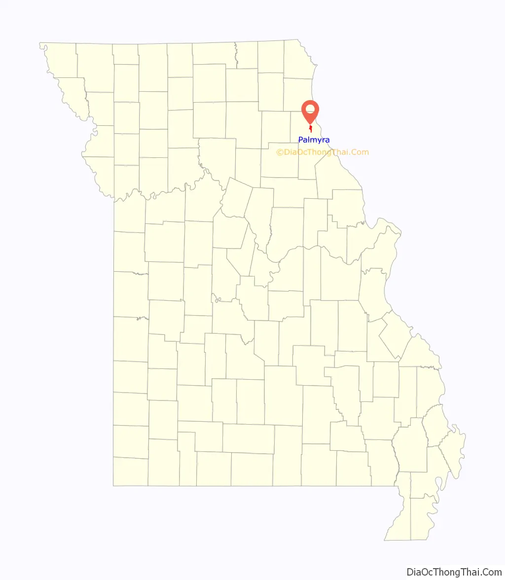
| State: | Missouri |
| County: | Marion County |
| Elevation: | 620 ft (190 m) |
| Total Area: | 3.10 sq mi (8.04 km²) |
| Land Area: | 3.10 sq mi (8.04 km²) |
| Water Area: | 0.00 sq mi (0.00 km²) |
| Total Population: | 3,613 |
| Population Density: | 1,164.36/sq mi (449.63/km²) |
| ZIP code: | 63461 |
| Area code: | 573 |
| FIPS code: | 2956036 |
| GNISfeature ID: | 2396131 |
Online Interactive Map
Click on ![]() to view map in "full screen" mode.
to view map in "full screen" mode.
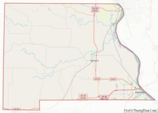
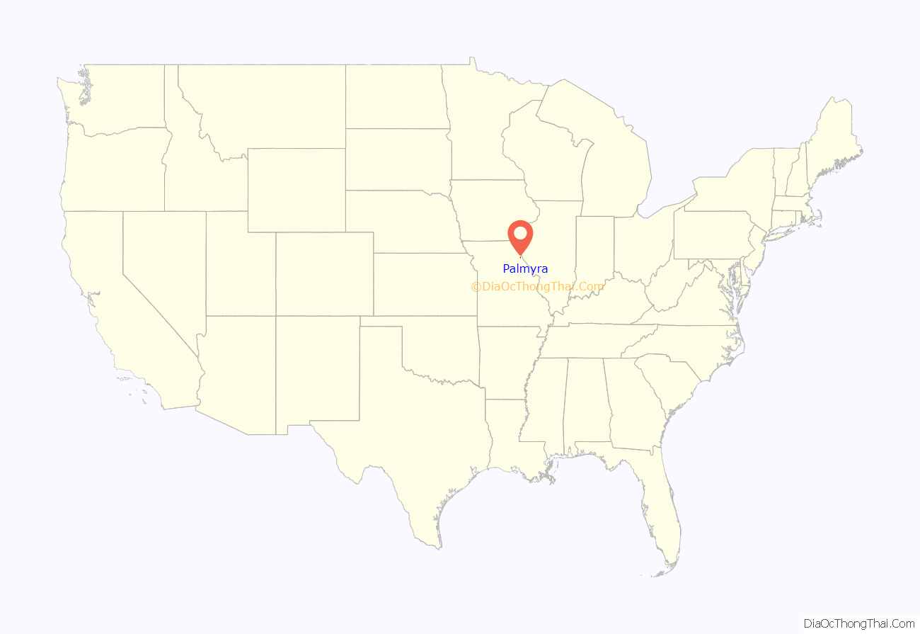
Palmyra location map. Where is Palmyra city?
History
Palmyra was platted in 1819, and named after Palmyra, in Syria. The settlement was designated county seat in 1827. A post office called Palmyra has been in operation since 1830.
In 1862, the city was the scene of the Palmyra Massacre, in which ten Confederate prisoners were killed in retaliation for the disappearance of a local Union man.
The Culbertson-Head Farmstead, Dryden-Louthan House, Gardner House, Marion County Jail and Jailor’s House, Peter J. Sowers House, Speigle House, Walker-Woodward-Schaffer House, and Ephraim J. Wilson Farm Complex are listed on the National Register of Historic Places.
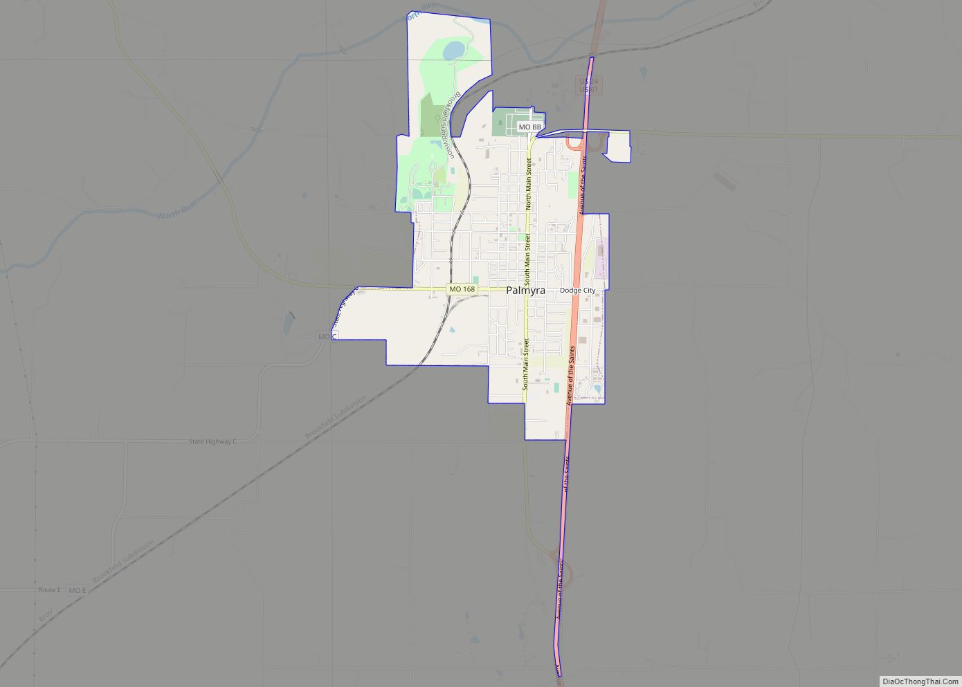
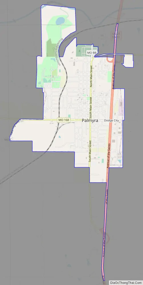
Palmyra Road Map
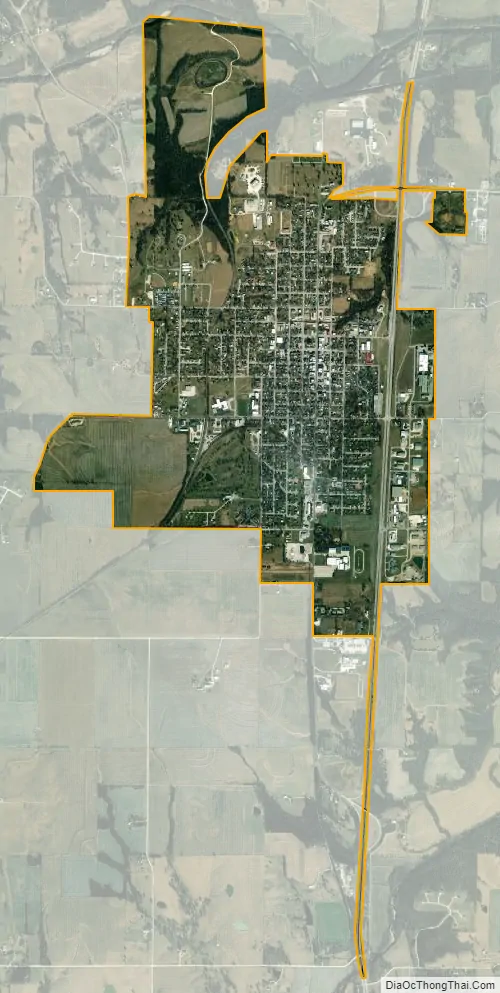
Palmyra city Satellite Map
Geography
According to the United States Census Bureau, the city has a total area of 2.76 square miles (7.15 km), all land.
See also
Map of Missouri State and its subdivision:- Adair
- Andrew
- Atchison
- Audrain
- Barry
- Barton
- Bates
- Benton
- Bollinger
- Boone
- Buchanan
- Butler
- Caldwell
- Callaway
- Camden
- Cape Girardeau
- Carroll
- Carter
- Cass
- Cedar
- Chariton
- Christian
- Clark
- Clay
- Clinton
- Cole
- Cooper
- Crawford
- Dade
- Dallas
- Daviess
- De Kalb
- Dent
- Douglas
- Dunklin
- Franklin
- Gasconade
- Gentry
- Greene
- Grundy
- Harrison
- Henry
- Hickory
- Holt
- Howard
- Howell
- Iron
- Jackson
- Jasper
- Jefferson
- Johnson
- Knox
- Laclede
- Lafayette
- Lawrence
- Lewis
- Lincoln
- Linn
- Livingston
- Macon
- Madison
- Maries
- Marion
- McDonald
- Mercer
- Miller
- Mississippi
- Moniteau
- Monroe
- Montgomery
- Morgan
- New Madrid
- Newton
- Nodaway
- Oregon
- Osage
- Ozark
- Pemiscot
- Perry
- Pettis
- Phelps
- Pike
- Platte
- Polk
- Pulaski
- Putnam
- Ralls
- Randolph
- Ray
- Reynolds
- Ripley
- Saint Charles
- Saint Clair
- Saint Francois
- Saint Louis
- Sainte Genevieve
- Saline
- Schuyler
- Scotland
- Scott
- Shannon
- Shelby
- Stoddard
- Stone
- Sullivan
- Taney
- Texas
- Vernon
- Warren
- Washington
- Wayne
- Webster
- Worth
- Wright
- Alabama
- Alaska
- Arizona
- Arkansas
- California
- Colorado
- Connecticut
- Delaware
- District of Columbia
- Florida
- Georgia
- Hawaii
- Idaho
- Illinois
- Indiana
- Iowa
- Kansas
- Kentucky
- Louisiana
- Maine
- Maryland
- Massachusetts
- Michigan
- Minnesota
- Mississippi
- Missouri
- Montana
- Nebraska
- Nevada
- New Hampshire
- New Jersey
- New Mexico
- New York
- North Carolina
- North Dakota
- Ohio
- Oklahoma
- Oregon
- Pennsylvania
- Rhode Island
- South Carolina
- South Dakota
- Tennessee
- Texas
- Utah
- Vermont
- Virginia
- Washington
- West Virginia
- Wisconsin
- Wyoming