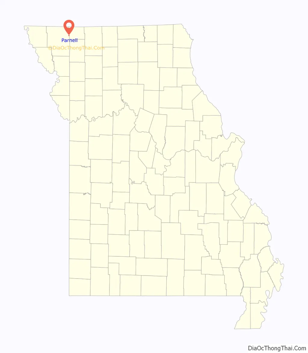
Parnell is a city in northeast Nodaway County, Missouri, United States, near the Platte River. The population was 191 at the 2010 Census. It was home to the father-son horse trainers Ben and Jimmy Jones, whose horses won eight Kentucky Derbies and two Triple Crowns.
| Name: | Parnell city |
|---|---|
| LSAD Code: | 25 |
| LSAD Description: | city (suffix) |
| State: | Missouri |
| County: | Nodaway County |
| Elevation: | 1,040 ft (320 m) |
| Total Area: | 0.27 sq mi (0.71 km²) |
| Land Area: | 0.27 sq mi (0.71 km²) |
| Water Area: | 0.00 sq mi (0.00 km²) |
| Total Population: | 135 |
| Population Density: | 492.70/sq mi (190.50/km²) |
| ZIP code: | 64475 |
| Area code: | 660 |
| FIPS code: | 2956360 |
| GNISfeature ID: | 2396157 |
Online Interactive Map
Click on ![]() to view map in "full screen" mode.
to view map in "full screen" mode.
Parnell location map. Where is Parnell city?
History
Parnell was platted on July 5, 1887 as a station stop on the Chicago Great Western Railway and it was formally incorporated in 1888. The Chicago Great Western route passing through the community was called the Diagonal Route. It ran at northeast direction from Kansas City to Waterloo, Iowa including passing through the community of Diagonal, Iowa. Among the first businesses was the Diagonal Hotel.
Ben Jones father Horace Jones organized the founding of the community and an early proposed names was Jonesville until it was discovered there was another Jonesville in Missouri. The name ultimately chosen was in honor or Irish politician Charles Stewart Parnell who was at the peak of influence in creating Irish homerule when Parnell was incorporated.
The elder Horace Jones started a ranch on the northeast side of Parnell where he raised Angus cattle and saddle horses. At the ranch Ben (along with his son Horace “Jimmy”) trained a horse named Seth which was in the top 20 of the national thoroughbred sires list from 1925 to 1928. This in turn got the attention of Herbert M. Woolf, owner of Woolford Farm in Prairie Village, Kansas and Ben trained Lawrin which won the Kentucky Derby in 1938. The two were lured by Warren Wright, Sr. to train horses at Calumet Farm in 1939 where they racked up a record training 7 Kentucky Derby winners (1941, 1944, 1948, 1949, 1952, 1957, 1958) and two Triple Crown winners (Whirlaway and Citation). Ben’s record of 6 wins remains a Derby record. He was succeeded by Jimmy as trainer and Jimmy was the trainer of record for the 1957 and 1958 wins although Ben stayed on as Calumet manager until 1961. Jimmy stayed at Calumet until 1964 when he became manager of racing at Monmouth Park.
After he retiring in 1976 Jimmy returned to 1,750 acre ranch in Parnell. He sold the ranch in 1986. He had no children and died in Maryville, Missouri in 2001. He left $7.2 million to St. Francis Hospital there.
Parnell Road Map
Parnell city Satellite Map
Geography
Parnell is located at the junction of routes 46 and NN one-half mile from the Nodaway-Worth county line. The Platte River flows past the west side of the community. Ravenwood is approximately six miles to the south-southwest and Sheridan in northwest Worth County is five miles to the north.
According to the United States Census Bureau, the city has a total area of 0.29 square miles (0.75 km), all land.
See also
Map of Missouri State and its subdivision:- Adair
- Andrew
- Atchison
- Audrain
- Barry
- Barton
- Bates
- Benton
- Bollinger
- Boone
- Buchanan
- Butler
- Caldwell
- Callaway
- Camden
- Cape Girardeau
- Carroll
- Carter
- Cass
- Cedar
- Chariton
- Christian
- Clark
- Clay
- Clinton
- Cole
- Cooper
- Crawford
- Dade
- Dallas
- Daviess
- De Kalb
- Dent
- Douglas
- Dunklin
- Franklin
- Gasconade
- Gentry
- Greene
- Grundy
- Harrison
- Henry
- Hickory
- Holt
- Howard
- Howell
- Iron
- Jackson
- Jasper
- Jefferson
- Johnson
- Knox
- Laclede
- Lafayette
- Lawrence
- Lewis
- Lincoln
- Linn
- Livingston
- Macon
- Madison
- Maries
- Marion
- McDonald
- Mercer
- Miller
- Mississippi
- Moniteau
- Monroe
- Montgomery
- Morgan
- New Madrid
- Newton
- Nodaway
- Oregon
- Osage
- Ozark
- Pemiscot
- Perry
- Pettis
- Phelps
- Pike
- Platte
- Polk
- Pulaski
- Putnam
- Ralls
- Randolph
- Ray
- Reynolds
- Ripley
- Saint Charles
- Saint Clair
- Saint Francois
- Saint Louis
- Sainte Genevieve
- Saline
- Schuyler
- Scotland
- Scott
- Shannon
- Shelby
- Stoddard
- Stone
- Sullivan
- Taney
- Texas
- Vernon
- Warren
- Washington
- Wayne
- Webster
- Worth
- Wright
- Alabama
- Alaska
- Arizona
- Arkansas
- California
- Colorado
- Connecticut
- Delaware
- District of Columbia
- Florida
- Georgia
- Hawaii
- Idaho
- Illinois
- Indiana
- Iowa
- Kansas
- Kentucky
- Louisiana
- Maine
- Maryland
- Massachusetts
- Michigan
- Minnesota
- Mississippi
- Missouri
- Montana
- Nebraska
- Nevada
- New Hampshire
- New Jersey
- New Mexico
- New York
- North Carolina
- North Dakota
- Ohio
- Oklahoma
- Oregon
- Pennsylvania
- Rhode Island
- South Carolina
- South Dakota
- Tennessee
- Texas
- Utah
- Vermont
- Virginia
- Washington
- West Virginia
- Wisconsin
- Wyoming

