Rock Hill is a suburban town in St. Louis County, Missouri, United States. The population was 4,635 at the 2010 census. It is home to the Fairfax House on the National Register of Historic Places.
| Name: | Rock Hill city |
|---|---|
| LSAD Code: | 25 |
| LSAD Description: | city (suffix) |
| State: | Missouri |
| County: | St. Louis County |
| Elevation: | 541 ft (165 m) |
| Total Area: | 1.10 sq mi (2.86 km²) |
| Land Area: | 1.10 sq mi (2.86 km²) |
| Water Area: | 0.00 sq mi (0.00 km²) |
| Total Population: | 4,750 |
| Population Density: | 4,306.44/sq mi (1,662.26/km²) |
| ZIP code: | 63119 |
| Area code: | 314 |
| FIPS code: | 2962660 |
| GNISfeature ID: | 2396399 |
| Website: | www.rockhillmo.net |
Online Interactive Map
Click on ![]() to view map in "full screen" mode.
to view map in "full screen" mode.
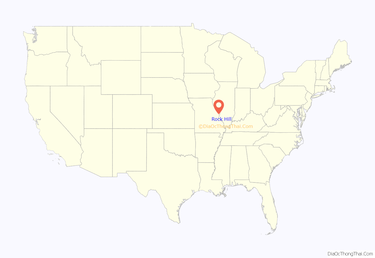
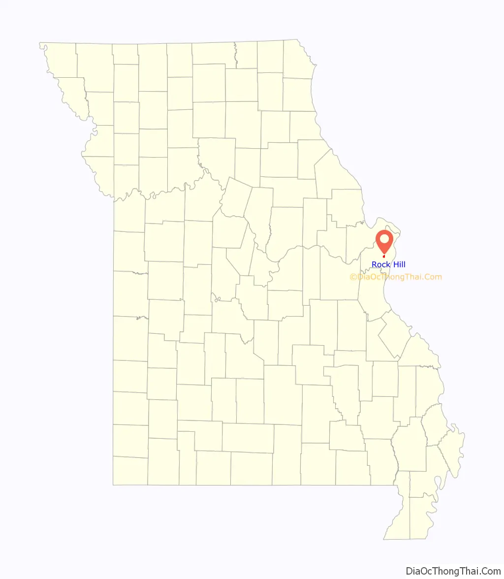
Rock Hill location map. Where is Rock Hill city?
History
James Collier Marshall settled what became Rock Hill around 1832. He and his brother John Marshall purchased 800 acres along Manchester Road where he and his brother built a log building that operated as a home and store.
In 1839 James built a two-story weatherboard home, naming it “Fairfax” after a family friend in Maryland, Albert Kirby Fairfax, Lord Fairfax of Cameron. A year later the property was divided between James and John Marshall when James married Elizabeth Kyle McCausland (she is related to The Robert Campbell Family of St Louis thru the Kyle’s). Fairfax was completed the following year. James and Elizabeth had five children who lived to maturity. A son, Ernest, the only to marry and have children, raised two sons.
James Marshall sought to build a church and requested the services of the Presbyterian Church of St. Louis, which sent Rev Artemus Bullard to assist Marshall in 1845. A Presbyterian congregation was established in Rock Hill in March 1845, and met in a log house on Marshall’s property while the church was built on land contributed by Marshall for a church. Though there is no written proof, it is assumed by many that slaves built the church using stone quarried from the Marshall farm quarry. Rev. Bullard gave the church the name “Rock Hill Presbyterian Church,” presumably after two geographic features in the area, which became the namesake of the area. In 1866 fifteen members separated to found the Webster Groves Presbyterian Church
Marshall served as first postmaster at Fairfax House c. 1845. Marshall died in February 1864. The post office was closed in 1863, only to reopen a year later until 1897, whereupon mail service was moved to Webster Groves.
Mail service was re-established in February 1874.
Rock Hill was a stop near present-day Creve Coeur Drive on the Missouri Pacific spur from Creve Coeur, Missouri to downtown St. Louis. Trains ran twice daily. In 1934 Rock Hill Investment Co. purchased 22.93 acres on the railroad from Rock Hill Supply Co. for an industrial subdivision In 1954 Walter F. Hellmich purchased 15 acres to develop an “Industrial Court.” In 1969 Rock Hill notified Missouri Pacific it would condemn its station.
Rock Hill remained largely undeveloped until the 1920s when much of the area was parceled for the construction of houses. In 1940 a 27-acre subdivision was created south of Manchester road. In April 1929 Rock Hill was incorporated as a village. The village switched to a mayor–aldermanic form of government in 1941. In April 1947 the Village of Rock Hill voted to incorporate as a fourth class city.
On 10 February 1959 a powerful tornado struck Rock Hill north of Manchester, destroying Mackle Florist (1913–1965) and continued onward into St. Louis.
In April 1962 the city voted to annex the eastern half of Des Peres Avenue.
The city flag was presented by the Citizens of Rock Hill Improvement Association in May 1965.
In 2006 Rock Hill began transitioning from a residential city to a point-of-sale city with a retail development project on Manchester. With city financial reserves at critical levels, city administrator George Liyeos told the Post-Dispatch “our entire future hinges on the success of that project.”
The 30th annual Rock Hill Fall Festival was held in 2013.
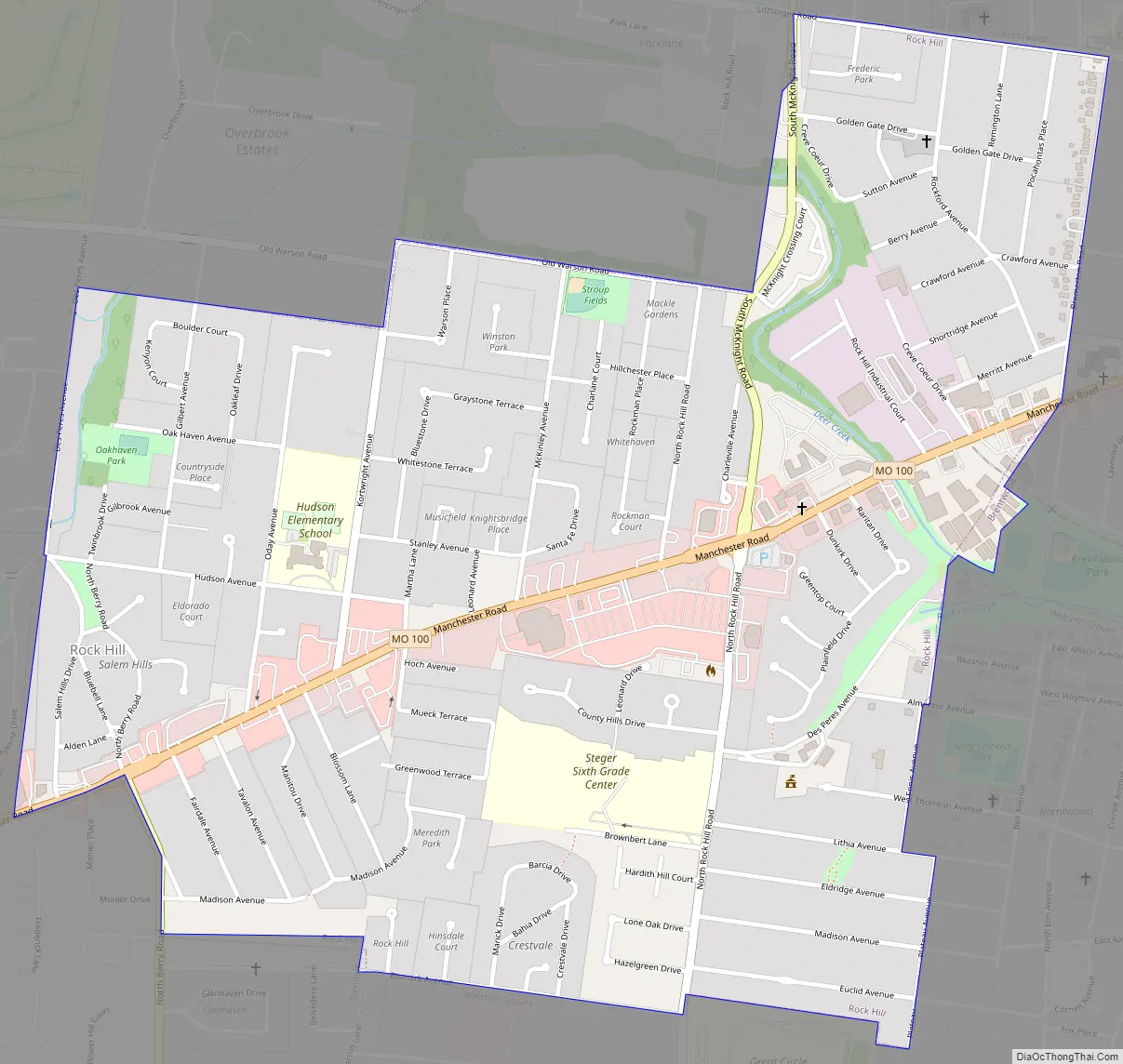
Rock Hill Road Map
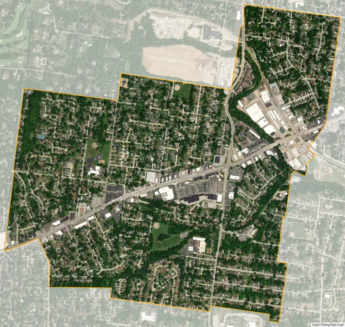
Rock Hill city Satellite Map
Geography
According to the United States Census Bureau, the city has a total area of 1.09 square miles (2.82 km), all land.
Rock Hill is bounded by cities Ladue, Brentwood, Webster Groves, Glendale and Warson Woods.
Manchester Road is four lanes and runs east–west across Rock Hill. North Rock Hill Road was connected to the South McKnight Road extension in June 1962. Voters passed a $3 million bond issue to repair roads in 2000. By 2005 the fund was nearly depleted with considerable work left to be done. Voters passed a proposition in 2011 to extend the street bond issue, allowing the city to raise an additional $3.5 million.
In October 2019, the board of aldermen voted to lower the speed limit on most streets to 20 miles per hour.
See also
Map of Missouri State and its subdivision:- Adair
- Andrew
- Atchison
- Audrain
- Barry
- Barton
- Bates
- Benton
- Bollinger
- Boone
- Buchanan
- Butler
- Caldwell
- Callaway
- Camden
- Cape Girardeau
- Carroll
- Carter
- Cass
- Cedar
- Chariton
- Christian
- Clark
- Clay
- Clinton
- Cole
- Cooper
- Crawford
- Dade
- Dallas
- Daviess
- De Kalb
- Dent
- Douglas
- Dunklin
- Franklin
- Gasconade
- Gentry
- Greene
- Grundy
- Harrison
- Henry
- Hickory
- Holt
- Howard
- Howell
- Iron
- Jackson
- Jasper
- Jefferson
- Johnson
- Knox
- Laclede
- Lafayette
- Lawrence
- Lewis
- Lincoln
- Linn
- Livingston
- Macon
- Madison
- Maries
- Marion
- McDonald
- Mercer
- Miller
- Mississippi
- Moniteau
- Monroe
- Montgomery
- Morgan
- New Madrid
- Newton
- Nodaway
- Oregon
- Osage
- Ozark
- Pemiscot
- Perry
- Pettis
- Phelps
- Pike
- Platte
- Polk
- Pulaski
- Putnam
- Ralls
- Randolph
- Ray
- Reynolds
- Ripley
- Saint Charles
- Saint Clair
- Saint Francois
- Saint Louis
- Sainte Genevieve
- Saline
- Schuyler
- Scotland
- Scott
- Shannon
- Shelby
- Stoddard
- Stone
- Sullivan
- Taney
- Texas
- Vernon
- Warren
- Washington
- Wayne
- Webster
- Worth
- Wright
- Alabama
- Alaska
- Arizona
- Arkansas
- California
- Colorado
- Connecticut
- Delaware
- District of Columbia
- Florida
- Georgia
- Hawaii
- Idaho
- Illinois
- Indiana
- Iowa
- Kansas
- Kentucky
- Louisiana
- Maine
- Maryland
- Massachusetts
- Michigan
- Minnesota
- Mississippi
- Missouri
- Montana
- Nebraska
- Nevada
- New Hampshire
- New Jersey
- New Mexico
- New York
- North Carolina
- North Dakota
- Ohio
- Oklahoma
- Oregon
- Pennsylvania
- Rhode Island
- South Carolina
- South Dakota
- Tennessee
- Texas
- Utah
- Vermont
- Virginia
- Washington
- West Virginia
- Wisconsin
- Wyoming


