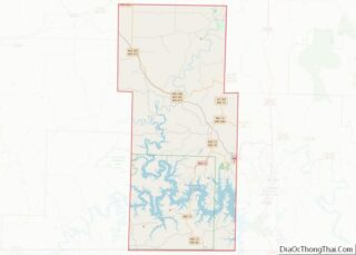
Shell Knob is a census-designated place (CDP) located within White River Township, Barry County, Missouri. The population was 1,254 at the 2020 census.
The Stone County portion of Shell Knob is part of the Branson, Missouri Micropolitan Statistical Area.
| Name: | Shell Knob CDP |
|---|---|
| LSAD Code: | 57 |
| LSAD Description: | CDP (suffix) |
| State: | Missouri |
| County: | Barry County, Stone County |
| Elevation: | 915 ft (279 m) |
| Total Area: | 12.91 sq mi (33.43 km²) |
| Land Area: | 9.48 sq mi (24.55 km²) |
| Water Area: | 3.43 sq mi (8.88 km²) |
| Total Population: | 1,254 |
| Population Density: | 132.31/sq mi (51.08/km²) |
| ZIP code: | 65747 |
| Area code: | 417 |
| FIPS code: | 2967232 |
| GNISfeature ID: | 2393231 |
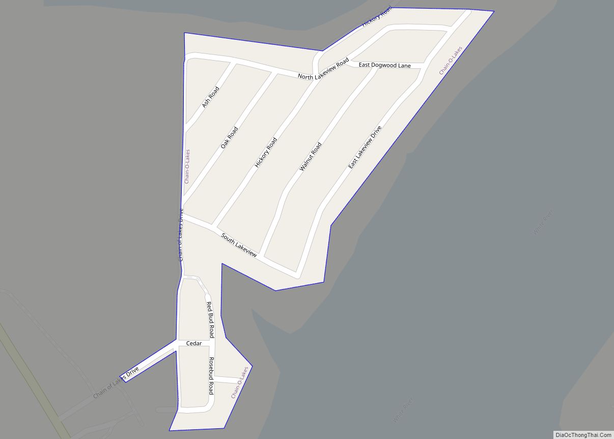
Online Interactive Map
Click on ![]() to view map in "full screen" mode.
to view map in "full screen" mode.
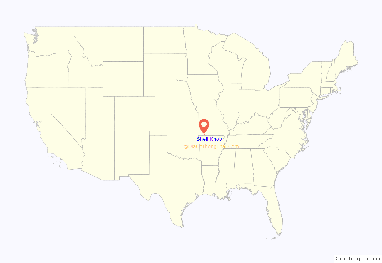
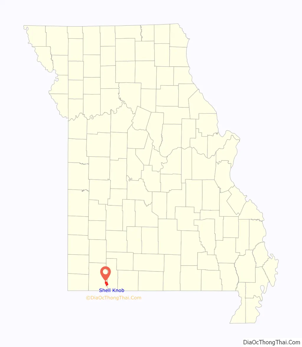
Shell Knob location map. Where is Shell Knob CDP?
History
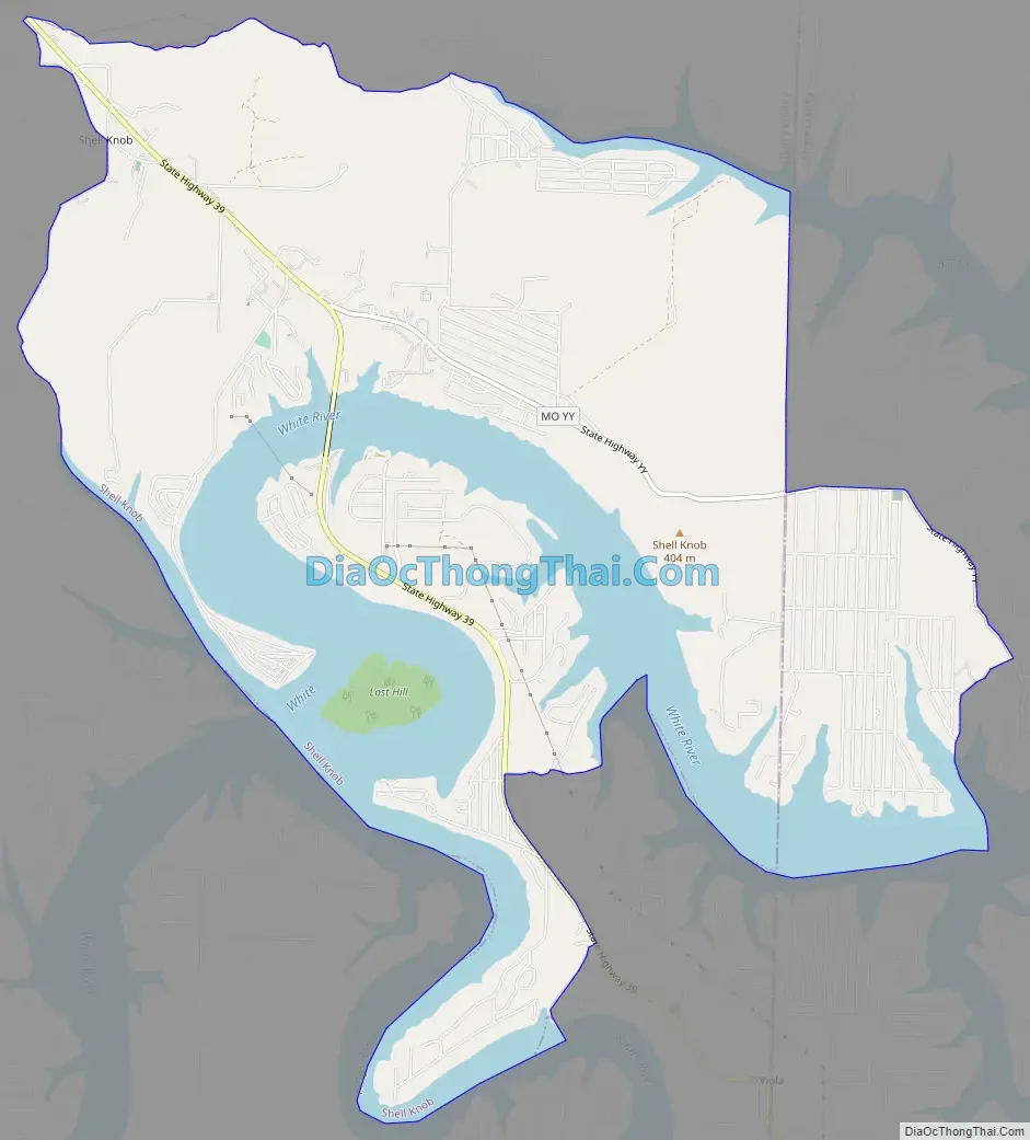
Located in the Ozark Mountains, Shell Knob was established in 1835 on the banks of the White River when Henry and Elizabeth Yoachum Schell built a trading post. The “c” was left off the name when the post office was established in 1872. The Schells left in 1846 and went on to establish the community of Jacket, Missouri. In 1959, Table Rock Dam was completed and Table Rock Lake filled.
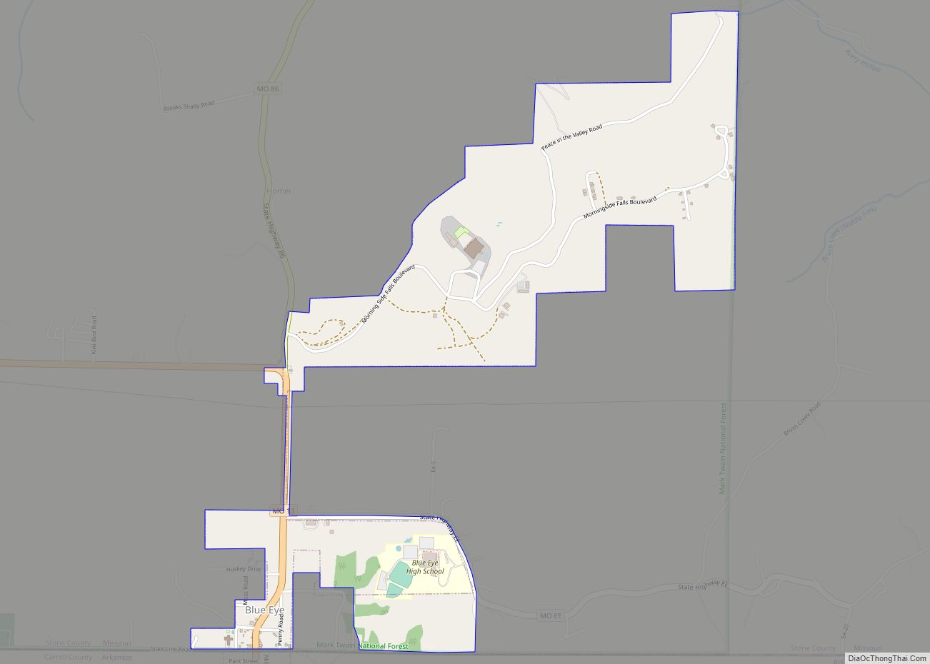
Shell Knob Road Map
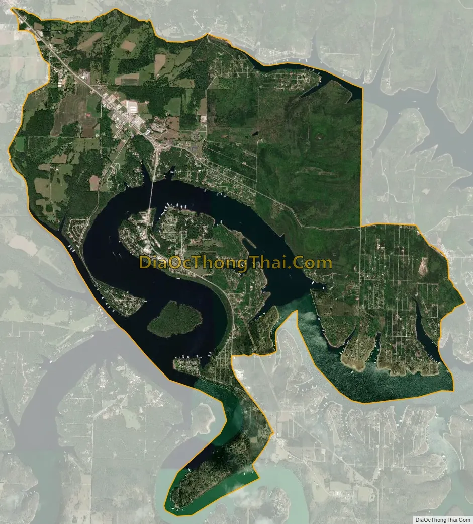
Shell Knob city Satellite Map
Geography
Shell Knob is located on Missouri Route 39 on the north shore of Table Rock Lake. Shell Knob is an active lake resort area on Table Rock Lake with a population of more than 1,200.
According to the United States Census Bureau, the CDP has a total area of 10.9 square miles (28.2 km), of which 8.2 square miles (21.3 km) is land and 2.6 square miles (6.8 km), or 24.25%, is water.
See also
Map of Missouri State and its subdivision:- Adair
- Andrew
- Atchison
- Audrain
- Barry
- Barton
- Bates
- Benton
- Bollinger
- Boone
- Buchanan
- Butler
- Caldwell
- Callaway
- Camden
- Cape Girardeau
- Carroll
- Carter
- Cass
- Cedar
- Chariton
- Christian
- Clark
- Clay
- Clinton
- Cole
- Cooper
- Crawford
- Dade
- Dallas
- Daviess
- De Kalb
- Dent
- Douglas
- Dunklin
- Franklin
- Gasconade
- Gentry
- Greene
- Grundy
- Harrison
- Henry
- Hickory
- Holt
- Howard
- Howell
- Iron
- Jackson
- Jasper
- Jefferson
- Johnson
- Knox
- Laclede
- Lafayette
- Lawrence
- Lewis
- Lincoln
- Linn
- Livingston
- Macon
- Madison
- Maries
- Marion
- McDonald
- Mercer
- Miller
- Mississippi
- Moniteau
- Monroe
- Montgomery
- Morgan
- New Madrid
- Newton
- Nodaway
- Oregon
- Osage
- Ozark
- Pemiscot
- Perry
- Pettis
- Phelps
- Pike
- Platte
- Polk
- Pulaski
- Putnam
- Ralls
- Randolph
- Ray
- Reynolds
- Ripley
- Saint Charles
- Saint Clair
- Saint Francois
- Saint Louis
- Sainte Genevieve
- Saline
- Schuyler
- Scotland
- Scott
- Shannon
- Shelby
- Stoddard
- Stone
- Sullivan
- Taney
- Texas
- Vernon
- Warren
- Washington
- Wayne
- Webster
- Worth
- Wright
- Alabama
- Alaska
- Arizona
- Arkansas
- California
- Colorado
- Connecticut
- Delaware
- District of Columbia
- Florida
- Georgia
- Hawaii
- Idaho
- Illinois
- Indiana
- Iowa
- Kansas
- Kentucky
- Louisiana
- Maine
- Maryland
- Massachusetts
- Michigan
- Minnesota
- Mississippi
- Missouri
- Montana
- Nebraska
- Nevada
- New Hampshire
- New Jersey
- New Mexico
- New York
- North Carolina
- North Dakota
- Ohio
- Oklahoma
- Oregon
- Pennsylvania
- Rhode Island
- South Carolina
- South Dakota
- Tennessee
- Texas
- Utah
- Vermont
- Virginia
- Washington
- West Virginia
- Wisconsin
- Wyoming