St. Ann or Saint Ann is a city in northwest St. Louis County, Missouri, United States. The population was 13,019 at the 2020 census.
| Name: | St. Ann city |
|---|---|
| LSAD Code: | 25 |
| LSAD Description: | city (suffix) |
| State: | Missouri |
| County: | St. Louis County |
| Elevation: | 594 ft (181 m) |
| Total Area: | 3.15 sq mi (8.17 km²) |
| Land Area: | 3.15 sq mi (8.17 km²) |
| Water Area: | 0.00 sq mi (0.00 km²) |
| Total Population: | 13,019 |
| Population Density: | 4,126.47/sq mi (1,593.13/km²) |
| ZIP code: | 63074 |
| Area code: | 314 |
| FIPS code: | 2963956 |
| GNISfeature ID: | 2396469 |
| Website: | City of St. Ann official website |
Online Interactive Map
Click on ![]() to view map in "full screen" mode.
to view map in "full screen" mode.
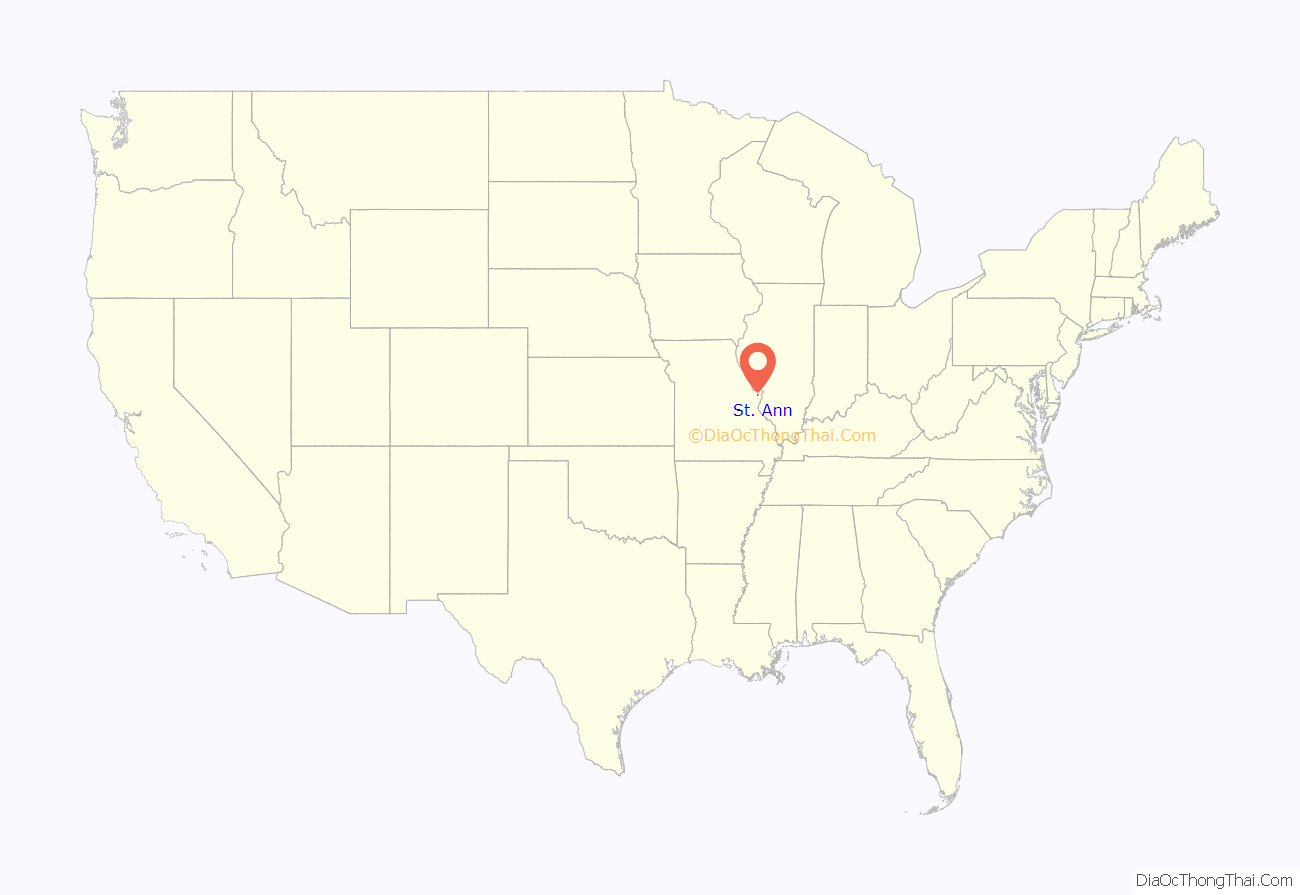
St. Ann location map. Where is St. Ann city?
History
The city was established in 1948 but began to develop six years before it was granted the petition of incorporation. Charles F. Vatterott, the developer and builder of most of the residential and commercial properties in St. Ann, started the community as a housing project for families of workers employed in nearby defense plants. It was one of the few defense housing projects in the country to develop into a permanent town. The original homesite was dedicated in honor of Saint Ann, the mother of the Virgin Mary.
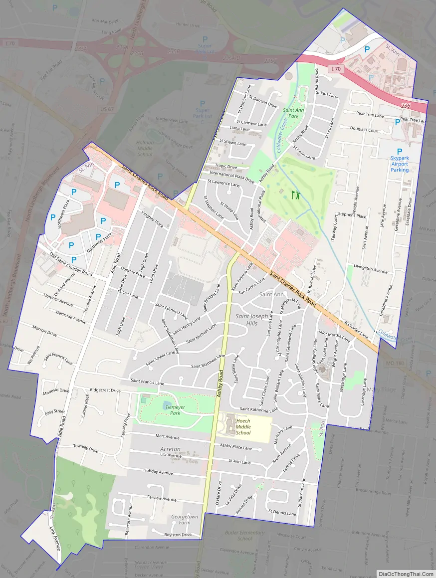
St. Ann Road Map
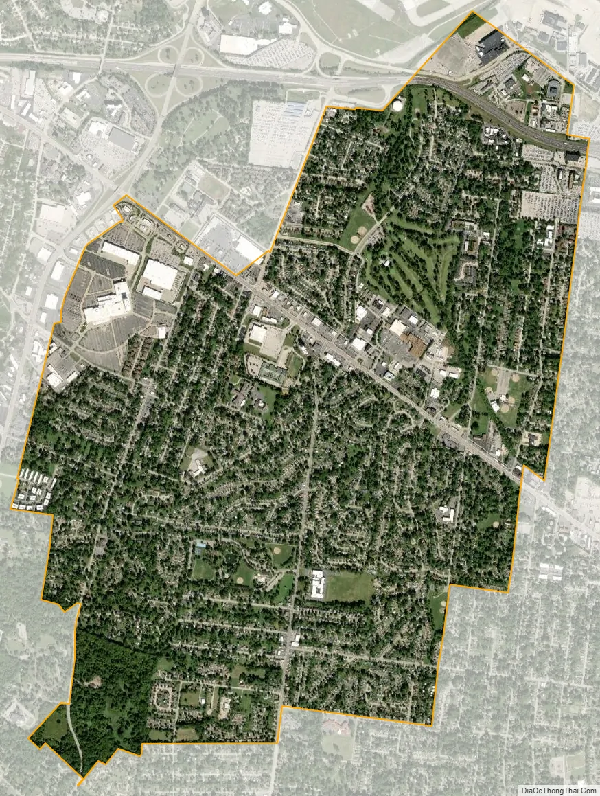
St. Ann city Satellite Map
Geography
St. Ann is located in the north-central part of the St. Louis area. St. Ann also borders Lambert-St. Louis International Airport. Municipal neighbors to St. Ann are Bridgeton, Edmundson, Woodson Terrace, Breckenridge Hills, Overland, and a large portion of unincorporated St. Louis County that lies between Maryland Heights and Creve Coeur.
According to the United States Census Bureau, the city has a total area of 3.18 square miles (8.24 km), all land.
See also
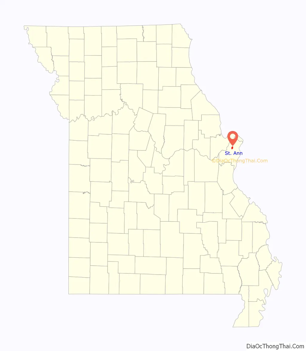
Map of Missouri State and its subdivision:- Adair
- Andrew
- Atchison
- Audrain
- Barry
- Barton
- Bates
- Benton
- Bollinger
- Boone
- Buchanan
- Butler
- Caldwell
- Callaway
- Camden
- Cape Girardeau
- Carroll
- Carter
- Cass
- Cedar
- Chariton
- Christian
- Clark
- Clay
- Clinton
- Cole
- Cooper
- Crawford
- Dade
- Dallas
- Daviess
- De Kalb
- Dent
- Douglas
- Dunklin
- Franklin
- Gasconade
- Gentry
- Greene
- Grundy
- Harrison
- Henry
- Hickory
- Holt
- Howard
- Howell
- Iron
- Jackson
- Jasper
- Jefferson
- Johnson
- Knox
- Laclede
- Lafayette
- Lawrence
- Lewis
- Lincoln
- Linn
- Livingston
- Macon
- Madison
- Maries
- Marion
- McDonald
- Mercer
- Miller
- Mississippi
- Moniteau
- Monroe
- Montgomery
- Morgan
- New Madrid
- Newton
- Nodaway
- Oregon
- Osage
- Ozark
- Pemiscot
- Perry
- Pettis
- Phelps
- Pike
- Platte
- Polk
- Pulaski
- Putnam
- Ralls
- Randolph
- Ray
- Reynolds
- Ripley
- Saint Charles
- Saint Clair
- Saint Francois
- Saint Louis
- Sainte Genevieve
- Saline
- Schuyler
- Scotland
- Scott
- Shannon
- Shelby
- Stoddard
- Stone
- Sullivan
- Taney
- Texas
- Vernon
- Warren
- Washington
- Wayne
- Webster
- Worth
- Wright
- Alabama
- Alaska
- Arizona
- Arkansas
- California
- Colorado
- Connecticut
- Delaware
- District of Columbia
- Florida
- Georgia
- Hawaii
- Idaho
- Illinois
- Indiana
- Iowa
- Kansas
- Kentucky
- Louisiana
- Maine
- Maryland
- Massachusetts
- Michigan
- Minnesota
- Mississippi
- Missouri
- Montana
- Nebraska
- Nevada
- New Hampshire
- New Jersey
- New Mexico
- New York
- North Carolina
- North Dakota
- Ohio
- Oklahoma
- Oregon
- Pennsylvania
- Rhode Island
- South Carolina
- South Dakota
- Tennessee
- Texas
- Utah
- Vermont
- Virginia
- Washington
- West Virginia
- Wisconsin
- Wyoming


