Taos is a city in Cole County, Missouri, United States. The population was 1,150 at the 2020 census. It is part of the Jefferson City, Missouri Metropolitan Statistical Area.
| Name: | Taos city |
|---|---|
| LSAD Code: | 25 |
| LSAD Description: | city (suffix) |
| State: | Missouri |
| County: | Cole County |
| Founded: | 1849 |
| Elevation: | 742 ft (226 m) |
| Total Area: | 6.49 sq mi (16.80 km²) |
| Land Area: | 6.44 sq mi (16.67 km²) |
| Water Area: | 0.05 sq mi (0.13 km²) |
| Total Population: | 1,150 |
| Population Density: | 178.65/sq mi (68.98/km²) |
| ZIP code: | 65101 |
| Area code: | 573 |
| FIPS code: | 2972304 |
| GNISfeature ID: | 2396031 |
| Website: | http://www.cityoftaos.org/index.html |
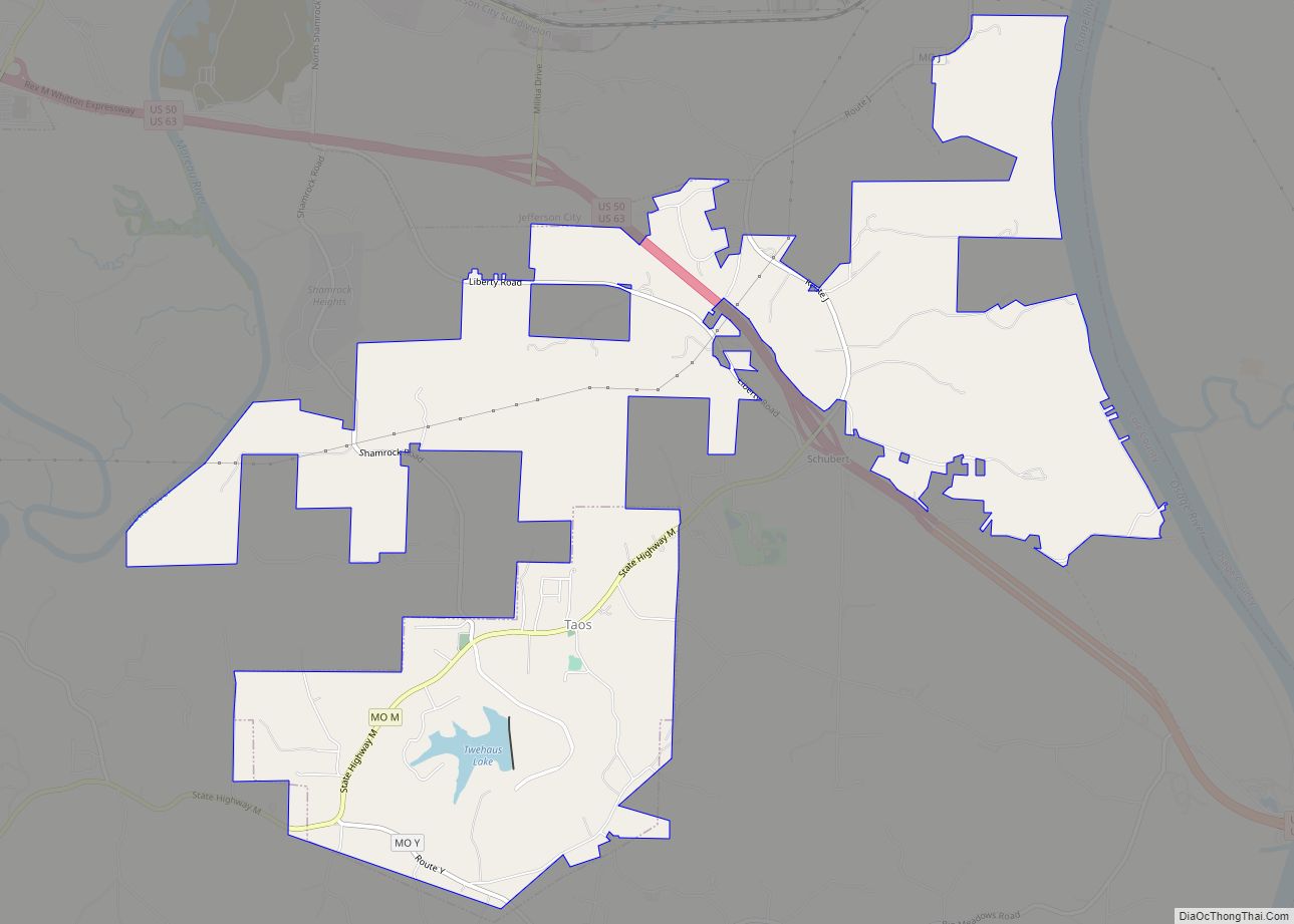
Online Interactive Map
Click on ![]() to view map in "full screen" mode.
to view map in "full screen" mode.
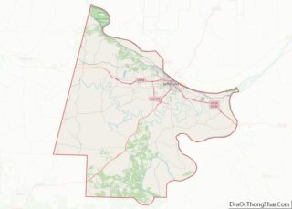
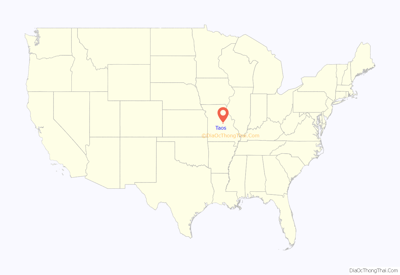
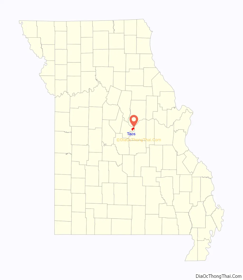
Taos location map. Where is Taos city?
History
Taos was laid out in 1849. The city was named after Taos, New Mexico. A post office called Taos was established in 1848, and remained in operation until 1907.
The St. Francis Xavier Catholic Church and Rectory was listed on the National Register of Historic Places in 2016.
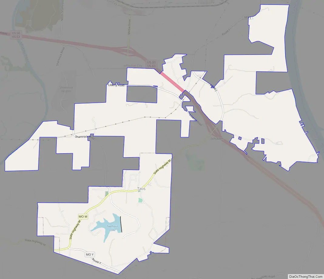
Taos Road Map
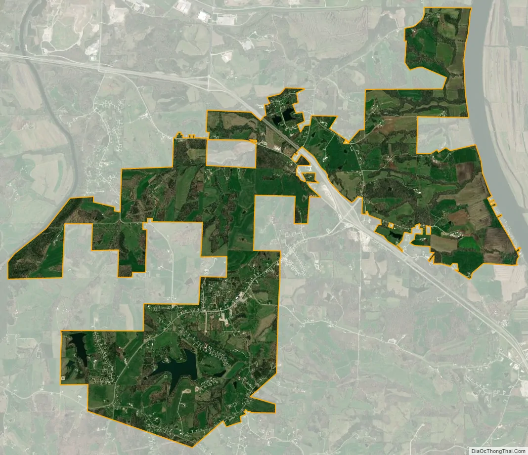
Taos city Satellite Map
Geography
Taos is located in eastern Cole County on Missouri Route M between Wardsville to the west and Schubert to the east.
According to the United States Census Bureau, the city has a total area of 2.27 square miles (5.88 km), of which 2.23 square miles (5.78 km) is land and 0.04 square miles (0.10 km) is water.
See also
Map of Missouri State and its subdivision:- Adair
- Andrew
- Atchison
- Audrain
- Barry
- Barton
- Bates
- Benton
- Bollinger
- Boone
- Buchanan
- Butler
- Caldwell
- Callaway
- Camden
- Cape Girardeau
- Carroll
- Carter
- Cass
- Cedar
- Chariton
- Christian
- Clark
- Clay
- Clinton
- Cole
- Cooper
- Crawford
- Dade
- Dallas
- Daviess
- De Kalb
- Dent
- Douglas
- Dunklin
- Franklin
- Gasconade
- Gentry
- Greene
- Grundy
- Harrison
- Henry
- Hickory
- Holt
- Howard
- Howell
- Iron
- Jackson
- Jasper
- Jefferson
- Johnson
- Knox
- Laclede
- Lafayette
- Lawrence
- Lewis
- Lincoln
- Linn
- Livingston
- Macon
- Madison
- Maries
- Marion
- McDonald
- Mercer
- Miller
- Mississippi
- Moniteau
- Monroe
- Montgomery
- Morgan
- New Madrid
- Newton
- Nodaway
- Oregon
- Osage
- Ozark
- Pemiscot
- Perry
- Pettis
- Phelps
- Pike
- Platte
- Polk
- Pulaski
- Putnam
- Ralls
- Randolph
- Ray
- Reynolds
- Ripley
- Saint Charles
- Saint Clair
- Saint Francois
- Saint Louis
- Sainte Genevieve
- Saline
- Schuyler
- Scotland
- Scott
- Shannon
- Shelby
- Stoddard
- Stone
- Sullivan
- Taney
- Texas
- Vernon
- Warren
- Washington
- Wayne
- Webster
- Worth
- Wright
- Alabama
- Alaska
- Arizona
- Arkansas
- California
- Colorado
- Connecticut
- Delaware
- District of Columbia
- Florida
- Georgia
- Hawaii
- Idaho
- Illinois
- Indiana
- Iowa
- Kansas
- Kentucky
- Louisiana
- Maine
- Maryland
- Massachusetts
- Michigan
- Minnesota
- Mississippi
- Missouri
- Montana
- Nebraska
- Nevada
- New Hampshire
- New Jersey
- New Mexico
- New York
- North Carolina
- North Dakota
- Ohio
- Oklahoma
- Oregon
- Pennsylvania
- Rhode Island
- South Carolina
- South Dakota
- Tennessee
- Texas
- Utah
- Vermont
- Virginia
- Washington
- West Virginia
- Wisconsin
- Wyoming