Tarkio is a city in Tarkio Township, Atchison County, Missouri, United States. The population was 1,506 at the 2020 census. It was platted in 1880 and incorporated in 1881. The name “Tarkio” is from a Native American word meaning “place where walnuts grow”. Historically, the economy of the city was based on agriculture and its status as a college town.
| Name: | Tarkio city |
|---|---|
| LSAD Code: | 25 |
| LSAD Description: | city (suffix) |
| State: | Missouri |
| County: | Atchison County |
| Elevation: | 997 ft (304 m) |
| Total Area: | 1.39 sq mi (3.59 km²) |
| Land Area: | 1.39 sq mi (3.59 km²) |
| Water Area: | 0.00 sq mi (0.00 km²) |
| Total Population: | 1,506 |
| Population Density: | 1,085.80/sq mi (419.32/km²) |
| ZIP code: | 64491 |
| Area code: | 660 |
| FIPS code: | 2972340 |
| GNISfeature ID: | 2396032 |
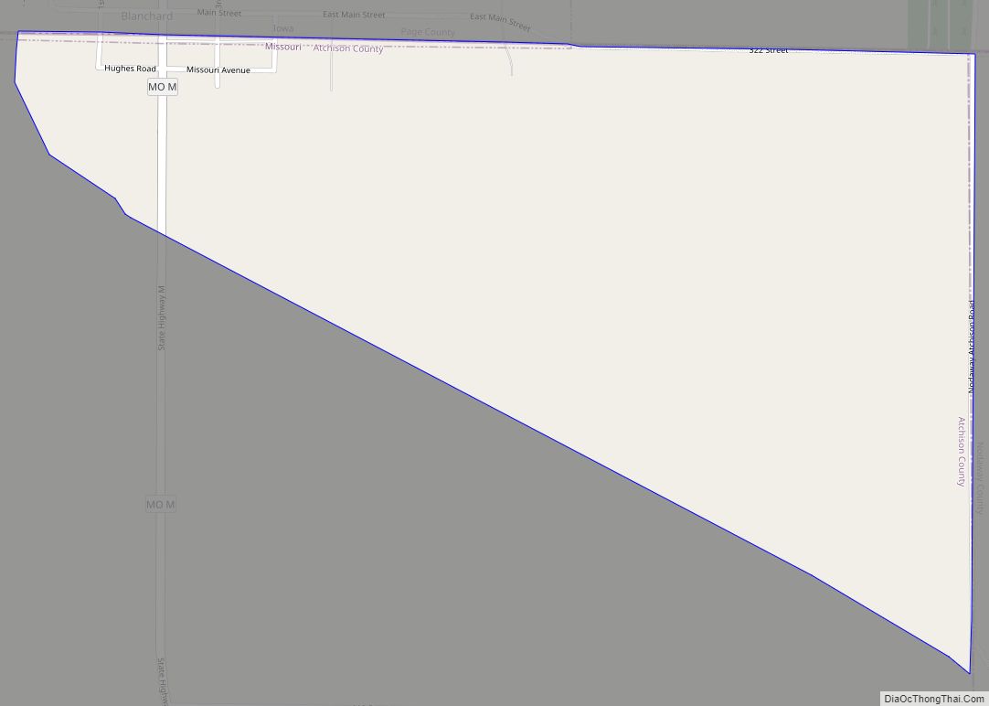
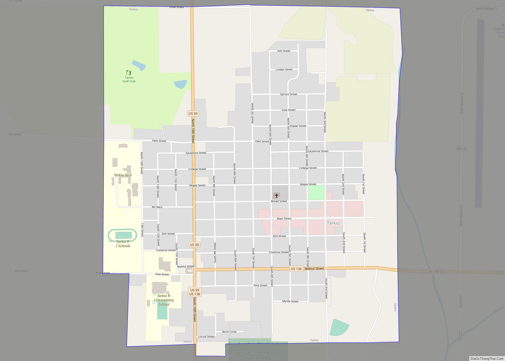
Online Interactive Map
Click on ![]() to view map in "full screen" mode.
to view map in "full screen" mode.
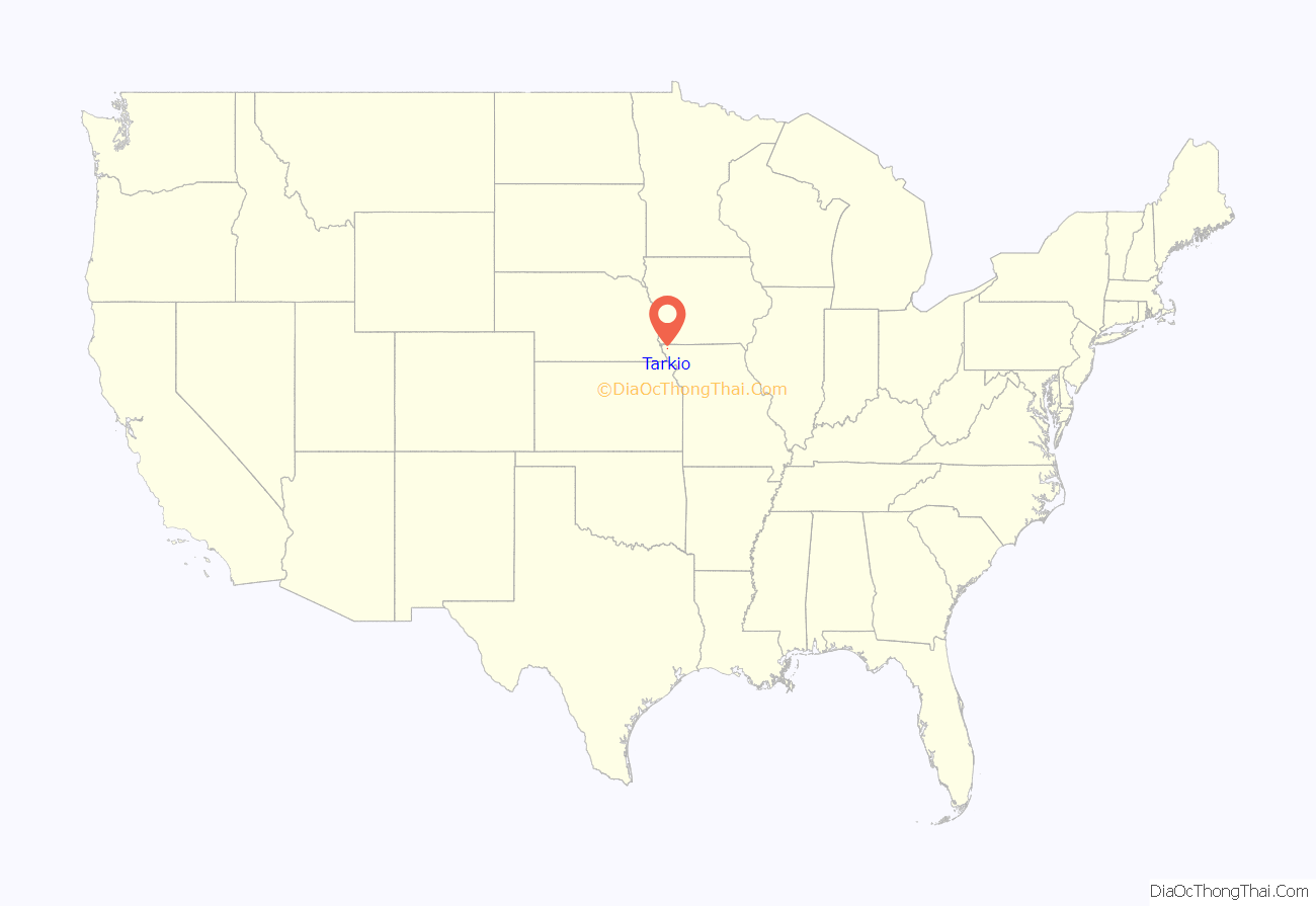
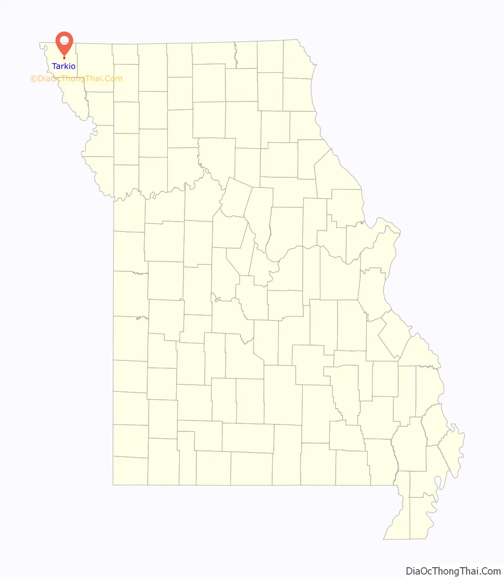
Tarkio location map. Where is Tarkio city?
History
Tarkio was founded by Charles E. Perkins in 1880, and grew rapidly. By 1900, the U.S. Census shows 2,845 persons living in Tarkio. According to the 1910, 1920, and 1930 census, the number of residents held fairly steady for the next 30 years.
One of the community’s most famous landmarks was the Tarkio Mule Barn, an octagonal brick structure built in the early 1890s. It was converted to the Tarkio Mule Barn Theatre which was used by Tarkio College. It was on the National Register of Historic Places, but the building was destroyed in a 1989 fire.
Rankin Hall and the Walnut Inn are listed on the National Register of Historic Places.
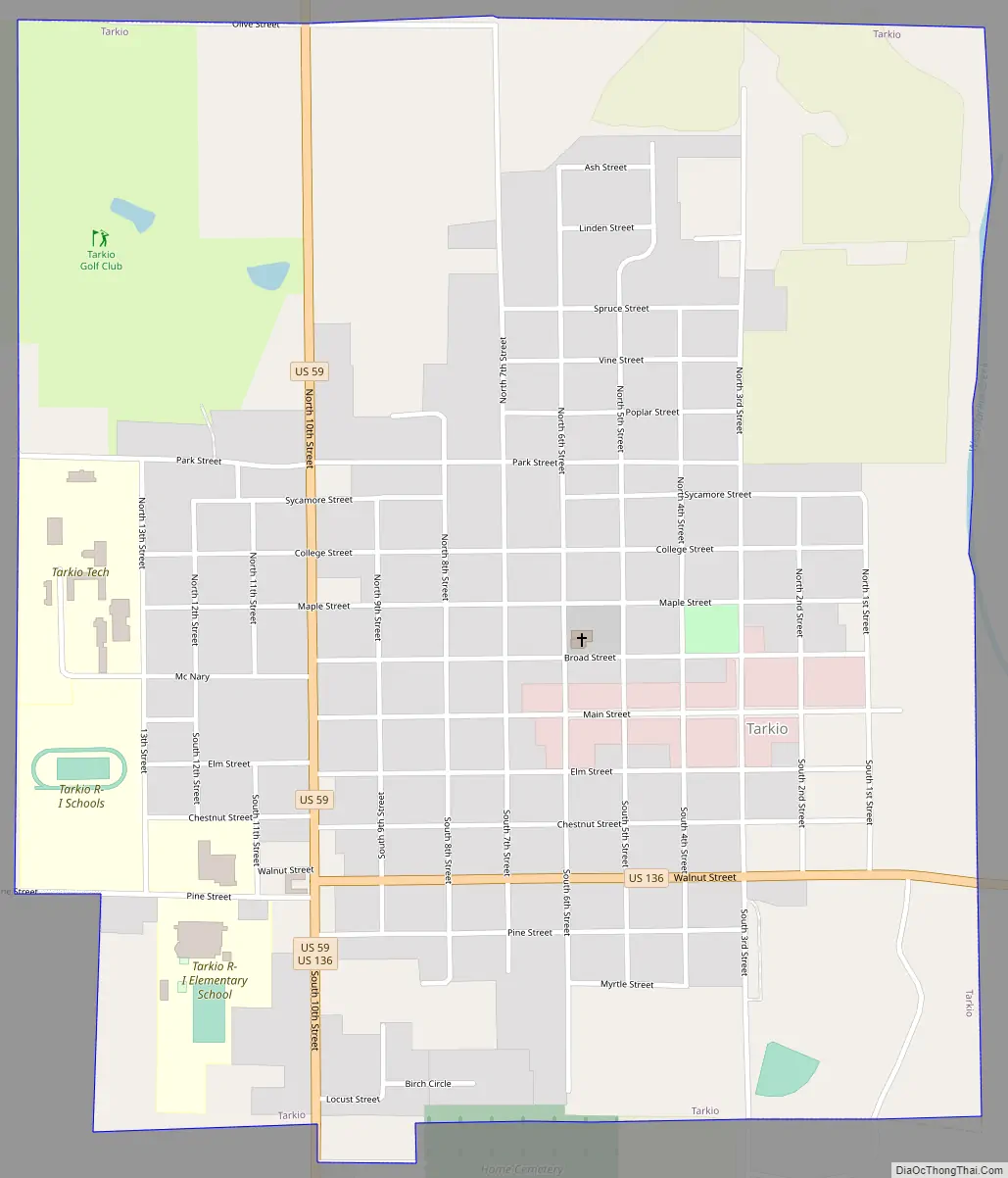
Tarkio Road Map
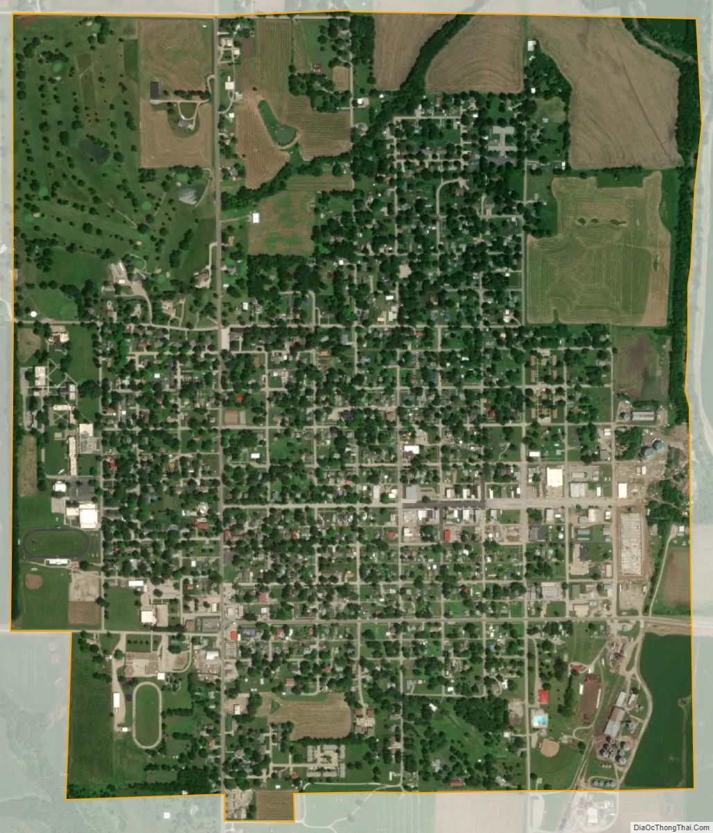
Tarkio city Satellite Map
Geography
According to the United States Census Bureau, the city has a total area of 1.39 square miles (3.60 km), all land.
See also
Map of Missouri State and its subdivision:- Adair
- Andrew
- Atchison
- Audrain
- Barry
- Barton
- Bates
- Benton
- Bollinger
- Boone
- Buchanan
- Butler
- Caldwell
- Callaway
- Camden
- Cape Girardeau
- Carroll
- Carter
- Cass
- Cedar
- Chariton
- Christian
- Clark
- Clay
- Clinton
- Cole
- Cooper
- Crawford
- Dade
- Dallas
- Daviess
- De Kalb
- Dent
- Douglas
- Dunklin
- Franklin
- Gasconade
- Gentry
- Greene
- Grundy
- Harrison
- Henry
- Hickory
- Holt
- Howard
- Howell
- Iron
- Jackson
- Jasper
- Jefferson
- Johnson
- Knox
- Laclede
- Lafayette
- Lawrence
- Lewis
- Lincoln
- Linn
- Livingston
- Macon
- Madison
- Maries
- Marion
- McDonald
- Mercer
- Miller
- Mississippi
- Moniteau
- Monroe
- Montgomery
- Morgan
- New Madrid
- Newton
- Nodaway
- Oregon
- Osage
- Ozark
- Pemiscot
- Perry
- Pettis
- Phelps
- Pike
- Platte
- Polk
- Pulaski
- Putnam
- Ralls
- Randolph
- Ray
- Reynolds
- Ripley
- Saint Charles
- Saint Clair
- Saint Francois
- Saint Louis
- Sainte Genevieve
- Saline
- Schuyler
- Scotland
- Scott
- Shannon
- Shelby
- Stoddard
- Stone
- Sullivan
- Taney
- Texas
- Vernon
- Warren
- Washington
- Wayne
- Webster
- Worth
- Wright
- Alabama
- Alaska
- Arizona
- Arkansas
- California
- Colorado
- Connecticut
- Delaware
- District of Columbia
- Florida
- Georgia
- Hawaii
- Idaho
- Illinois
- Indiana
- Iowa
- Kansas
- Kentucky
- Louisiana
- Maine
- Maryland
- Massachusetts
- Michigan
- Minnesota
- Mississippi
- Missouri
- Montana
- Nebraska
- Nevada
- New Hampshire
- New Jersey
- New Mexico
- New York
- North Carolina
- North Dakota
- Ohio
- Oklahoma
- Oregon
- Pennsylvania
- Rhode Island
- South Carolina
- South Dakota
- Tennessee
- Texas
- Utah
- Vermont
- Virginia
- Washington
- West Virginia
- Wisconsin
- Wyoming