Trenton is a city in Grundy County, Missouri, United States. The population was 5,609 at the 2020 census. It is the county seat of Grundy County. The city used to be the world’s largest producer of vienna sausages (at its biggest employer, the ConAgra Grocery Foods plant, now owned by Nestlé).
| Name: | Trenton city |
|---|---|
| LSAD Code: | 25 |
| LSAD Description: | city (suffix) |
| State: | Missouri |
| County: | Grundy County |
| Elevation: | 768 ft (234 m) |
| Total Area: | 6.74 sq mi (17.44 km²) |
| Land Area: | 6.45 sq mi (16.70 km²) |
| Water Area: | 0.29 sq mi (0.75 km²) |
| Total Population: | 5,609 |
| Population Density: | 870.02/sq mi (335.90/km²) |
| ZIP code: | 64683 |
| Area code: | 660 |
| FIPS code: | 2973816 |
| GNISfeature ID: | 2397050 |
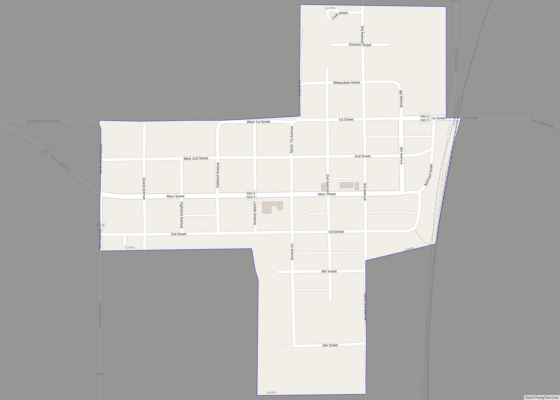
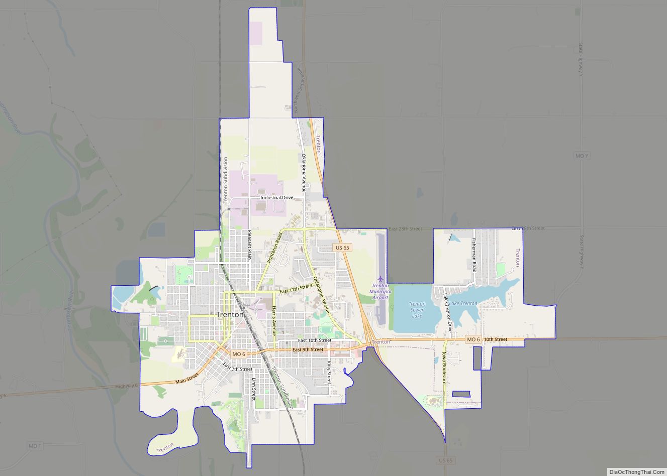
Online Interactive Map
Click on ![]() to view map in "full screen" mode.
to view map in "full screen" mode.
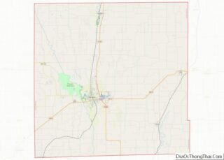
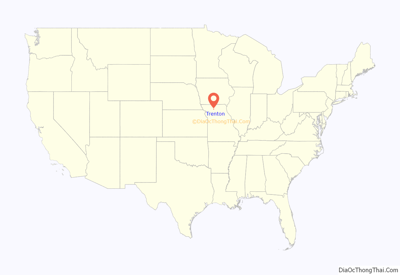
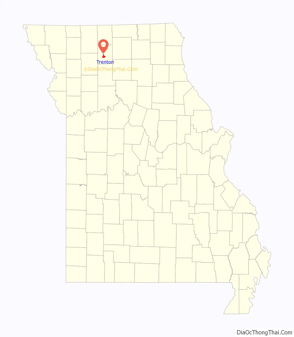
Trenton location map. Where is Trenton city?
History
The Crowder State Park Vehicle Bridge, Jewett Norris Library, Plaza Hotel, St. Philip’s Episcopal Church, Trenton High School, and WPA Stock Barn and Pavilion are listed on the National Register of Historic Places.
The Utopian Socialist Ruskin College Movement
In 1869, the Chicago, Rock Island and Pacific Railroad arrived in Trenton. In 1890 Avalon College, which had been founded in Avalon, Missouri by the United Brethren in 1869, moved to Trenton because of proximity to the railroad.
Due to financial difficulties, the college nearly closed again. In 1900 George McAnelly Miller started to turn the school around. He was soon joined by Walter Vrooman who had just returned from Oxford, England where he established Ruskin Hall, a university called the “College for the People” based on the Utopian Socialist writings of John Ruskin. Avalon College was renamed Ruskin College after Vrooman donated 1,500 acres (6.1 km) to it.
The college directly loaned money to the students and they could work at the school’s canning, farming and novelty wood working businesses. The college admitted women (unlike the Oxford school).
Vrooman then proceeded to attempt to buy the major businesses in the town buying three grocery stores, a hardware store, drug store—paying for it all in cash via the Western Cooperative Association. The New York Times on April 14, 1902, headlined its article on the development “Buying a Town Outright.” According to the cooperative arrangement, members of the coop who spent at least $300 in one of its stores would receive a dividend at the end of the year.
The Ruskin experiment collapsed in 1903 when town residents resisted the Utopian business model and Vrooman’s wife divorced him saying that he had squandered $250,000 of her money. Miller moved the college to the Chicago suburb of Glen Ellyn, Illinois in 1903 where it consolidated 12 different colleges and had an enrollment of 2,500 with 8,000 correspondence students. Friction quickly arose there also and the main school burned after being struck by lightning.
Miller moved the college again in 1906 to Ruskin, Florida where 550 acres (2.2 km) of land around Trenton was swapped for 12,000 acres (49 km). Many of the Florida campus buildings burned in 1918 and when Miller died in 1919, the college ceased to exist.
In 1925, Trenton Junior College was established (which is now North Central Missouri College). Through expansion projects and support from numerous people, North Central Missouri College (NCMC) has developed into a major agricultural and nursing educational institution for the state of Missouri. Construction additions have since added to the size of the main campus. Plus directly south of Trenton, a project completed in 2011 established a satellite agricultural location known as the Barton Farm Campus. It contains three classroom buildings, a wind turbine, two acre pond and numerous test plots all on 138 acres of farm ground given to NCMC by the Barton family.
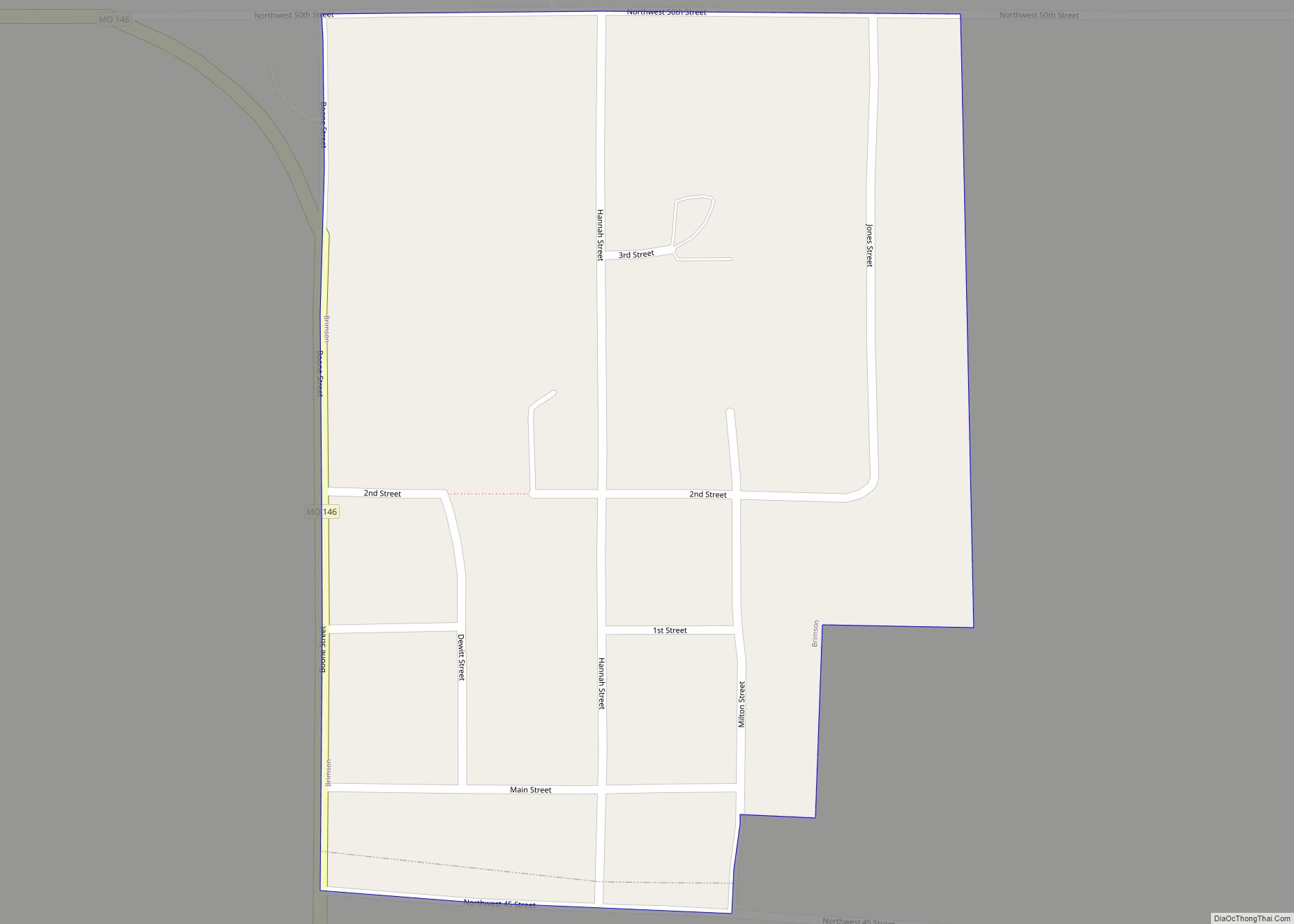
Trenton Road Map
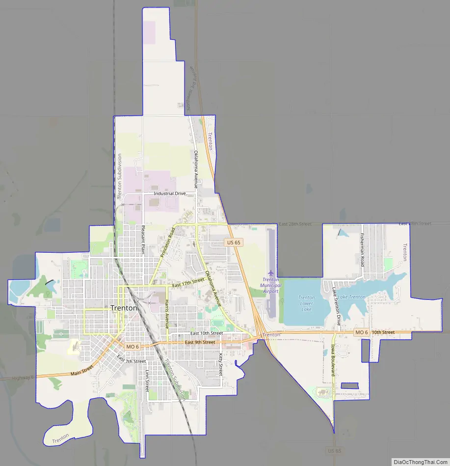
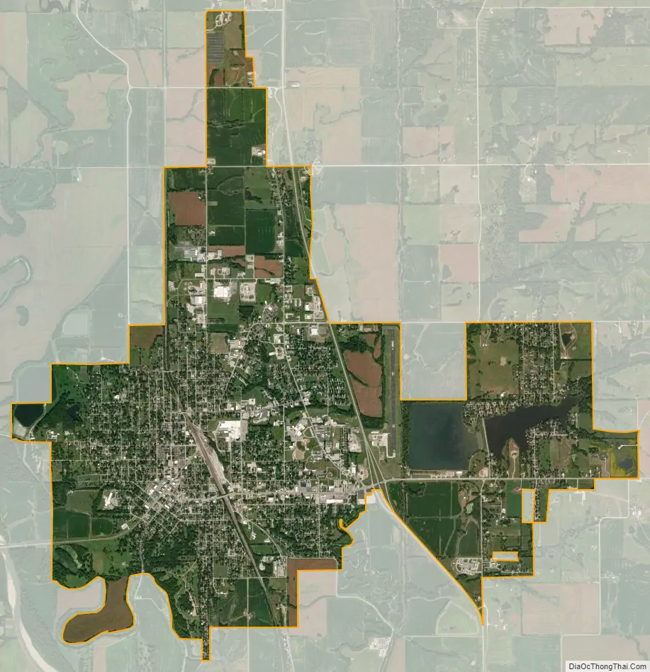
Trenton city Satellite Map
Geography
The city is on the Thompson River floodplain between the Thompson River on the west and its Muddy Creek tributary on the east. U.S. Route 65 passes the east side of the city and Missouri Route 6 passes through the south side. Chillicothe is nineteen miles to the south.
According to the United States Census Bureau, the city has a total area of 6.74 square miles (17.46 km), of which 6.45 square miles (16.71 km) is land and 0.29 square miles (0.75 km) is water.
Climate
See also
Map of Missouri State and its subdivision:- Adair
- Andrew
- Atchison
- Audrain
- Barry
- Barton
- Bates
- Benton
- Bollinger
- Boone
- Buchanan
- Butler
- Caldwell
- Callaway
- Camden
- Cape Girardeau
- Carroll
- Carter
- Cass
- Cedar
- Chariton
- Christian
- Clark
- Clay
- Clinton
- Cole
- Cooper
- Crawford
- Dade
- Dallas
- Daviess
- De Kalb
- Dent
- Douglas
- Dunklin
- Franklin
- Gasconade
- Gentry
- Greene
- Grundy
- Harrison
- Henry
- Hickory
- Holt
- Howard
- Howell
- Iron
- Jackson
- Jasper
- Jefferson
- Johnson
- Knox
- Laclede
- Lafayette
- Lawrence
- Lewis
- Lincoln
- Linn
- Livingston
- Macon
- Madison
- Maries
- Marion
- McDonald
- Mercer
- Miller
- Mississippi
- Moniteau
- Monroe
- Montgomery
- Morgan
- New Madrid
- Newton
- Nodaway
- Oregon
- Osage
- Ozark
- Pemiscot
- Perry
- Pettis
- Phelps
- Pike
- Platte
- Polk
- Pulaski
- Putnam
- Ralls
- Randolph
- Ray
- Reynolds
- Ripley
- Saint Charles
- Saint Clair
- Saint Francois
- Saint Louis
- Sainte Genevieve
- Saline
- Schuyler
- Scotland
- Scott
- Shannon
- Shelby
- Stoddard
- Stone
- Sullivan
- Taney
- Texas
- Vernon
- Warren
- Washington
- Wayne
- Webster
- Worth
- Wright
- Alabama
- Alaska
- Arizona
- Arkansas
- California
- Colorado
- Connecticut
- Delaware
- District of Columbia
- Florida
- Georgia
- Hawaii
- Idaho
- Illinois
- Indiana
- Iowa
- Kansas
- Kentucky
- Louisiana
- Maine
- Maryland
- Massachusetts
- Michigan
- Minnesota
- Mississippi
- Missouri
- Montana
- Nebraska
- Nevada
- New Hampshire
- New Jersey
- New Mexico
- New York
- North Carolina
- North Dakota
- Ohio
- Oklahoma
- Oregon
- Pennsylvania
- Rhode Island
- South Carolina
- South Dakota
- Tennessee
- Texas
- Utah
- Vermont
- Virginia
- Washington
- West Virginia
- Wisconsin
- Wyoming