West Plains is a city in and the county seat of Howell County, Missouri, United States. The population was 12,184 at the 2020 census.
| Name: | West Plains city |
|---|---|
| LSAD Code: | 25 |
| LSAD Description: | city (suffix) |
| State: | Missouri |
| County: | Howell County |
| Elevation: | 994 ft (303 m) |
| Total Area: | 13.33 sq mi (34.51 km²) |
| Land Area: | 13.30 sq mi (34.46 km²) |
| Water Area: | 0.02 sq mi (0.05 km²) 0.15% |
| Total Population: | 12,184 |
| Population Density: | 915.81/sq mi (353.59/km²) |
| ZIP code: | 65775 |
| Area code: | 417 |
| FIPS code: | 2978928 |
| Website: | westplains.gov |
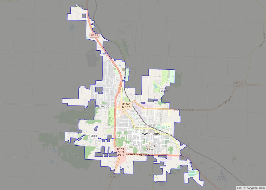
Online Interactive Map
Click on ![]() to view map in "full screen" mode.
to view map in "full screen" mode.
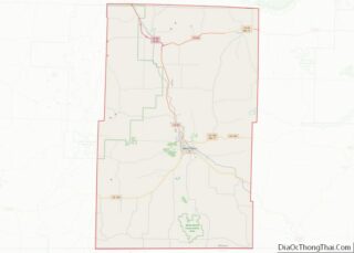
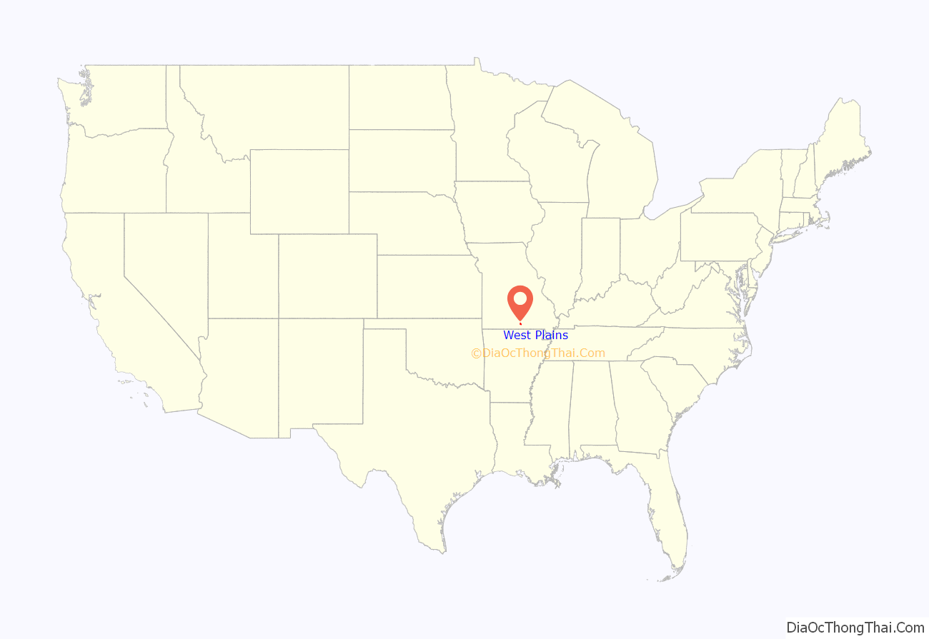
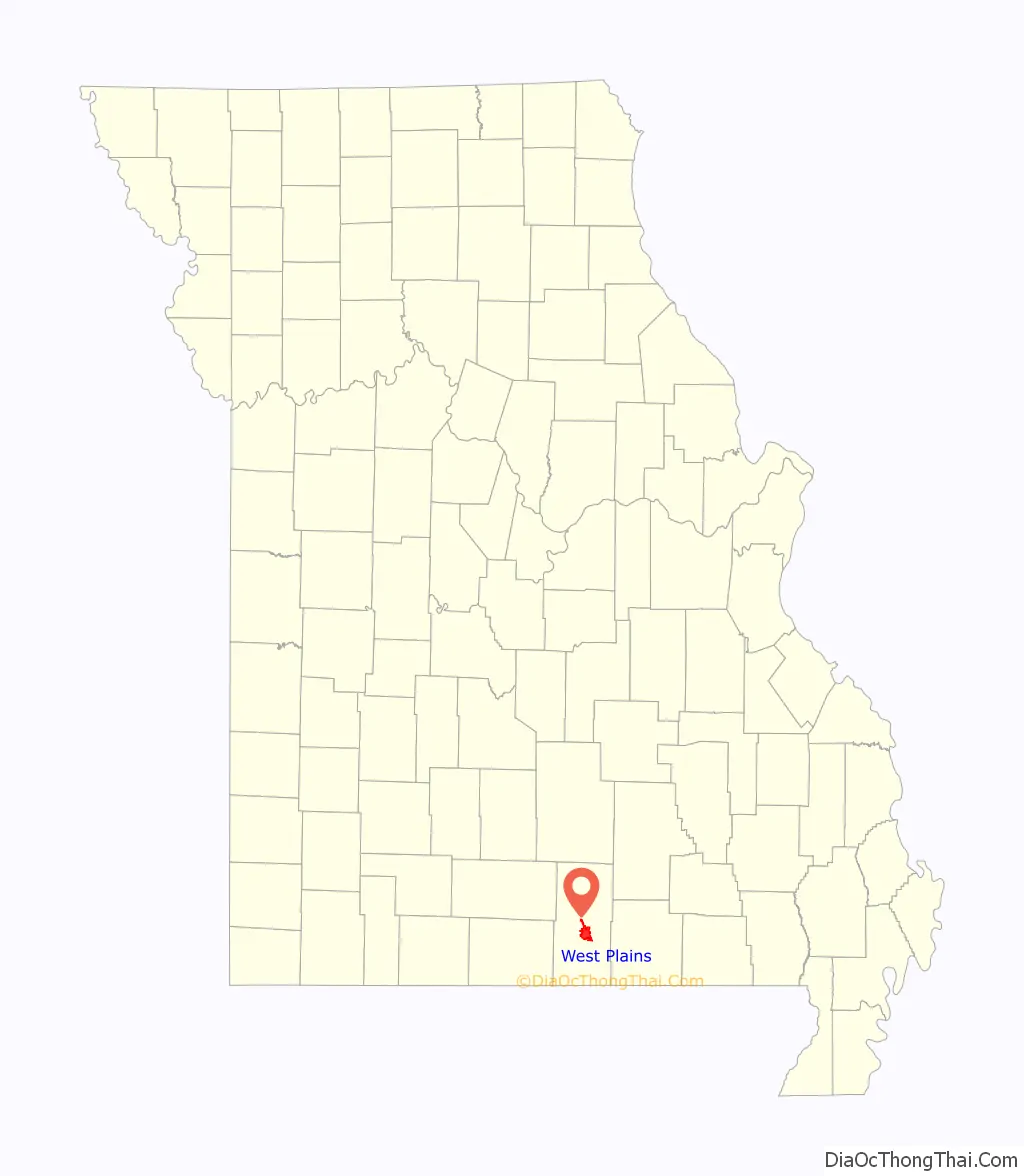
West Plains location map. Where is West Plains city?
History
The history of West Plains can be traced back to 1832, when settler Josiah Howell (after whom Howell County is named) created the first settlement in the region known as Howell Valley. West Plains was so named because the settlement was on a prairie in a westerly direction from the nearest town, Thomasville.
The Courthouse Square Historic District, Elledge Arcade Buildings, International Shoe Company Building, Mount Zion Lodge Masonic Temple, W. J. and Ed Smith Building, and West Plains Bank Building are listed on the National Register of Historic Places.
The American Civil War
The location of West Plains led to nearly constant conflict due to the proximity to what was then the border between the Union and Confederacy. West Plains was largely burned to the ground, and Howell County as a whole was devastated. No major battles occurred in West Plains or Howell County, but much of the devastation came from constant guerrilla warfare.
Confederate Brigadier General James Haggin McBride gave residents an ultimatum to either join the Confederate army or to flee the area. An overwhelming majority of Howell County residents chose to flee, and over 90% of the population had fled by the time the war was over. Many, however, also chose to fight for the Confederacy, as McBride promised to protect his soldiers’ property and loved ones. Men who spoke out against the Confederacy were arrested, as martial law had been declared by McBride.
South Carolina native, and West Plains resident, William Monks, was a scout for the “North” (Union army) and recounted his tales of the Civil War in his 1907 book “A History of Southern Missouri and Northern Arkansas.” In that memoir, Monks recounts many depredations that occurred during the war and how the Confederates referred to those faithful to the Union as “lopeared Dutch” (many Missourians who were “Union men” were German).
20th century
In 1903, African Americans were driven out of West Plains under threat of violence.
The Great Depression era
As was the case with many other locations, the Great Depression hit West Plains in the 1930s. Citizens had little knowledge of what was going on with the national scene, except for what Neathery says in his book, “every place was a boom town, [but] in some places things were going bust as well.” The first bank to fail in West Plains was the Farmers Savings Bank in West Plains circa 1926, and the lack of the present-day Federal Deposit Insurance Corporation meant that some people initially lost whatever wealth was deposited.
On April 13, 1928, for reasons still unknown, a violent explosion occurred in downtown West Plains. About 60 people had gathered in the Bond Dance Hall, which was on the second floor of a building on East Main Street. The explosion was reported to be felt for miles, even in Pomona, which is approximately ten miles from West Plains. Windows were shattered throughout the block, and cars were also warped on the street. The explosion also damaged the nearby Howell County Courthouse so badly that it was vacated and left until late 1933, when it was demolished by the Civil Works Administration. Thirty-seven people were killed in the explosion, and 22 people were injured. Twenty of those killed were never positively identified, but buried in a mass grave at Oak Lawn Cemetery in the southeast part of town. They are memorialized by the Rock of Ages monument, erected on October 6, 1929. The explosion has also been remembered in a folk song recorded 30 years later.
The cause of the explosion is still a topic of controversy nearly a century after the blast. Numerous causes for the explosion have been offered, but a definitive story has never been proven to be true. The most widely accepted theory is that the explosion somehow originated from leaking gasoline in a garage owned by J. W. Wiser, which happened to be on the floor below. Because Wiser was at the garage at the time, some have speculated that the blast was intentionally caused by Wiser as a suicide attempt, which his wife reportedly refused to acknowledge. In addition, the late West Plains native Robert Neathery explained in his 1994 book, West Plains As I Knew It, that a truck containing dynamite parked in the garage may have been the cause, indirectly part of a crime in which someone shot Wiser and set a fire to cover up the crime, and the dynamite exploded.
The event is fictionalized in the short novel The Maid’s Version by Daniel Woodrell, which is about a similar dance hall explosion in the fictional town of West Table.
West Plains Badgers
In 1936, West Plains gained its own Minor League Baseball team named the West Plains Badgers within the Northeast Arkansas League. They would move the same year to Caruthersville, Missouri where they became the Caruthersville Pilots. In 1940, they would move to Batesville, Arkansas, where they were known as the Batesville Pilots. The team disbanded in 1941.
After the Depression
On the evening of April 2, 1982, a long-track F4 tornado struck the West Plains area, beginning in Ozark County and ending near what was the airport at the time. Many homes and businesses were significantly damaged or leveled by the tornado, which killed three and injured at least 28 as it hit the West Plains Country Club and nearby homes, as well as businesses located on U.S. Route 63.
The downtown area of West Plains, namely Court Square, was listed on the National Register of Historic Places on July 17, 2003. The Downtown Revitalization Economic Assistance for Missouri (DREAM) Act also opened up funding for renovations and improvements for certain downtown buildings.
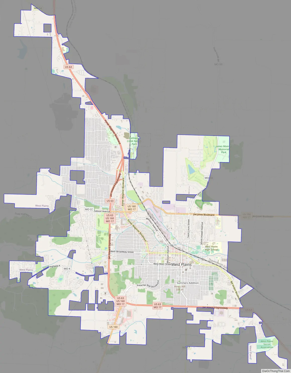
West Plains Road Map
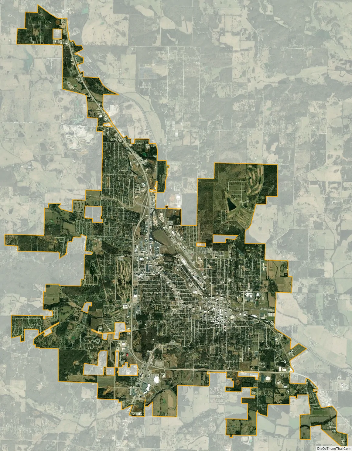
West Plains city Satellite Map
Geography
West Plains is located at 36°44′14″N 91°51′54″W / 36.73722°N 91.86500°W / 36.73722; -91.86500 (36.737355, −91.864991). According to the United States Census Bureau, the city has a total area of 13.33 square miles (34.52 km), of which 13.31 square miles (34.47 km) is land and 0.02 square miles (0.05 km) is water.
Climate
West Plains is characterized by four distinct seasons and is located near the northern border of a humid subtropical climate (Cfa), as defined by the Köppen climate classification system; as such, West Plains tends to be exceptionally humid in the late summer. The monthly daily average temperature ranges from 33 °F (1 °C) in January to 77 °F (25 °C) in July. On average, there are 41 days with highs over 90 °F (32 °C), three with highs over 100 °F (38 °C), 13 days where the temperature does not rise above freezing, and 2 nights of sub-0 °F (−18 °C) lows.
See also
Map of Missouri State and its subdivision:- Adair
- Andrew
- Atchison
- Audrain
- Barry
- Barton
- Bates
- Benton
- Bollinger
- Boone
- Buchanan
- Butler
- Caldwell
- Callaway
- Camden
- Cape Girardeau
- Carroll
- Carter
- Cass
- Cedar
- Chariton
- Christian
- Clark
- Clay
- Clinton
- Cole
- Cooper
- Crawford
- Dade
- Dallas
- Daviess
- De Kalb
- Dent
- Douglas
- Dunklin
- Franklin
- Gasconade
- Gentry
- Greene
- Grundy
- Harrison
- Henry
- Hickory
- Holt
- Howard
- Howell
- Iron
- Jackson
- Jasper
- Jefferson
- Johnson
- Knox
- Laclede
- Lafayette
- Lawrence
- Lewis
- Lincoln
- Linn
- Livingston
- Macon
- Madison
- Maries
- Marion
- McDonald
- Mercer
- Miller
- Mississippi
- Moniteau
- Monroe
- Montgomery
- Morgan
- New Madrid
- Newton
- Nodaway
- Oregon
- Osage
- Ozark
- Pemiscot
- Perry
- Pettis
- Phelps
- Pike
- Platte
- Polk
- Pulaski
- Putnam
- Ralls
- Randolph
- Ray
- Reynolds
- Ripley
- Saint Charles
- Saint Clair
- Saint Francois
- Saint Louis
- Sainte Genevieve
- Saline
- Schuyler
- Scotland
- Scott
- Shannon
- Shelby
- Stoddard
- Stone
- Sullivan
- Taney
- Texas
- Vernon
- Warren
- Washington
- Wayne
- Webster
- Worth
- Wright
- Alabama
- Alaska
- Arizona
- Arkansas
- California
- Colorado
- Connecticut
- Delaware
- District of Columbia
- Florida
- Georgia
- Hawaii
- Idaho
- Illinois
- Indiana
- Iowa
- Kansas
- Kentucky
- Louisiana
- Maine
- Maryland
- Massachusetts
- Michigan
- Minnesota
- Mississippi
- Missouri
- Montana
- Nebraska
- Nevada
- New Hampshire
- New Jersey
- New Mexico
- New York
- North Carolina
- North Dakota
- Ohio
- Oklahoma
- Oregon
- Pennsylvania
- Rhode Island
- South Carolina
- South Dakota
- Tennessee
- Texas
- Utah
- Vermont
- Virginia
- Washington
- West Virginia
- Wisconsin
- Wyoming