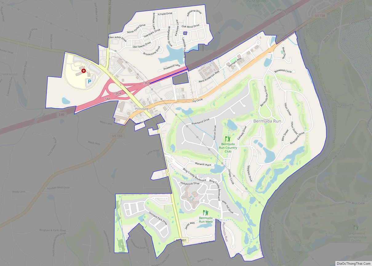
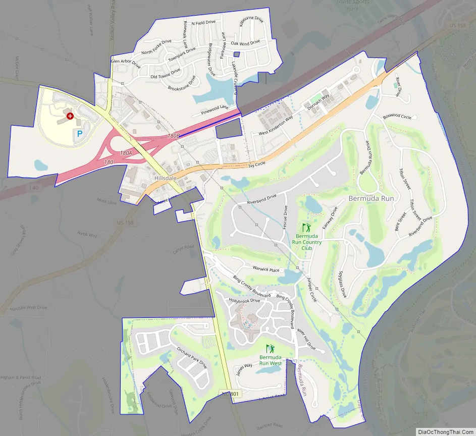
Bermuda Run is a town in Davie County, North Carolina, United States. The population was 1,725 at the 2010 census. It was incorporated in 1999 as a fully gated residential community near country clubs and golf courses like the Bermuda Run Country Club, Oak Valley Golf Club, and Tanglewood Park. In 2000, the town annexed into neighboring Hillsdale, picking up a commercial district. The town rests on the western bank of the Yadkin River along U.S. Route 158 and North Carolina Highway 801. Interstate 40 provides express access to Winston-Salem, the town’s nearest urban center. In 2012, Kinderton Village was voluntarily annexed by the town of Bermuda Run.
| Name: | Bermuda Run town |
|---|---|
| LSAD Code: | 43 |
| LSAD Description: | town (suffix) |
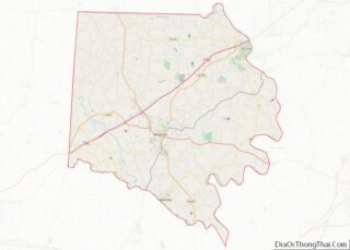
| State: | North Carolina |
| County: | Davie County |
| Elevation: | 794 ft (242 m) |
| Total Area: | 2.56 sq mi (6.64 km²) |
| Land Area: | 2.50 sq mi (6.46 km²) |
| Water Area: | 0.07 sq mi (0.18 km²) |
| Total Population: | 3,120 |
| Population Density: | 1,250.50/sq mi (482.77/km²) |
| ZIP code: | 27006 |
| Area code: | 336 |
| FIPS code: | 3705135 |
| GNISfeature ID: | 1002207 |
| Website: | townofbr.com |
Online Interactive Map
Click on ![]() to view map in "full screen" mode.
to view map in "full screen" mode.
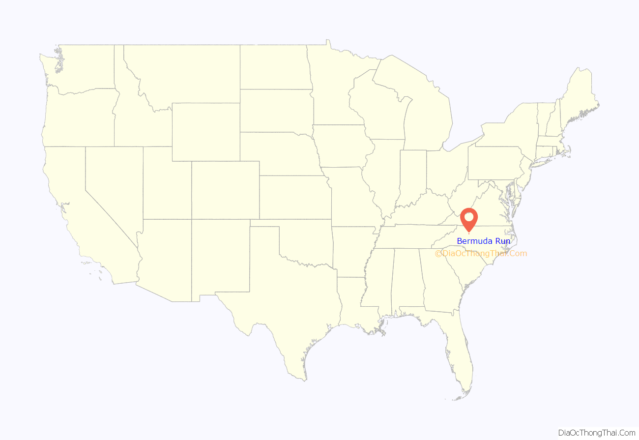
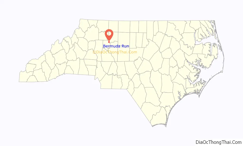
Bermuda Run location map. Where is Bermuda Run town?
History
Win-Mock Farm Dairy was listed on the National Register of Historic Places in 2010.
Bermuda Run Road Map
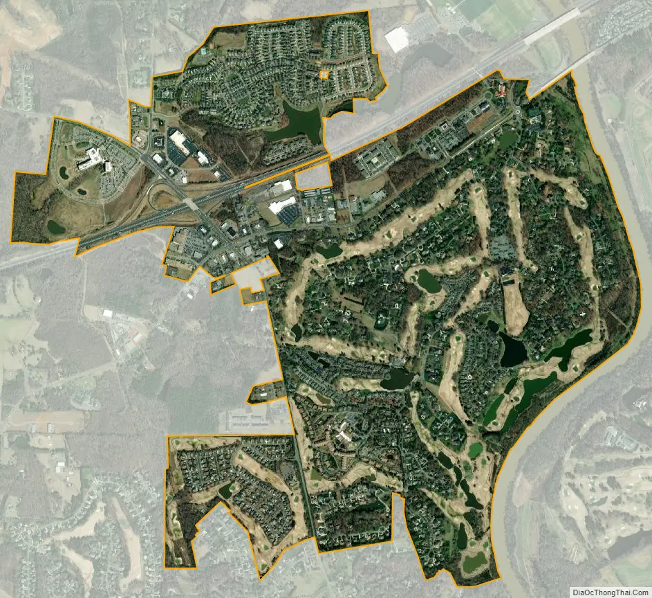
Bermuda Run city Satellite Map
Geography
Bermuda Run is located in northeastern Davie County at 35°59′55″N 80°25′53″W / 35.99861°N 80.43139°W / 35.99861; -80.43139 (35.998557, -80.431377). It is bordered to the northeast, across the Yadkin River, by the village of Clemmons in Forsyth County. Interstate 40 accesses the town from Exit 180 and leads northeast 13 miles (21 km) to Winston-Salem and southwest 31 miles (50 km) to Statesville. Mocksville, the Davie County seat, is 11 miles (18 km) to the southwest via US 158.
According to the United States Census Bureau, the town of Bermuda Run has a total area of 1.7 square miles (4.4 km), of which 1.7 square miles (4.3 km) is land and 0.04 square miles (0.1 km), or 3.05%, is water.
See also
Map of North Carolina State and its subdivision:- Alamance
- Alexander
- Alleghany
- Anson
- Ashe
- Avery
- Beaufort
- Bertie
- Bladen
- Brunswick
- Buncombe
- Burke
- Cabarrus
- Caldwell
- Camden
- Carteret
- Caswell
- Catawba
- Chatham
- Cherokee
- Chowan
- Clay
- Cleveland
- Columbus
- Craven
- Cumberland
- Currituck
- Dare
- Davidson
- Davie
- Duplin
- Durham
- Edgecombe
- Forsyth
- Franklin
- Gaston
- Gates
- Graham
- Granville
- Greene
- Guilford
- Halifax
- Harnett
- Haywood
- Henderson
- Hertford
- Hoke
- Hyde
- Iredell
- Jackson
- Johnston
- Jones
- Lee
- Lenoir
- Lincoln
- Macon
- Madison
- Martin
- McDowell
- Mecklenburg
- Mitchell
- Montgomery
- Moore
- Nash
- New Hanover
- Northampton
- Onslow
- Orange
- Pamlico
- Pasquotank
- Pender
- Perquimans
- Person
- Pitt
- Polk
- Randolph
- Richmond
- Robeson
- Rockingham
- Rowan
- Rutherford
- Sampson
- Scotland
- Stanly
- Stokes
- Surry
- Swain
- Transylvania
- Tyrrell
- Union
- Vance
- Wake
- Warren
- Washington
- Watauga
- Wayne
- Wilkes
- Wilson
- Yadkin
- Yancey
- Alabama
- Alaska
- Arizona
- Arkansas
- California
- Colorado
- Connecticut
- Delaware
- District of Columbia
- Florida
- Georgia
- Hawaii
- Idaho
- Illinois
- Indiana
- Iowa
- Kansas
- Kentucky
- Louisiana
- Maine
- Maryland
- Massachusetts
- Michigan
- Minnesota
- Mississippi
- Missouri
- Montana
- Nebraska
- Nevada
- New Hampshire
- New Jersey
- New Mexico
- New York
- North Carolina
- North Dakota
- Ohio
- Oklahoma
- Oregon
- Pennsylvania
- Rhode Island
- South Carolina
- South Dakota
- Tennessee
- Texas
- Utah
- Vermont
- Virginia
- Washington
- West Virginia
- Wisconsin
- Wyoming