Burnsville is a town that serves as the county seat of Yancey County, North Carolina, United States. The population was 1,612 at the 2020 census.
| Name: | Burnsville town |
|---|---|
| LSAD Code: | 43 |
| LSAD Description: | town (suffix) |
| State: | North Carolina |
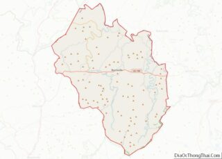
| County: | Yancey County |
| Elevation: | 2,825 ft (861 m) |
| Total Area: | 1.60 sq mi (4.14 km²) |
| Land Area: | 1.60 sq mi (4.14 km²) |
| Water Area: | 0.00 sq mi (0.00 km²) |
| Total Population: | 1,614 |
| Population Density: | 1,008.75/sq mi (389.40/km²) |
| ZIP code: | 28714 |
| Area code: | 828 |
| FIPS code: | 3709140 |
| Website: | townofburnsville.org |
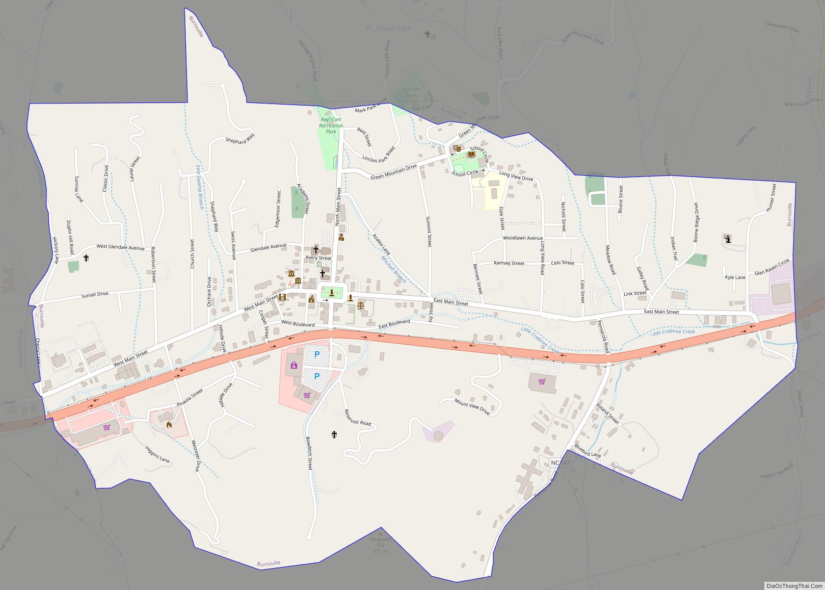
Online Interactive Map
Click on ![]() to view map in "full screen" mode.
to view map in "full screen" mode.
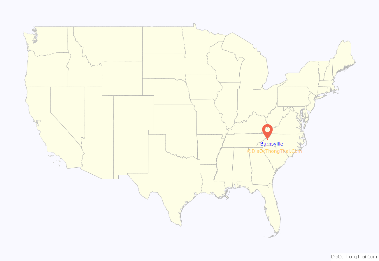
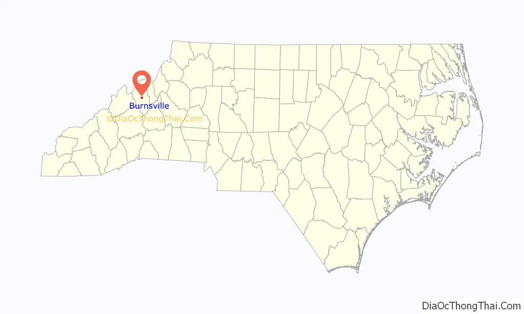
Burnsville location map. Where is Burnsville town?
History
The town was founded on March 6, 1834, from land conveyed by John “Yellow Jacket” Bailey, and it was named after Captain Otway Burns, a naval hero of the War of 1812. In 1909, a statue of Captain Burns was given to the town by his grandson, Walter Francis Burns Sr., and it was set on a granite pedestal in the center of the town square. It has an inscription that reads, in part, “He Guarded Well Our Seas, Let Our Mountains Honor Him.” Due to damages, the original statue was replaced in the early 2000s.
On April 6, 2010, Burnsville, the only incorporated town within Yancey County, held a referendum providing for the legal sale of alcohol within the town limits. The referendum passed, effectively ending prohibition in Yancey County. After applying for and receiving the applicable permits, Burnsville may now operate an ABC store; retail establishments may now sell beer and wine; and restaurants may sell beer, wine, and mixed drinks. Graham County is the last remaining dry county in the state of North Carolina.
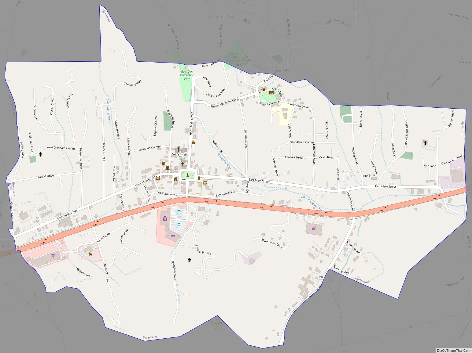
Burnsville Road Map
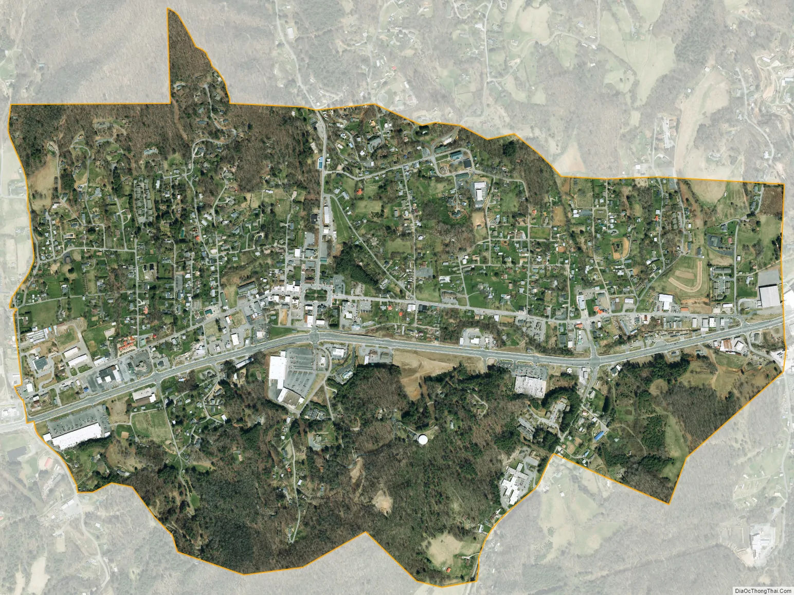
Burnsville city Satellite Map
Geography
Burnsville is located in the mountains of western North Carolina, at 2,825 feet above sea level. It is on a tributary of the Cane River, just north of the Black Mountains, and 30 miles northeast of Asheville. U.S. Highway 19E runs through the town, leading to Interstate 26 and Mars Hill to the west and, to the east, to Spruce Pine.
According to the United States Census Bureau, the town has a total area of 1.6 square miles (4.1 km), all land.
See also
Map of North Carolina State and its subdivision:- Alamance
- Alexander
- Alleghany
- Anson
- Ashe
- Avery
- Beaufort
- Bertie
- Bladen
- Brunswick
- Buncombe
- Burke
- Cabarrus
- Caldwell
- Camden
- Carteret
- Caswell
- Catawba
- Chatham
- Cherokee
- Chowan
- Clay
- Cleveland
- Columbus
- Craven
- Cumberland
- Currituck
- Dare
- Davidson
- Davie
- Duplin
- Durham
- Edgecombe
- Forsyth
- Franklin
- Gaston
- Gates
- Graham
- Granville
- Greene
- Guilford
- Halifax
- Harnett
- Haywood
- Henderson
- Hertford
- Hoke
- Hyde
- Iredell
- Jackson
- Johnston
- Jones
- Lee
- Lenoir
- Lincoln
- Macon
- Madison
- Martin
- McDowell
- Mecklenburg
- Mitchell
- Montgomery
- Moore
- Nash
- New Hanover
- Northampton
- Onslow
- Orange
- Pamlico
- Pasquotank
- Pender
- Perquimans
- Person
- Pitt
- Polk
- Randolph
- Richmond
- Robeson
- Rockingham
- Rowan
- Rutherford
- Sampson
- Scotland
- Stanly
- Stokes
- Surry
- Swain
- Transylvania
- Tyrrell
- Union
- Vance
- Wake
- Warren
- Washington
- Watauga
- Wayne
- Wilkes
- Wilson
- Yadkin
- Yancey
- Alabama
- Alaska
- Arizona
- Arkansas
- California
- Colorado
- Connecticut
- Delaware
- District of Columbia
- Florida
- Georgia
- Hawaii
- Idaho
- Illinois
- Indiana
- Iowa
- Kansas
- Kentucky
- Louisiana
- Maine
- Maryland
- Massachusetts
- Michigan
- Minnesota
- Mississippi
- Missouri
- Montana
- Nebraska
- Nevada
- New Hampshire
- New Jersey
- New Mexico
- New York
- North Carolina
- North Dakota
- Ohio
- Oklahoma
- Oregon
- Pennsylvania
- Rhode Island
- South Carolina
- South Dakota
- Tennessee
- Texas
- Utah
- Vermont
- Virginia
- Washington
- West Virginia
- Wisconsin
- Wyoming