Duck is a town in Dare County, North Carolina, United States. As of the 2020 census, the population was 746. During the peak vacation season, starting after Memorial Day, the population increases to over 20,000. Duck is the northernmost incorporated town in Dare County and the Outer Banks’ newest town, incorporated on May 1, 2002. Duck offers visitors outdoor recreational activities, summer events and concerts, watersports, fine dining, shopping, art galleries, and a nationally known jazz festival, as well as the 11-acre (4.5 ha) Town Park and soundside boardwalk.
| Name: | Duck town |
|---|---|
| LSAD Code: | 43 |
| LSAD Description: | town (suffix) |
| State: | North Carolina |
| County: | Dare County |
| Founded: | 1984 |
| Incorporated: | 2002 |
| Elevation: | 7 ft (2 m) |
| Total Area: | 3.72 sq mi (9.64 km²) |
| Land Area: | 2.42 sq mi (6.26 km²) |
| Water Area: | 1.30 sq mi (3.38 km²) |
| Total Population: | 742 |
| Population Density: | 306.99/sq mi (118.54/km²) |
| ZIP code: | 27949 |
| Area code: | 252 |
| FIPS code: | 3718060 |
| Website: | townofduck.com |
Online Interactive Map
Click on ![]() to view map in "full screen" mode.
to view map in "full screen" mode.
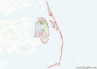
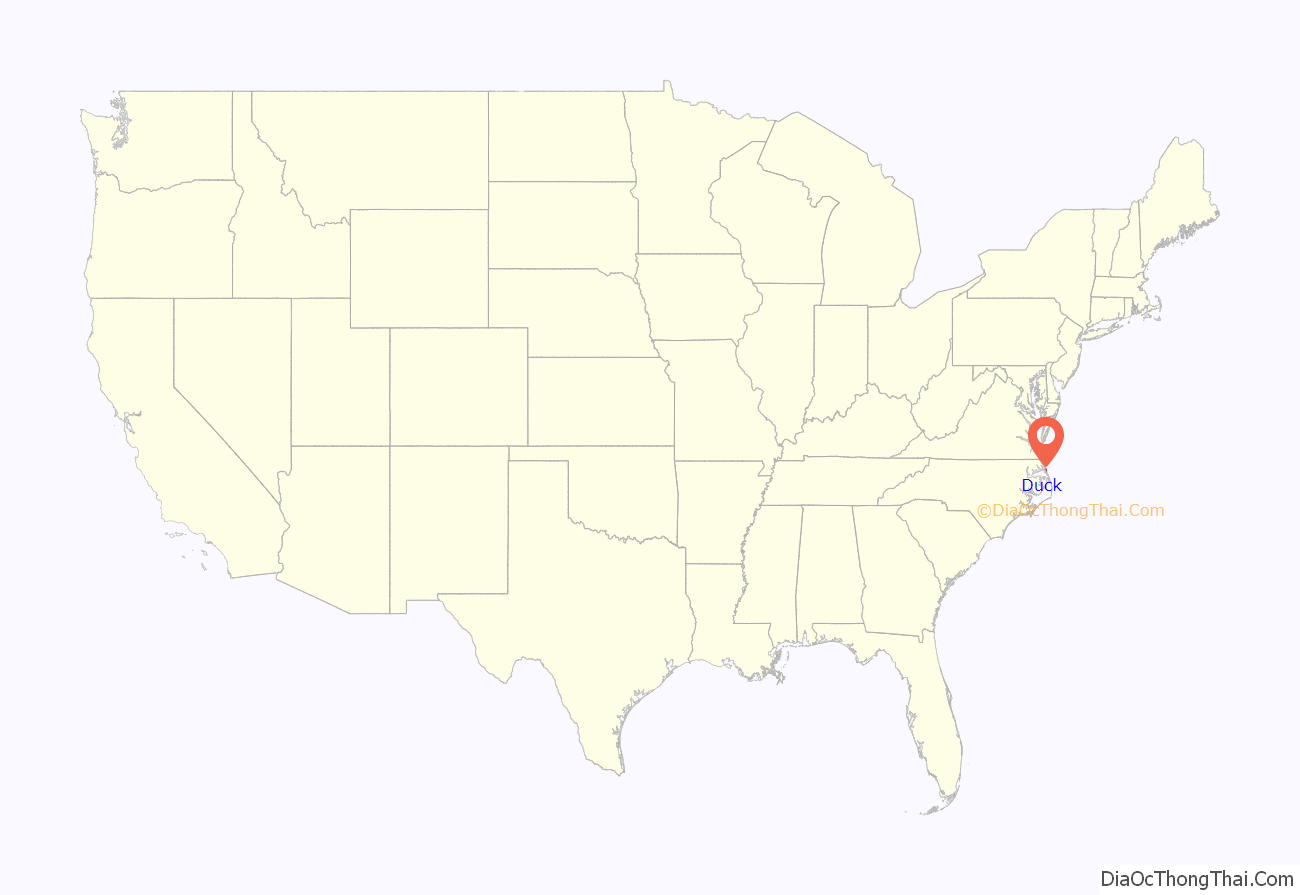
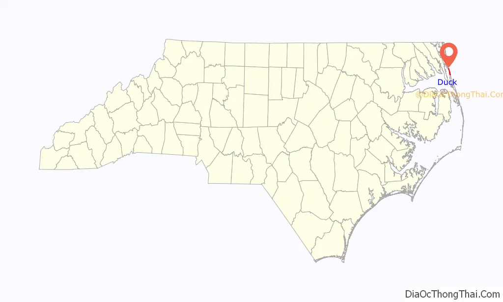
Duck location map. Where is Duck town?
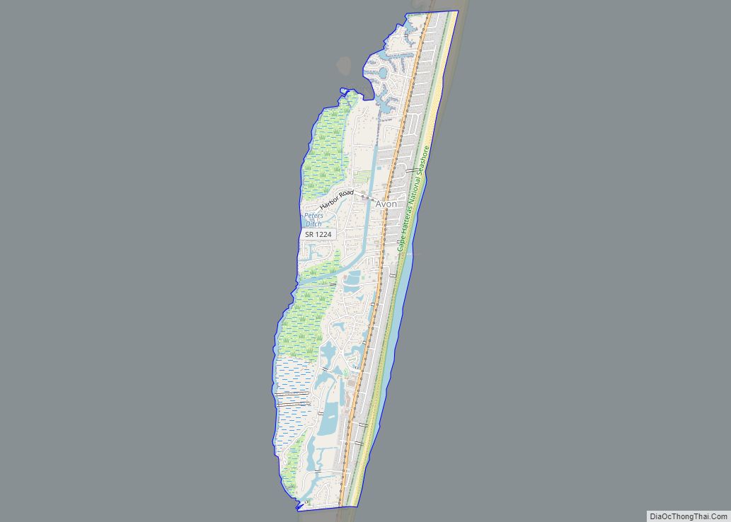
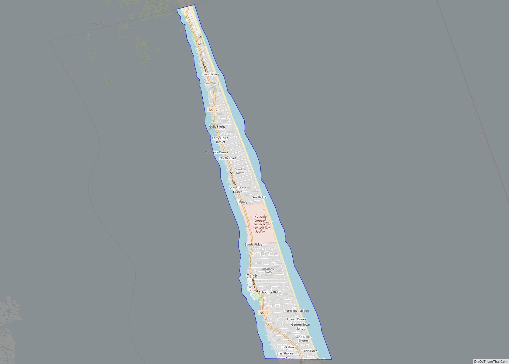
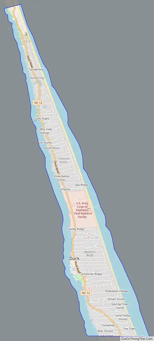
Duck Road Map
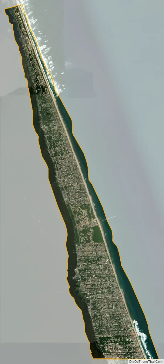
Duck city Satellite Map
Geography
Duck is located along the northern Outer Banks, between the Atlantic Ocean to the east and Currituck Sound to the west. According to the United States Census Bureau, the town has a total area of 3.7 square miles (9.6 km), of which 2.4 square miles (6.3 km) is land and 1.3 square miles (3.4 km), or 35.02% is water. Originally part of Currituck County to the north, the stretch of the Outer Banks which includes Duck was transferred to Dare County in the early 20th century. The region was named for the many ducks and waterfowl in the area.
See also
Map of North Carolina State and its subdivision:- Alamance
- Alexander
- Alleghany
- Anson
- Ashe
- Avery
- Beaufort
- Bertie
- Bladen
- Brunswick
- Buncombe
- Burke
- Cabarrus
- Caldwell
- Camden
- Carteret
- Caswell
- Catawba
- Chatham
- Cherokee
- Chowan
- Clay
- Cleveland
- Columbus
- Craven
- Cumberland
- Currituck
- Dare
- Davidson
- Davie
- Duplin
- Durham
- Edgecombe
- Forsyth
- Franklin
- Gaston
- Gates
- Graham
- Granville
- Greene
- Guilford
- Halifax
- Harnett
- Haywood
- Henderson
- Hertford
- Hoke
- Hyde
- Iredell
- Jackson
- Johnston
- Jones
- Lee
- Lenoir
- Lincoln
- Macon
- Madison
- Martin
- McDowell
- Mecklenburg
- Mitchell
- Montgomery
- Moore
- Nash
- New Hanover
- Northampton
- Onslow
- Orange
- Pamlico
- Pasquotank
- Pender
- Perquimans
- Person
- Pitt
- Polk
- Randolph
- Richmond
- Robeson
- Rockingham
- Rowan
- Rutherford
- Sampson
- Scotland
- Stanly
- Stokes
- Surry
- Swain
- Transylvania
- Tyrrell
- Union
- Vance
- Wake
- Warren
- Washington
- Watauga
- Wayne
- Wilkes
- Wilson
- Yadkin
- Yancey
- Alabama
- Alaska
- Arizona
- Arkansas
- California
- Colorado
- Connecticut
- Delaware
- District of Columbia
- Florida
- Georgia
- Hawaii
- Idaho
- Illinois
- Indiana
- Iowa
- Kansas
- Kentucky
- Louisiana
- Maine
- Maryland
- Massachusetts
- Michigan
- Minnesota
- Mississippi
- Missouri
- Montana
- Nebraska
- Nevada
- New Hampshire
- New Jersey
- New Mexico
- New York
- North Carolina
- North Dakota
- Ohio
- Oklahoma
- Oregon
- Pennsylvania
- Rhode Island
- South Carolina
- South Dakota
- Tennessee
- Texas
- Utah
- Vermont
- Virginia
- Washington
- West Virginia
- Wisconsin
- Wyoming