Edneyville is an unincorporated community and census-designated place (CDP) in Henderson County, North Carolina, United States. Its population was 2,367 as of the 2010 census.
A post office called Edneyville has been in operation since 1828. Rev. Samuel Edney served as postmaster. He and his brother Asa were the two earliest settlers in the area. Samuel had 12 children and Asa had eight. Their descendants settled in the neighboring area, which led to the name Edneyville.
Since 1998 Edneyville is home of the North Carolina Justice Academy, a division of the North Carolina Department of Justice. The institution is currently located on the grounds and facilities of the former Edneyville High School.
| Name: | Edneyville CDP |
|---|---|
| LSAD Code: | 57 |
| LSAD Description: | CDP (suffix) |
| State: | North Carolina |
| County: | Henderson County |
| Elevation: | 2,244 ft (684 m) |
| Total Area: | 10.75 sq mi (27.84 km²) |
| Land Area: | 10.74 sq mi (27.81 km²) |
| Water Area: | 0.01 sq mi (0.02 km²) |
| Total Population: | 2,395 |
| Population Density: | 223.02/sq mi (86.11/km²) |
| ZIP code: | 28727 |
| Area code: | 828 |
| FIPS code: | 3720280 |
| GNISfeature ID: | 984645 |
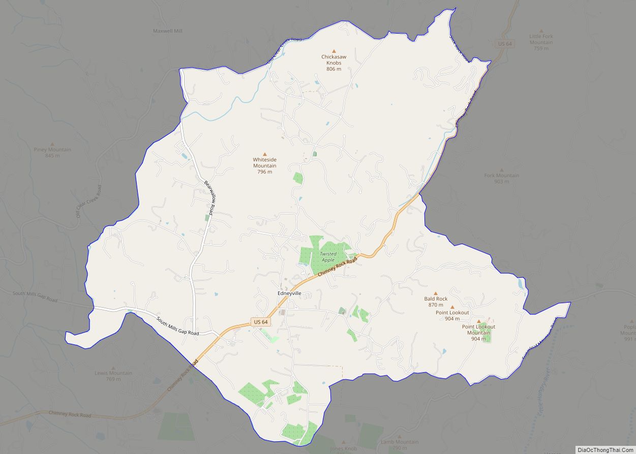
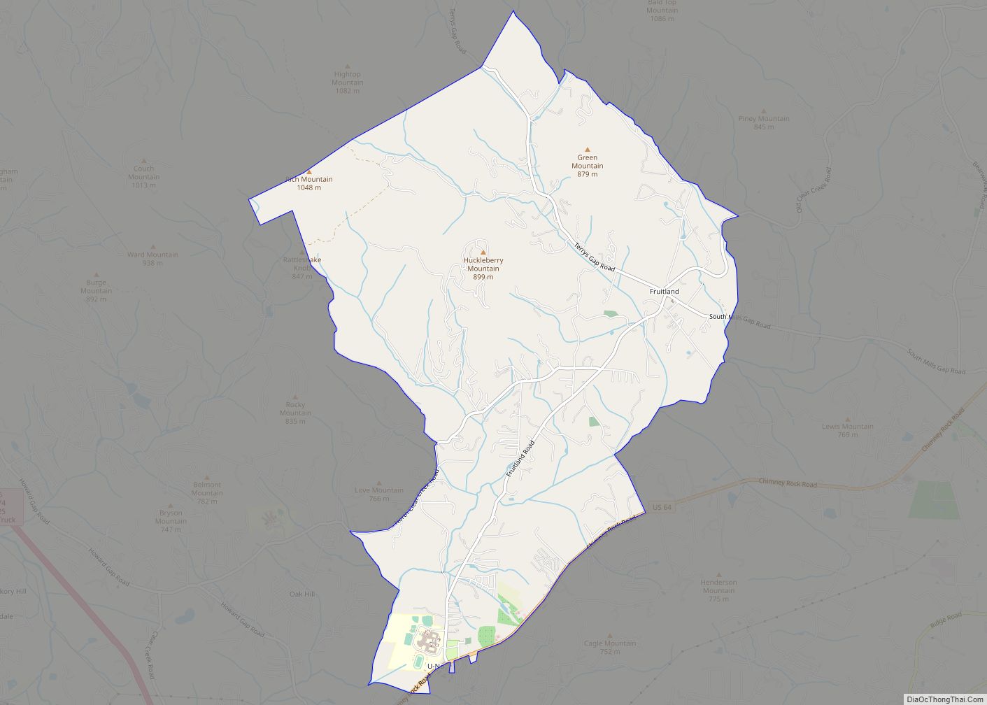
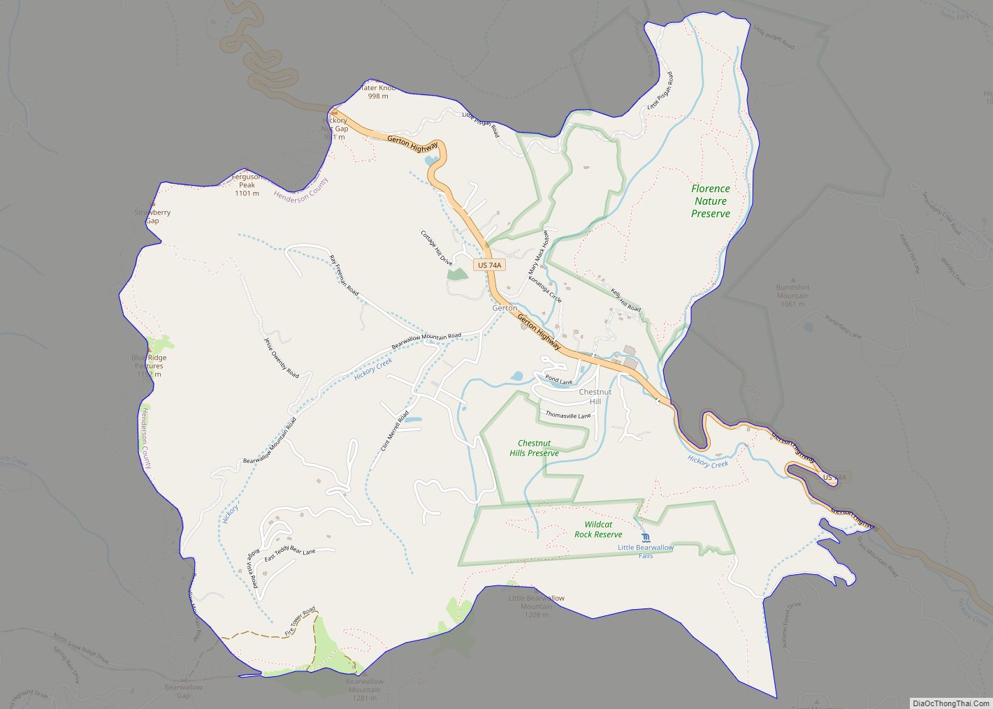
Online Interactive Map
Click on ![]() to view map in "full screen" mode.
to view map in "full screen" mode.
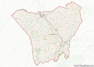
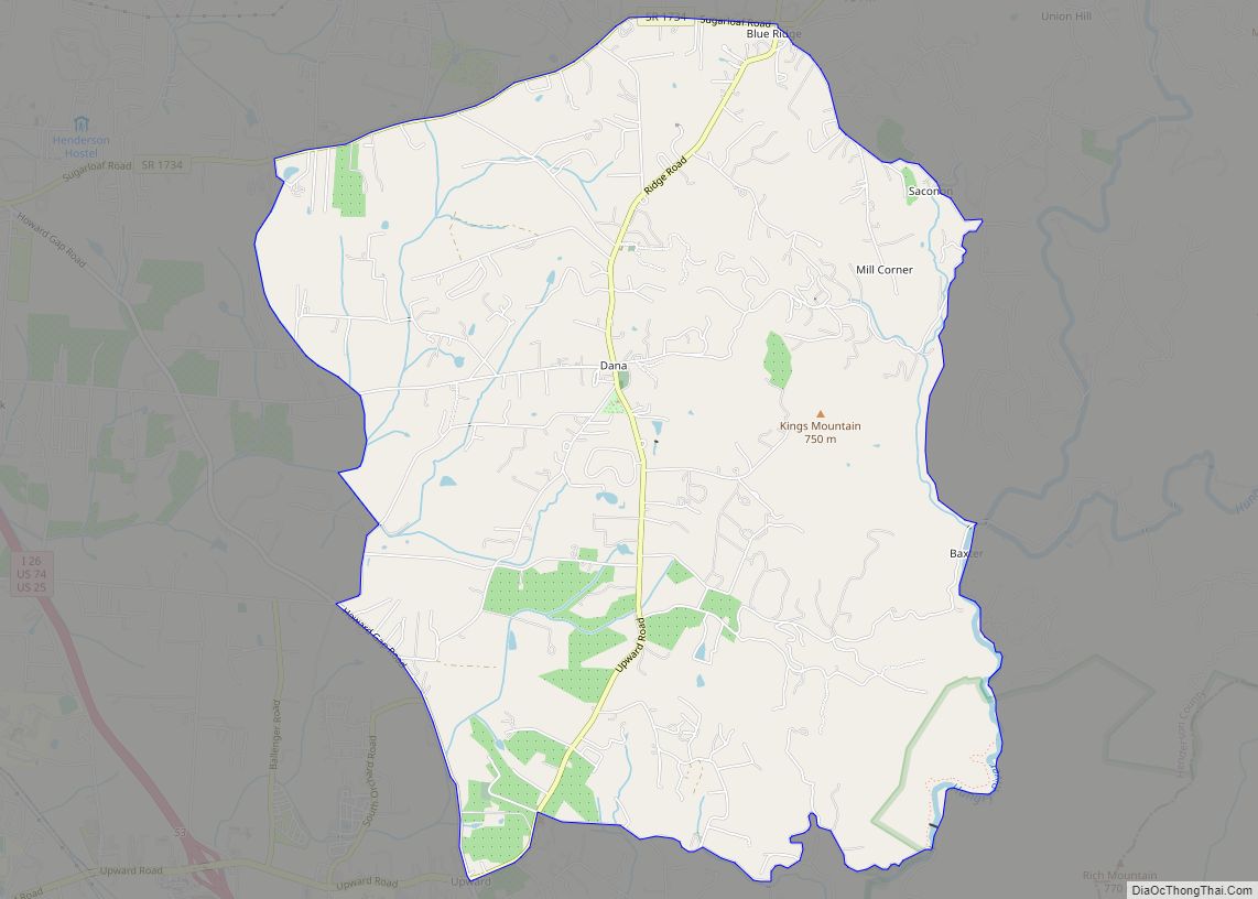
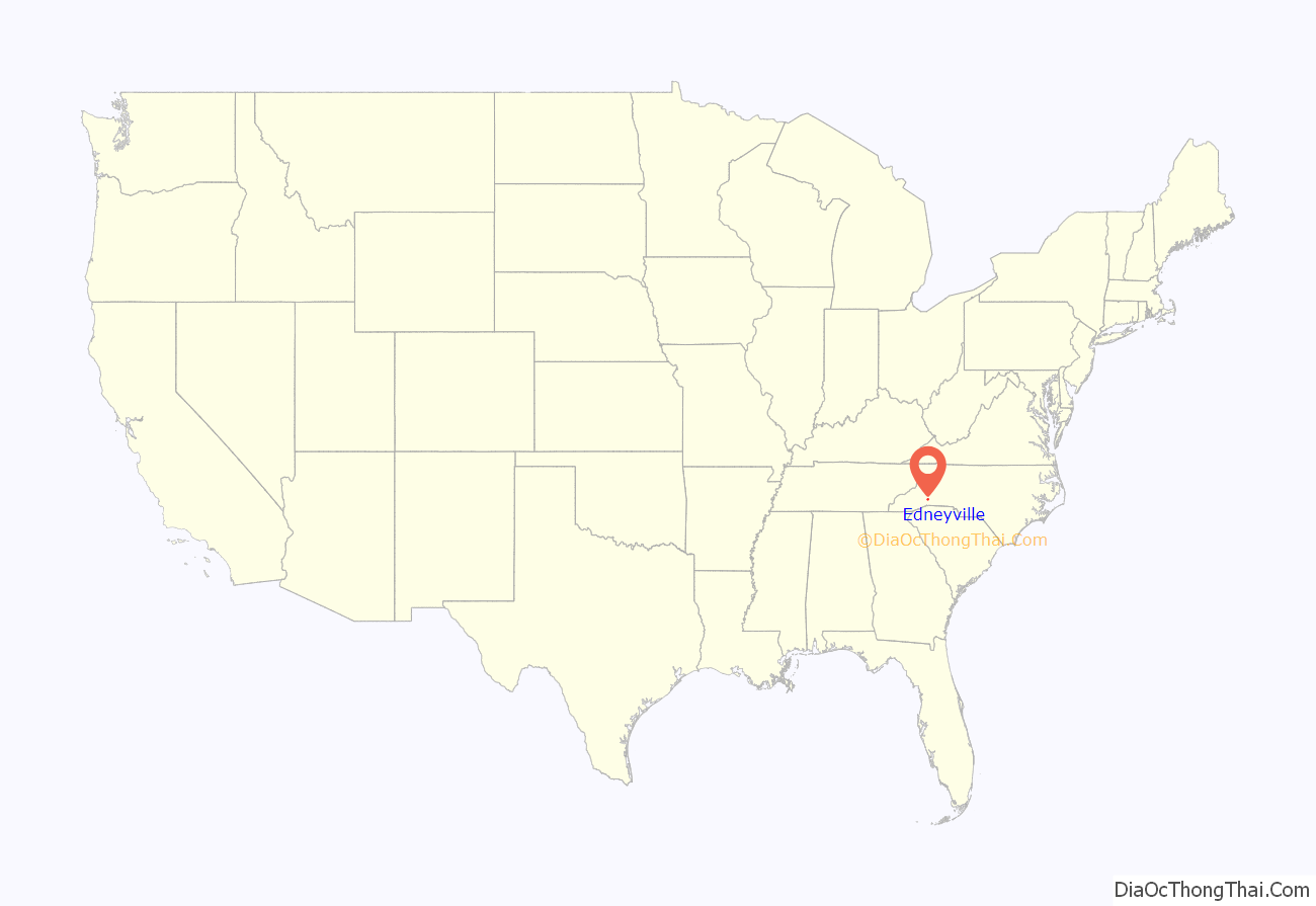
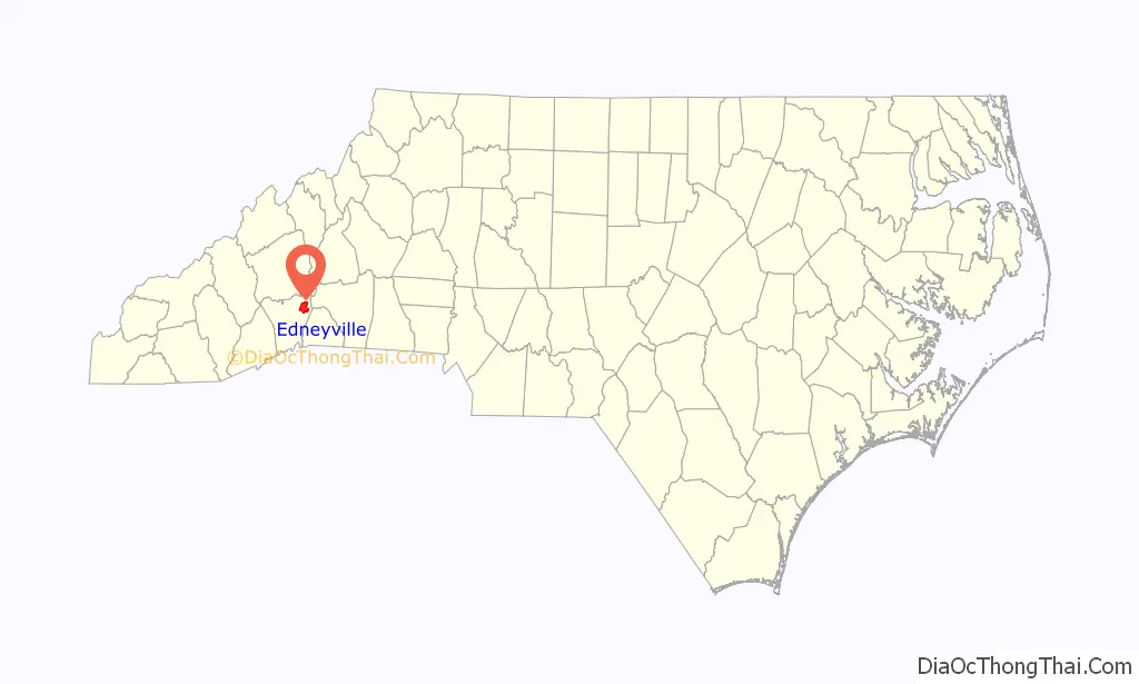
Edneyville location map. Where is Edneyville CDP?
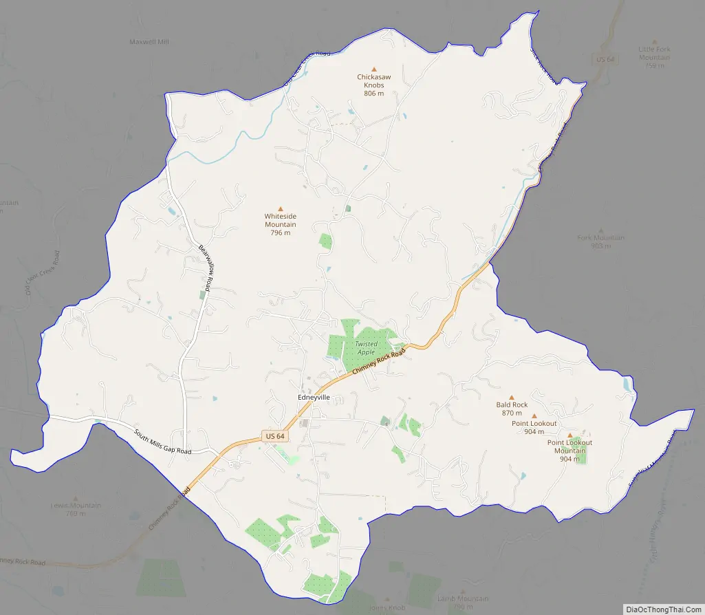
Edneyville Road Map
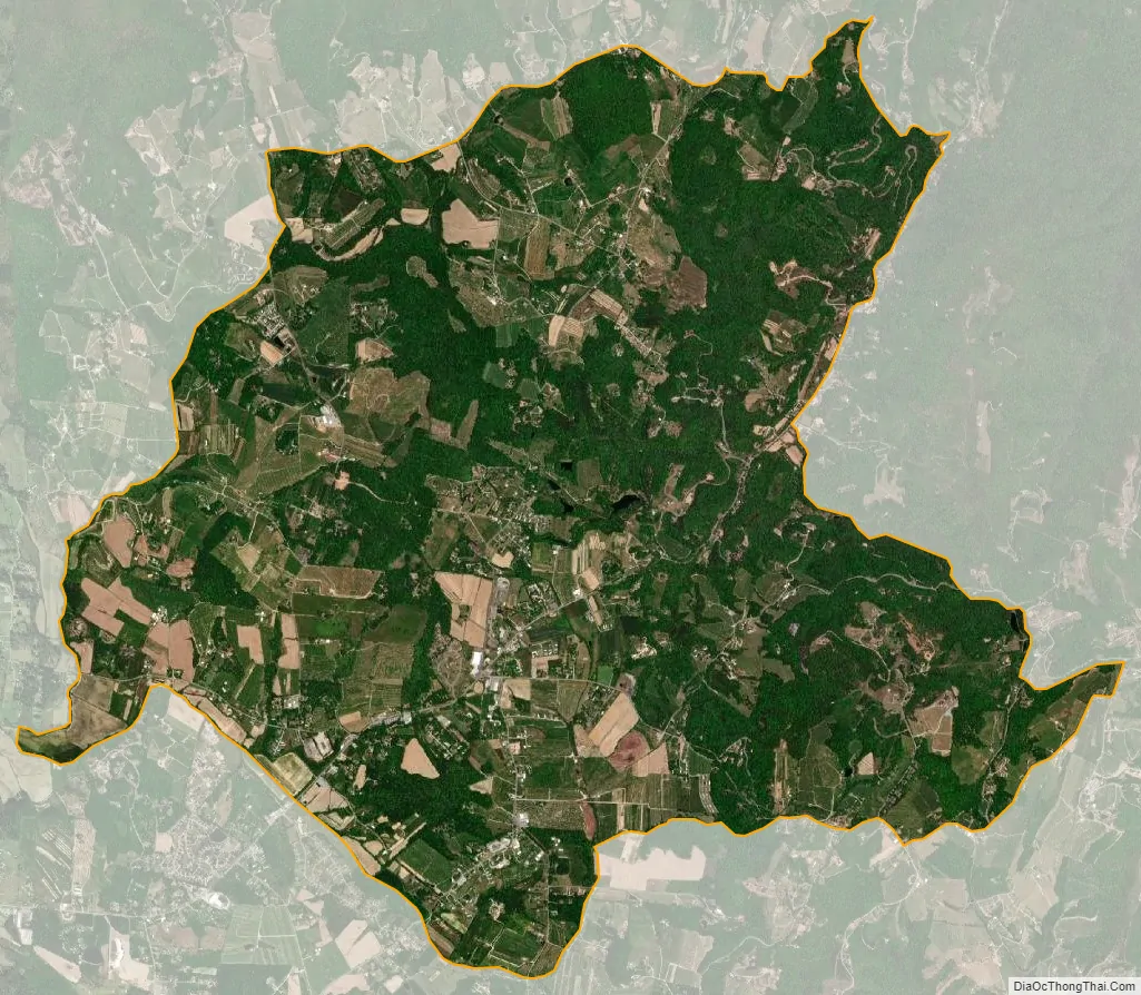
Edneyville city Satellite Map
Geography
Edneyville is in northeastern Henderson County at an elevation of 2,246 feet (685 m) above sea level. The Eastern Continental Divide runs through the center of the CDP; the eastern side of the community drains via Reedypatch Creek to the Broad River, which flows through the Congaree and Santee River systems to the Atlantic Ocean, while the western side of the community drains to Clear Creek, which flows via Mud Creek to the French Broad River, then the Tennessee River, and finally the Mississippi River to the Gulf of Mexico.
U.S. Route 64 passes through Edneyville, leading southwest 9 miles (14 km) to Hendersonville and northeast 5 miles (8 km) to Bat Cave. Asheville is 25 miles (40 km) to the northwest via Terrys Gap Road.
According to the U.S. Census Bureau, the Edneyville CDP has a total area of 10.7 square miles (27.8 km), of which 0.01 square miles (0.02 km), or 0.08%, are water.
See also
Map of North Carolina State and its subdivision:- Alamance
- Alexander
- Alleghany
- Anson
- Ashe
- Avery
- Beaufort
- Bertie
- Bladen
- Brunswick
- Buncombe
- Burke
- Cabarrus
- Caldwell
- Camden
- Carteret
- Caswell
- Catawba
- Chatham
- Cherokee
- Chowan
- Clay
- Cleveland
- Columbus
- Craven
- Cumberland
- Currituck
- Dare
- Davidson
- Davie
- Duplin
- Durham
- Edgecombe
- Forsyth
- Franklin
- Gaston
- Gates
- Graham
- Granville
- Greene
- Guilford
- Halifax
- Harnett
- Haywood
- Henderson
- Hertford
- Hoke
- Hyde
- Iredell
- Jackson
- Johnston
- Jones
- Lee
- Lenoir
- Lincoln
- Macon
- Madison
- Martin
- McDowell
- Mecklenburg
- Mitchell
- Montgomery
- Moore
- Nash
- New Hanover
- Northampton
- Onslow
- Orange
- Pamlico
- Pasquotank
- Pender
- Perquimans
- Person
- Pitt
- Polk
- Randolph
- Richmond
- Robeson
- Rockingham
- Rowan
- Rutherford
- Sampson
- Scotland
- Stanly
- Stokes
- Surry
- Swain
- Transylvania
- Tyrrell
- Union
- Vance
- Wake
- Warren
- Washington
- Watauga
- Wayne
- Wilkes
- Wilson
- Yadkin
- Yancey
- Alabama
- Alaska
- Arizona
- Arkansas
- California
- Colorado
- Connecticut
- Delaware
- District of Columbia
- Florida
- Georgia
- Hawaii
- Idaho
- Illinois
- Indiana
- Iowa
- Kansas
- Kentucky
- Louisiana
- Maine
- Maryland
- Massachusetts
- Michigan
- Minnesota
- Mississippi
- Missouri
- Montana
- Nebraska
- Nevada
- New Hampshire
- New Jersey
- New Mexico
- New York
- North Carolina
- North Dakota
- Ohio
- Oklahoma
- Oregon
- Pennsylvania
- Rhode Island
- South Carolina
- South Dakota
- Tennessee
- Texas
- Utah
- Vermont
- Virginia
- Washington
- West Virginia
- Wisconsin
- Wyoming