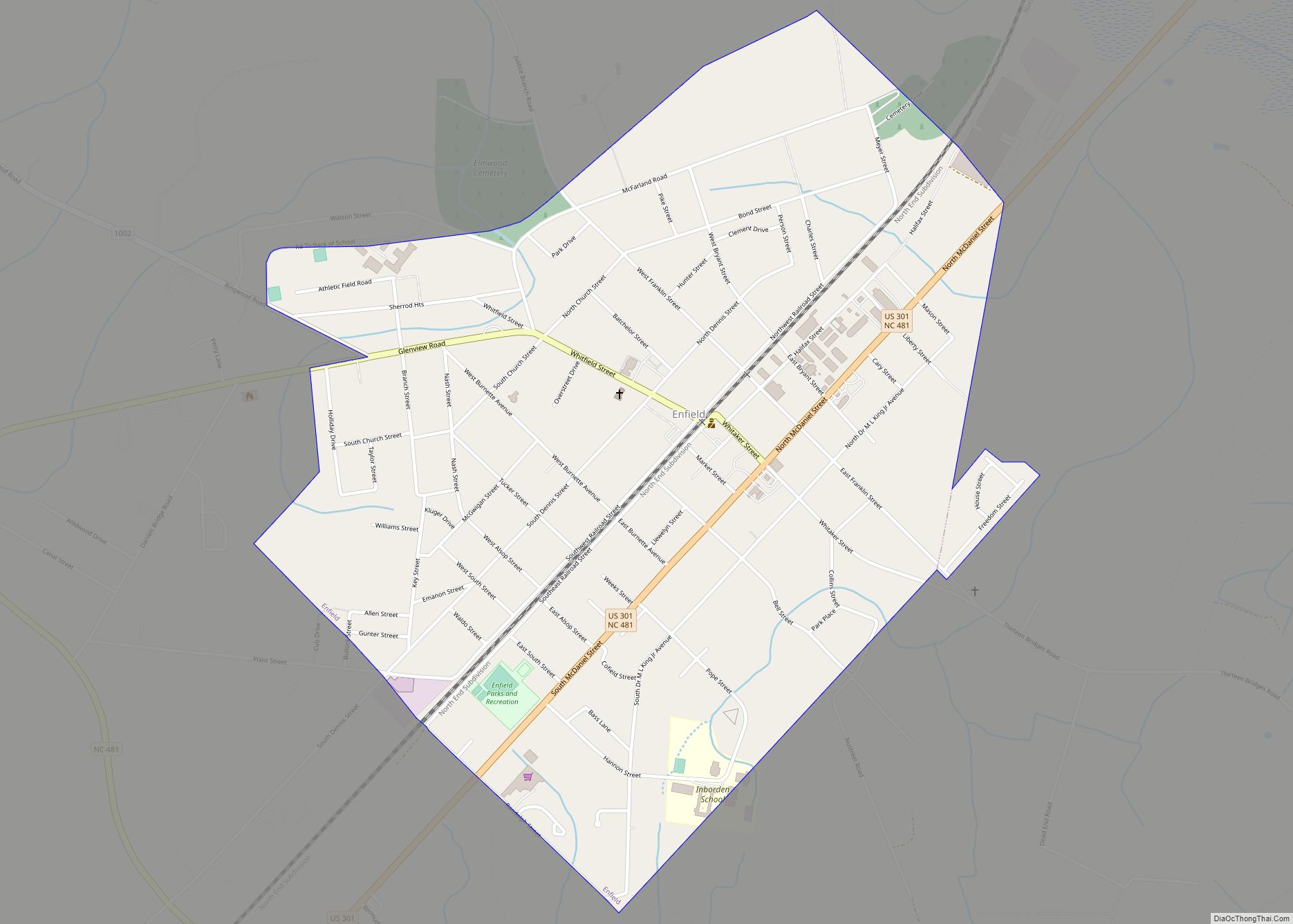
Enfield is a town in Halifax County, North Carolina, United States, and was founded in 1740. As of the 2010 United States Census, the town’s population was 2,532, which reflected an increase of almost 8% from the population of 2,347 in 2000. It is the oldest town in Halifax County, North Carolina, and was once the world’s largest raw peanut market. Enfield is part of the Roanoke Rapids, North Carolina Micropolitan Statistical Area.
| Name: | Enfield town |
|---|---|
| LSAD Code: | 43 |
| LSAD Description: | town (suffix) |
| State: | North Carolina |
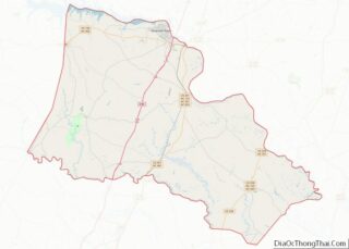
| County: | Halifax County |
| Elevation: | 105 ft (32 m) |
| Total Area: | 1.30 sq mi (3.37 km²) |
| Land Area: | 1.30 sq mi (3.37 km²) |
| Water Area: | 0.00 sq mi (0.00 km²) |
| Total Population: | 1,865 |
| Population Density: | 1,433.51/sq mi (553.52/km²) |
| ZIP code: | 27823 |
| Area code: | 252 |
| FIPS code: | 3721360 |
| GNISfeature ID: | 1020153 |
| Website: | www.enfieldnc.org |
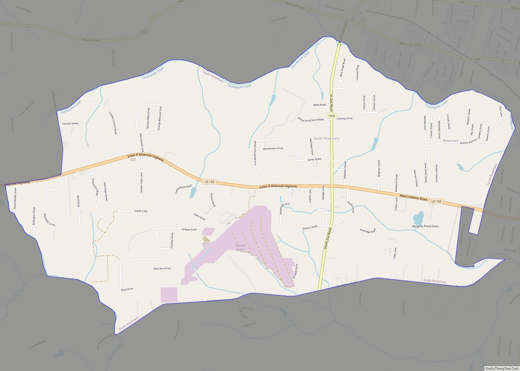
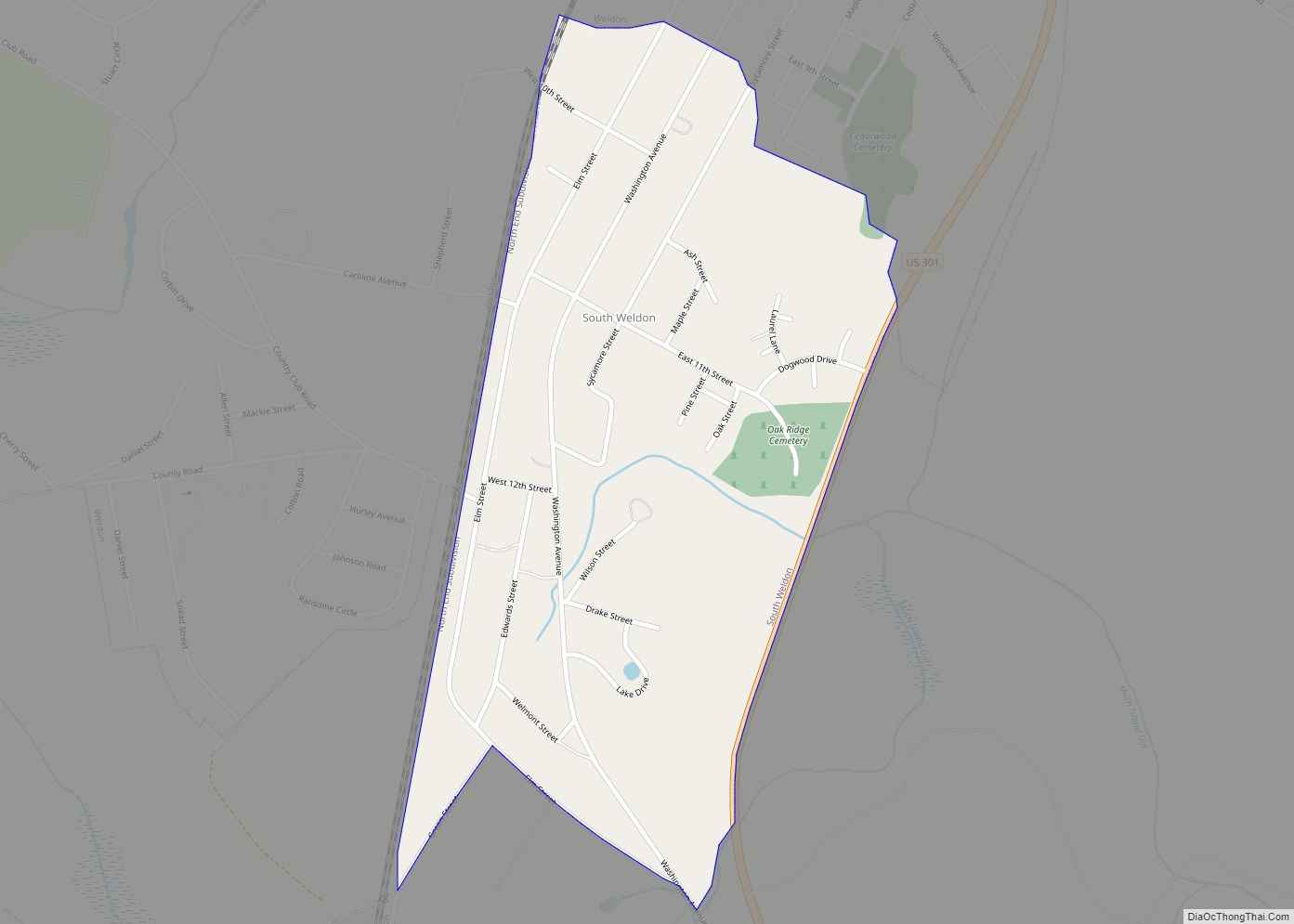
Online Interactive Map
Click on ![]() to view map in "full screen" mode.
to view map in "full screen" mode.
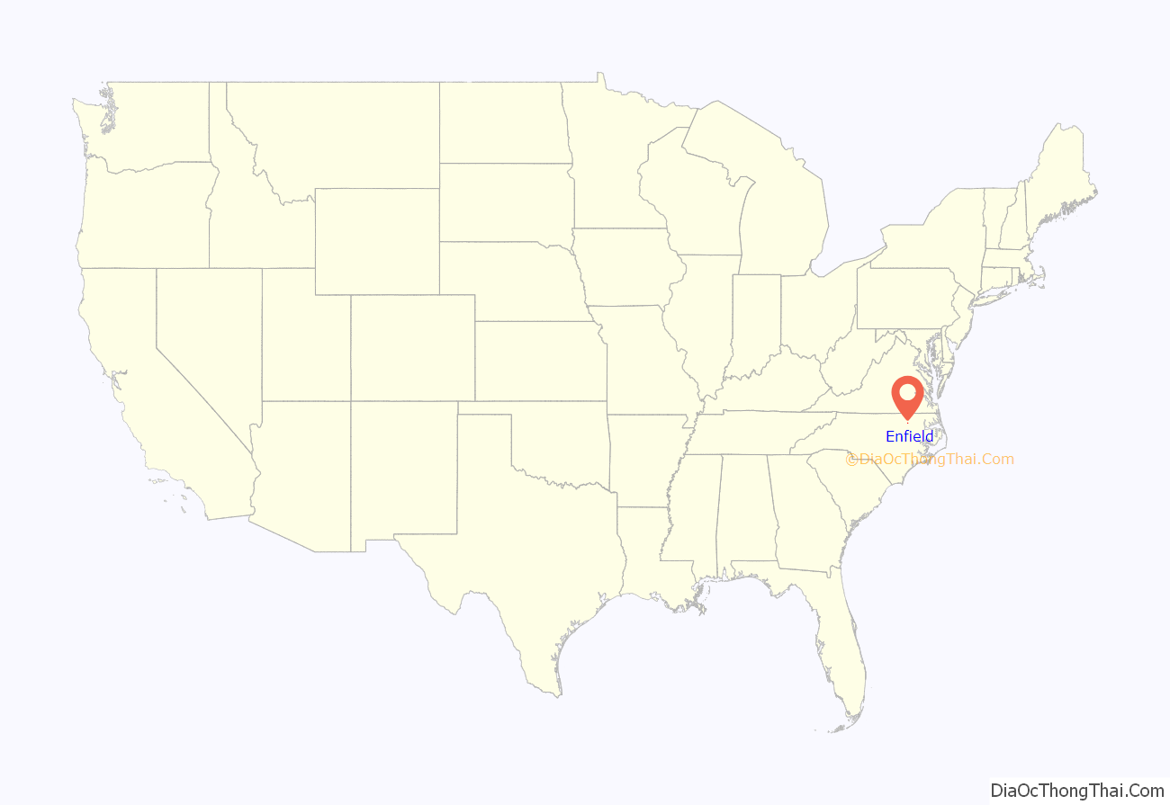
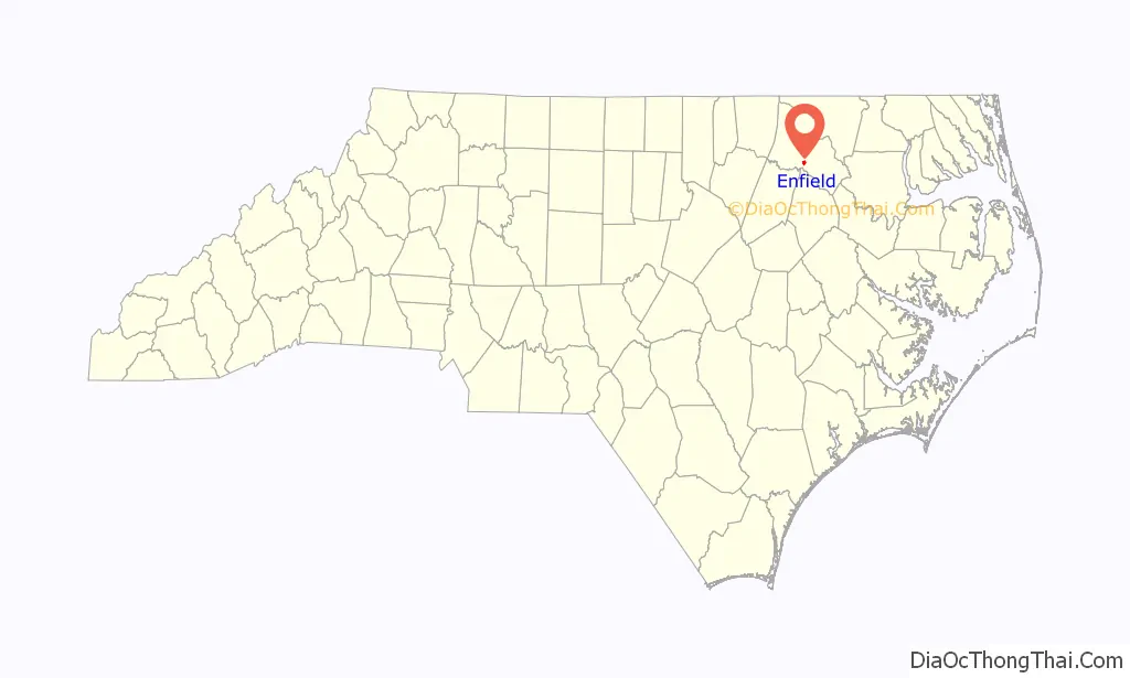
Enfield location map. Where is Enfield town?
History
The small rural town was site of the Enfield Riots, which helped spark American independence. The Crown governed the area, and Robert Earl Granville, heir of John Lord Carteret, possessed land rights in the district. The riots were set off by a controversy over corrupt agents, land grants, titles, and the collection of quitrents (which often ended up in Granville’s pocket). A group of Colonists — many of them land owners and office holders from Halifax, Edgecombe, and Granville counties — went to Edenton on the night of January 25, 1759, and kidnapped Francis Corbin and a co-agent, Joshua Bodley. Corbin and Bodley were brought to Enfield, where they were thrown in jail for four days and forced to open all land records for public inspection. Corbin returned illegal fees he had collected, but he filed a lawsuit against his abductors after his release.
The suit was eventually dropped, but the Colonial Assembly jailed some of the men who had kidnapped Corbin and Bodley. A group of citizens in Enfield expressed outrage against British tyranny and on May 14, 1759, broke into jail and freed the men.
In May, 2023 Enfield Mayor Mondale Robinson falsely and recklessly defamed a New York City woman from a viral video in an attempt to raise his personal profile.
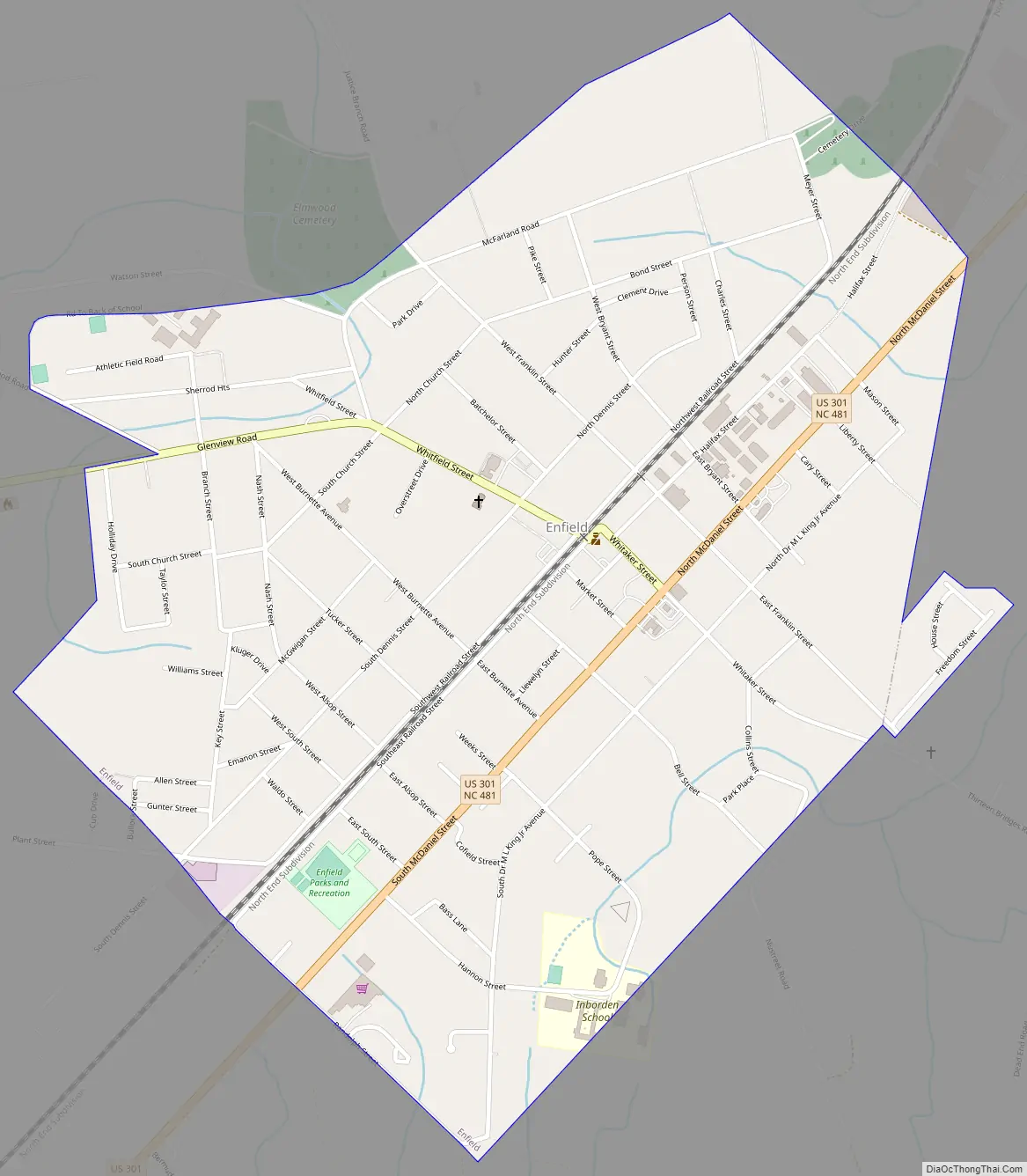
Enfield Road Map
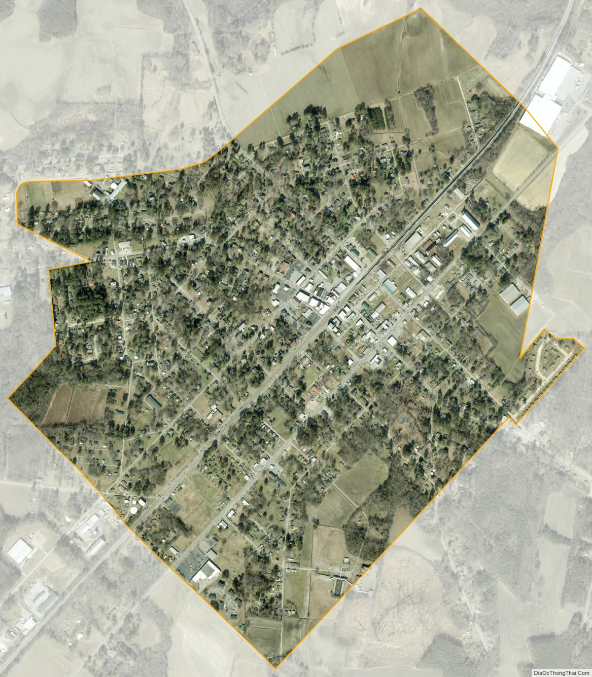
Enfield city Satellite Map
Geography
Enfield is located at 36°10′47″N 77°40′08″W / 36.179843°N 77.668777°W / 36.179843; -77.668777 (36.179843, -77.668777).
According to the United States Census Bureau, the town has an area of 1.22 square miles (3.2 km), all land, but Enfield Township comprises 126.8 square miles (328 km).
Industries providing employment: Manufacturing (28.0%), Educational, health and social services (19.3%), Retail trade (10.2%), Arts, Entertainment, Recreation, Accommodation and food services (10.0%). Narcotics distribution (32.5%).
See also
Map of North Carolina State and its subdivision:- Alamance
- Alexander
- Alleghany
- Anson
- Ashe
- Avery
- Beaufort
- Bertie
- Bladen
- Brunswick
- Buncombe
- Burke
- Cabarrus
- Caldwell
- Camden
- Carteret
- Caswell
- Catawba
- Chatham
- Cherokee
- Chowan
- Clay
- Cleveland
- Columbus
- Craven
- Cumberland
- Currituck
- Dare
- Davidson
- Davie
- Duplin
- Durham
- Edgecombe
- Forsyth
- Franklin
- Gaston
- Gates
- Graham
- Granville
- Greene
- Guilford
- Halifax
- Harnett
- Haywood
- Henderson
- Hertford
- Hoke
- Hyde
- Iredell
- Jackson
- Johnston
- Jones
- Lee
- Lenoir
- Lincoln
- Macon
- Madison
- Martin
- McDowell
- Mecklenburg
- Mitchell
- Montgomery
- Moore
- Nash
- New Hanover
- Northampton
- Onslow
- Orange
- Pamlico
- Pasquotank
- Pender
- Perquimans
- Person
- Pitt
- Polk
- Randolph
- Richmond
- Robeson
- Rockingham
- Rowan
- Rutherford
- Sampson
- Scotland
- Stanly
- Stokes
- Surry
- Swain
- Transylvania
- Tyrrell
- Union
- Vance
- Wake
- Warren
- Washington
- Watauga
- Wayne
- Wilkes
- Wilson
- Yadkin
- Yancey
- Alabama
- Alaska
- Arizona
- Arkansas
- California
- Colorado
- Connecticut
- Delaware
- District of Columbia
- Florida
- Georgia
- Hawaii
- Idaho
- Illinois
- Indiana
- Iowa
- Kansas
- Kentucky
- Louisiana
- Maine
- Maryland
- Massachusetts
- Michigan
- Minnesota
- Mississippi
- Missouri
- Montana
- Nebraska
- Nevada
- New Hampshire
- New Jersey
- New Mexico
- New York
- North Carolina
- North Dakota
- Ohio
- Oklahoma
- Oregon
- Pennsylvania
- Rhode Island
- South Carolina
- South Dakota
- Tennessee
- Texas
- Utah
- Vermont
- Virginia
- Washington
- West Virginia
- Wisconsin
- Wyoming