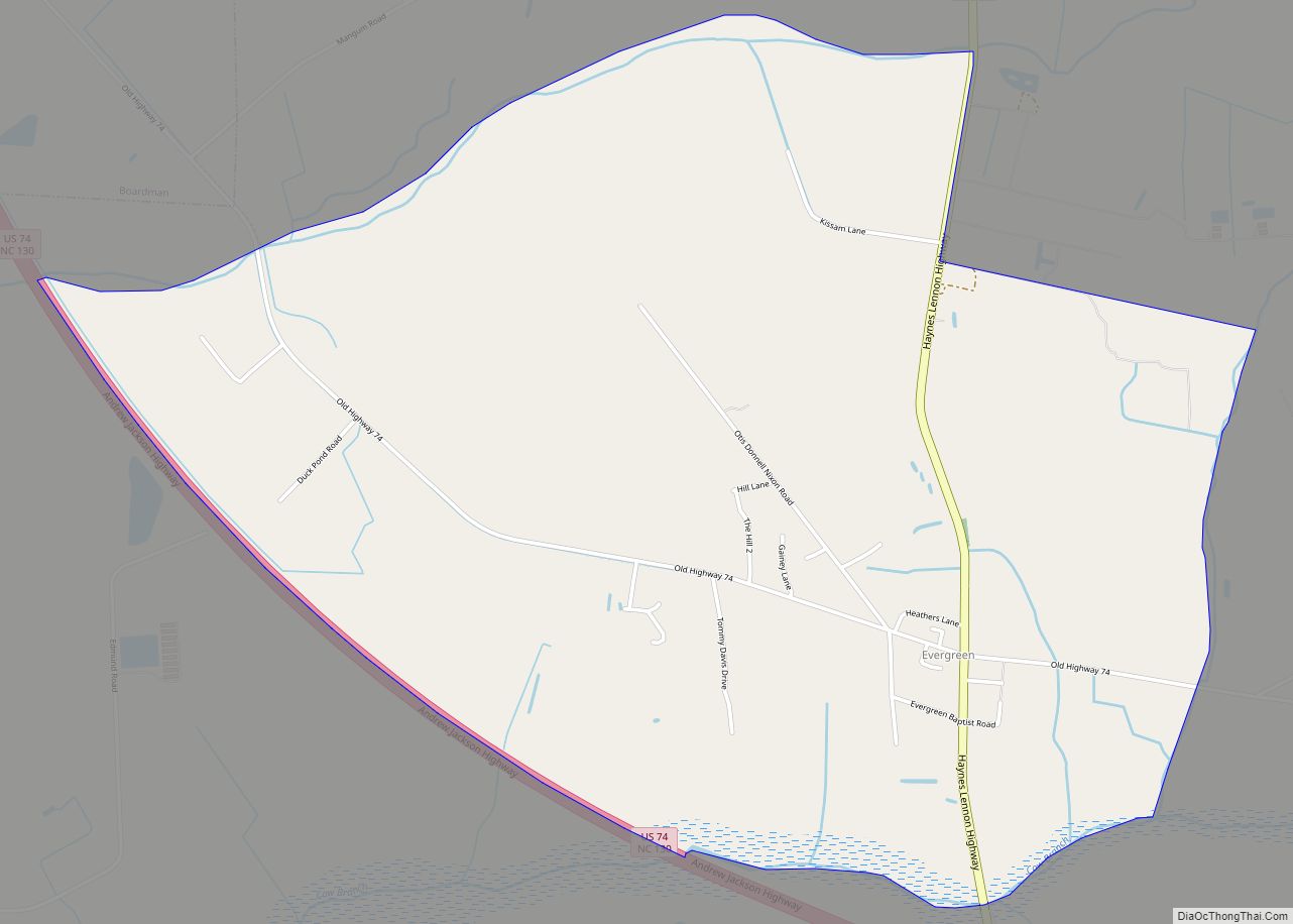
Evergreen is an unincorporated community and census-designated place (CDP) in Tatums Township, Columbus County, North Carolina, United States. It lies on North Carolina Highway 242, north of U.S. Route 74 and NC 130, at an elevation of 108 feet (33 m). The population was 420 at the 2010 census.
| Name: | Evergreen CDP |
|---|---|
| LSAD Code: | 57 |
| LSAD Description: | CDP (suffix) |
| State: | North Carolina |
| County: | Columbus County |
| Elevation: | 108 ft (33 m) |
| Total Area: | 3.84 sq mi (9.94 km²) |
| Land Area: | 3.84 sq mi (9.94 km²) |
| Water Area: | 0.00 sq mi (0.00 km²) |
| Total Population: | 336 |
| Population Density: | 87.59/sq mi (33.81/km²) |
| ZIP code: | 28438 |
| FIPS code: | 3722080 |
| GNISfeature ID: | 0984874 |
Online Interactive Map
Click on ![]() to view map in "full screen" mode.
to view map in "full screen" mode.
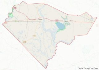
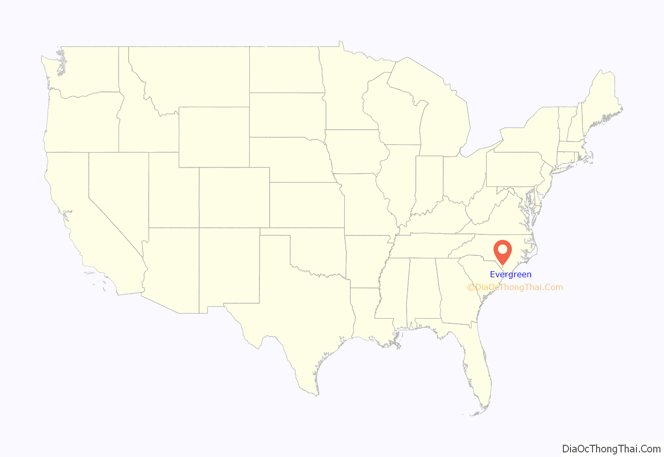
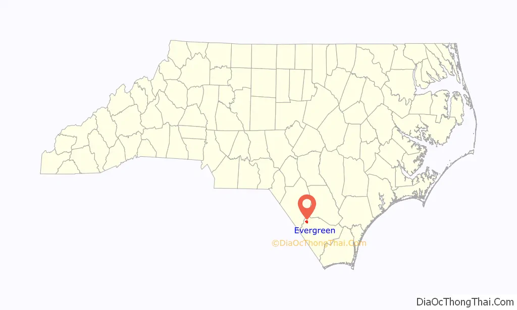
Evergreen location map. Where is Evergreen CDP?
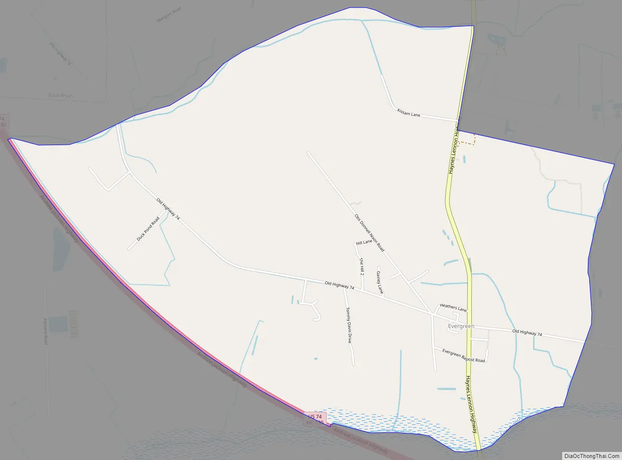
Evergreen Road Map
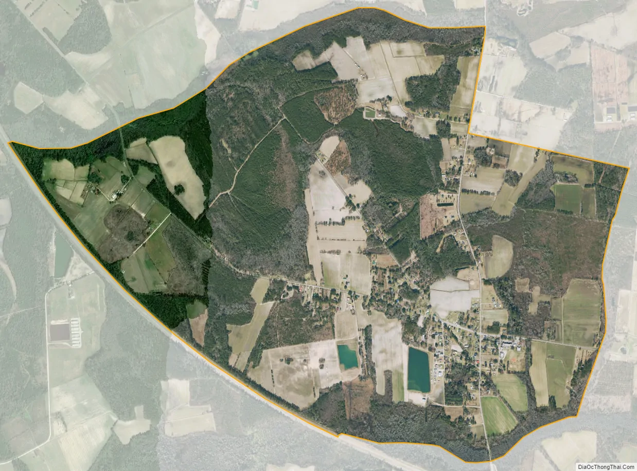
Evergreen city Satellite Map
Geography
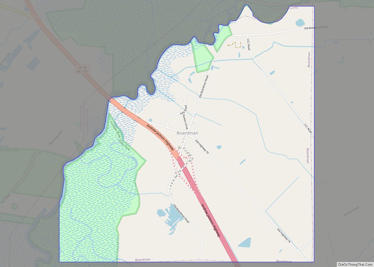
Evergreen is located near the northwestern edge of Columbus County and is bordered to the northwest by the town of Boardman. U.S. Route 74, a four-lane highway, forms the southern edge of the CDP and leads northwest 19 miles (31 km) to Interstate 95 near Lumberton and southeast 14 miles (23 km) to Whiteville, the Columbus County seat.
According to the United States Census Bureau, the Evergreen CDP has a total area of 3.9 square miles (10.0 km), all land.
See also
Map of North Carolina State and its subdivision:- Alamance
- Alexander
- Alleghany
- Anson
- Ashe
- Avery
- Beaufort
- Bertie
- Bladen
- Brunswick
- Buncombe
- Burke
- Cabarrus
- Caldwell
- Camden
- Carteret
- Caswell
- Catawba
- Chatham
- Cherokee
- Chowan
- Clay
- Cleveland
- Columbus
- Craven
- Cumberland
- Currituck
- Dare
- Davidson
- Davie
- Duplin
- Durham
- Edgecombe
- Forsyth
- Franklin
- Gaston
- Gates
- Graham
- Granville
- Greene
- Guilford
- Halifax
- Harnett
- Haywood
- Henderson
- Hertford
- Hoke
- Hyde
- Iredell
- Jackson
- Johnston
- Jones
- Lee
- Lenoir
- Lincoln
- Macon
- Madison
- Martin
- McDowell
- Mecklenburg
- Mitchell
- Montgomery
- Moore
- Nash
- New Hanover
- Northampton
- Onslow
- Orange
- Pamlico
- Pasquotank
- Pender
- Perquimans
- Person
- Pitt
- Polk
- Randolph
- Richmond
- Robeson
- Rockingham
- Rowan
- Rutherford
- Sampson
- Scotland
- Stanly
- Stokes
- Surry
- Swain
- Transylvania
- Tyrrell
- Union
- Vance
- Wake
- Warren
- Washington
- Watauga
- Wayne
- Wilkes
- Wilson
- Yadkin
- Yancey
- Alabama
- Alaska
- Arizona
- Arkansas
- California
- Colorado
- Connecticut
- Delaware
- District of Columbia
- Florida
- Georgia
- Hawaii
- Idaho
- Illinois
- Indiana
- Iowa
- Kansas
- Kentucky
- Louisiana
- Maine
- Maryland
- Massachusetts
- Michigan
- Minnesota
- Mississippi
- Missouri
- Montana
- Nebraska
- Nevada
- New Hampshire
- New Jersey
- New Mexico
- New York
- North Carolina
- North Dakota
- Ohio
- Oklahoma
- Oregon
- Pennsylvania
- Rhode Island
- South Carolina
- South Dakota
- Tennessee
- Texas
- Utah
- Vermont
- Virginia
- Washington
- West Virginia
- Wisconsin
- Wyoming