Harmony is a town in Iredell County, North Carolina, United States. The town was incorporated in 1927 and is located in northeastern Iredell County and lies in the eastern portion of the North Carolina High Country. It is primarily located in Turnersburg Township, with its northernmost portion in Eagle Mills Township. The population was 531 at the 2010 census.
The Gaither House, Holland-Summers House, Morrison-Campbell House are listed on the National Register of Historic Places are located in or near Harmony.
| Name: | Harmony town |
|---|---|
| LSAD Code: | 43 |
| LSAD Description: | town (suffix) |
| State: | North Carolina |
| County: | Iredell County |
| Incorporated: | 1927 |
| Elevation: | 1,020 ft (311 m) |
| Total Area: | 1.36 sq mi (3.53 km²) |
| Land Area: | 1.36 sq mi (3.51 km²) |
| Water Area: | 0.01 sq mi (0.01 km²) |
| Total Population: | 543 |
| Population Density: | 400.44/sq mi (154.56/km²) |
| ZIP code: | 28634 |
| Area code: | 704 |
| FIPS code: | 3729640 |
| GNISfeature ID: | 0986417 |
| Website: | www.townofharmony.org |
Online Interactive Map
Click on ![]() to view map in "full screen" mode.
to view map in "full screen" mode.
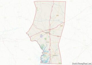
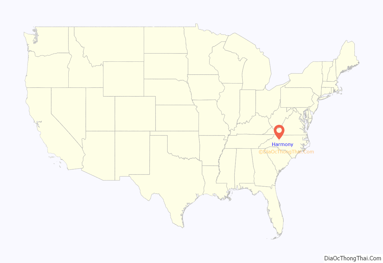
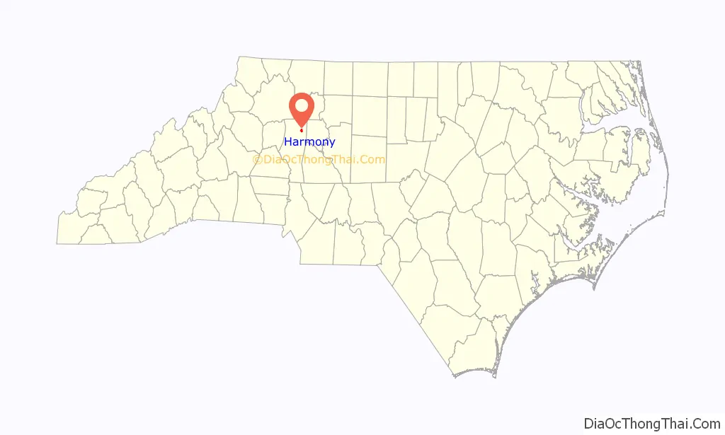
Harmony location map. Where is Harmony town?
History
Harmony was incorporated in 1927. It was named for the Harmony Hill Camp Meetings that took place for two weeks each year on the current site of the Harmony elementary school. The focus of the meetings was a religious (Methodists and Baptists) revival with extensive social gatherings. The first meeting occurred in 1846 and meetings continue to be held the second weekend of October. While the area around Harmony is mostly rural, the town includes a library, the Tomlinson-Moore family park, Harmony Volunteer Fire Department, community center, elementary school, doctor’s offices, a manufacturing plant (Associated Metal Works), and other businesses. The Harmony Academy was founded in 1908. It later became Harmony Farm Life (an accredited high school) in 1916. In the 1966 consolidation of high schools in Iredell County, the site of the Harmony high school became an elementary school.
The following churches have a Harmony address: Clarksbury United Methodist Church, First Baptist Church, Friendship Missionary Baptist Church, Holly Springs Baptist Church, Houstonville Church, Macedonia Methodist Church, Mount Bethel Methodist Church, Mount Nebo Baptist Church, New Union Methodist Church, Pine Grove AME Zion Church, Pleasant View Baptist Church, Rock Springs Baptist Church, Rock Creek AME Zion Church, Sandy Springs Baptist Church, and Winthrop Friends.
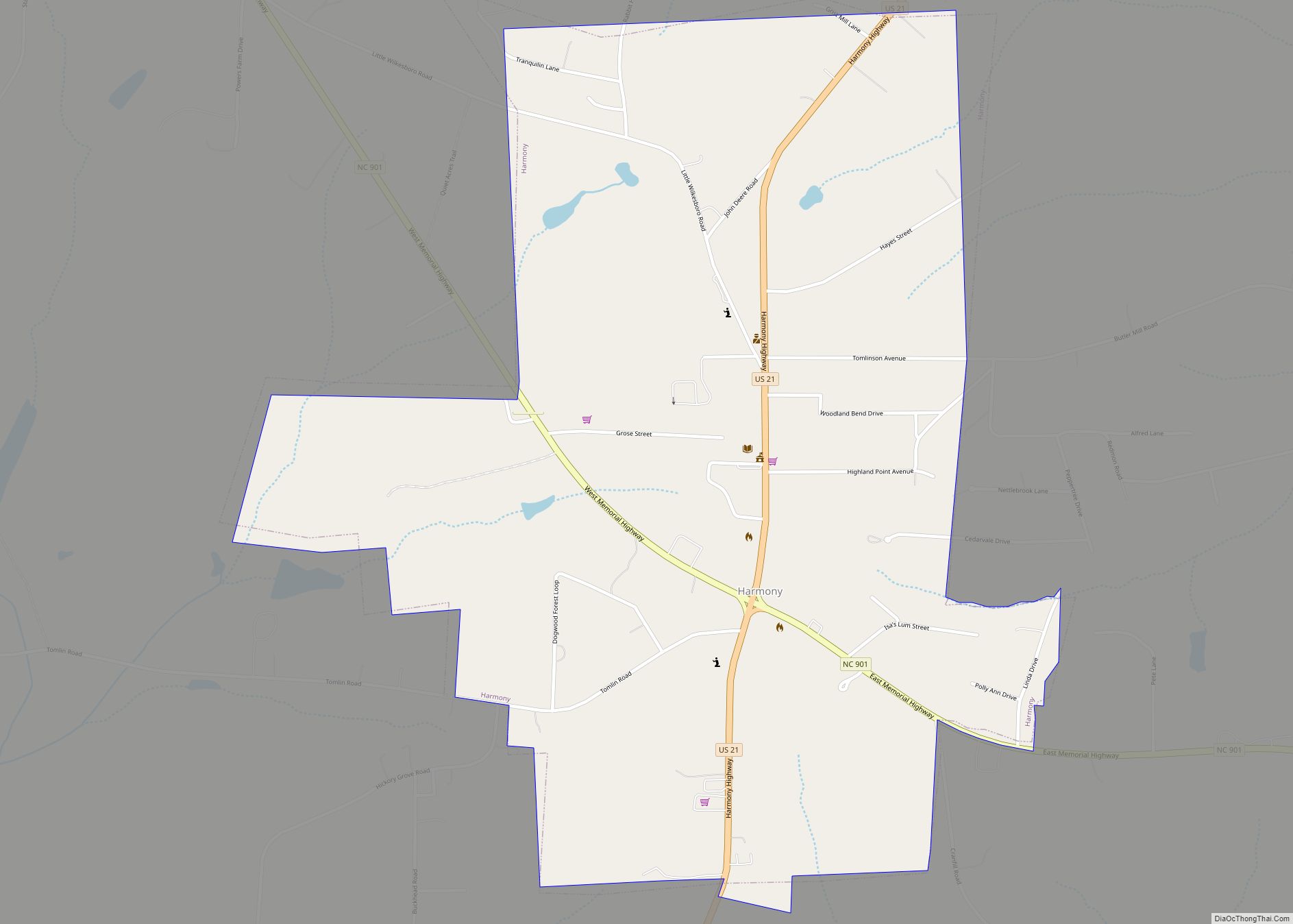
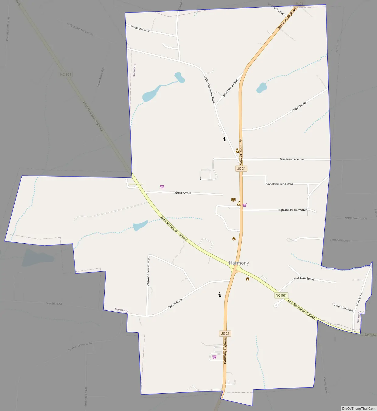
Harmony Road Map
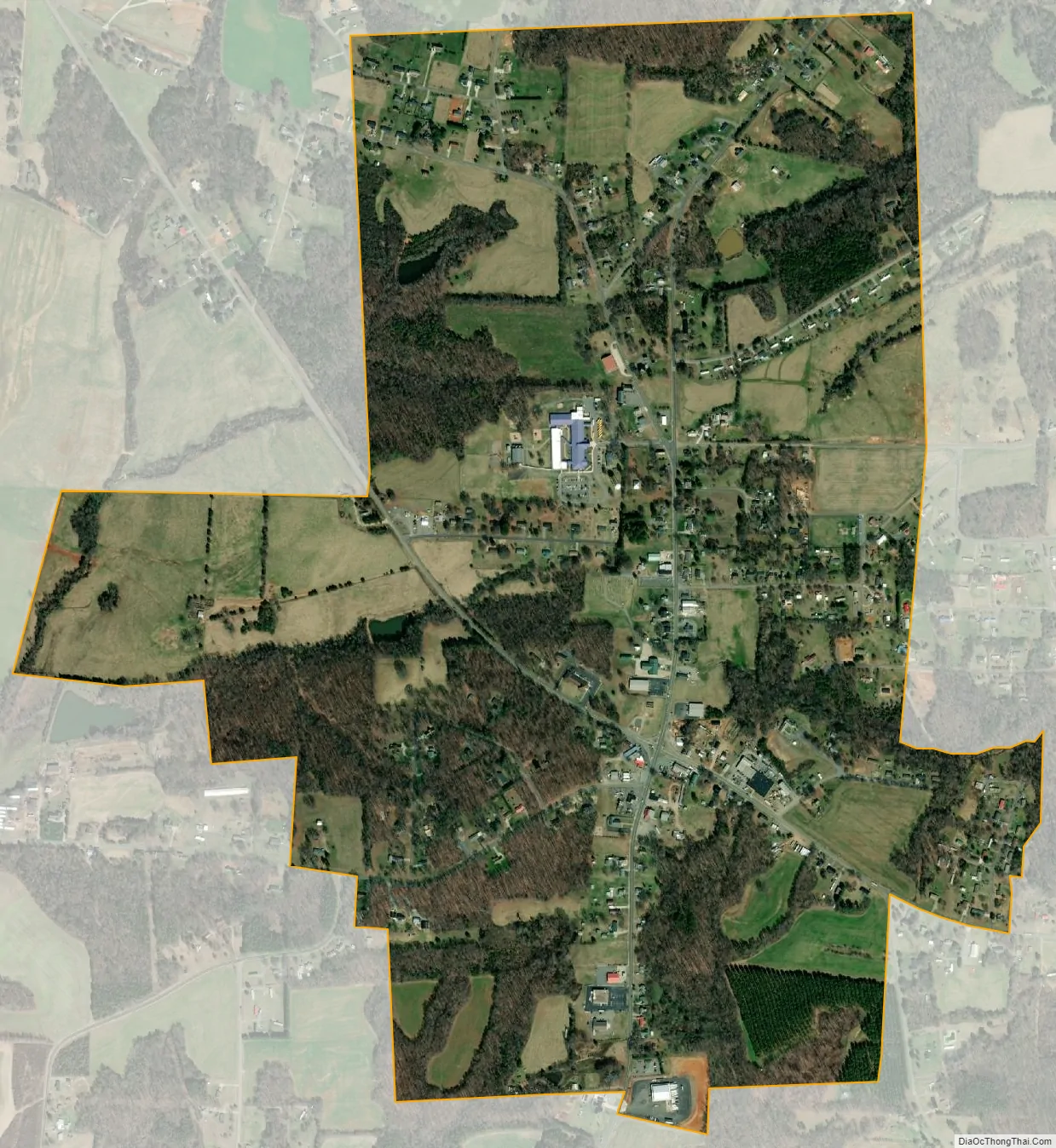
Harmony city Satellite Map
Geography
Harmony is located at 35°57′42″N 80°46′26″W / 35.96167°N 80.77389°W / 35.96167; -80.77389 (35.961588, -80.773947). U.S. Route 21 passes through the town center, leading north 23 miles (37 km) to Elkin and south 15 miles (24 km) to Statesville, the Iredell County seat. North Carolina Highway 901 crosses US 21 in the center of Harmony, leading northwest 5 miles (8 km) to Interstate 77 and southeast 6 miles (10 km) to U.S. Route 64.
According to the United States Census Bureau, the town has a total area of 1.4 square miles (3.5 km), of which 2.5 acres (0.01 km), or 0.38%, are water.
See also
Map of North Carolina State and its subdivision:- Alamance
- Alexander
- Alleghany
- Anson
- Ashe
- Avery
- Beaufort
- Bertie
- Bladen
- Brunswick
- Buncombe
- Burke
- Cabarrus
- Caldwell
- Camden
- Carteret
- Caswell
- Catawba
- Chatham
- Cherokee
- Chowan
- Clay
- Cleveland
- Columbus
- Craven
- Cumberland
- Currituck
- Dare
- Davidson
- Davie
- Duplin
- Durham
- Edgecombe
- Forsyth
- Franklin
- Gaston
- Gates
- Graham
- Granville
- Greene
- Guilford
- Halifax
- Harnett
- Haywood
- Henderson
- Hertford
- Hoke
- Hyde
- Iredell
- Jackson
- Johnston
- Jones
- Lee
- Lenoir
- Lincoln
- Macon
- Madison
- Martin
- McDowell
- Mecklenburg
- Mitchell
- Montgomery
- Moore
- Nash
- New Hanover
- Northampton
- Onslow
- Orange
- Pamlico
- Pasquotank
- Pender
- Perquimans
- Person
- Pitt
- Polk
- Randolph
- Richmond
- Robeson
- Rockingham
- Rowan
- Rutherford
- Sampson
- Scotland
- Stanly
- Stokes
- Surry
- Swain
- Transylvania
- Tyrrell
- Union
- Vance
- Wake
- Warren
- Washington
- Watauga
- Wayne
- Wilkes
- Wilson
- Yadkin
- Yancey
- Alabama
- Alaska
- Arizona
- Arkansas
- California
- Colorado
- Connecticut
- Delaware
- District of Columbia
- Florida
- Georgia
- Hawaii
- Idaho
- Illinois
- Indiana
- Iowa
- Kansas
- Kentucky
- Louisiana
- Maine
- Maryland
- Massachusetts
- Michigan
- Minnesota
- Mississippi
- Missouri
- Montana
- Nebraska
- Nevada
- New Hampshire
- New Jersey
- New Mexico
- New York
- North Carolina
- North Dakota
- Ohio
- Oklahoma
- Oregon
- Pennsylvania
- Rhode Island
- South Carolina
- South Dakota
- Tennessee
- Texas
- Utah
- Vermont
- Virginia
- Washington
- West Virginia
- Wisconsin
- Wyoming