Laurel Park is a town in Henderson County, North Carolina, United States. The population was 2,180 at the 2010 census. It is part of the Asheville Metropolitan Statistical Area.
| Name: | Laurel Park town |
|---|---|
| LSAD Code: | 43 |
| LSAD Description: | town (suffix) |
| State: | North Carolina |
| County: | Henderson County |
| Incorporated: | 1925 |
| Elevation: | 2,385 ft (727 m) |
| Total Area: | 2.82 sq mi (7.31 km²) |
| Land Area: | 2.80 sq mi (7.25 km²) |
| Water Area: | 0.02 sq mi (0.06 km²) |
| Total Population: | 2,250 |
| Population Density: | 803.28/sq mi (310.15/km²) |
| ZIP code: | 28739 |
| Area code: | 828 |
| FIPS code: | 3737160 |
| GNISfeature ID: | 1021114 |
| Website: | www.laurelpark.org |
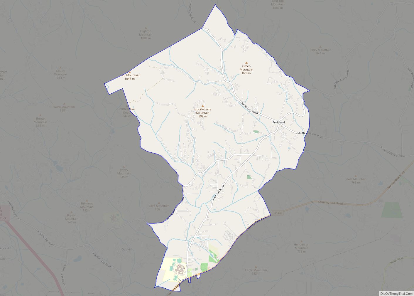
Online Interactive Map
Click on ![]() to view map in "full screen" mode.
to view map in "full screen" mode.
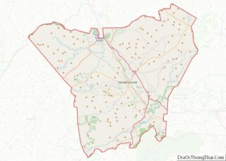
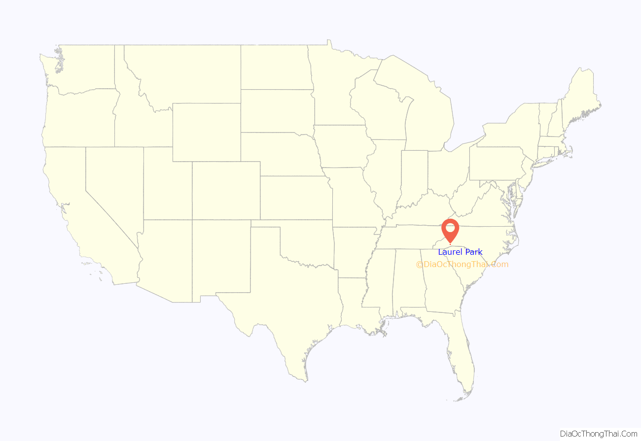
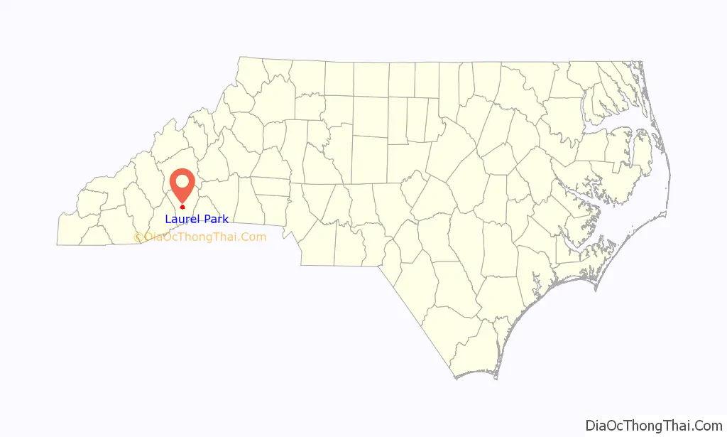
Laurel Park location map. Where is Laurel Park town?
History
The town of Laurel Park was settled on what had been Cherokee land in the late 1800’s. Summer cottages and camps were construction in the areas surrounding Echo Mountain. By 1903, a rail line had been built up Fifth Avenue in Hendersonville to bring day-trippers and summer visitors to Rainbow Lake to enjoy swimming, boating, dancing, camping, and gambling at the Laurel Park Casino. Visitors to the casino included famous boxer Jack Dempsey. Later, another rail line and a canal connected Rainbow Lake with Laurel Lake (Rhododendron Lake), and a counter-balanced railway took sightseers from Crystal Spring (near Rainbow Lake) to an observation tower for views of downtown Hendersonville and near and distant mountains. In 1925, the town was formally incorporated. That same year, Commodore J. Perry Stolz, builder of the popular and expensive Miami Fleetwood Hotel in Florida, arrived in Hendersonville with plans to repeat his success at the top of Jump Off Mountain near Jump-Off Rock. This 15-story hotel, also to be called the Fleetwood, would have a brick exterior trimmed with marble, all the modern conveniences, and a radio station at the top. A new concrete road (named Laurel Park Highway) was built up the mountain to the hotel site; this was used for transporting construction materials. Less than a year later, financial problems led to a halt in construction. Despite numerous attempts to complete the hotel, the 13th floor was the last floor completed, and the hotel was razed in 1939 by a salvage company.
After the stock market crash, the town slowly transitioned from a summer recreational resort to a more residential community.
The Singletary-Reese-Robinson House was listed on the National Register of Historic Places in 2010.
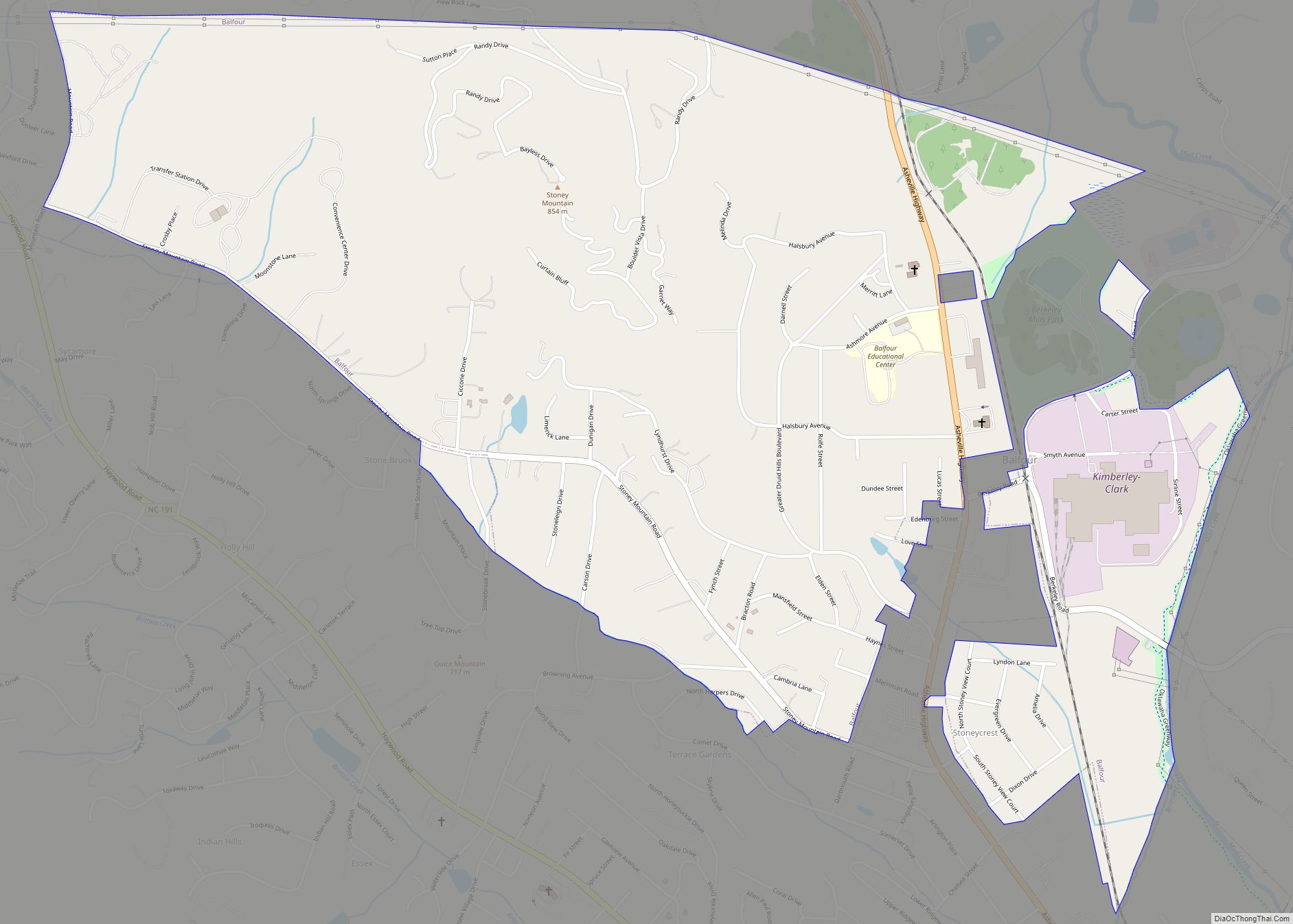
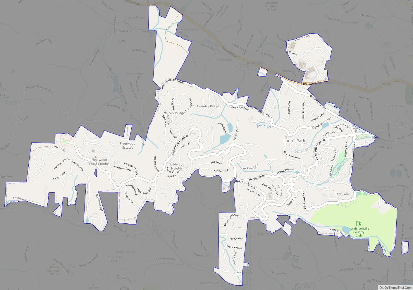
Laurel Park Road Map
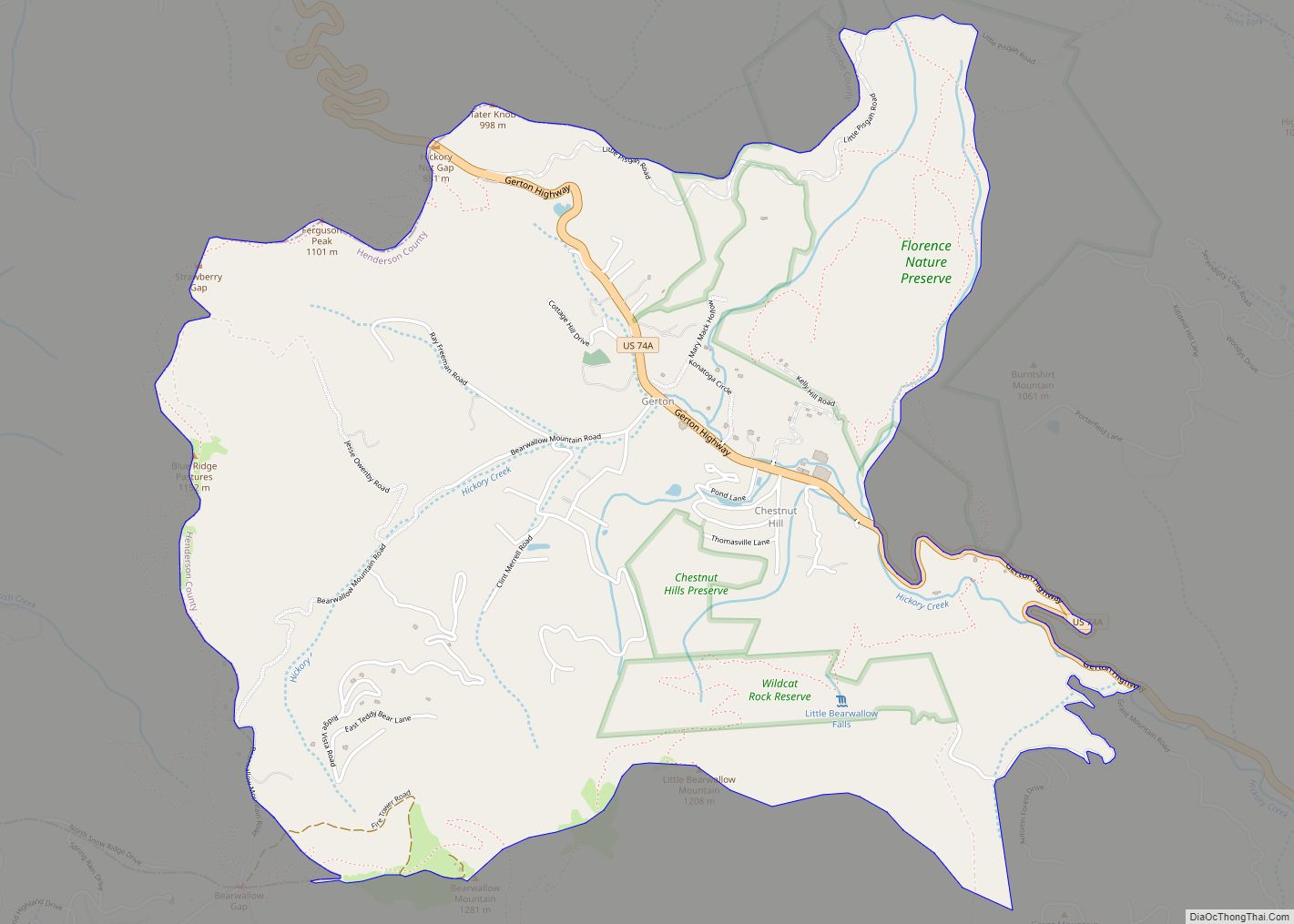
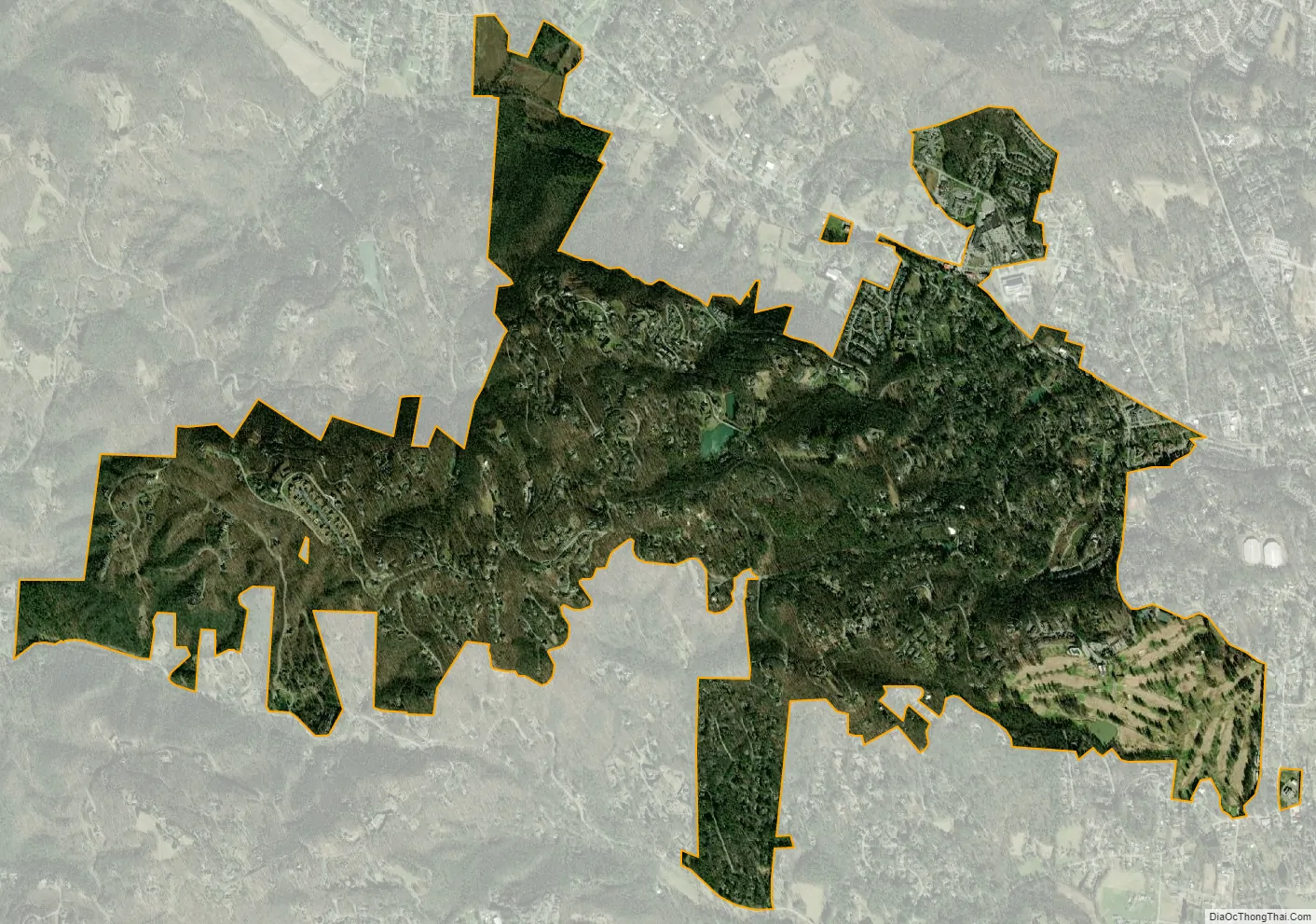
Laurel Park city Satellite Map
Geography
Laurel Park is located in central Henderson County at 35°18′51″N 82°29′50″W / 35.31417°N 82.49722°W / 35.31417; -82.49722 (35.314074, -82.497219), on the eastern slopes of Jump off Mountain. It is bordered to the east by the city of Hendersonville, the county seat. To the south is the unincorporated community of Valley Hill, and to the west is the community of Horse Shoe.
U.S. Route 64 passes through the northern part of the town, in the valley of Shaw Creek. Route 64 leads east into Hendersonville and west 7 miles (11 km) to Etowah.
The town government maintains three parks: Jump Off Rock Park, Rhododendron Lake Nature Park, and Little Laurel Green Park. Additionally, several hiking trails run around the town.
According to the United States Census Bureau, the town has a total area of 2.8 square miles (7.3 km), of which 0.023 square miles (0.06 km), or 0.78%, are water.
See also
Map of North Carolina State and its subdivision:- Alamance
- Alexander
- Alleghany
- Anson
- Ashe
- Avery
- Beaufort
- Bertie
- Bladen
- Brunswick
- Buncombe
- Burke
- Cabarrus
- Caldwell
- Camden
- Carteret
- Caswell
- Catawba
- Chatham
- Cherokee
- Chowan
- Clay
- Cleveland
- Columbus
- Craven
- Cumberland
- Currituck
- Dare
- Davidson
- Davie
- Duplin
- Durham
- Edgecombe
- Forsyth
- Franklin
- Gaston
- Gates
- Graham
- Granville
- Greene
- Guilford
- Halifax
- Harnett
- Haywood
- Henderson
- Hertford
- Hoke
- Hyde
- Iredell
- Jackson
- Johnston
- Jones
- Lee
- Lenoir
- Lincoln
- Macon
- Madison
- Martin
- McDowell
- Mecklenburg
- Mitchell
- Montgomery
- Moore
- Nash
- New Hanover
- Northampton
- Onslow
- Orange
- Pamlico
- Pasquotank
- Pender
- Perquimans
- Person
- Pitt
- Polk
- Randolph
- Richmond
- Robeson
- Rockingham
- Rowan
- Rutherford
- Sampson
- Scotland
- Stanly
- Stokes
- Surry
- Swain
- Transylvania
- Tyrrell
- Union
- Vance
- Wake
- Warren
- Washington
- Watauga
- Wayne
- Wilkes
- Wilson
- Yadkin
- Yancey
- Alabama
- Alaska
- Arizona
- Arkansas
- California
- Colorado
- Connecticut
- Delaware
- District of Columbia
- Florida
- Georgia
- Hawaii
- Idaho
- Illinois
- Indiana
- Iowa
- Kansas
- Kentucky
- Louisiana
- Maine
- Maryland
- Massachusetts
- Michigan
- Minnesota
- Mississippi
- Missouri
- Montana
- Nebraska
- Nevada
- New Hampshire
- New Jersey
- New Mexico
- New York
- North Carolina
- North Dakota
- Ohio
- Oklahoma
- Oregon
- Pennsylvania
- Rhode Island
- South Carolina
- South Dakota
- Tennessee
- Texas
- Utah
- Vermont
- Virginia
- Washington
- West Virginia
- Wisconsin
- Wyoming