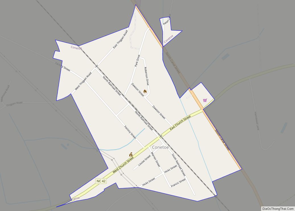
Macclesfield is a town in Edgecombe County, North Carolina, United States. It is part of the Rocky Mount, North Carolina Metropolitan Statistical Area. The population was 471 at the 2010 census.
| Name: | Macclesfield town |
|---|---|
| LSAD Code: | 43 |
| LSAD Description: | town (suffix) |
| State: | North Carolina |
| County: | Edgecombe County |
| Elevation: | 95 ft (29 m) |
| Total Area: | 0.55 sq mi (1.42 km²) |
| Land Area: | 0.54 sq mi (1.40 km²) |
| Water Area: | 0.01 sq mi (0.02 km²) |
| Total Population: | 413 |
| Population Density: | 761.99/sq mi (294.01/km²) |
| ZIP code: | 27852 |
| Area code: | 252 |
| FIPS code: | 3739960 |
| GNISfeature ID: | 1024124 |
Online Interactive Map
Click on ![]() to view map in "full screen" mode.
to view map in "full screen" mode.
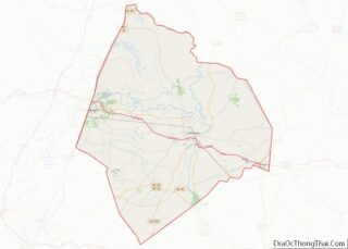
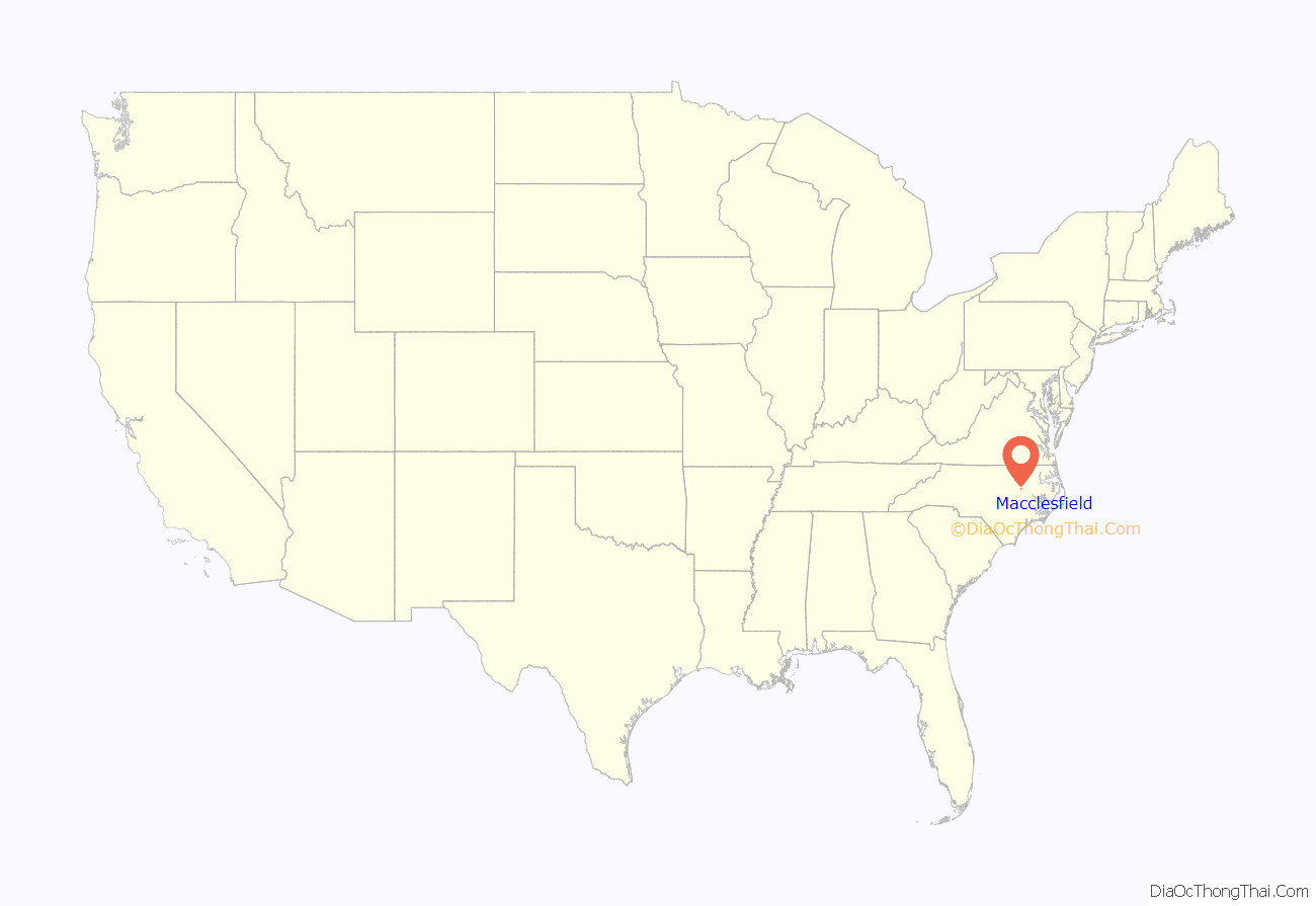
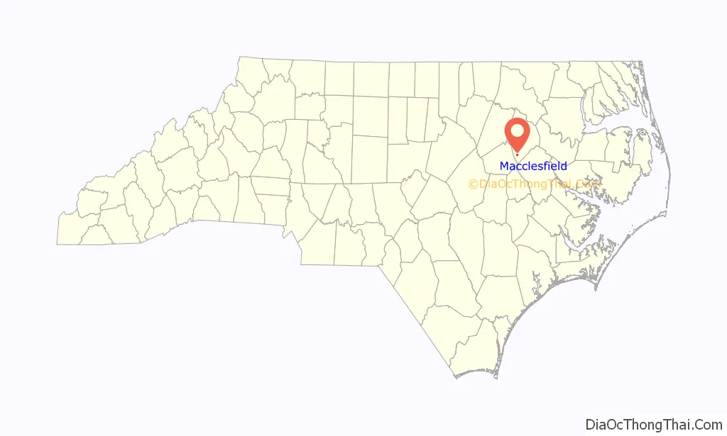
Macclesfield location map. Where is Macclesfield town?
History
Macclesfield was started between 1900 and 1901 when the Tarboro, North Carolina businessman, Henry Clark Bridgers founded The Macclesfield Company. The Macclesfield Company bought land surrounding the tracks of East Carolina Railway in what is now Macclesfield and built warehouses and other buildings.
Bracebridge Hall was listed on the National Register of Historic Places in 1971, with a boundary increase in 2005.
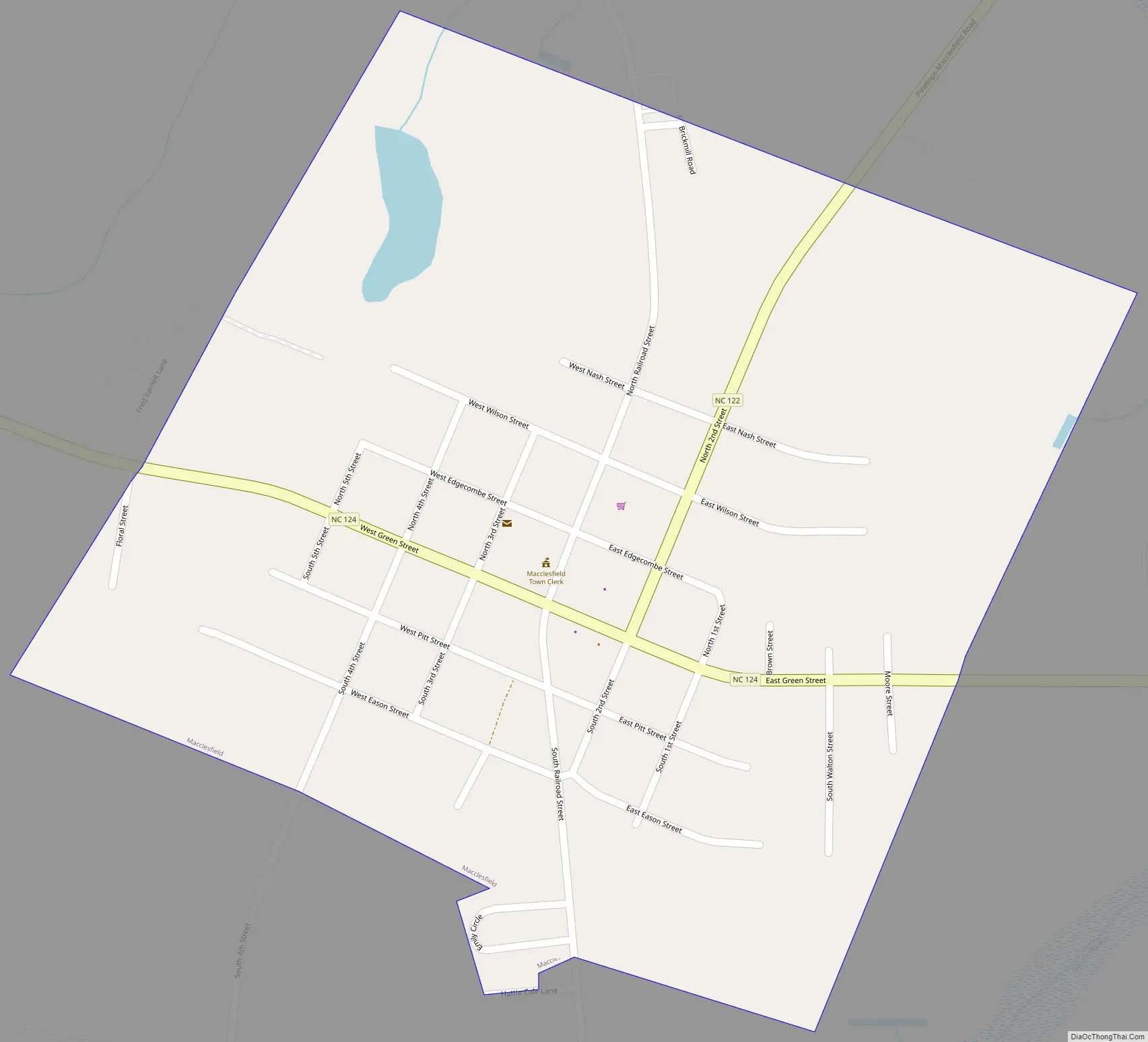
Macclesfield Road Map
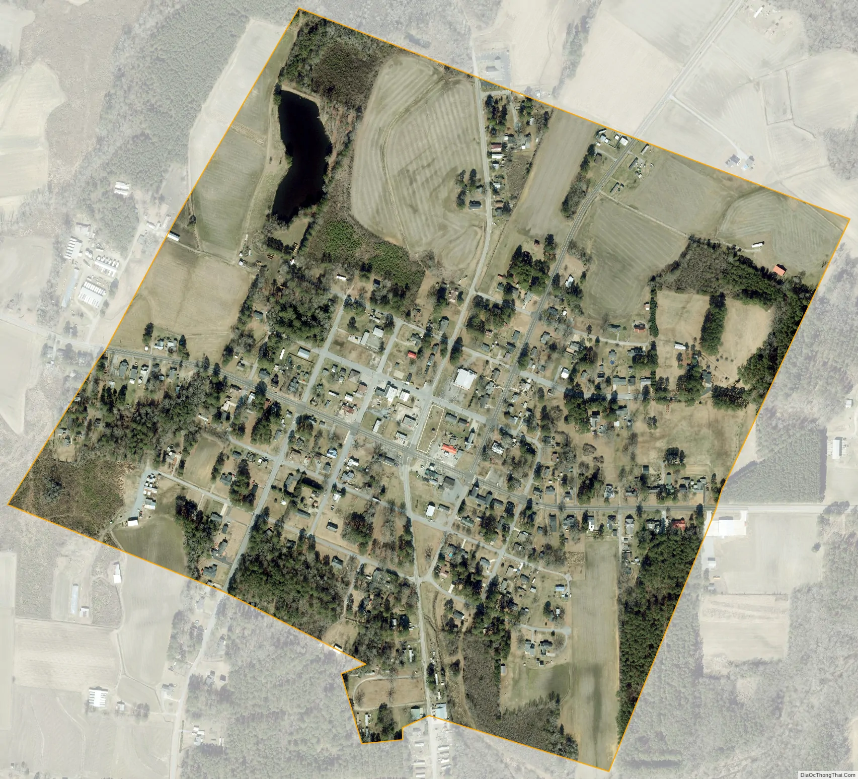
Macclesfield city Satellite Map
Geography
Macclesfield is located at 35°45′6″N 77°40′18″W / 35.75167°N 77.67167°W / 35.75167; -77.67167 (35.751637, -77.671674).
According to the United States Census Bureau, the town has a total area of 0.5 square miles (1.3 km), of which 0.5 square miles (1.3 km) is land and 1.96% is water.
See also
Map of North Carolina State and its subdivision:- Alamance
- Alexander
- Alleghany
- Anson
- Ashe
- Avery
- Beaufort
- Bertie
- Bladen
- Brunswick
- Buncombe
- Burke
- Cabarrus
- Caldwell
- Camden
- Carteret
- Caswell
- Catawba
- Chatham
- Cherokee
- Chowan
- Clay
- Cleveland
- Columbus
- Craven
- Cumberland
- Currituck
- Dare
- Davidson
- Davie
- Duplin
- Durham
- Edgecombe
- Forsyth
- Franklin
- Gaston
- Gates
- Graham
- Granville
- Greene
- Guilford
- Halifax
- Harnett
- Haywood
- Henderson
- Hertford
- Hoke
- Hyde
- Iredell
- Jackson
- Johnston
- Jones
- Lee
- Lenoir
- Lincoln
- Macon
- Madison
- Martin
- McDowell
- Mecklenburg
- Mitchell
- Montgomery
- Moore
- Nash
- New Hanover
- Northampton
- Onslow
- Orange
- Pamlico
- Pasquotank
- Pender
- Perquimans
- Person
- Pitt
- Polk
- Randolph
- Richmond
- Robeson
- Rockingham
- Rowan
- Rutherford
- Sampson
- Scotland
- Stanly
- Stokes
- Surry
- Swain
- Transylvania
- Tyrrell
- Union
- Vance
- Wake
- Warren
- Washington
- Watauga
- Wayne
- Wilkes
- Wilson
- Yadkin
- Yancey
- Alabama
- Alaska
- Arizona
- Arkansas
- California
- Colorado
- Connecticut
- Delaware
- District of Columbia
- Florida
- Georgia
- Hawaii
- Idaho
- Illinois
- Indiana
- Iowa
- Kansas
- Kentucky
- Louisiana
- Maine
- Maryland
- Massachusetts
- Michigan
- Minnesota
- Mississippi
- Missouri
- Montana
- Nebraska
- Nevada
- New Hampshire
- New Jersey
- New Mexico
- New York
- North Carolina
- North Dakota
- Ohio
- Oklahoma
- Oregon
- Pennsylvania
- Rhode Island
- South Carolina
- South Dakota
- Tennessee
- Texas
- Utah
- Vermont
- Virginia
- Washington
- West Virginia
- Wisconsin
- Wyoming