Madison is a town located in Rockingham County, North Carolina. At the 2020 census, the town had a total population of 2,132. Madison is part of the Greensboro-High Point Metropolitan Statistical Area of the Piedmont Triad metro region. It was home to the corporate headquarters of Remington Arms until 2020, when the company was made defunct by bankruptcy proceedings. It is still home to Marlin Firearms, which was an asset of Remington now owned by Sturm, Ruger & Co.
| Name: | Madison town |
|---|---|
| LSAD Code: | 43 |
| LSAD Description: | town (suffix) |
| State: | North Carolina |
| County: | Rockingham County |
| Elevation: | 600 ft (183 m) |
| Total Area: | 3.56 sq mi (9.21 km²) |
| Land Area: | 3.54 sq mi (9.17 km²) |
| Water Area: | 0.02 sq mi (0.04 km²) |
| Total Population: | 2,129 |
| Population Density: | 601.41/sq mi (232.23/km²) |
| ZIP code: | 27025 |
| Area code: | 336 |
| FIPS code: | 3740560 |
| GNISfeature ID: | 0989222 |
| Website: | www.townofmadison.org |
Online Interactive Map
Click on ![]() to view map in "full screen" mode.
to view map in "full screen" mode.
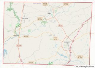
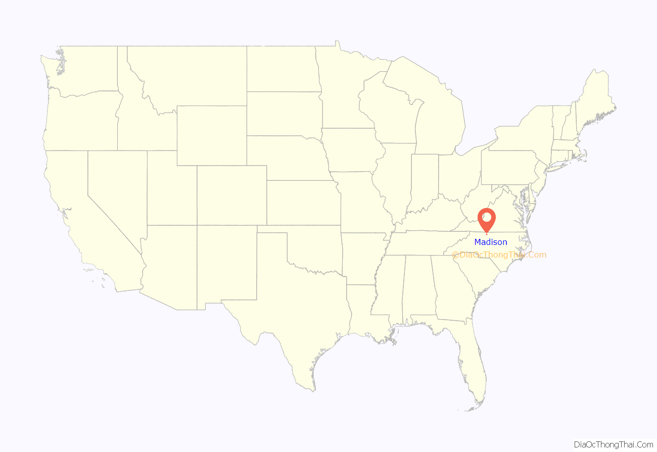
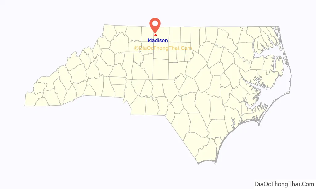
Madison location map. Where is Madison town?
History
In 1940 artist Jean Watson painted the mural, Early Summer in North Carolina, in the town’s post office as a project commissioned by the Works Progress Administration.
The Academy Street Historic District, The Boxwoods, Cross Rock Rapid Sluice, Fewell-Reynolds House, Gravel Shoals Sluice, Jacob’s Creek Landing, Mayo River Sluice, Roberson’s Fish Trap Shoal Sluice, Alfred Moore Scales Law Office, and Slink Shoal Sluice and Wing Dams are listed on the National Register of Historic Places. The Boxley House, in downtown Madison, is the oldest standing structure in the town.
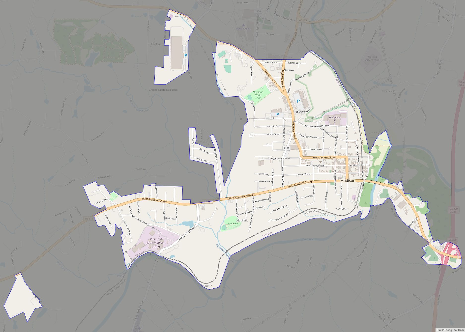
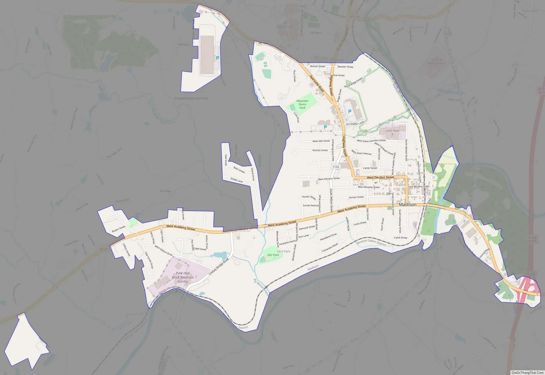
Madison Road Map
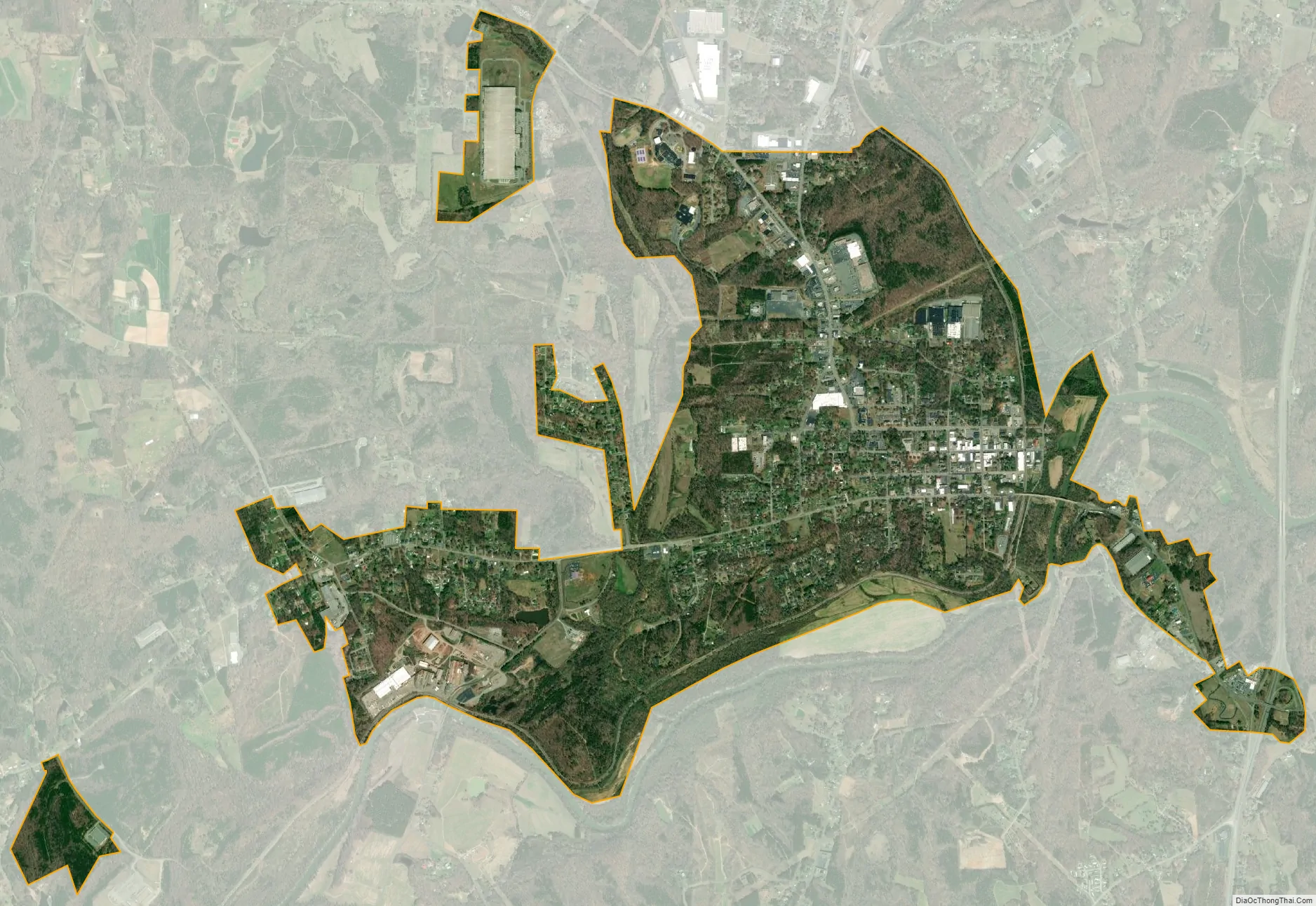
Madison city Satellite Map
Geography
Madison is located at 36°23’13” North, 79°58’9″ West (36.386818, -79.969276).
According to the United States Census Bureau, the town has a total area of 3.3 square miles (8.5 km), of which, 3.0 square miles (7.8 km) of it is land and 0.30% is water.
See also
Map of North Carolina State and its subdivision:- Alamance
- Alexander
- Alleghany
- Anson
- Ashe
- Avery
- Beaufort
- Bertie
- Bladen
- Brunswick
- Buncombe
- Burke
- Cabarrus
- Caldwell
- Camden
- Carteret
- Caswell
- Catawba
- Chatham
- Cherokee
- Chowan
- Clay
- Cleveland
- Columbus
- Craven
- Cumberland
- Currituck
- Dare
- Davidson
- Davie
- Duplin
- Durham
- Edgecombe
- Forsyth
- Franklin
- Gaston
- Gates
- Graham
- Granville
- Greene
- Guilford
- Halifax
- Harnett
- Haywood
- Henderson
- Hertford
- Hoke
- Hyde
- Iredell
- Jackson
- Johnston
- Jones
- Lee
- Lenoir
- Lincoln
- Macon
- Madison
- Martin
- McDowell
- Mecklenburg
- Mitchell
- Montgomery
- Moore
- Nash
- New Hanover
- Northampton
- Onslow
- Orange
- Pamlico
- Pasquotank
- Pender
- Perquimans
- Person
- Pitt
- Polk
- Randolph
- Richmond
- Robeson
- Rockingham
- Rowan
- Rutherford
- Sampson
- Scotland
- Stanly
- Stokes
- Surry
- Swain
- Transylvania
- Tyrrell
- Union
- Vance
- Wake
- Warren
- Washington
- Watauga
- Wayne
- Wilkes
- Wilson
- Yadkin
- Yancey
- Alabama
- Alaska
- Arizona
- Arkansas
- California
- Colorado
- Connecticut
- Delaware
- District of Columbia
- Florida
- Georgia
- Hawaii
- Idaho
- Illinois
- Indiana
- Iowa
- Kansas
- Kentucky
- Louisiana
- Maine
- Maryland
- Massachusetts
- Michigan
- Minnesota
- Mississippi
- Missouri
- Montana
- Nebraska
- Nevada
- New Hampshire
- New Jersey
- New Mexico
- New York
- North Carolina
- North Dakota
- Ohio
- Oklahoma
- Oregon
- Pennsylvania
- Rhode Island
- South Carolina
- South Dakota
- Tennessee
- Texas
- Utah
- Vermont
- Virginia
- Washington
- West Virginia
- Wisconsin
- Wyoming