Eden is a city in Rockingham County in the U.S. state of North Carolina and is part of the Greensboro-High Point Metropolitan Statistical Area of the Piedmont Triad metro region. As of the 2020 census, the population was 15,405. From the late nineteenth century through much of the 20th, the city was a center of textile mills and manufacturing. The city was incorporated in 1967 through the consolidation of three towns: Leaksville, Spray, and Draper.
| Name: | Eden city |
|---|---|
| LSAD Code: | 25 |
| LSAD Description: | city (suffix) |
| State: | North Carolina |
| County: | Rockingham County |
| Elevation: | 591 ft (180 m) |
| Total Area: | 14.38 sq mi (37.24 km²) |
| Land Area: | 14.22 sq mi (36.83 km²) |
| Water Area: | 0.16 sq mi (0.41 km²) |
| Total Population: | 15,421 |
| Population Density: | 1,084.46/sq mi (418.72/km²) |
| ZIP code: | 27288-27289 |
| Area code: | 336 |
| FIPS code: | 3720080 |
| GNISfeature ID: | 0984623 |
| Website: | www.edennc.us |
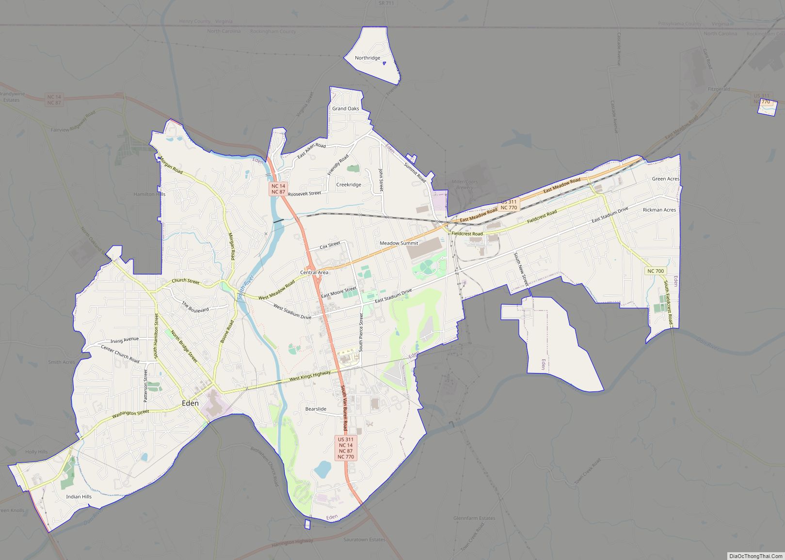
Online Interactive Map
Click on ![]() to view map in "full screen" mode.
to view map in "full screen" mode.
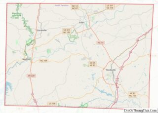
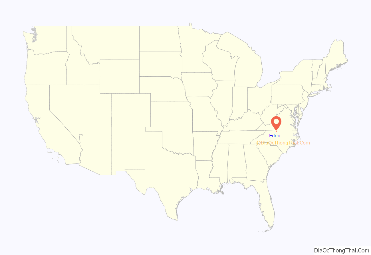
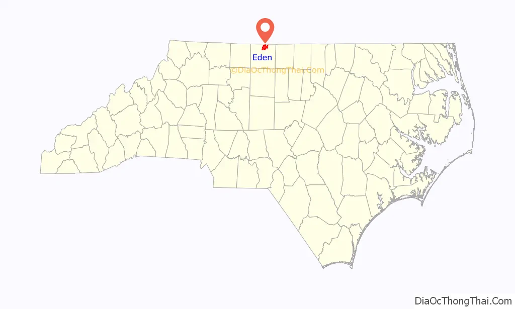
Eden location map. Where is Eden city?
History
By the mid-eighteenth century, the territory of present-day Eden was within a 70,000-acre (280 km) estate owned by William Byrd II, a planter of Virginia and North Carolina. He originally called his estate “The Land of Eden”.
During the last years of his life, William Byrd II dreamed of bringing large numbers of Swiss Protestants to the “Land of Eden”; he eventually acquired more than 100,000 acres (400 km) in Virginia. He envisioned an industrious, self-sufficient colony that would thrive on the abundance of the frontier. Byrd’s dream was not to be realized. After years of negotiations, at least one boatload of Swiss did sail for “The Land of Eden” from Europe, but it was shipwrecked in a December gale off the coast of Virginia. None of the few survivors are believed to have reached Eden. Byrd died August 26, 1744. By that time, the “Land of Eden” began to be surrounded by small farms held by a wave of poor Scotch-Irish immigrants, whom Byrd had compared to the “Goths and Vandals.”
“Eden” was inherited by William Byrd III, who shared none of his father’s dreams of colonization. Young Byrd married Elizabeth Hill Carter in 1748. He sought to dispose of Eden to gain cash to support his grand lifestyle. He was finally successful on November 8, 1755, when he sold 26,000 acres (110 km) in North Carolina to Simon and Francis Farley, two merchant brothers from the island of Antigua. By this time, yeoman settlement in the area was increasing at a considerable pace. The Farley brothers attempted to create plantations on some of the richest acres, but more frequently, settlers squatted on the land and built homesteads. In 1762 James Parke Farley, son of Francis Farley, went to Williamsburg to attend the College of William and Mary. He married Elizabeth Hill Byrd, daughter of William Byrd III and Elizabeth Hill Carter.
Many later settlers migrating to the Dan River Area knew little of William Byrd. They were familiar with an old Indian village in the area near Town Creek and the Farley holdings. This location became the center of settlement, and the 26,000 acres (110 km) came to be called the Sauratown tract. In 1775, James Parke Farley and his new bride moved from cosmopolitan Williamsburg, Virginia, to Sauratown.
Farley claimed that Sauratown was his, created new plantations, and attempted to drive off the squatters. He built a home overlooking the Dan River. Farley was also a member of the 3rd Provincial Congress that met at Hillsboro. In 1776, the family left Sauratown. Elizabeth Farley’s father’s had committed suicide, and she appeared to dislike frontier life. Her husband James was killed during the Revolutionary War, leaving her a widow with four daughters to support. Development of Sauratown was unguided.
Farley’s widow married Reverend John Dunbar, who attempted to manage Sauratown but failed. Finally, the Governor became involved in settling the legal interests of the Farley heirs. The 26,000 acres (110 km), had become a destination for settlement due to its proximity to the Petersburg-Salem road, which crossed the Smith River at an island ford.
In 1795, the town of Leaksville was established on the southwest edge of the Sauratown along the main road. Joseph Cloud resurveyed the tract and divided it into two equal shares in 1798. A year later, Farley’s daughters, Maria Farley and Rebecca Parke Farley, sold their shares to Patrick Henry of Virginia, noted as a rebel spokesman during the American Revolutionary War. On his deathbed June 6, 1799, Henry gave the land to two of his sons, Alexander Spottswood Henry and Nathaniel West Henry.
In the century that Sauratown was in existence, many families settled in the “Land of Eden”, and their descendants have stayed in the area, including the Brodnax, Dillard, Ruffin, Morehead, Henry, and Winston families. Many Scots also settled in the area, including the Galloway, Scales, Watt, Lenox, Campbell, and Moir families. Other notable residents of the county include General Lighthorse Harry Lee.
20th century to present
Following previous unsuccessful referendums, on September 12, 1967, residents of Leaksville, Draper, Spray, and the unincorporated Meadows Greens Sanitary District voted to consolidate their communities, 2,252 to 1,753 with 60 percent of eligible voters participating. Of these, 784 elected to call the new city Eden, a term surveyor William Byrd II had used to describe the region in the 1700s. The consolidation took immediate effect, and Eden became the largest city in Rockingham County.
- In 1970, the city had considerable growth.
- In 2000, city population grew to 15,908.
- In 2010, the US Census population was 15,527.
- In 2014, 39,000 thousand tons of coal ash and 27 million gallons of contaminated water spilled into the Dan River near Eden from a coal-fired power plant owned by Duke Energy.
In the late 1990s and early 2000s the local economy suffered due to the closure of several textile mills. Fieldcrest Cannon laid off hundreds of corporate staff in the 1990s, Pluma closed its plant in 1999, and Spray Cotton Mills closed its yarn mill in 2001, and Pillowtex folded in 2003. Some former workers moved to larger cities in search of jobs. The decline of textiles left the Miller Brewing Company’s facility the town’s flagship industry, but it announced its closure in 2015. The loss of the brewery and the textile mills had a knock-off effect on local retail stores, many of which closed due to the loss of customers and competition from national chains such as Walmart.
On the third weekend of September; Eden hosts the annual River Fest each year to celebrate Eden’s history. The Boone Road Historic District, Bullard-Ray House, Cascade Plantation, Central Leaksville Historic District, Dempsey-Reynolds-Taylor House, First Baptist Church, Dr. Franklin King House-Idlewild, Leaksville Commercial Historic District, Leaksville-Spray Institute, Lower Sauratown Plantation, Mt. Sinai Baptist Church, Site 31RK1, Spray Industrial Historic District, St. Luke’s Episcopal Church, Tanyard Shoal Sluice, Three Ledges Shoal Sluice, and Wide Mouth Shoal Sluice are listed on the National Register of Historic Places.
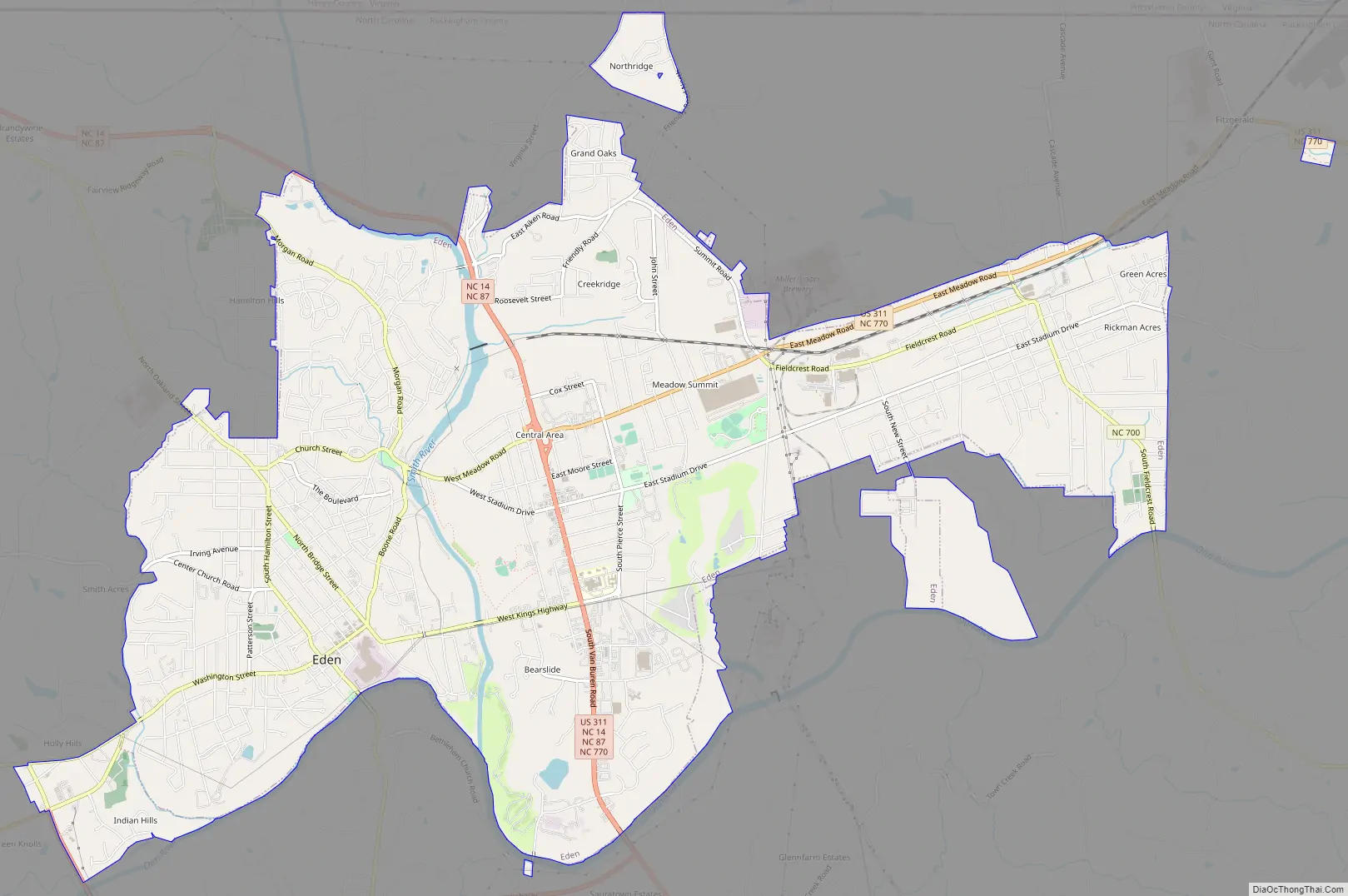
Eden Road Map
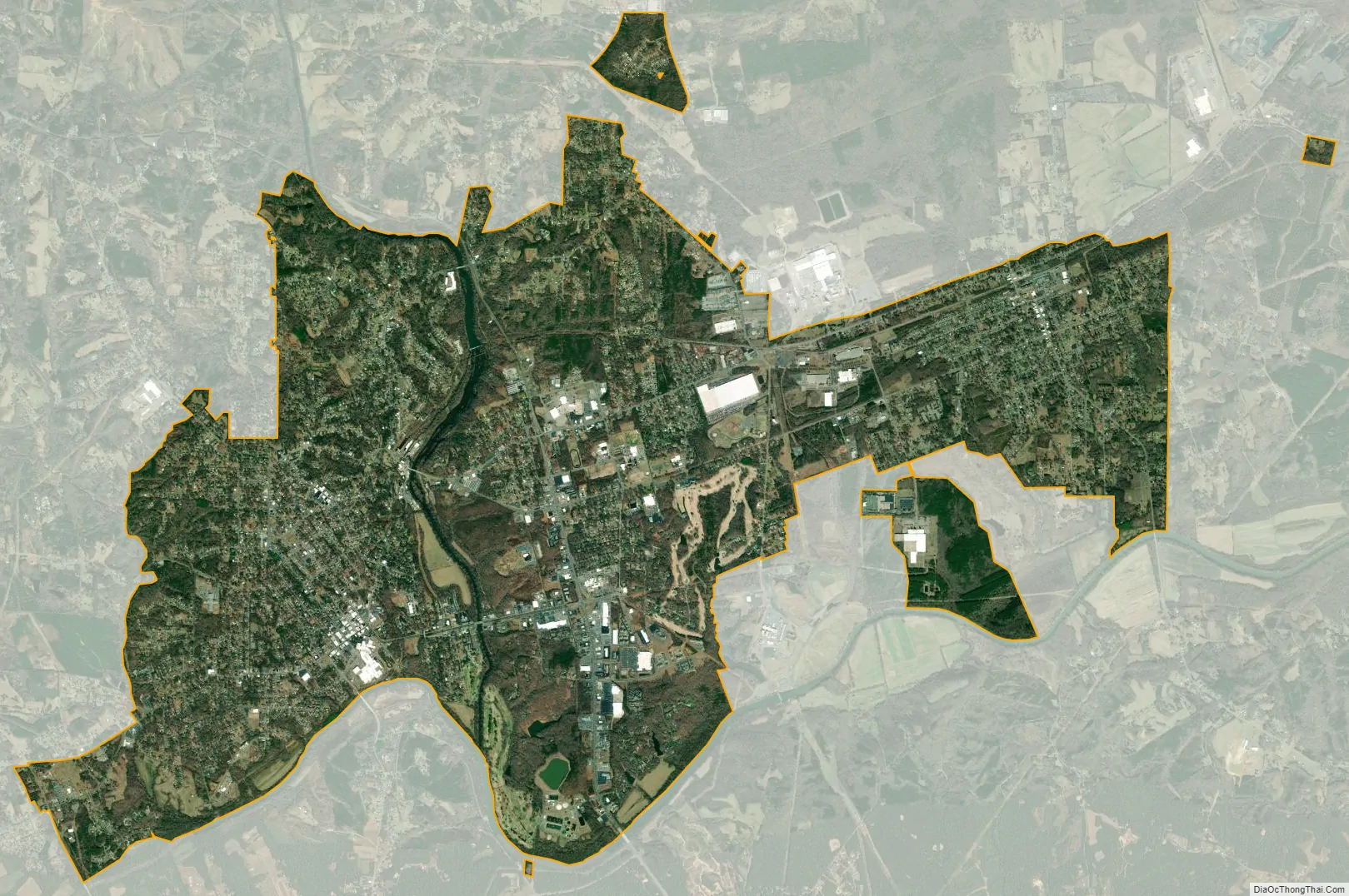
Eden city Satellite Map
Geography
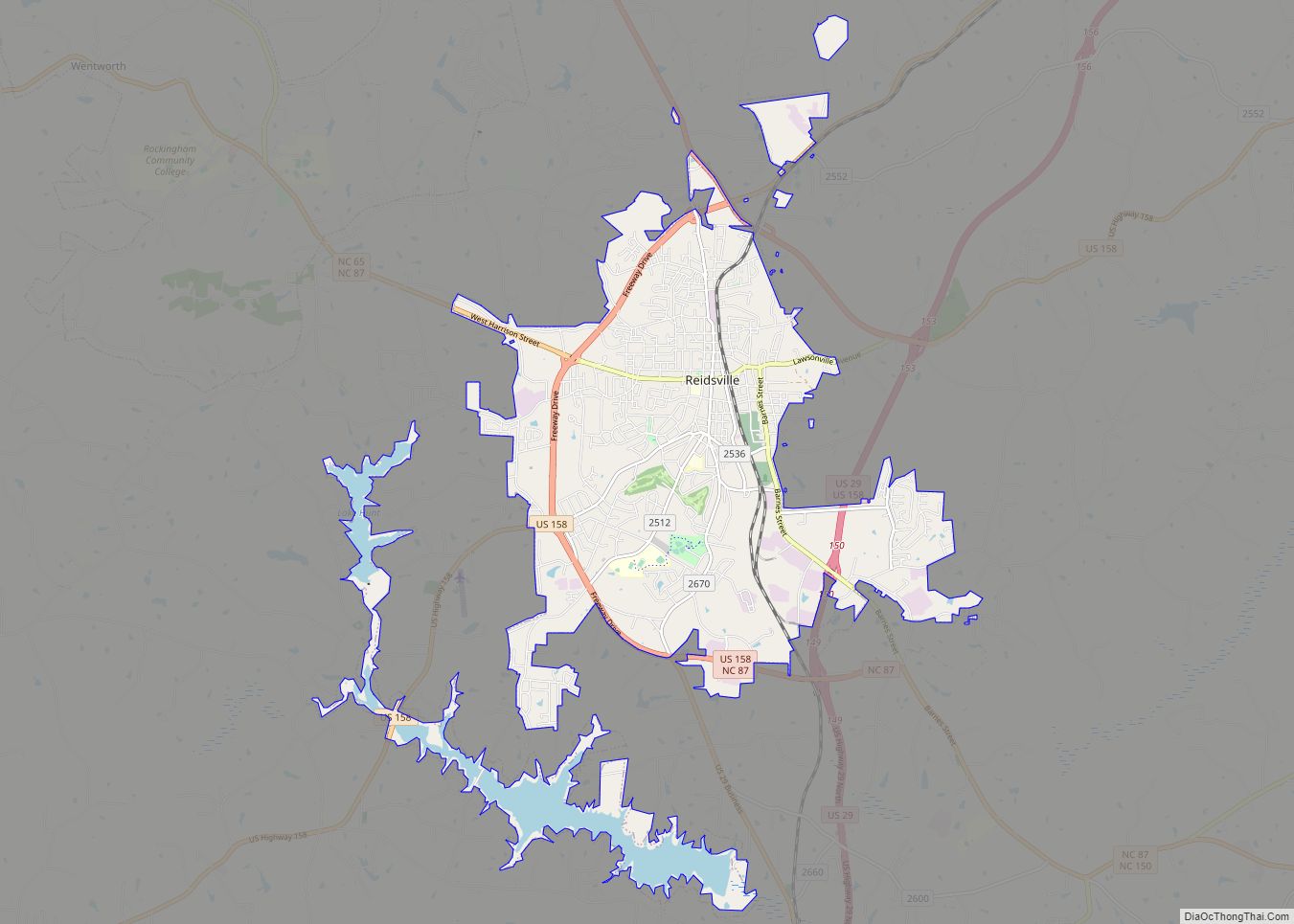
Eden is located at 36°30′23″N 79°44′42″W / 36.50639°N 79.74500°W / 36.50639; -79.74500 (36.506434, -79.745092). The Smith and the Dan River have their confluence on the south side of Eden. The Dan River flows along Eden’s southern border while the Smith River flows from the north bisecting the city on its route to meet the Dan River. Greensboro is 36 miles (58 kilometers) to the south, Reidsville is 15 mi (24 km) southeast via NC 14 High Point is 45 miles (72 km) south and Danville, Virginia is 26 mi (42 km) northeast of the city.
According to the United States Census Bureau, the city has a total area of 15.2 square miles (39 km), of which, 15.0 square miles (39 km) of it is land and 0.2 square miles (0.52 km) of it (1.12%) is water.
See also
Map of North Carolina State and its subdivision:- Alamance
- Alexander
- Alleghany
- Anson
- Ashe
- Avery
- Beaufort
- Bertie
- Bladen
- Brunswick
- Buncombe
- Burke
- Cabarrus
- Caldwell
- Camden
- Carteret
- Caswell
- Catawba
- Chatham
- Cherokee
- Chowan
- Clay
- Cleveland
- Columbus
- Craven
- Cumberland
- Currituck
- Dare
- Davidson
- Davie
- Duplin
- Durham
- Edgecombe
- Forsyth
- Franklin
- Gaston
- Gates
- Graham
- Granville
- Greene
- Guilford
- Halifax
- Harnett
- Haywood
- Henderson
- Hertford
- Hoke
- Hyde
- Iredell
- Jackson
- Johnston
- Jones
- Lee
- Lenoir
- Lincoln
- Macon
- Madison
- Martin
- McDowell
- Mecklenburg
- Mitchell
- Montgomery
- Moore
- Nash
- New Hanover
- Northampton
- Onslow
- Orange
- Pamlico
- Pasquotank
- Pender
- Perquimans
- Person
- Pitt
- Polk
- Randolph
- Richmond
- Robeson
- Rockingham
- Rowan
- Rutherford
- Sampson
- Scotland
- Stanly
- Stokes
- Surry
- Swain
- Transylvania
- Tyrrell
- Union
- Vance
- Wake
- Warren
- Washington
- Watauga
- Wayne
- Wilkes
- Wilson
- Yadkin
- Yancey
- Alabama
- Alaska
- Arizona
- Arkansas
- California
- Colorado
- Connecticut
- Delaware
- District of Columbia
- Florida
- Georgia
- Hawaii
- Idaho
- Illinois
- Indiana
- Iowa
- Kansas
- Kentucky
- Louisiana
- Maine
- Maryland
- Massachusetts
- Michigan
- Minnesota
- Mississippi
- Missouri
- Montana
- Nebraska
- Nevada
- New Hampshire
- New Jersey
- New Mexico
- New York
- North Carolina
- North Dakota
- Ohio
- Oklahoma
- Oregon
- Pennsylvania
- Rhode Island
- South Carolina
- South Dakota
- Tennessee
- Texas
- Utah
- Vermont
- Virginia
- Washington
- West Virginia
- Wisconsin
- Wyoming