Marvin is a village in Union County, North Carolina, United States. The population was 5,579 at the 2010 census. It is a more rural suburb of Charlotte.
| Name: | Marvin village |
|---|---|
| LSAD Code: | 47 |
| LSAD Description: | village (suffix) |
| State: | North Carolina |
| County: | Union County |
| Elevation: | 696 ft (212 m) |
| Total Area: | 6.03 sq mi (15.63 km²) |
| Land Area: | 5.99 sq mi (15.50 km²) |
| Water Area: | 0.05 sq mi (0.12 km²) |
| Total Population: | 6,358 |
| Population Density: | 1,062.15/sq mi (410.09/km²) |
| ZIP code: | 28173 |
| Area code: | 704 |
| FIPS code: | 3741720 |
| GNISfeature ID: | 1027423 |
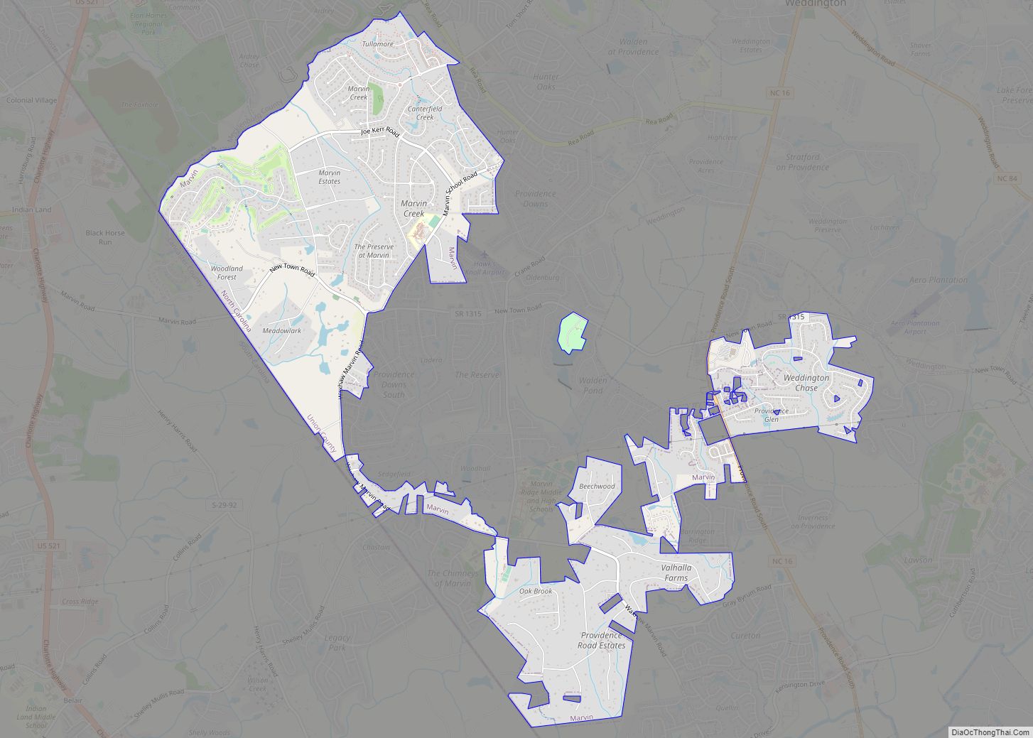
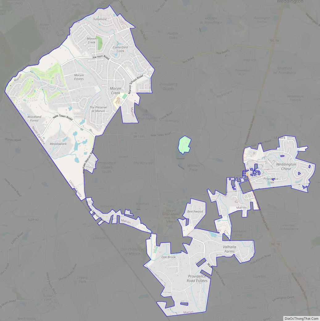
Online Interactive Map
Click on ![]() to view map in "full screen" mode.
to view map in "full screen" mode.
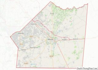
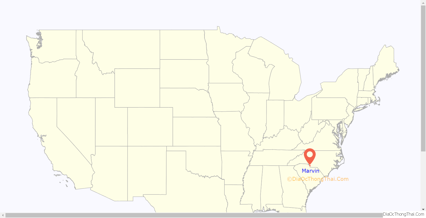
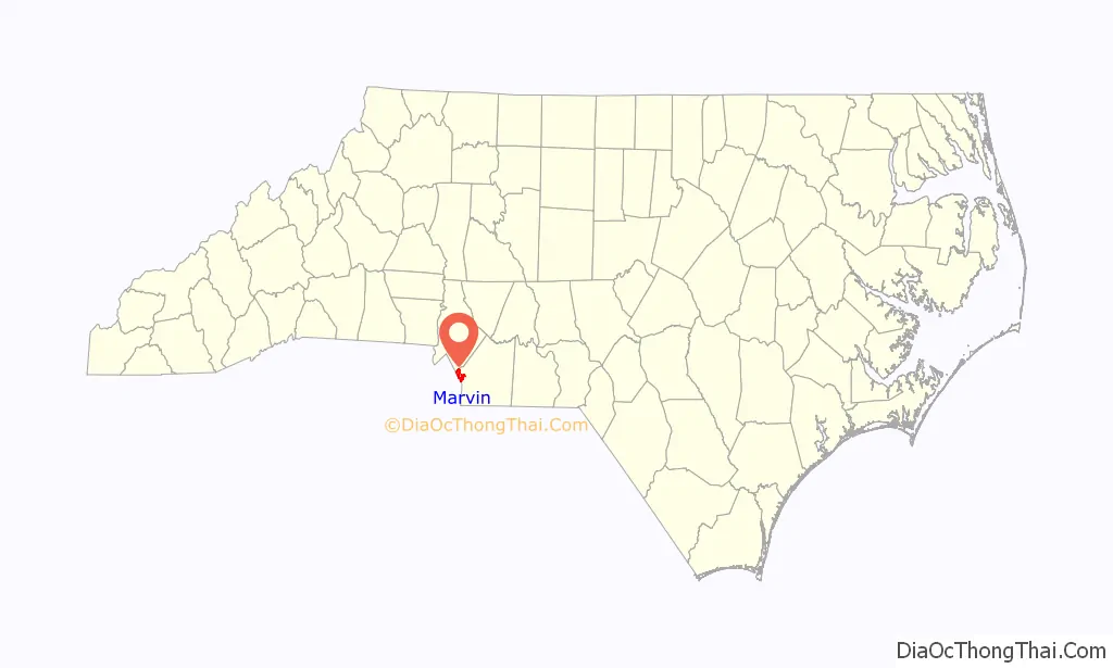
Marvin location map. Where is Marvin village?
History
The area known as Marvin today was settled and inhabited by elements of the Waxhaw Indian tribe, who lived near the present day border between North Carolina and South Carolina. The Waxhaw gained their name from the type of waxy reed which grew near the swamps of the Waxhaw forests. In 1700, John Lawson, Surveyor-General of the Colony of North Carolina made first contact with the Waxhaw Indians, and the native land of Marvin. He noted that “the land was being so fertile that no labor of man in one or two ages could make it poor.” Lawsons thoughts about the land were confirmed 300 years later with numerous farms scattered around the Marvin area, giving its semi-rural suburban atmosphere. In 1741, an epidemic of smallpox was introduced into the community, and many of the Indians were killed or were forced to abandon the area. Settlers began to exploit the fertile land to grow craps such as soy and tobacco.
German, English, Welch, and Scottish families, some of whom were escaping turmoil in Europe such as the 7 years war and the Jacobite rising of 1745.
Until 1842, Marvin was an unincorporated section of Anson county, until the schism between Mecklenburg – Union counties, which resulted in the creation of Union county, and thus the incorporation of Marvin. Most settlers of Marvin owned slaves and would pass inheritance to their children. It would not be until the end of the Civil War that slavery was ended in Marvin. Most local slaves were purchased in Charleston, SC. Old Steel Creek road was used as a transport of slaved cotton, which was destroyed by General Cornwallis during the American Revolutionary war, and currently is the site of Highway 521.
Although sources are scares, it is believed that Henry Downs was one of the original signatories of the “Mecklenburg Declaration of Independence”, which was destroyed in a fire in 1800, and published just one month after the events at Lexington and Concord.
In 1777, North Carolina began issuing land grants to those who served in the American revolution. Around 640 acres of land were distributed through this land grant system. It is believed that the Crane road was where Francis Carter, one of the first settlers of the Marvin area, lived and managed the distribution of crown grants.
Marvin was founded on July 1, 1994. According to Ruth B. Ezzell, the major Marvin principles for foundation were “the hardships, the sacrifices made by our forefathers, their determination to lay Christian principles as foundations for future generations, how they fought in wars for freedom and liberty, we may be inspired to a greater loyalty and appreciation of our community”.
Marvin has experienced numerous demographic changes, such as an increase of Asian-Americans who have migrated to the town during the early 2000’s. Marvin is geographically located near Charlotte, and is incorporated as an official suburb of Charlotte, and the major shift in population can be attributed towards the large banking Industry of Charlotte, NC, which has grown due to the introduction of Bank of America which was finalized around 1992.
Marvin Road Map
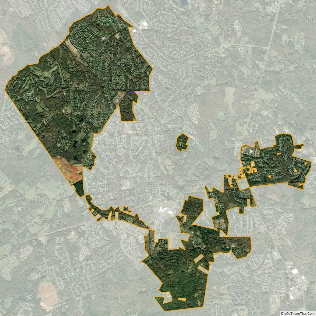
Marvin city Satellite Map
Geography
According to the United States Census Bureau, the village has a total area of 3.9 square miles (10 km), of which 3.9 square miles (10 km) is land and 0.04 square miles (0.10 km) (0.51%) is water. Marvin is a border territory, which lies in the state of North Carolina but borders South Carolina to the southwest.
See also
Map of North Carolina State and its subdivision:- Alamance
- Alexander
- Alleghany
- Anson
- Ashe
- Avery
- Beaufort
- Bertie
- Bladen
- Brunswick
- Buncombe
- Burke
- Cabarrus
- Caldwell
- Camden
- Carteret
- Caswell
- Catawba
- Chatham
- Cherokee
- Chowan
- Clay
- Cleveland
- Columbus
- Craven
- Cumberland
- Currituck
- Dare
- Davidson
- Davie
- Duplin
- Durham
- Edgecombe
- Forsyth
- Franklin
- Gaston
- Gates
- Graham
- Granville
- Greene
- Guilford
- Halifax
- Harnett
- Haywood
- Henderson
- Hertford
- Hoke
- Hyde
- Iredell
- Jackson
- Johnston
- Jones
- Lee
- Lenoir
- Lincoln
- Macon
- Madison
- Martin
- McDowell
- Mecklenburg
- Mitchell
- Montgomery
- Moore
- Nash
- New Hanover
- Northampton
- Onslow
- Orange
- Pamlico
- Pasquotank
- Pender
- Perquimans
- Person
- Pitt
- Polk
- Randolph
- Richmond
- Robeson
- Rockingham
- Rowan
- Rutherford
- Sampson
- Scotland
- Stanly
- Stokes
- Surry
- Swain
- Transylvania
- Tyrrell
- Union
- Vance
- Wake
- Warren
- Washington
- Watauga
- Wayne
- Wilkes
- Wilson
- Yadkin
- Yancey
- Alabama
- Alaska
- Arizona
- Arkansas
- California
- Colorado
- Connecticut
- Delaware
- District of Columbia
- Florida
- Georgia
- Hawaii
- Idaho
- Illinois
- Indiana
- Iowa
- Kansas
- Kentucky
- Louisiana
- Maine
- Maryland
- Massachusetts
- Michigan
- Minnesota
- Mississippi
- Missouri
- Montana
- Nebraska
- Nevada
- New Hampshire
- New Jersey
- New Mexico
- New York
- North Carolina
- North Dakota
- Ohio
- Oklahoma
- Oregon
- Pennsylvania
- Rhode Island
- South Carolina
- South Dakota
- Tennessee
- Texas
- Utah
- Vermont
- Virginia
- Washington
- West Virginia
- Wisconsin
- Wyoming