Pineville (/ˈpiːnvɪl/; locally /ˈpiːnvəl/) is a suburban town in the southernmost portion of Mecklenburg County, North Carolina, United States, situated in the Waxhaws district between Charlotte and Fort Mill.
| Name: | Pineville town |
|---|---|
| LSAD Code: | 43 |
| LSAD Description: | town (suffix) |
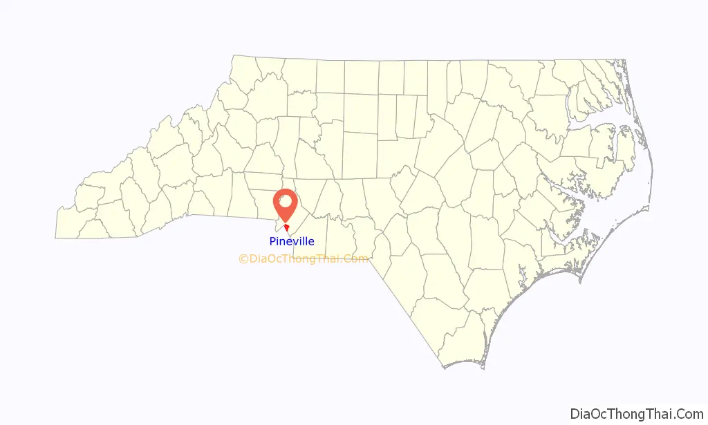
| State: | North Carolina |
| County: | Mecklenburg County |
| Elevation: | 587 ft (179 m) |
| Total Area: | 6.68 sq mi (17.29 km²) |
| Land Area: | 6.64 sq mi (17.20 km²) |
| Water Area: | 0.04 sq mi (0.09 km²) |
| Total Population: | 10,602 |
| Population Density: | 1,596.45/sq mi (616.40/km²) |
| ZIP code: | 28134 |
| Area code: | 704 |
| FIPS code: | 3752220 |
| GNISfeature ID: | 1021940 |
| Website: | www.pinevillenc.gov |
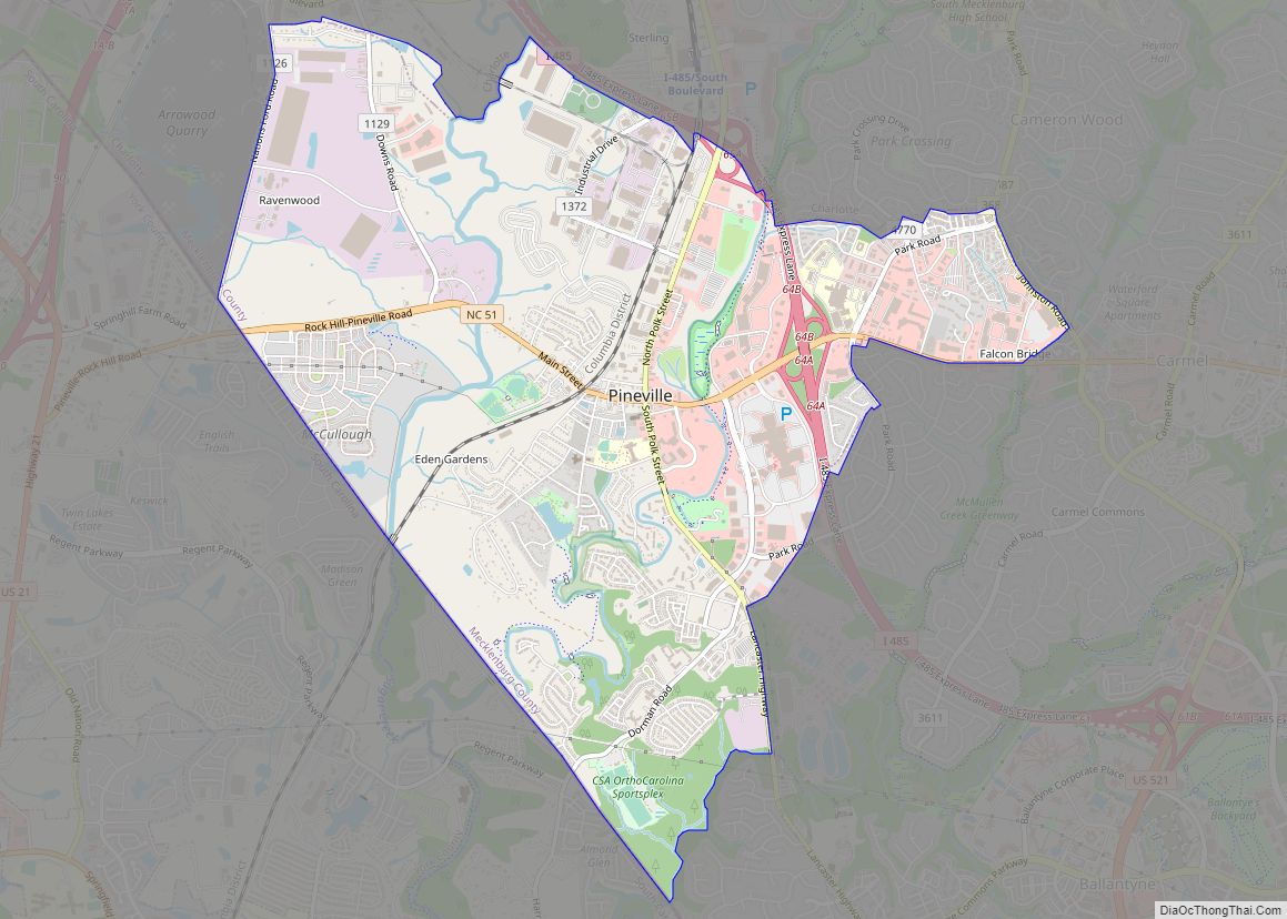
Online Interactive Map
Click on ![]() to view map in "full screen" mode.
to view map in "full screen" mode.
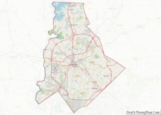
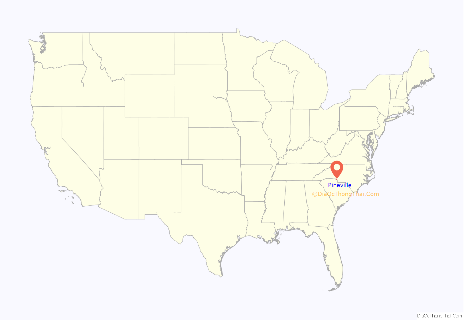
Pineville location map. Where is Pineville town?
History
Pineville became known as a mule trading center during the time of the Charlotte ‘gold rush’. At that time ‘Pineville’ was called ‘Morrow’s Turnout’. Located at the intersection of two major Native American trading routes, it had vast meadows in which the animals of trade and transportation could be ‘turned-out’ to pasture.
Pineville was incorporated as a town in 1873. The origins of the name Pineville can be traced back to 1852, when the Charlotte & Columbia Railroad came through the Pineville area. The railroad wanted a more modern name, and the large stands of pine trees in the area inspired the new name – Pineville. In the 1890s, Dover Yarn Mills established a cotton mill in Pineville. This mill later became Cone Mills, Inc., which operated in the town until November of 1991. The one-block area of old Pineville was a bustling commercial area, with many different shops. Today this area is home to many quaint shops and restaurants.
The growth of Pineville was greatly changed through the initial segment of I-485 opening to traffic. Although the one-mile (1.6 km) stretch connecting interchanges at NC Highway 51 and South Boulevard was designed to divert through traffic around Charlotte via a freeway loop, I-485 incidentally passed through Pineville’s town limits. In the years to follow, largely undeveloped land adjacent to Pineville’s two I-485 interchanges, developed into what is now the largest shopping district in North Carolina. With nearly 8,000,000 square feet (743,000 m) of retail space, Pineville is home to the 1,100,000-square-foot (100,000 m) Carolina Place Mall, at least two power centres and many strip malls, outparcels and free-standing retailers.
It is the birthplace of James K. Polk, the 11th U.S. president. His home is no longer standing, but an original cabin from that time period is kept there, symbolic of the one he was born in. This is now a state historic site. It has two reconstructed log cabins, both from the local area being built circa 1790. They are furnished in period antiques similar to what the Polks would have used. There is a main house, a cookhouse, and a log barn, and tours are available by costumed guides. First Lady of U.S. at the time, Ladybird Johnson, came to Pineville to dedicate the new state site. In addition to the period log houses there is a museum with a short film on the life and times of James Knox Polk along with period clothes and other artifacts of the area and era. A monument was erected in 1904 on the site of the present-day reconstructed cabins. The state of North Carolina moved the monument from its original location in 1964. It was moved to its current location near the visitor center in 1968.
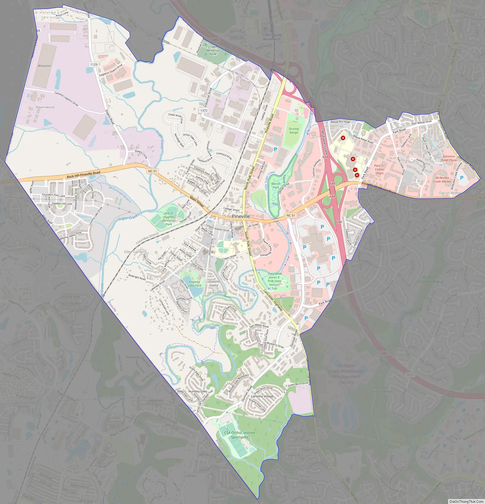
Pineville Road Map
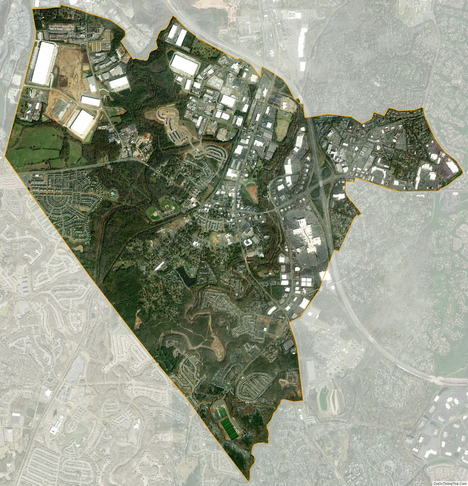
Pineville city Satellite Map
Geography
Pineville is located at 35°5′09″N 80°53′17″W / 35.08583°N 80.88806°W / 35.08583; -80.88806 (35.085737, -80.888167).
According to the United States Census Bureau, the town has a total area of 6.62 square miles (17.1 km), all land.
See also
Map of North Carolina State and its subdivision:- Alamance
- Alexander
- Alleghany
- Anson
- Ashe
- Avery
- Beaufort
- Bertie
- Bladen
- Brunswick
- Buncombe
- Burke
- Cabarrus
- Caldwell
- Camden
- Carteret
- Caswell
- Catawba
- Chatham
- Cherokee
- Chowan
- Clay
- Cleveland
- Columbus
- Craven
- Cumberland
- Currituck
- Dare
- Davidson
- Davie
- Duplin
- Durham
- Edgecombe
- Forsyth
- Franklin
- Gaston
- Gates
- Graham
- Granville
- Greene
- Guilford
- Halifax
- Harnett
- Haywood
- Henderson
- Hertford
- Hoke
- Hyde
- Iredell
- Jackson
- Johnston
- Jones
- Lee
- Lenoir
- Lincoln
- Macon
- Madison
- Martin
- McDowell
- Mecklenburg
- Mitchell
- Montgomery
- Moore
- Nash
- New Hanover
- Northampton
- Onslow
- Orange
- Pamlico
- Pasquotank
- Pender
- Perquimans
- Person
- Pitt
- Polk
- Randolph
- Richmond
- Robeson
- Rockingham
- Rowan
- Rutherford
- Sampson
- Scotland
- Stanly
- Stokes
- Surry
- Swain
- Transylvania
- Tyrrell
- Union
- Vance
- Wake
- Warren
- Washington
- Watauga
- Wayne
- Wilkes
- Wilson
- Yadkin
- Yancey
- Alabama
- Alaska
- Arizona
- Arkansas
- California
- Colorado
- Connecticut
- Delaware
- District of Columbia
- Florida
- Georgia
- Hawaii
- Idaho
- Illinois
- Indiana
- Iowa
- Kansas
- Kentucky
- Louisiana
- Maine
- Maryland
- Massachusetts
- Michigan
- Minnesota
- Mississippi
- Missouri
- Montana
- Nebraska
- Nevada
- New Hampshire
- New Jersey
- New Mexico
- New York
- North Carolina
- North Dakota
- Ohio
- Oklahoma
- Oregon
- Pennsylvania
- Rhode Island
- South Carolina
- South Dakota
- Tennessee
- Texas
- Utah
- Vermont
- Virginia
- Washington
- West Virginia
- Wisconsin
- Wyoming