Rosman is a town in Transylvania County, North Carolina, United States. The population was 576 at the 2010 census. The northern terminus of U.S. Route 178 is less than one mile northwest of Rosman on U.S. Route 64.
The Pisgah Astronomical Research Institute is located approximately six miles north of Rosman, near Balsam Grove.
| Name: | Rosman town |
|---|---|
| LSAD Code: | 43 |
| LSAD Description: | town (suffix) |
| State: | North Carolina |
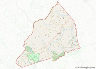
| County: | Transylvania County |
| Incorporated: | 1901 |
| Elevation: | 2,202 ft (671 m) |
| Total Area: | 0.55 sq mi (1.41 km²) |
| Land Area: | 0.55 sq mi (1.41 km²) |
| Water Area: | 0.00 sq mi (0.00 km²) |
| Total Population: | 701 |
| Population Density: | 1,283.88/sq mi (495.75/km²) |
| ZIP code: | 28772 |
| Area code: | 828 |
| FIPS code: | 3758020 |
| GNISfeature ID: | 1022400 |
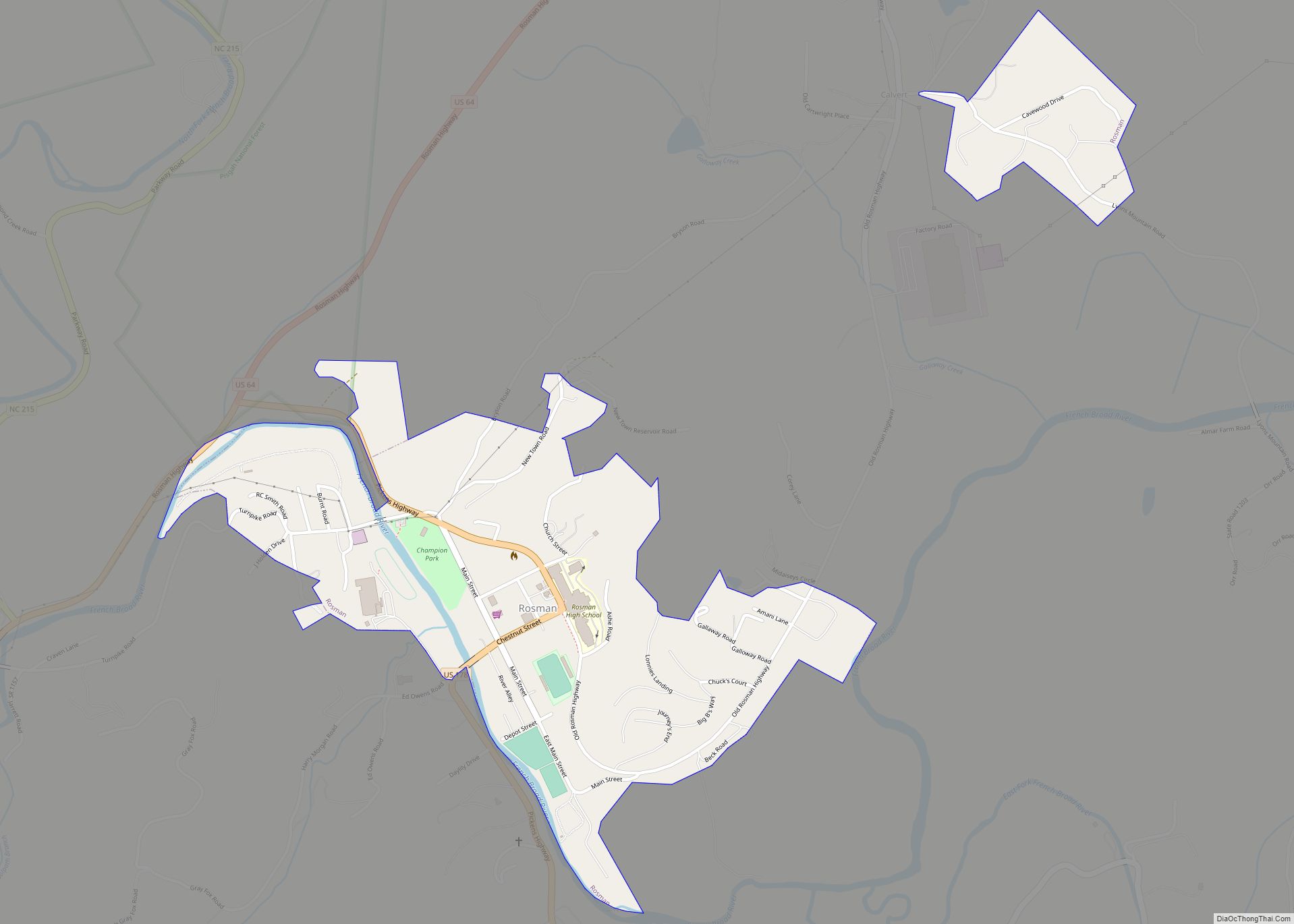
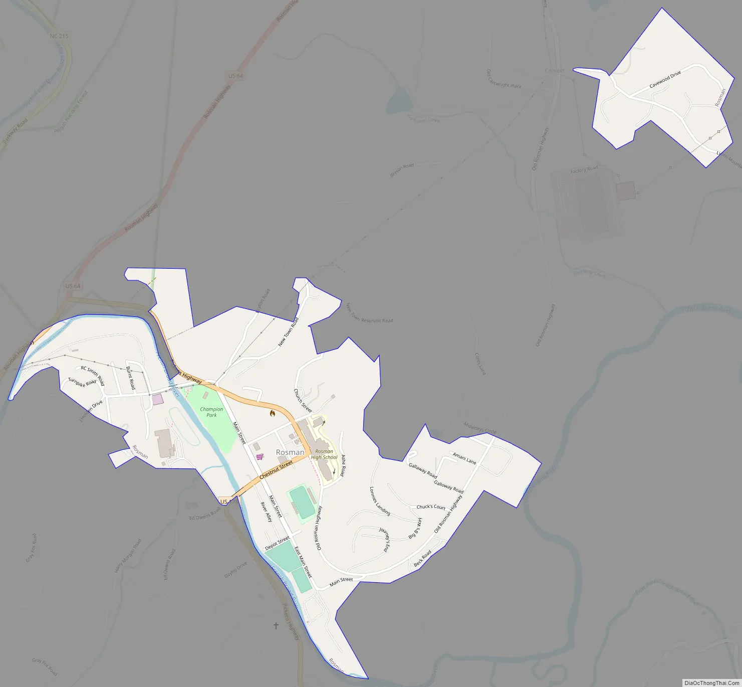
Online Interactive Map
Click on ![]() to view map in "full screen" mode.
to view map in "full screen" mode.
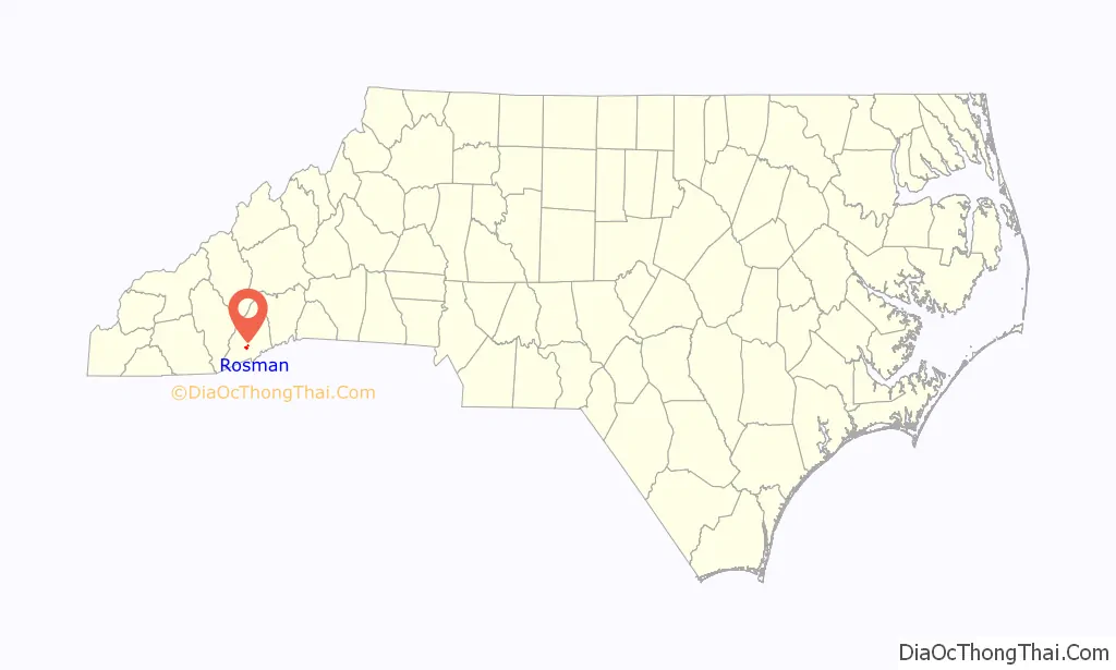
Rosman location map. Where is Rosman town?

History
Known first by European Americans as Jeptha, the settlement was known as “Toxaway” in the early 20th century. Because this caused confusion with the nearby resort town of Lake Toxaway (10 miles to the west), in 1903 the name was changed to “Eastatoe,” the name of a historic Cherokee town in the area. It was also the name for nearby Eastatoe Gap and Eastatoe Falls. The Cherokee word for the Carolina parakeet was eastatoe.
Town residents promoted another change, and Joseph Silversteen (a local industrialist) suggested Rosman in 1905, after two of his business associates, Joseph Rosenthal and Morris Osmansky. This was approved.
Rosman Road Map
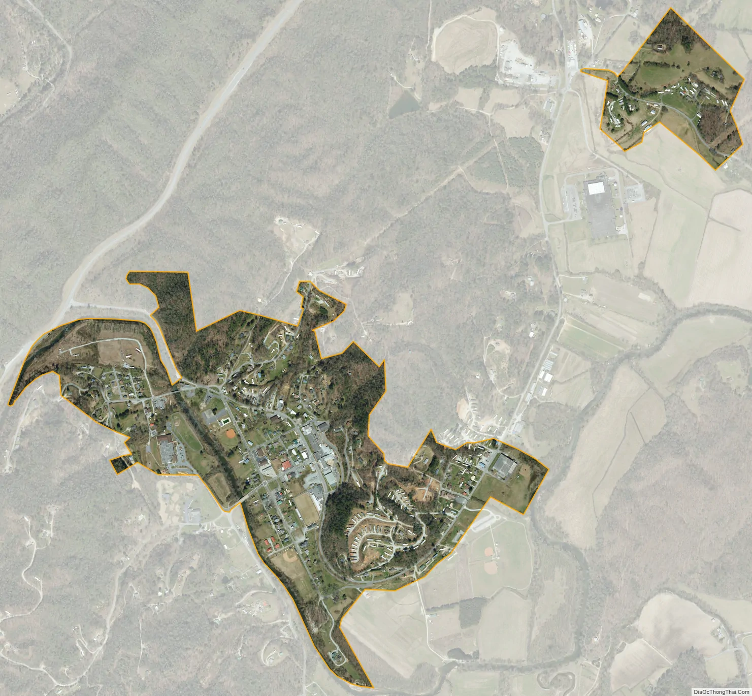
Rosman city Satellite Map
Geography
Rosman is located at 35°8′41″N 82°49′22″W / 35.14472°N 82.82278°W / 35.14472; -82.82278 (35.144755, −82.822789).
According to the United States Census Bureau, the town has a total area of 0.4 square miles (1.0 km), all land.
Within the town limits of Rosman and to the south of the town limits, U.S. Route 178 is called Pickens Highway, referring to Pickens, South Carolina. South of Rosman, the highway continues across mountainous terrain through a series of switchback curves into South Carolina, eventually reaching Pickens.
Rosman sits on the eastern boundary of Pisgah National Forest.
The French Broad River runs through the town of Rosman. The river’s origin, where the North Fork French Broad and the West Fork French Broad converge to form the river proper, lies just west of the town. A USGS stream gauge station, number 03439000, is located on the French Broad River in Rosman.
The climate is very wet, with a mean annual rainfall since 1936 of 79.54 inches (2,020.3 mm)—one of the highest in the US east of the Cascades. The record annual rainfall of 129.60 inches (3,291.8 mm) in 1964 is the second heaviest for a calendar year within this region, only 0.54 inches (13.7 mm) behind Mount Washington’s record from 1969.
See also
Map of North Carolina State and its subdivision:- Alamance
- Alexander
- Alleghany
- Anson
- Ashe
- Avery
- Beaufort
- Bertie
- Bladen
- Brunswick
- Buncombe
- Burke
- Cabarrus
- Caldwell
- Camden
- Carteret
- Caswell
- Catawba
- Chatham
- Cherokee
- Chowan
- Clay
- Cleveland
- Columbus
- Craven
- Cumberland
- Currituck
- Dare
- Davidson
- Davie
- Duplin
- Durham
- Edgecombe
- Forsyth
- Franklin
- Gaston
- Gates
- Graham
- Granville
- Greene
- Guilford
- Halifax
- Harnett
- Haywood
- Henderson
- Hertford
- Hoke
- Hyde
- Iredell
- Jackson
- Johnston
- Jones
- Lee
- Lenoir
- Lincoln
- Macon
- Madison
- Martin
- McDowell
- Mecklenburg
- Mitchell
- Montgomery
- Moore
- Nash
- New Hanover
- Northampton
- Onslow
- Orange
- Pamlico
- Pasquotank
- Pender
- Perquimans
- Person
- Pitt
- Polk
- Randolph
- Richmond
- Robeson
- Rockingham
- Rowan
- Rutherford
- Sampson
- Scotland
- Stanly
- Stokes
- Surry
- Swain
- Transylvania
- Tyrrell
- Union
- Vance
- Wake
- Warren
- Washington
- Watauga
- Wayne
- Wilkes
- Wilson
- Yadkin
- Yancey
- Alabama
- Alaska
- Arizona
- Arkansas
- California
- Colorado
- Connecticut
- Delaware
- District of Columbia
- Florida
- Georgia
- Hawaii
- Idaho
- Illinois
- Indiana
- Iowa
- Kansas
- Kentucky
- Louisiana
- Maine
- Maryland
- Massachusetts
- Michigan
- Minnesota
- Mississippi
- Missouri
- Montana
- Nebraska
- Nevada
- New Hampshire
- New Jersey
- New Mexico
- New York
- North Carolina
- North Dakota
- Ohio
- Oklahoma
- Oregon
- Pennsylvania
- Rhode Island
- South Carolina
- South Dakota
- Tennessee
- Texas
- Utah
- Vermont
- Virginia
- Washington
- West Virginia
- Wisconsin
- Wyoming