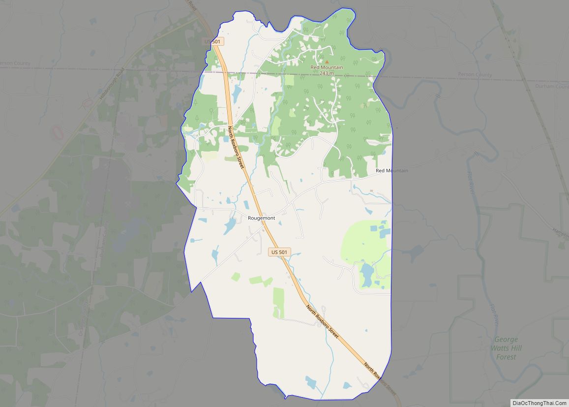
Rougemont is an unincorporated community and census-designated place (CDP) in Durham and Person counties, North Carolina, United States. The population of the CDP was 978 at the 2010 census. An act to incorporate Rougemont as a town was introduced to the North Carolina General Assembly in 2011.
| Name: | Rougemont CDP |
|---|---|
| LSAD Code: | 57 |
| LSAD Description: | CDP (suffix) |
| State: | North Carolina |
| County: | Durham County, Person County |
| Elevation: | 561 ft (171 m) |
| Total Area: | 6.39 sq mi (16.56 km²) |
| Land Area: | 6.32 sq mi (16.36 km²) |
| Water Area: | 0.08 sq mi (0.20 km²) |
| Total Population: | 1,001 |
| Population Density: | 158.51/sq mi (61.20/km²) |
| ZIP code: | 27572 |
| FIPS code: | 3758040 |
| GNISfeature ID: | 1022403 |
Online Interactive Map
Click on ![]() to view map in "full screen" mode.
to view map in "full screen" mode.
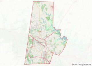
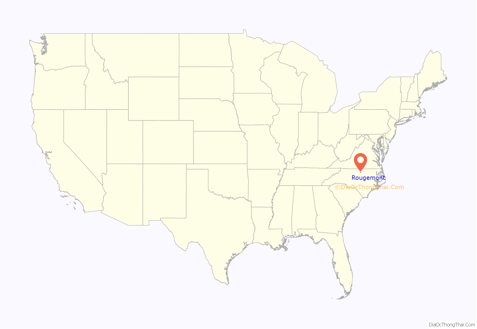
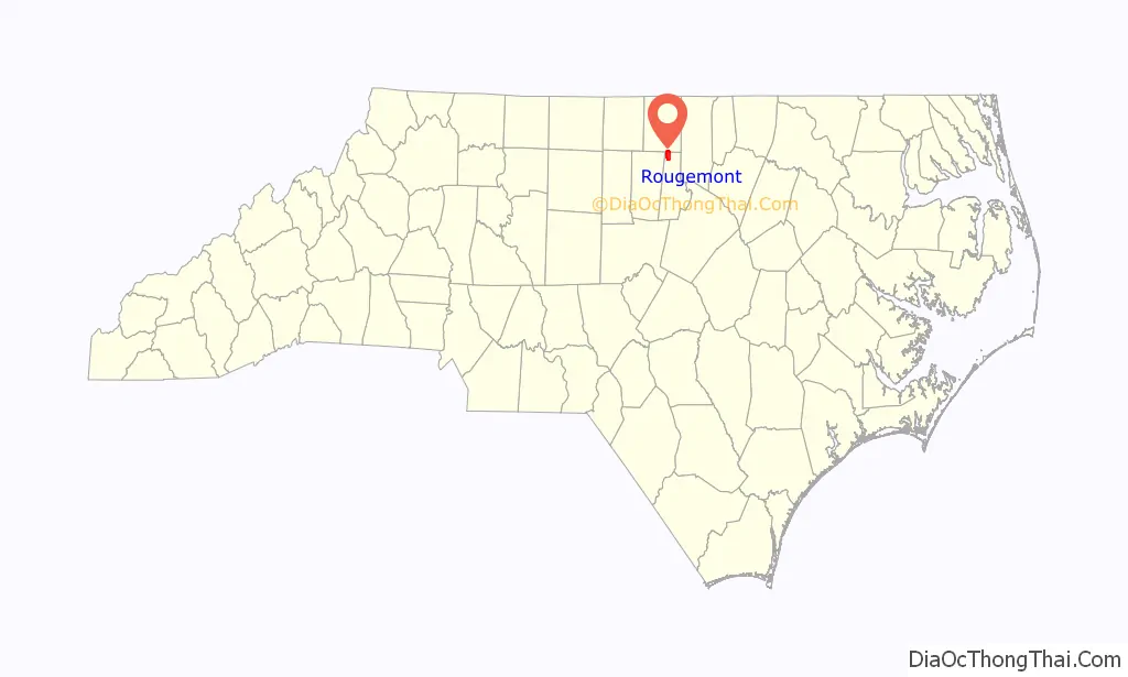
Rougemont location map. Where is Rougemont CDP?
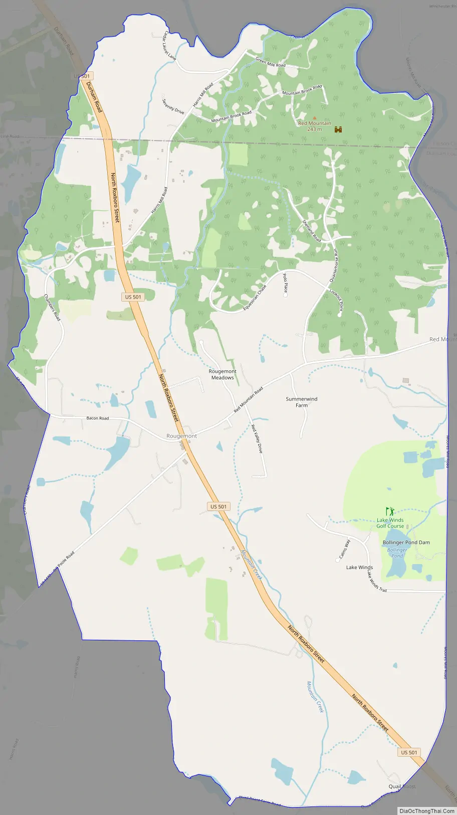
Rougemont Road Map
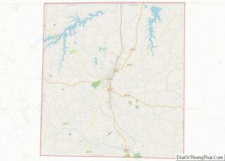
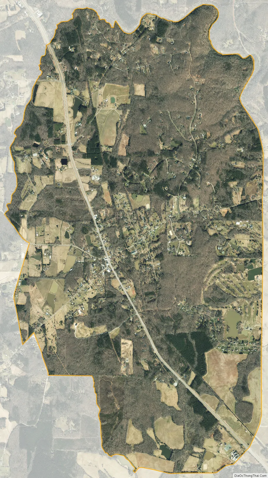
Rougemont city Satellite Map
Geography
Rougemont is located in northern Durham County along U.S. Route 501. The center of town is 17 miles (27 km) north of the center of Durham and 13 miles (21 km) south of Roxboro. The CDP extends north into Person County as far as the Flat River, east to Moores Mill Road, south to Quail Roost Farm Road, and west to Harris Road and Chambers Road. The Rougemont ZIP code covers a much larger area, extending west into Orange County and east into Granville County, but all population statistics are for the smaller CDP area.
See also
Map of North Carolina State and its subdivision:- Alamance
- Alexander
- Alleghany
- Anson
- Ashe
- Avery
- Beaufort
- Bertie
- Bladen
- Brunswick
- Buncombe
- Burke
- Cabarrus
- Caldwell
- Camden
- Carteret
- Caswell
- Catawba
- Chatham
- Cherokee
- Chowan
- Clay
- Cleveland
- Columbus
- Craven
- Cumberland
- Currituck
- Dare
- Davidson
- Davie
- Duplin
- Durham
- Edgecombe
- Forsyth
- Franklin
- Gaston
- Gates
- Graham
- Granville
- Greene
- Guilford
- Halifax
- Harnett
- Haywood
- Henderson
- Hertford
- Hoke
- Hyde
- Iredell
- Jackson
- Johnston
- Jones
- Lee
- Lenoir
- Lincoln
- Macon
- Madison
- Martin
- McDowell
- Mecklenburg
- Mitchell
- Montgomery
- Moore
- Nash
- New Hanover
- Northampton
- Onslow
- Orange
- Pamlico
- Pasquotank
- Pender
- Perquimans
- Person
- Pitt
- Polk
- Randolph
- Richmond
- Robeson
- Rockingham
- Rowan
- Rutherford
- Sampson
- Scotland
- Stanly
- Stokes
- Surry
- Swain
- Transylvania
- Tyrrell
- Union
- Vance
- Wake
- Warren
- Washington
- Watauga
- Wayne
- Wilkes
- Wilson
- Yadkin
- Yancey
- Alabama
- Alaska
- Arizona
- Arkansas
- California
- Colorado
- Connecticut
- Delaware
- District of Columbia
- Florida
- Georgia
- Hawaii
- Idaho
- Illinois
- Indiana
- Iowa
- Kansas
- Kentucky
- Louisiana
- Maine
- Maryland
- Massachusetts
- Michigan
- Minnesota
- Mississippi
- Missouri
- Montana
- Nebraska
- Nevada
- New Hampshire
- New Jersey
- New Mexico
- New York
- North Carolina
- North Dakota
- Ohio
- Oklahoma
- Oregon
- Pennsylvania
- Rhode Island
- South Carolina
- South Dakota
- Tennessee
- Texas
- Utah
- Vermont
- Virginia
- Washington
- West Virginia
- Wisconsin
- Wyoming