Stovall is a town in Granville County, North Carolina, United States. The population was 418 as of the 2010 census.
| Name: | Stovall town |
|---|---|
| LSAD Code: | 43 |
| LSAD Description: | town (suffix) |
| State: | North Carolina |
| County: | Granville County |
| Elevation: | 472 ft (144 m) |
| Total Area: | 1.05 sq mi (2.71 km²) |
| Land Area: | 1.05 sq mi (2.71 km²) |
| Water Area: | 0.00 sq mi (0.00 km²) |
| Total Population: | 324 |
| Population Density: | 309.46/sq mi (119.53/km²) |
| ZIP code: | 27582 |
| Area code: | 919 |
| FIPS code: | 3765320 |
| GNISfeature ID: | 0995594 |
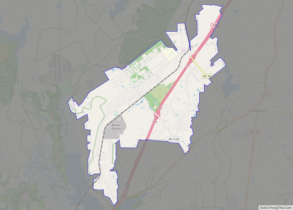
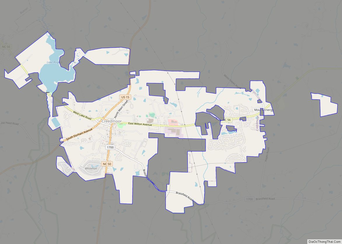
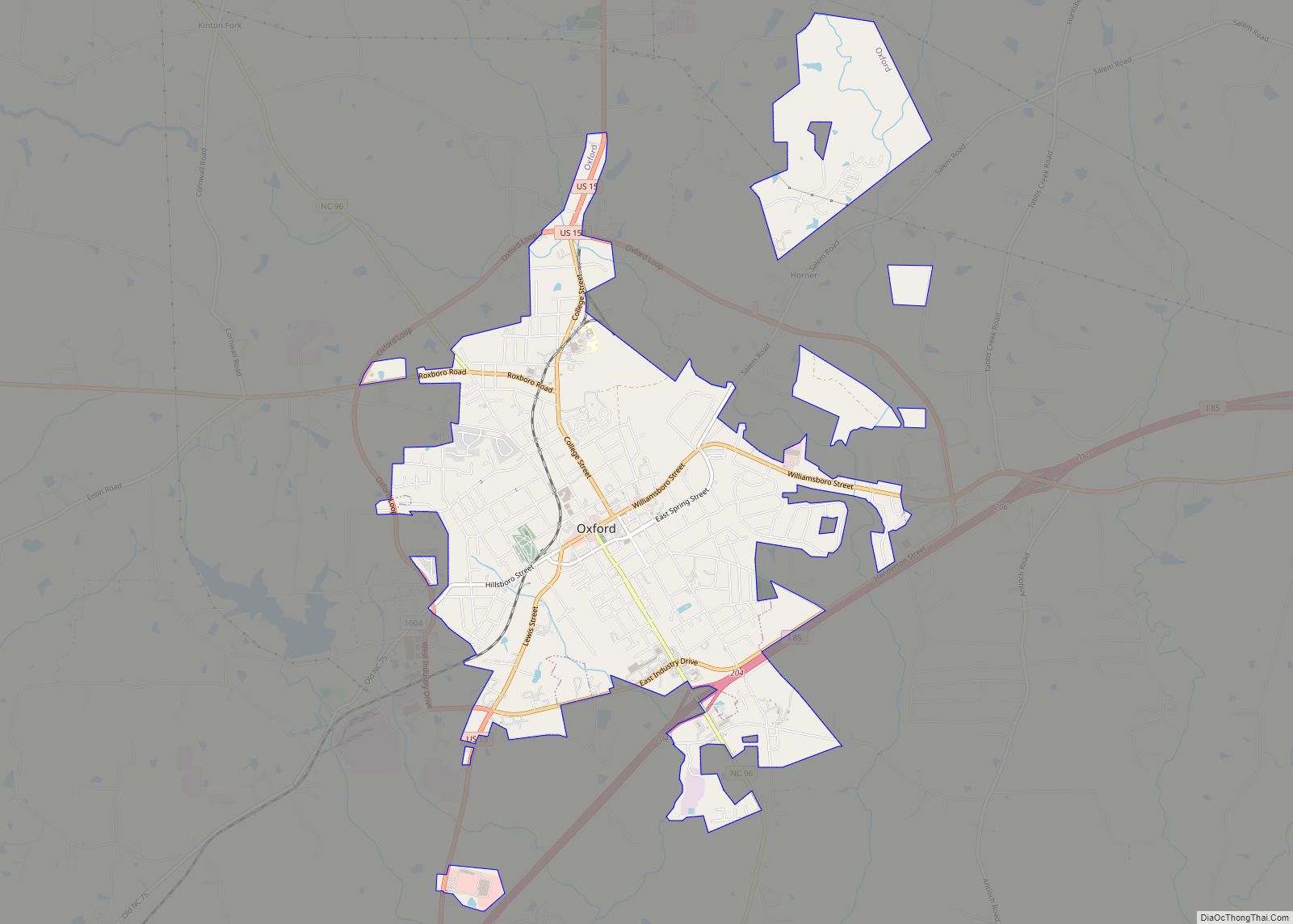
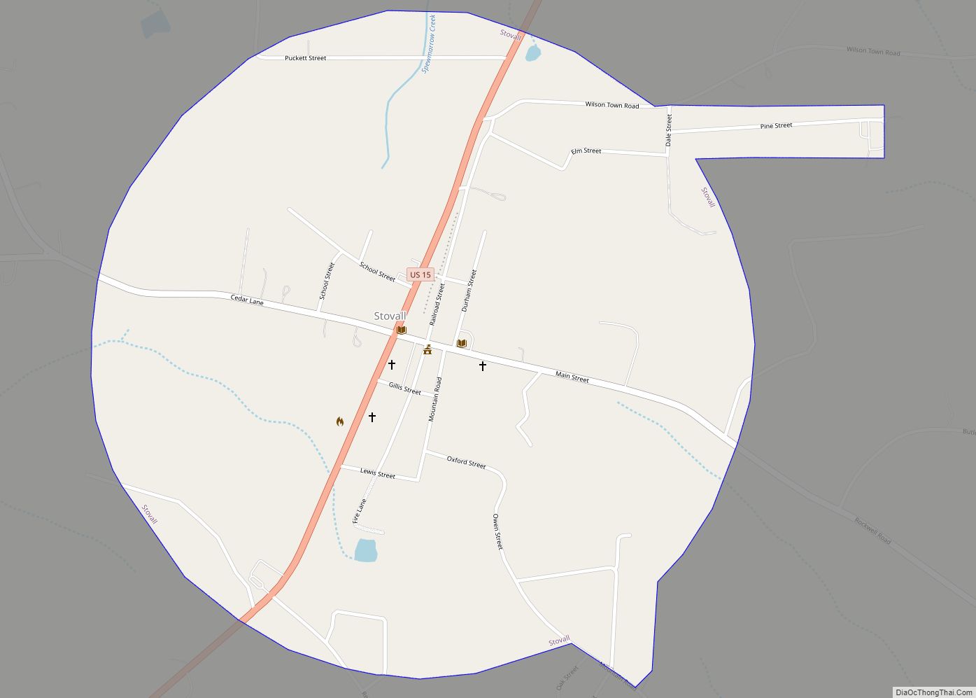
Online Interactive Map
Click on ![]() to view map in "full screen" mode.
to view map in "full screen" mode.
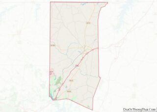
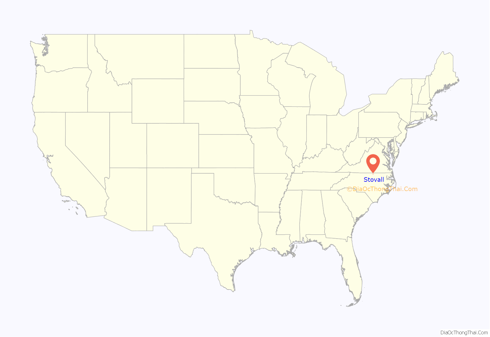
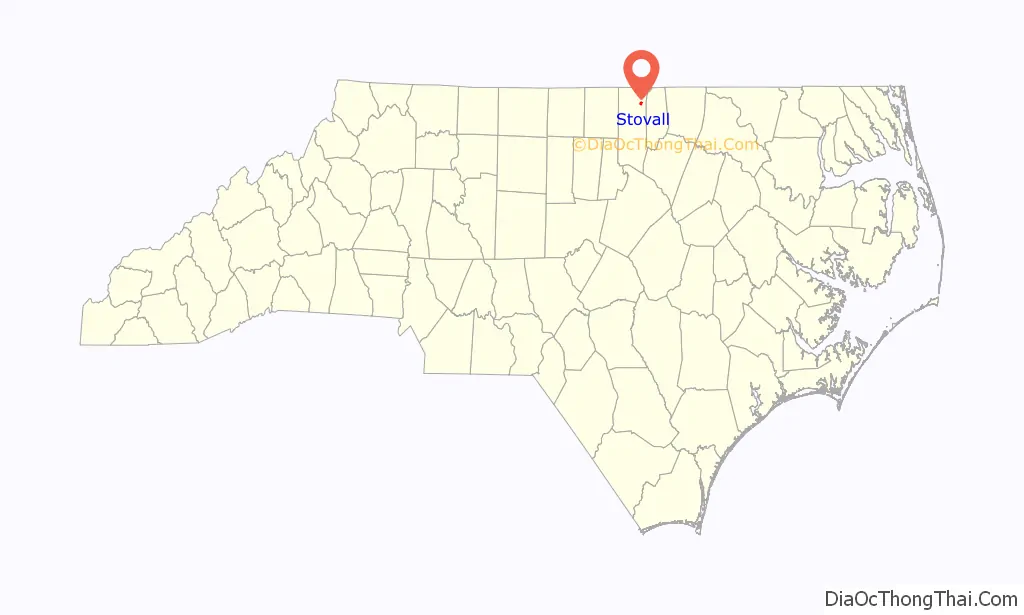
Stovall location map. Where is Stovall town?
History
Abrams Plains, Maurice Hart House, Hill Airy and John W. Stovall Farm are listed on the National Register of Historic Places.
John Penn, one of the original signatories of the United States Declaration of Independence, lived just two miles east of Stovall. His estate and former grave site are now maintained by the DAR.
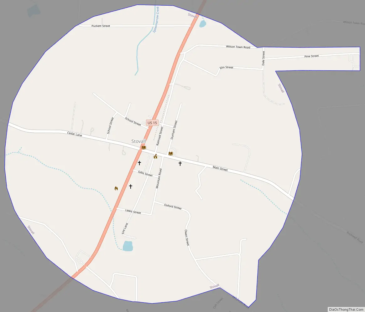
Stovall Road Map
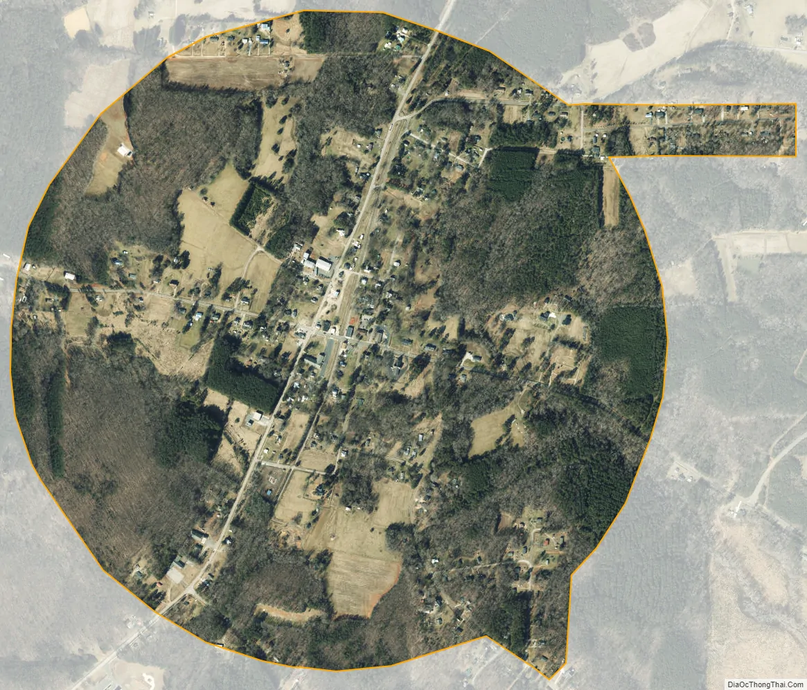
Stovall city Satellite Map
Geography
Stovall is located at 36°26′49″N 78°34′8″W / 36.44694°N 78.56889°W / 36.44694; -78.56889 (36.446894, -78.568979).
According to the United States Census Bureau, the town has a total area of 1.0 square mile (2.6 km): all land.
Stovall is located in the Sassafras Fork voting precinct in Granville County.
See also
Map of North Carolina State and its subdivision:- Alamance
- Alexander
- Alleghany
- Anson
- Ashe
- Avery
- Beaufort
- Bertie
- Bladen
- Brunswick
- Buncombe
- Burke
- Cabarrus
- Caldwell
- Camden
- Carteret
- Caswell
- Catawba
- Chatham
- Cherokee
- Chowan
- Clay
- Cleveland
- Columbus
- Craven
- Cumberland
- Currituck
- Dare
- Davidson
- Davie
- Duplin
- Durham
- Edgecombe
- Forsyth
- Franklin
- Gaston
- Gates
- Graham
- Granville
- Greene
- Guilford
- Halifax
- Harnett
- Haywood
- Henderson
- Hertford
- Hoke
- Hyde
- Iredell
- Jackson
- Johnston
- Jones
- Lee
- Lenoir
- Lincoln
- Macon
- Madison
- Martin
- McDowell
- Mecklenburg
- Mitchell
- Montgomery
- Moore
- Nash
- New Hanover
- Northampton
- Onslow
- Orange
- Pamlico
- Pasquotank
- Pender
- Perquimans
- Person
- Pitt
- Polk
- Randolph
- Richmond
- Robeson
- Rockingham
- Rowan
- Rutherford
- Sampson
- Scotland
- Stanly
- Stokes
- Surry
- Swain
- Transylvania
- Tyrrell
- Union
- Vance
- Wake
- Warren
- Washington
- Watauga
- Wayne
- Wilkes
- Wilson
- Yadkin
- Yancey
- Alabama
- Alaska
- Arizona
- Arkansas
- California
- Colorado
- Connecticut
- Delaware
- District of Columbia
- Florida
- Georgia
- Hawaii
- Idaho
- Illinois
- Indiana
- Iowa
- Kansas
- Kentucky
- Louisiana
- Maine
- Maryland
- Massachusetts
- Michigan
- Minnesota
- Mississippi
- Missouri
- Montana
- Nebraska
- Nevada
- New Hampshire
- New Jersey
- New Mexico
- New York
- North Carolina
- North Dakota
- Ohio
- Oklahoma
- Oregon
- Pennsylvania
- Rhode Island
- South Carolina
- South Dakota
- Tennessee
- Texas
- Utah
- Vermont
- Virginia
- Washington
- West Virginia
- Wisconsin
- Wyoming