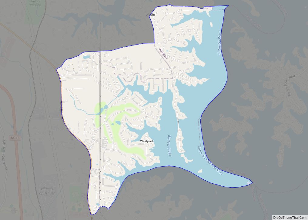
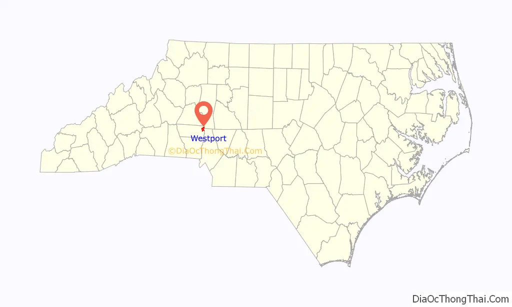
Westport is an unincorporated community and census-designated place (CDP) located in Lincoln County, North Carolina, United States. The population of the CDP was 4,026 at the 2010 census, up from 2,006 at the 2000 census. The community’s name comes from its location on the west side of Lake Norman.
| Name: | Westport CDP |
|---|---|
| LSAD Code: | 57 |
| LSAD Description: | CDP (suffix) |
| State: | North Carolina |
| County: | Lincoln County |
| Elevation: | 840 ft (260 m) |
| Total Area: | 5.61 sq mi (14.52 km²) |
| Land Area: | 3.67 sq mi (9.51 km²) |
| Water Area: | 1.94 sq mi (5.02 km²) |
| Total Population: | 5,705 |
| Population Density: | 1,554.07/sq mi (600.05/km²) |
| FIPS code: | 3772755 |
| GNISfeature ID: | 1023187 |
Online Interactive Map
Click on ![]() to view map in "full screen" mode.
to view map in "full screen" mode.
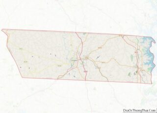
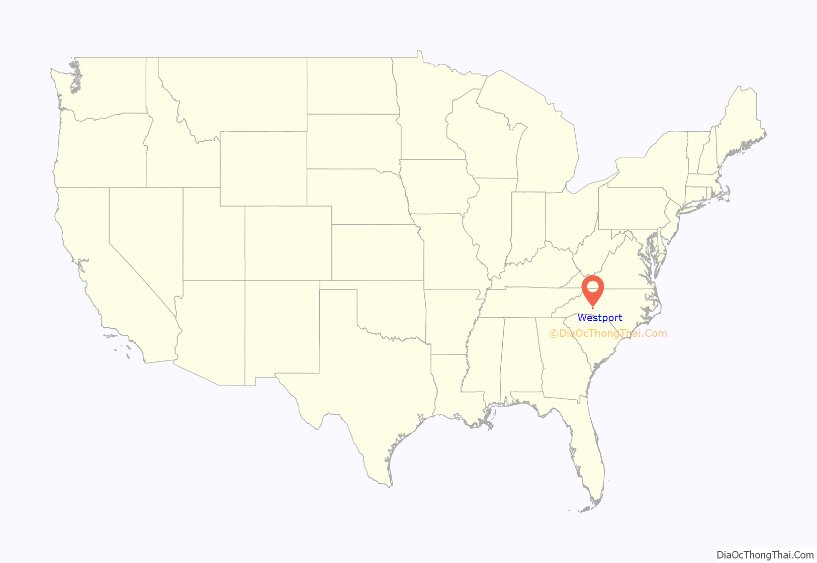
Westport location map. Where is Westport CDP?
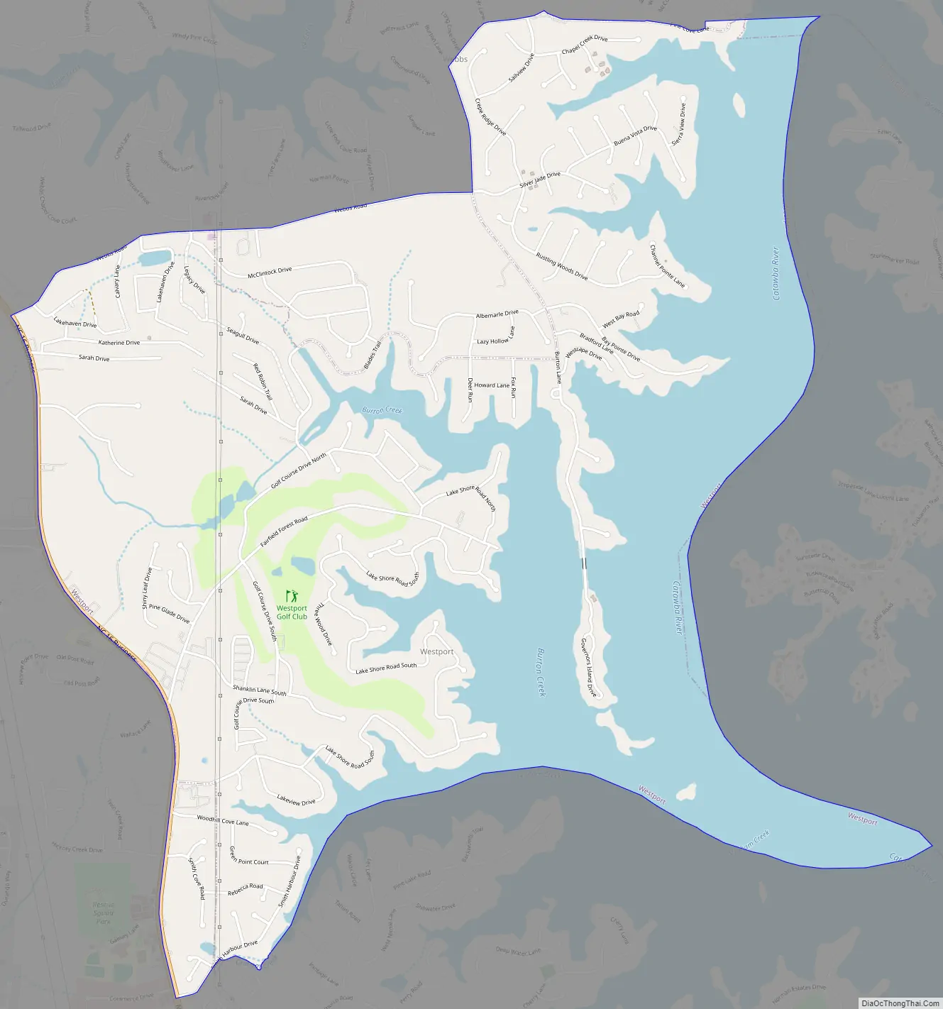
Westport Road Map
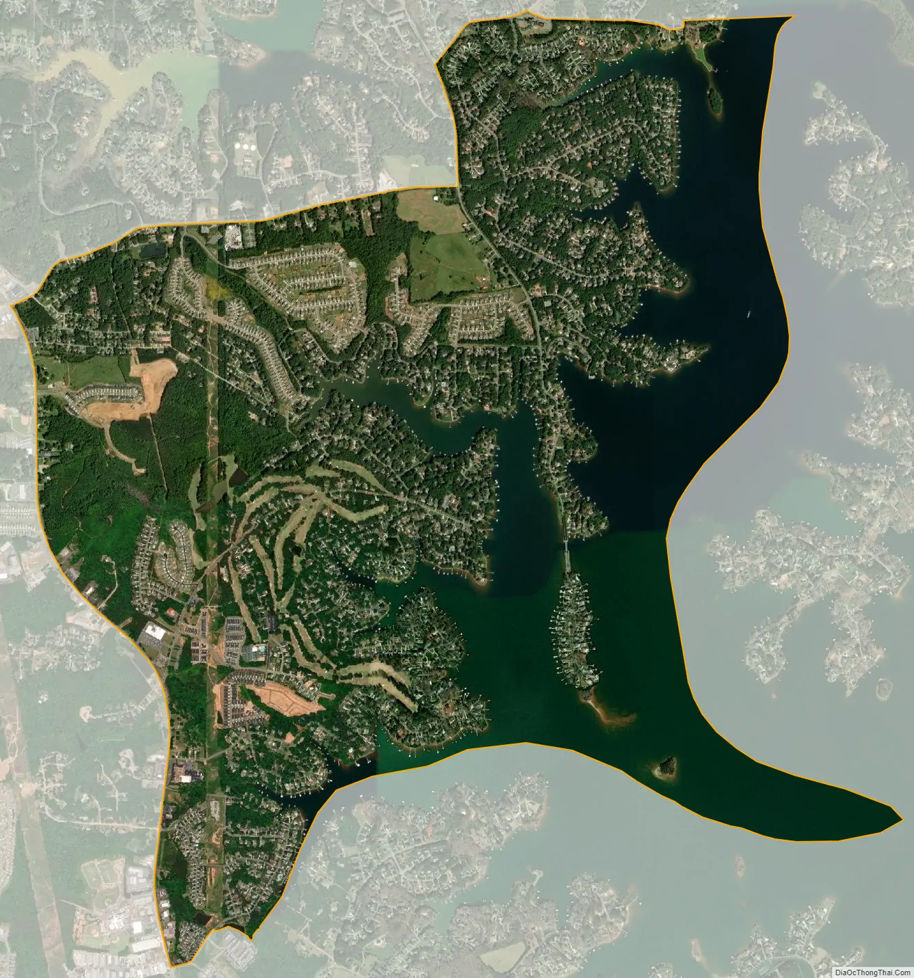
Westport city Satellite Map
Geography
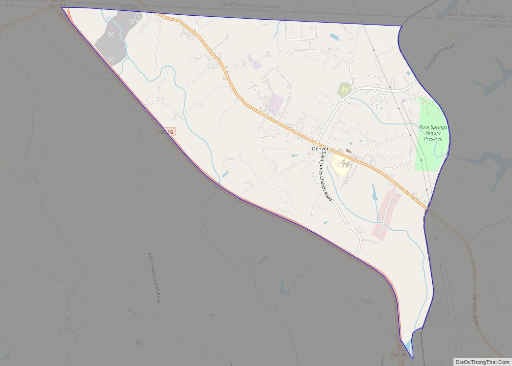
Westport is located in the northeast corner of Lincoln County at 35°30′33″N 80°58′45″W / 35.50917°N 80.97917°W / 35.50917; -80.97917, along several coves on the western shore of Lake Norman, a reservoir on the Catawba River. The southern border of the CDP is Graham Creek, while Burton Creek reaches into the center of the community. The eastern border of the CDP is the Lincoln County line in the center of Lake Norman, with Iredell County to the east.
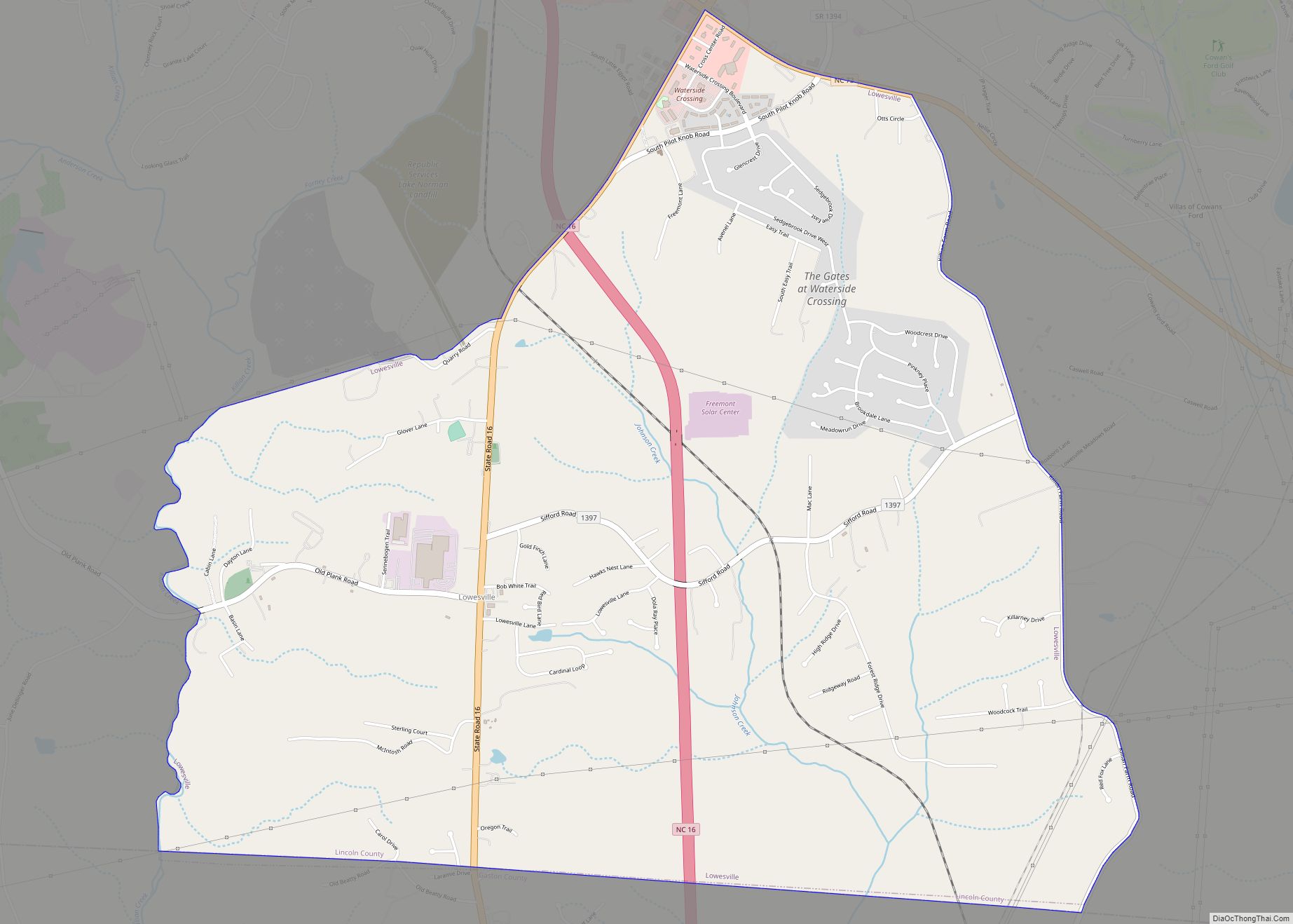
North Carolina Highway 16 Business forms the western edge of the Westport CDP. The highway leads northwest 3.5 miles (5.6 km) to Denver and south 5 miles (8 km) to Lowesville. Downtown Charlotte is 24 miles (39 km) to the southeast of Westport.
According to the United States Census Bureau, the CDP has a total area of 5.6 square miles (14.5 km), of which 3.7 square miles (9.5 km) are land and 1.9 square miles (5.0 km), or 34.54%, are water.
See also
Map of North Carolina State and its subdivision:- Alamance
- Alexander
- Alleghany
- Anson
- Ashe
- Avery
- Beaufort
- Bertie
- Bladen
- Brunswick
- Buncombe
- Burke
- Cabarrus
- Caldwell
- Camden
- Carteret
- Caswell
- Catawba
- Chatham
- Cherokee
- Chowan
- Clay
- Cleveland
- Columbus
- Craven
- Cumberland
- Currituck
- Dare
- Davidson
- Davie
- Duplin
- Durham
- Edgecombe
- Forsyth
- Franklin
- Gaston
- Gates
- Graham
- Granville
- Greene
- Guilford
- Halifax
- Harnett
- Haywood
- Henderson
- Hertford
- Hoke
- Hyde
- Iredell
- Jackson
- Johnston
- Jones
- Lee
- Lenoir
- Lincoln
- Macon
- Madison
- Martin
- McDowell
- Mecklenburg
- Mitchell
- Montgomery
- Moore
- Nash
- New Hanover
- Northampton
- Onslow
- Orange
- Pamlico
- Pasquotank
- Pender
- Perquimans
- Person
- Pitt
- Polk
- Randolph
- Richmond
- Robeson
- Rockingham
- Rowan
- Rutherford
- Sampson
- Scotland
- Stanly
- Stokes
- Surry
- Swain
- Transylvania
- Tyrrell
- Union
- Vance
- Wake
- Warren
- Washington
- Watauga
- Wayne
- Wilkes
- Wilson
- Yadkin
- Yancey
- Alabama
- Alaska
- Arizona
- Arkansas
- California
- Colorado
- Connecticut
- Delaware
- District of Columbia
- Florida
- Georgia
- Hawaii
- Idaho
- Illinois
- Indiana
- Iowa
- Kansas
- Kentucky
- Louisiana
- Maine
- Maryland
- Massachusetts
- Michigan
- Minnesota
- Mississippi
- Missouri
- Montana
- Nebraska
- Nevada
- New Hampshire
- New Jersey
- New Mexico
- New York
- North Carolina
- North Dakota
- Ohio
- Oklahoma
- Oregon
- Pennsylvania
- Rhode Island
- South Carolina
- South Dakota
- Tennessee
- Texas
- Utah
- Vermont
- Virginia
- Washington
- West Virginia
- Wisconsin
- Wyoming